Articles | Volume 18, issue 7
https://doi.org/10.5194/essd-18-5601-2026
© Author(s) 2026. This work is distributed under
the Creative Commons Attribution 4.0 License.
the Creative Commons Attribution 4.0 License.
https://doi.org/10.5194/essd-18-5601-2026
© Author(s) 2026. This work is distributed under
the Creative Commons Attribution 4.0 License.
the Creative Commons Attribution 4.0 License.
Data description article
| 
30 Jul 2026
Data description article |
| 30 Jul 2026
| 30 Jul 2026
Mapping complex cropping patterns in China (2018–2021) at 10 m resolution: a data-driven framework based on multi-product integration and Google satellite embedding
Ministry of Education Key Laboratory for Earth System Modeling, Department of Earth System Science, Tsinghua University, Beijing, 100084, China

Ministry of Education Key Laboratory for Earth System Modeling, Department of Earth System Science, Tsinghua University, Beijing, 100084, China
Ministry of Education Ecological Field Station for East Asian Migratory Birds, Beijing 100084, China
Institute of Carbon Neutrality, Tsinghua University, Beijing, 100084, China
Related authors
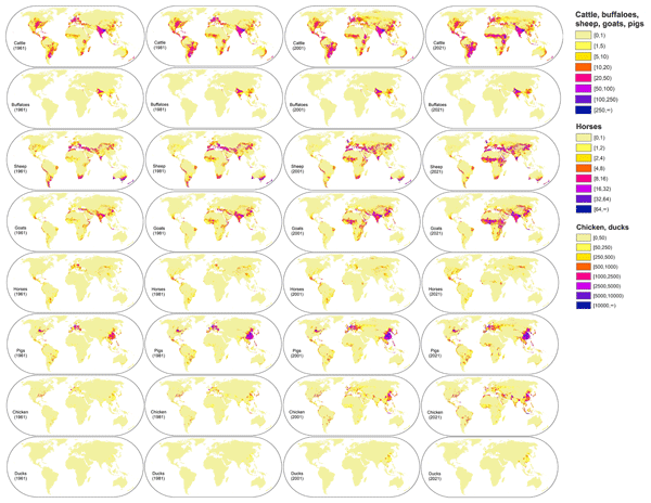
Zhenrong Du, Le Yu, Yue Zhao, Xinyue Li, Xiaoxuan Liu, Xiyu Li, Pengyu Hao, Zhongxin Chen, Zhe Guo, Liangzhi You, Xiaorui Ma, and Hongyu Wang
Earth Syst. Sci. Data, 17, 5543–5556, https://doi.org/10.5194/essd-17-5543-2025, https://doi.org/10.5194/essd-17-5543-2025, 2025
Short summary
Short summary
We created the first global maps showing where livestocks have been raised each year from 1961 to 2021. These maps help to see how livestock numbers and locations have changed over time. Using global statistics and satellite data, we built a model to estimate livestock density at a high resolution (5 km). This work supports better decisions in food security, disease control, and environmental protection around the world.
Xiyu Li, Le Yu, Zhenrong Du, and Xiaoxuan Liu
Earth Syst. Sci. Data Discuss., https://doi.org/10.5194/essd-2024-233, https://doi.org/10.5194/essd-2024-233, 2024
Manuscript not accepted for further review
Short summary
Short summary
We developed a new method to update detailed maps showing where different crops are grown over time, focusing on Africa, China, and the USA. Using various data sources and machine learning, we produced accurate maps at a 10 km resolution covering up to 42 crop types from 1961 to 2022. Our work bridges statistical data and satellite imagery, helping researchers and policymakers to address global agricultural challenges in food security and environmental impacts.
Shijun Zheng, Hui Wu, Le Yu, and Keping Ma
Earth Syst. Sci. Data Discuss., https://doi.org/10.5194/essd-2026-354, https://doi.org/10.5194/essd-2026-354, 2026
Preprint under review for ESSD
Short summary
Short summary
We created the first global, long-term dataset showing how land vertebrate biodiversity has changed from the past to the future. By combining species records, habitat information, climate data, and land-use change, we mapped where species can live and how diversity patterns shift over time. This work provides an important tool to better understand biodiversity loss and to support conservation and policy decisions in a changing world.
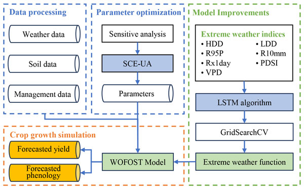
Jinhui Zheng, Le Yu, Zhenrong Du, Liujun Xiao, and Xiaomeng Huang
Geosci. Model Dev., 18, 8379–8400, https://doi.org/10.5194/gmd-18-8379-2025, https://doi.org/10.5194/gmd-18-8379-2025, 2025
Short summary
Short summary
This study integrates the extreme weather index and deep learning algorithms with the World Food Studies Simulation Model (WOFOST), proposing the WOFOST-EW v1. WOFOST-EW significantly improves the simulation of winter wheat growth under extreme weather conditions, providing more accurate predictions of phenology and yield. As extreme weather events become more frequent, WOFOST-EW provides a key tool for agricultural development.
Zhenrong Du, Le Yu, Yue Zhao, Xinyue Li, Xiaoxuan Liu, Xiyu Li, Pengyu Hao, Zhongxin Chen, Zhe Guo, Liangzhi You, Xiaorui Ma, and Hongyu Wang
Earth Syst. Sci. Data, 17, 5543–5556, https://doi.org/10.5194/essd-17-5543-2025, https://doi.org/10.5194/essd-17-5543-2025, 2025
Short summary
Short summary
We created the first global maps showing where livestocks have been raised each year from 1961 to 2021. These maps help to see how livestock numbers and locations have changed over time. Using global statistics and satellite data, we built a model to estimate livestock density at a high resolution (5 km). This work supports better decisions in food security, disease control, and environmental protection around the world.
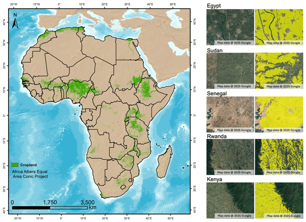
Zihang Lou, Dailiang Peng, Zhou Shi, Hongyan Wang, Ke Liu, Yaqiong Zhang, Xue Yan, Zhongxing Chen, Su Ye, Le Yu, Jinkang Hu, Yulong Lv, Hao Peng, Yizhou Zhang, and Bing Zhang
Earth Syst. Sci. Data, 17, 3777–3796, https://doi.org/10.5194/essd-17-3777-2025, https://doi.org/10.5194/essd-17-3777-2025, 2025
Short summary
Short summary
This study creates the first detailed annual maps of Africa's cropland extent from 2000 to 2022 in 30 m resolution to support global efforts against hunger and sustainable farming. Our findings show Africa's cropland grew by 8.5 % over 2 decades, while 11.5 % of cropland was abandoned by 2018, revealing hidden challenges in agricultural sustainability. These yearly field-sized maps help governments track where farming grows or shrinks, plan food supplies, and protect vital cropland.
Xiyu Li, Le Yu, Zhenrong Du, and Xiaoxuan Liu
Earth Syst. Sci. Data Discuss., https://doi.org/10.5194/essd-2024-233, https://doi.org/10.5194/essd-2024-233, 2024
Manuscript not accepted for further review
Short summary
Short summary
We developed a new method to update detailed maps showing where different crops are grown over time, focusing on Africa, China, and the USA. Using various data sources and machine learning, we produced accurate maps at a 10 km resolution covering up to 42 crop types from 1961 to 2022. Our work bridges statistical data and satellite imagery, helping researchers and policymakers to address global agricultural challenges in food security and environmental impacts.
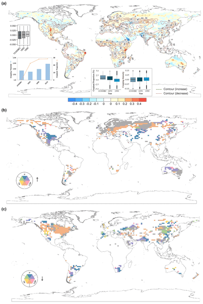
Xiaoxuan Liu, Peng Zhu, Shu Liu, Le Yu, Yong Wang, Zhenrong Du, Dailiang Peng, Ece Aksoy, Hui Lu, and Peng Gong
Earth Syst. Dynam., 15, 817–828, https://doi.org/10.5194/esd-15-817-2024, https://doi.org/10.5194/esd-15-817-2024, 2024
Short summary
Short summary
An increase of 28 % in cropland expansion since 10 000 BCE has led to a 1.2 % enhancement in the global cropping potential, with varying efficiencies across regions. The continuous expansion has altered the support for population growth and has had impacts on climate and biodiversity, highlighting the effects of climate change. It also points out the limitations of previous studies.
Ying Tu, Shengbiao Wu, Bin Chen, Qihao Weng, Yuqi Bai, Jun Yang, Le Yu, and Bing Xu
Earth Syst. Sci. Data, 16, 2297–2316, https://doi.org/10.5194/essd-16-2297-2024, https://doi.org/10.5194/essd-16-2297-2024, 2024
Short summary
Short summary
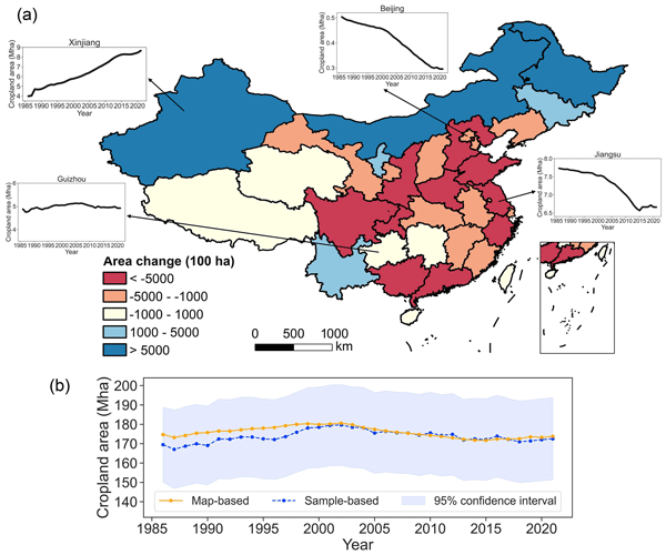
We developed the first 30 m annual cropland dataset of China (CACD) for 1986–2021. The overall accuracy of CACD reached up to 0.93±0.01 and was superior to other products. Our fine-resolution cropland maps offer valuable information for diverse applications and decision-making processes in the future.
Jiabo Yin, Louise J. Slater, Abdou Khouakhi, Le Yu, Pan Liu, Fupeng Li, Yadu Pokhrel, and Pierre Gentine
Earth Syst. Sci. Data, 15, 5597–5615, https://doi.org/10.5194/essd-15-5597-2023, https://doi.org/10.5194/essd-15-5597-2023, 2023
Short summary
Short summary
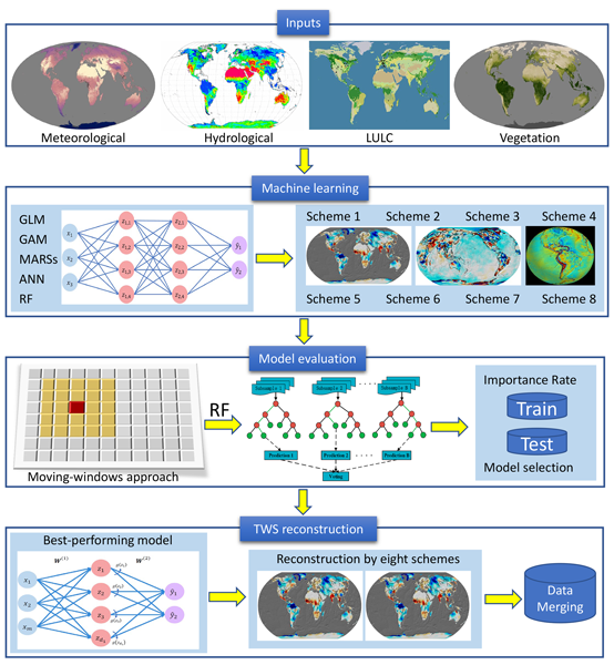
This study presents long-term (i.e., 1940–2022) and high-resolution (i.e., 0.25°) monthly time series of TWS anomalies over the global land surface. The reconstruction is achieved by using a set of machine learning models with a large number of predictors, including climatic and hydrological variables, land use/land cover data, and vegetation indicators (e.g., leaf area index). Our proposed GTWS-MLrec performs overall as well as, or is more reliable than, previous TWS datasets.
Shijun Zheng, Dailiang Peng, Bing Zhang, Yuhao Pan, Le Yu, Yan Wang, Xuxiang Feng, and Changyong Dou
EGUsphere, https://doi.org/10.5194/egusphere-2022-1110, https://doi.org/10.5194/egusphere-2022-1110, 2022
Preprint archived
Short summary
Short summary
This study observed the marked interannual differences in the vegetation response to the trend towards a warmer and wetter climate in northwest China. And found that the influence of precipitation to vegetation has gradually become stronger from 1982 to 2019 in northwest China, whereas which of temperature has gradually become weaker.

Bowen Cao, Le Yu, Xuecao Li, Min Chen, Xia Li, Pengyu Hao, and Peng Gong
Earth Syst. Sci. Data, 13, 5403–5421, https://doi.org/10.5194/essd-13-5403-2021, https://doi.org/10.5194/essd-13-5403-2021, 2021
Short summary
Short summary
In the study, the first 1 km global cropland proportion dataset for 10 000 BCE–2100 CE was produced through the harmonization and downscaling framework. The mapping result coincides well with widely used datasets at present. With improved spatial resolution, our maps can better capture the cropland distribution details and spatial heterogeneity. The dataset will be valuable for long-term simulations and precise analyses. The framework can be extended to specific regions or other land use types.
Cited articles
Adnan, M. N. and Islam, M. Z.: One-vs-all binarization technique in the context of random forest, Proceedings of the European Symposium on Artificial Neural Networks, Computational Intelligence and Machine Learning, 385–390, ISBN 978-287587014-8, 2015.
Alam, M. M. T. and Simic Milas, A.: Dimensionality optimized machine learning retrieval of canopy chlorophyll, nitrogen, and phosphorus from google satellite embeddings, Smart Agricultural Technology, 12, 101601, https://doi.org/10.1016/j.atech.2025.101601, 2025.
Ashourloo, D., Shahrabi, H. S., Azadbakht, M., Aghighi, H., Nematollahi, H., Alimohammadi, A., and Matkan, A. A.: Automatic canola mapping using time series of sentinel 2 images, ISPRS J. Photogramm., 156, 63–76, https://doi.org/10.1016/j.isprsjprs.2019.08.007, 2019.
Barbieri, P., Pellerin, S., Seufert, V., and Nesme, T.: Changes in crop rotations would impact food production in an organically farmed world, Nat. Sustain., 2, 378–385, https://doi.org/10.1038/s41893-019-0259-5, 2019.
Bastani, F., Wolters, P., Gupta, R., Ferdinando, J., and Kembhavi, A.: Satlaspretrain: A large-scale dataset for remote sensing image understanding, Proceedings of the IEEE/CVF International Conference on Computer Vision, 16772–16782, https://doi.org/10.1109/ICCV51070.2023.01538, 2023.
Becker-Reshef, I., Barker, B., Whitcraft, A., Oliva, P., Mobley, K., Justice, C., and Sahajpal, R.: Crop Type Maps for Operational Global Agricultural Monitoring, Sci. Data, 10, 172, https://doi.org/10.1038/s41597-023-02047-9, 2023.
Blickensdörfer, L., Schwieder, M., Pflugmacher, D., Nendel, C., Erasmi, S., and Hostert, P.: Mapping of crop types and crop sequences with combined time series of Sentinel-1, Sentinel-2 and Landsat 8 data for Germany, Remote Sens. Environ., 269, 112831, https://doi.org/10.1016/j.rse.2021.112831, 2022.
Boryan, C., Yang, Z., Mueller, R., and Craig, M.: Monitoring US agriculture: the US Department of Agriculture, National Agricultural Statistics Service, Cropland Data Layer Program, Geocarto Int., 26, 341–358, https://doi.org/10.1080/10106049.2011.562309, 2011.
Breiman, L.: Random Forests, Mach. Learn., 45, 5–32, https://doi.org/10.1023/A:1010933404324, 2001.
Brown, C. F., Kazmierski, M. R., Pasquarella, V. J., Rucklidge, W. J., Samsikova, M., Zhang, C., Shelhamer, E., Lahera, E., Wiles, O., and Ilyushchenko, S.: Alphaearth foundations: An embedding field model for accurate and efficient global mapping from sparse label data, arXiv [preprint], https://doi.org/10.48550/arXiv.2507.22291, 2025.
Cai, Y., Li, B., Liu, X., Jiang, X., Zhu, Y., Luo, S., Qin, Y., Xie, S., Ye, J., Shen, H., Guo, Z., Liu, X., and Zeng, Z.: Annual 10-m high-resolution cropland maps for Southeast Asia since 2019 using AlphaEarth embeddings, Earth Syst. Sci. Data Discuss. [preprint], https://doi.org/10.5194/essd-2026-78, in review, 2026.
Chen, H., Li, H., Liu, Z., Zhang, C., Zhang, S., and Atkinson, P. M.: A novel Greenness and Water Content Composite Index (GWCCI) for soybean mapping from single remotely sensed multispectral images, Remote Sens. Environ., 295, 113679, https://doi.org/10.1016/j.rse.2023.113679, 2023.
Cui, K. and Shoemaker, S. P.: A look at food security in China, NPJ Science of Food, 2, 4, https://doi.org/10.1038/s41538-018-0012-x, 2018.
d'Andrimont, R., Taymans, M., Lemoine, G., Ceglar, A., Yordanov, M., and van der Velde, M.: Detecting flowering phenology in oil seed rape parcels with Sentinel-1 and -2 time series, Remote Sens. Environ., 239, 111660, https://doi.org/10.1016/j.rse.2020.111660, 2020.
d'Andrimont, R., Verhegghen, A., Lemoine, G., Kempeneers, P., Meroni, M., and van der Velde, M.: From parcel to continental scale – A first European crop type map based on Sentinel-1 and LUCAS Copernicus in-situ observations, Remote Sens. Environ., 266, 112708, https://doi.org/10.1016/j.rse.2021.112708, 2021.
Dai, K., Cheng, C., Li, B., Xie, Y., Gomez, J. A., Wang, Z., and Wu, X.: Mapping the harvest area of a comprehensive set of crop types in China from 1990 to 2020 at a 1-km resolution, Scientific Data, 12, 1371, https://doi.org/10.1038/s41597-025-05723-0, 2025.
Danylo, O., Pirker, J., Lemoine, G., Ceccherini, G., See, L., McCallum, I., Hadi, Kraxner, F., Achard, F., and Fritz, S.: A map of the extent and year of detection of oil palm plantations in Indonesia, Malaysia and Thailand, Scientific Data, 8, 96, https://doi.org/10.1038/s41597-021-00867-1, 2021.
Di Tommaso, S., Wang, S., Strey, R., and Lobell, D. B.: Mapping sugarcane globally at 10 m resolution using Global Ecosystem Dynamics Investigation (GEDI) and Sentinel-2, Earth Syst. Sci. Data, 16, 4931–4947, https://doi.org/10.5194/essd-16-4931-2024, 2024.
Dong, J., Fu, Y., Wang, J., Tian, H., Fu, S., Niu, Z., Han, W., Zheng, Y., Huang, J., and Yuan, W.: Early-season mapping of winter wheat in China based on Landsat and Sentinel images, Earth Syst. Sci. Data, 12, 3081–3095, https://doi.org/10.5194/essd-12-3081-2020, 2020a.
Dong, Q., Chen, X., Chen, J., Zhang, C., Liu, L., Cao, X., Zang, Y., Zhu, X., and Cui, X.: Mapping Winter Wheat in North China Using Sentinel 2A/B Data: A Method Based on Phenology-Time Weighted Dynamic Time Warping, Remote Sens., 12, 1274, https://doi.org/10.3390/rs12081274, 2020b.
Fisette, T., Rollin, P., Aly, Z., Campbell, L., Daneshfar, B., Filyer, P., Smith, A., Davidson, A., Shang, J., and Jarvis, I.: AAFC annual crop inventory, 2013 Second International Conference on Agro-Geoinformatics (Agro-Geoinformatics), 12–16 August 2013, https://doi.org/10.1109/Argo-Geoinformatics.2013.6621920, 2013.
Foley, J. A., Ramankutty, N., Brauman, K. A., Cassidy, E. S., Gerber, J. S., Johnston, M., Mueller, N. D., O'Connell, C., Ray, D. K., West, P. C., Balzer, C., Bennett, E. M., Carpenter, S. R., Hill, J., Monfreda, C., Polasky, S., Rockström, J., Sheehan, J., Siebert, S., Tilman, D., and Zaks, D. P. M.: Solutions for a cultivated planet, Nature, 478, 337–342, https://doi.org/10.1038/nature10452, 2011.
Franche, C., Lindström, K., and Elmerich, C.: Nitrogen-fixing bacteria associated with leguminous and non-leguminous plants, Plant Soil, 321, 35–59, https://doi.org/10.1007/s11104-008-9833-8, 2009.
Galar, M., Fernández, A., Barrenechea, E., Bustince, H., and Herrera, F.: An overview of ensemble methods for binary classifiers in multi-class problems: Experimental study on one-vs-one and one-vs-all schemes, Pattern Recognition, 44, 1761–1776, https://doi.org/10.1016/j.patcog.2011.01.017, 2011.
Gong, P., Wang, J., Yu, L., Zhao, Y., Zhao, Y., Liang, L., Niu, Z., Huang, X., Fu, H., Liu, S., Li, C., Li, X., Fu, W., Liu, C., Xu, Y., Wang, X., Cheng, Q., Hu, L., Yao, W., Zhang, H., Zhu, P., Zhao, Z., Zhang, H., Zheng, Y., Ji, L., Zhang, Y., Chen, H., Yan, A., Guo, J., Yu, L., Wang, L., Liu, X., Shi, T., Zhu, M., Chen, Y., Yang, G., Tang, P., Xu, B., Giri, C., Clinton, N., Zhu, Z., Chen, J., and Chen, J.: Finer resolution observation and monitoring of global land cover: first mapping results with Landsat TM and ETM+ data, Int. J. Remote Sens., 34, 2607–2654, https://doi.org/10.1080/01431161.2012.748992, 2013.
Gong, P., Liu, H., Zhang, M., Li, C., Wang, J., Huang, H., Clinton, N., Ji, L., Li, W., Bai, Y., Chen, B., Xu, B., Zhu, Z., Yuan, C., Ping Suen, H., Guo, J., Xu, N., Li, W., Zhao, Y., Yang, J., Yu, C., Wang, X., Fu, H., Yu, L., Dronova, I., Hui, F., Cheng, X., Shi, X., Xiao, F., Liu, Q., and Song, L.: Stable classification with limited sample: transferring a 30-m resolution sample set collected in 2015 to mapping 10-m resolution global land cover in 2017, Sci. Bull., 64, 370–373, https://doi.org/10.1016/j.scib.2019.03.002, 2019.
Gunton, R. M., Firbank, L. G., Inman, A., and Winter, D. M.: How scalable is sustainable intensification?, Nat. Plants, 2, 16065, https://doi.org/10.1038/nplants.2016.65, 2016.
Guo, X., Lao, J., Dang, B., Zhang, Y., Yu, L., Ru, L., Zhong, L., Huang, Z., Wu, K., and Hu, D.: Skysense: A multi-modal remote sensing foundation model towards universal interpretation for earth observation imagery, Proceedings of the IEEE/CVF Conference on Computer Vision and Pattern Recognition, 27672–27683, https://doi.org/10.1109/CVPR52733.2024.02613, 2024.
Halpern, B. S., Frazier, M., Verstaen, J., Rayner, P.-E., Clawson, G., Blanchard, J. L., Cottrell, R. S., Froehlich, H. E., Gephart, J. A., Jacobsen, N. S., Kuempel, C. D., McIntyre, P. B., Metian, M., Moran, D., Nash, K. L., Többen, J., and Williams, D. R.: The environmental footprint of global food production, Nat. Sustain., 5, 1027–1039, https://doi.org/10.1038/s41893-022-00965-x, 2022.
Han, J., Zhang, Z., Luo, Y., Cao, J., Zhang, L., Cheng, F., Zhuang, H., Zhang, J., and Tao, F.: NESEA-Rice10: high-resolution annual paddy rice maps for Northeast and Southeast Asia from 2017 to 2019, Earth Syst. Sci. Data, 13, 5969–5986, https://doi.org/10.5194/essd-13-5969-2021, 2021.
Hu, J., Zhang, B., Peng, D., Huang, J., Zhang, W., Zhao, B., Li, Y., Cheng, E., Lou, Z., Liu, S., Yang, S., Tan, Y., and Lv, Y.: Mapping 10-m harvested area in the major winter wheat-producing regions of China from 2018 to 2022, Scientific Data, 11, 1038, https://doi.org/10.1038/s41597-024-03867-z, 2024.
Huang, Y., Qiu, B., Chen, C., Zhu, X., Wu, W., Jiang, F., Lin, D., and Peng, Y.: Automated soybean mapping based on canopy water content and chlorophyll content using Sentinel-2 images, Int. J. Appl. Earth Obs., 109, 102801, https://doi.org/10.1016/j.jag.2022.102801, 2022.
Huang, Y., Qiu, B., Yang, P., Wu, W., Chen, X., Zhu, X., Xu, S., Wang, L., Dong, Z., Zhang, J., Berry, J., Tang, Z., Tan, J., Duan, D., Peng, Y., Lin, D., Cheng, F., Liang, J., Huang, H., and Chen, C.: National-scale 10 m annual maize maps for China and the contiguous United States using a robust index from Sentinel-2 time series, Comput. Electron. Agr., 221, 109018, https://doi.org/10.1016/j.compag.2024.109018, 2024.
Hultgren, A., Carleton, T., Delgado, M., Gergel, D. R., Greenstone, M., Houser, T., Hsiang, S., Jina, A., Kopp, R. E., Malevich, S. B., McCusker, K. E., Mayer, T., Nath, I., Rising, J., Rode, A., and Yuan, J.: Impacts of climate change on global agriculture accounting for adaptation, Nature, 642, 644–652, https://doi.org/10.1038/s41586-025-09085-w, 2025.
IGN – Institut National de l'Information Géographique et Forestière: Registre Parcellaire Graphique (RPG) [data set], https://geoservices.ign.fr/rpg (last access: 25 July 2026), 2024.
Jwaideh, M. A. A. and Dalin, C.: The multi-dimensional environmental impact of global crop commodities, Nat. Sustain., 8, 396–410, https://doi.org/10.1038/s41893-025-01528-6, 2025.
Kang, X., Huang, C., Chen, J. M., Lv, X., Wang, J., Zhong, T., Wang, H., Fan, X., Ma, Y., Yi, X., Zhang, Z., Zhang, L., and Tong, Q.: The 10-m cotton maps in Xinjiang, China during 2018–2021, Scientific Data, 10, 688, https://doi.org/10.1038/s41597-023-02584-3, 2023.
Khan, H. and Ahmad, A.: Evaluating AlphaEarth Foundation Embeddings for Pixel- and Object-Based Land Cover Classification in Google Earth Engine, Preprints.org [preprint], https://doi.org/10.20944/preprints202511.2172.v1, 27 November 2025.
Kirillov, A., Mintun, E., Ravi, N., Mao, H., Rolland, C., Gustafson, L., Xiao, T., Whitehead, S., Berg, A. C., and Lo, W.-Y.: Segment anything, Proceedings of the IEEE/CVF International Conference on Computer Vision, 4015–4026, https://doi.org/10.1109/ICCV51070.2023.00371, 2023.
Li, C., Hoffland, E., Kuyper, T. W., Yu, Y., Zhang, C., Li, H., Zhang, F., and van der Werf, W.: Syndromes of production in intercropping impact yield gains, Nat. Plants, 6, 653–660, https://doi.org/10.1038/s41477-020-0680-9, 2020.
Li, H., Song, X.-P., Hansen, M. C., Becker-Reshef, I., Adusei, B., Pickering, J., Wang, L., Wang, L., Lin, Z., Zalles, V., Potapov, P., Stehman, S. V., and Justice, C.: Development of a 10-m resolution maize and soybean map over China: Matching satellite-based crop classification with sample-based area estimation, Remote Sens. Environ., 294, 113623, https://doi.org/10.1016/j.rse.2023.113623, 2023a.
Li, H., Di, L., Zhang, C., Lin, L., Guo, L., Yu, E. G., and Yang, Z.: Automated In-Season Crop-Type Data Layer Mapping Without Ground Truth for the Conterminous United States Based on Multisource Satellite Imagery, IEEE T. Geosci. Remote, 62, 1–14, https://doi.org/10.1109/TGRS.2024.3361895, 2024.
Li, X. and Yu, L.: Mapping Complex Cropping Patterns in China (2018–2021) at 10 m Resolution: A Data-Driven Framework based on Multi-Product Integration and Google Satellite Embedding, figshare [data set], https://doi.org/10.6084/m9.figshare.30582161.v1, 2025.
Li, X., Yu, L., Du, Z., and Liu, X.: Crop Statistic to Annual Map: Tracking spatiotemporal dynamics of crop-specific areas through machine learning and statistics disaggregating, Scientific Data, 12, 1249, https://doi.org/10.1038/s41597-025-05572-x, 2025.
Li, X., Qu, Y., Geng, H., Xin, Q., Huang, J., Peng, S., and Zhang, L.: Mapping annual 10-m maize cropland changes in China during 2017–2021, Scientific Data, 10, 765, https://doi.org/10.1038/s41597-023-02665-3, 2023b.
Liu, L., Xiao, X., Qin, Y., Wang, J., Xu, X., Hu, Y., and Qiao, Z.: Mapping cropping intensity in China using time series Landsat and Sentinel-2 images and Google Earth Engine, Remote Sens. Environ., 239, 111624, https://doi.org/10.1016/j.rse.2019.111624, 2020.
Liu, W. and Zhang, H.: Mapping annual 10 m rapeseed extent using multisource data in the Yangtze River Economic Belt of China (2017–2021) on Google Earth Engine, Int. J. Appl. Earth Obs., 117, 103198, https://doi.org/10.1016/j.jag.2023.103198, 2023.
Liu, W., Li, S., Tao, J., Liu, X., Yin, G., Xia, Y., Wang, T., and Zhang, H.: CARM30: China annual rapeseed maps at 30 m spatial resolution from 2000 to 2022 using multi-source data, Scientific Data, 11, 356, https://doi.org/10.1038/s41597-024-03188-1, 2024a.
Liu, Y., Ou, C., Liu, Y., Cao, Z., Robinson, G. M., and Li, X.: Unequal impacts of global urban–rural settlement construction on cropland and production over the past three decades, Sci. Bull., 70, 1699–1709, https://doi.org/10.1016/j.scib.2024.12.054, 2025.
Liu, Y., Yu, Q., Zhou, Q., Wang, C., Bellingrath-Kimura, S. D., and Wu, W.: Mapping the Complex Crop Rotation Systems in Southern China Considering Cropping Intensity, Crop Diversity, and Their Seasonal Dynamics, IEEE J. Sel. Top. Appl., 15, 9584–9598, https://doi.org/10.1109/JSTARS.2022.3218881, 2022.
Liu, Y., Chen, X., Chen, J., Zang, Y., Wang, J., Lu, M., Sun, L., Dong, Q., Qiu, B., and Zhu, X.: Long-term (2013–2022) mapping of winter wheat in the North China Plain using Landsat data: classification with optimal zoning strategy, Big Earth Data, 8, 494–521, https://doi.org/10.1080/20964471.2024.2363552, 2024b.
Lobell, D. B. and Di Tommaso, S.: A half-century of climate change in major agricultural regions: Trends, impacts, and surprises, P. Natl. Acad. Sci. USA, 122, e2502789122, https://doi.org/10.1073/pnas.2502789122, 2025.
Ma, Y., Shen, Y., Swatantran, A., and Lobell, D. B.: Harvesting AlphaEarth: Benchmarking the Geospatial Foundation Model for Agricultural Downstream Tasks, arXiv [preprint], https://doi.org/10.48550/arXiv.2601.00857, 2025.
Mantey, S., Attipoe, I., and Alhassan, A.: A Comparative Analysis of Satellite Imagery for Land Cover Classification: Evaluating Google Satellite Embeddings, Sentinel-2, And Landsat-8 Data with XGBoost, Research Square, https://doi.org/10.21203/rs.3.rs-7961146/v1, 2025.
Mei, Q., Zhang, Z., Han, J., Song, J., Dong, J., Wu, H., Xu, J., and Tao, F.: ChinaSoyArea10m: a dataset of soybean-planting areas with a spatial resolution of 10 m across China from 2017 to 2021, Earth Syst. Sci. Data, 16, 3213–3231, https://doi.org/10.5194/essd-16-3213-2024, 2024.
Meng, B., Yang, Q., Mehrabi, Z., and Wang, S.: Larger nations benefit more than smaller nations from the stabilizing effects of crop diversity, Nature Food, 5, 491–498, https://doi.org/10.1038/s43016-024-00992-1, 2024.
Nelson, K. S. and Burchfield, E. K.: Landscape complexity and US crop production, Nature Food, 2, 330–338, https://doi.org/10.1038/s43016-021-00281-1, 2021.
Pan, B., Zheng, Y., Shen, R., Ye, T., Zhao, W., Dong, J., Ma, H., and Yuan, W.: High Resolution Distribution Dataset of Double-Season Paddy Rice in China, Remote Sens., 13, 4609, https://doi.org/10.3390/rs13224609, 2021.
Peng, Q., Shen, R., Li, X., Ye, T., Dong, J., Fu, Y., and Yuan, W.: A twenty-year dataset of high-resolution maize distribution in China, Scientific Data, 10, 658, https://doi.org/10.1038/s41597-023-02573-6, 2023.
Pretty, J., Benton, T. G., Bharucha, Z. P., Dicks, L. V., Flora, C. B., Godfray, H. C. J., Goulson, D., Hartley, S., Lampkin, N., Morris, C., Pierzynski, G., Prasad, P. V. V., Reganold, J., Rockström, J., Smith, P., Thorne, P., and Wratten, S.: Global assessment of agricultural system redesign for sustainable intensification, Nat. Sustain., 1, 441–446, https://doi.org/10.1038/s41893-018-0114-0, 2018.
Qiu, B., Hu, X., Yang, P., Tang, Z., Wu, W., and Li, Z.: A robust approach for large-scale cropping intensity mapping in smallholder farms from vegetation, brownness indices and SAR time series, ISPRS J. Photogramm., 203, 328–344, https://doi.org/10.1016/j.isprsjprs.2023.08.007, 2023.
Qiu, B., Luo, Y., Tang, Z., Chen, C., Lu, D., Huang, H., Chen, Y., Chen, N., and Xu, W.: Winter wheat mapping combining variations before and after estimated heading dates, ISPRS J. Photogramm., 123, 35–46, https://doi.org/10.1016/j.isprsjprs.2016.09.016, 2017.
Qiu, B., Li, Z., Yang, P., Wu, W., Chen, X., Wu, B., Zhang, M., Duan, Y., Kurniawan, S., Tryjanowski, P., and Takacs, V.: Towards automation of national scale cropping pattern mapping by coupling Sentinel-1/2 data: A 10-m map of crop rotation systems for wheat in China, Agr. Syst., 227, 104338, https://doi.org/10.1016/j.agsy.2025.104338, 2025a.
Qiu, B., Jian, Z., Yang, P., Tang, Z., Zhu, X., Duan, M., Yu, Q., Chen, X., Zhang, M., Tu, P., Xu, W., and Zhao, Z.: Unveiling grain production patterns in China (2005–2020) towards targeted sustainable intensification, Agr. Syst., 216, 103878, https://doi.org/10.1016/j.agsy.2024.103878, 2024a.
Qiu, B., Liu, B., Tang, Z., Dong, J., Xu, W., Liang, J., Chen, N., Chen, J., Wang, L., Zhang, C., Li, Z., and Wu, F.: National-scale 10-m maps of cropland use intensity in China during 2018–2023, Scientific Data, 11, 691, https://doi.org/10.1038/s41597-024-03456-0, 2024b.
Qiu, B., Wu, F., Hu, X., Yang, P., Wu, W., Chen, J., Chen, X., He, L., Joe, B., Tubiello, F. N., Qian, J., and Wang, L.: A robust framework for mapping complex cropping patterns: The first national-scale 10 m map with 10 crops in China using Sentinel 1/2 images, ISPRS J. Photogramm., 224, 361–381, https://doi.org/10.1016/j.isprsjprs.2025.04.012, 2025b.
Qu, C., Li, P., and Zhang, C.: A spectral index for winter wheat mapping using multi-temporal Landsat NDVI data of key growth stages, ISPRS J. Photogramm., 175, 431–447, https://doi.org/10.1016/j.isprsjprs.2021.03.015, 2021.
Ray, D. K., Sloat, L. L., Garcia, A. S., Davis, K. F., Ali, T., and Xie, W.: Crop harvests for direct food use insufficient to meet the UN's food security goal, Nature Food, 3, 367–374, https://doi.org/10.1038/s43016-022-00504-z, 2022.
Renard, D. and Tilman, D.: National food production stabilized by crop diversity, Nature, 571, 257–260, https://doi.org/10.1038/s41586-019-1316-y, 2019.
Renard, D. and Tilman, D.: Cultivate biodiversity to harvest food security and sustainability, Curr. Biol., 31, R1154–R1158, https://doi.org/10.1016/j.cub.2021.06.082, 2021.
Rural Payments Agency: Crop Map of England (CROME) 2025, environment.data.gov.uk [data set], https://environment.data.gov.uk/dataset/04dc895b-e25d-485d-9b0c-d912a0259da8 (last access: 25 July 2026), 2025.
RVO – Rijksdienst voor Ondernemend: Basisregistratie Gewaspercelen (BRP), PDOK [data set], https://service.pdok.nl/rvo/brpgewaspercelen/atom/v1_0/basisregistratie_gewaspercelen_brp.xml (last access: 25 July 2026), 2026.
Shen, G., Yu, Q., Zhou, Q., Wang, C., and Wu, W.: From multiple cropping frequency to multiple cropping system: A new perspective for the characterization of cropland use intensity, Agr. Syst., 204, 103535, https://doi.org/10.1016/j.agsy.2022.103535, 2023a.
Shen, R., Dong, J., Yuan, W., Han, W., Ye, T., and Zhao, W.: A 30 m Resolution Distribution Map of Maize for China Based on Landsat and Sentinel Images, J. Remote Sens., https://doi.org/10.34133/2022/9846712, 2022.
Shen, R., Pan, B., Peng, Q., Dong, J., Chen, X., Zhang, X., Ye, T., Huang, J., and Yuan, W.: High-resolution distribution maps of single-season rice in China from 2017 to 2022, Earth Syst. Sci. Data, 15, 3203–3222, https://doi.org/10.5194/essd-15-3203-2023, 2023b.
Singha, M., Dong, J., Zhang, G., and Xiao, X.: High resolution paddy rice maps in cloud-prone Bangladesh and Northeast India using Sentinel-1 data, Scientific Data, 6, 26, https://doi.org/10.1038/s41597-019-0036-3, 2019.
Smith, M. E., Vico, G., Costa, A., Bowles, T., Gaudin, A. C. M., Hallin, S., Watson, C. A., Alarcòn, R., Berti, A., Blecharczyk, A., Calderon, F. J., Culman, S., Deen, W., Drury, C. F., Garcia, A. G. y., García-Díaz, A., Plaza, E. H., Jonczyk, K., Jäck, O., Lehman, R. M., Montemurro, F., Morari, F., Onofri, A., Osborne, S. L., Pasamón, J. L. T., Sandström, B., Santín-Montanyá, I., Sawinska, Z., Schmer, M. R., Stalenga, J., Strock, J., Tei, F., Topp, C. F. E., Ventrella, D., Walker, R. L., and Bommarco, R.: Increasing crop rotational diversity can enhance cereal yields, Communications Earth & Environment, 4, 89, https://doi.org/10.1038/s43247-023-00746-0, 2023.
Sulik, J. J. and Long, D. S.: Spectral indices for yellow canola flowers, Int. J. Remote Sens., 36, 2751–2765, https://doi.org/10.1080/01431161.2015.1047994, 2015.
Sun, X., Wang, P., Lu, W., Zhu, Z., Lu, X., He, Q., Li, J., Rong, X., Yang, Z., Chang, H. J. I. T. o. G., and Sensing, R.: RingMo: A remote sensing foundation model with masked image modeling, IEEE T. Geosci. Remote, 61, 1–22, https://doi.org/10.1109/TGRS.2022.3194732, 2022.
Tang, F. H. M., Nguyen, T. H., Conchedda, G., Casse, L., Tubiello, F. N., and Maggi, F.: CROPGRIDS: a global geo-referenced dataset of 173 crops, Scientific Data, 11, 413, https://doi.org/10.1038/s41597-024-03247-7, 2024.
Tao, J.-B., Wu, W.-B., Zhou, Y., Wang, Y., and Jiang, Y.: Mapping winter wheat using phenological feature of peak before winter on the North China Plain based on time-series MODIS data, J. Integr. Agr., 16, 348–359, https://doi.org/10.1016/S2095-3119(15)61304-1, 2017.
Tu, Y., Wu, S., Chen, B., Weng, Q., Bai, Y., Yang, J., Yu, L., and Xu, B.: A 30 m annual cropland dataset of China from 1986 to 2021, Earth Syst. Sci. Data, 16, 2297–2316, https://doi.org/10.5194/essd-16-2297-2024, 2024.
UN: Transforming our world: the 2030 Agenda for Sustainable Development, United Nations, https://sdgs.un.org/2030agenda (last access: 25 July 2026), 2015.
Wang, S., Di Tommaso, S., Deines, J. M., and Lobell, D. B.: Mapping twenty years of corn and soybean across the US Midwest using the Landsat archive, Scientific Data, 7, 307, https://doi.org/10.1038/s41597-020-00646-4, 2020.
Wu, B., Zhang, M., Zeng, H., Tian, F., Potgieter, A. B., Qin, X., Yan, N., Chang, S., Zhao, Y., Dong, Q., Boken, V., Plotnikov, D., Guo, H., Wu, F., Zhao, H., Deronde, B., Tits, L., and Loupian, E.: Challenges and opportunities in remote sensing-based crop monitoring: a review, Natl. Sci. Rev., 10, nwac290, https://doi.org/10.1093/nsr/nwac290, 2023.
Wu, H., Li, Z., Deng, X., and Zhao, Z.: Enhancing agricultural sustainability: Optimizing crop planting structures and spatial layouts within the water-land-energy-economy-environment-food nexus, Geography and Sustainability, 6, 100258, https://doi.org/10.1016/j.geosus.2024.100258, 2025a.
Wu, K., Zhang, Y., Ru, L., Dang, B., Lao, J., Yu, L., Luo, J., Zhu, Z., Sun, Y., Zhang, J., Zhu, Q., Wang, J., Yang, M., Chen, J., Zhang, Y., and Li, Y.: A semantic-enhanced multi-modal remote sensing foundation model for Earth observation, Nature Machine Intelligence, 7, 1235–1249, https://doi.org/10.1038/s42256-025-01078-8, 2025b.
Xiao, X., Boles, S., Frolking, S., Li, C., Babu, J. Y., Salas, W., and Moore, B.: Mapping paddy rice agriculture in South and Southeast Asia using multi-temporal MODIS images, Remote Sens. Environ., 100, 95–113, https://doi.org/10.1016/j.rse.2005.10.004, 2006.
Xiao, X., Boles, S., Liu, J., Zhuang, D., Frolking, S., Li, C., Salas, W., and Moore, B.: Mapping paddy rice agriculture in southern China using multi-temporal MODIS images, Remote Sens. Environ., 95, 480–492, https://doi.org/10.1016/j.rse.2004.12.009, 2005.
Xie, W., Zhu, A., Ali, T., Zhang, Z., Chen, X., Wu, F., Huang, J., and Davis, K. F.: Crop switching can enhance environmental sustainability and farmer incomes in China, Nature, 616, 300–305, https://doi.org/10.1038/s41586-023-05799-x, 2023.
Xin, Q., Zhang, L., Qu, Y., Geng, H., Li, X., and Peng, S.: Satellite mapping of maize cropland in one-season planting areas of China, Scientific Data, 10, 437, https://doi.org/10.1038/s41597-023-02334-5, 2023.
Xuan, F., Dong, Y., Li, J., Li, X., Su, W., Huang, X., Huang, J., Xie, Z., Li, Z., Liu, H., Tao, W., Wen, Y., and Zhang, Y.: Mapping crop type in Northeast China during 2013–2021 using automatic sampling and tile-based image classification, Int. J. Appl. Earth Obs., 117, 103178, https://doi.org/10.1016/j.jag.2022.103178, 2023.
Xun, L., Zhang, J., Cao, D., Yang, S., and Yao, F.: A novel cotton mapping index combining Sentinel-1 SAR and Sentinel-2 multispectral imagery, ISPRS J. Photogramm., 181, 148–166, https://doi.org/10.1016/j.isprsjprs.2021.08.021, 2021.
Yang, X., Xiong, J., Du, T., Ju, X., Gan, Y., Li, S., Xia, L., Shen, Y., Pacenka, S., Steenhuis, T. S., Siddique, K. H. M., Kang, S., and Butterbach-Bahl, K.: Diversifying crop rotation increases food production, reduces net greenhouse gas emissions and improves soil health, Nat. Commun., 15, 198, https://doi.org/10.1038/s41467-023-44464-9, 2024.
Yao, F., Lu, W., Yang, H., Xu, L., Liu, C., Hu, L., Yu, H., Liu, N., Deng, C., Tang, D., Chen, C., Yu, J., Sun, X., and Fu, K.: RingMo-Sense: Remote Sensing Foundation Model for Spatiotemporal Prediction via Spatiotemporal Evolution Disentangling, IEEE T. Geosci. Remote, 61, 1–21, https://doi.org/10.1109/TGRS.2023.3316166, 2023.
You, L. and Sun, Z.: Mapping global cropping system: Challenges, opportunities, and future perspectives, Crop and Environment, 1, 68–73, https://doi.org/10.1016/j.crope.2022.03.006, 2022.
You, N., Dong, J., Huang, J., Du, G., Zhang, G., He, Y., Yang, T., Di, Y., and Xiao, X.: The 10-m crop type maps in Northeast China during 2017–2019, Scientific Data, 8, 41, https://doi.org/10.1038/s41597-021-00827-9, 2021.
Yu, L., Du, Z., Li, X., Zheng, J., Zhao, Q., Wu, H., weise, D., Yang, Y., Zhang, Q., Li, X., Ma, X., and Huang, X.: Enhancing global agricultural monitoring system for climate-smart agriculture, Climate Smart Agriculture, 2, 100037, https://doi.org/10.1016/j.csag.2024.100037, 2025a.
Yu, L., Du, Z., Li, X., Gu, J., Li, X., Zhong, L., Wu, H., Zhao, Q., Ma, X., Zheng, J., Yang, Y., Song, W., Wang, P., Zhao, Z., Liao, L., Long, Y., Zhang, Y., Peng, J., Shen, M., Li, T., Sun, Z., Zhao, Y., Wu, C., Lin, G., Luo, Y., and Peng, D.: FROM-GLC Plus 3.0: Multimodal Land Change Mapping with SAM and Dense Surface Observations, J. Remote Sens., 5, 0728, https://doi.org/10.34133/remotesensing.0728, 2025b.
Zanaga, D., Van De Kerchove, R., De Keersmaecker, W., Souverijns, N., Brockmann, C., Quast, R., Wevers, J., Grosu, A., Paccini, A., Vergnaud, S., Cartus, O., Santoro, M., Fritz, S., Georgieva, I., Lesiv, M., Carter, S., Herold, M., Li, L., Tsendbazar, N.-E., Ramoino, F., and Arino, O: ESA WorldCover 10 m 2020 v100, Zenodo [data set], https://doi.org/10.5281/zenodo.5571936, 2021.
Zanaga, D., Van De Kerchove, R., Daems, D., De Keersmaecker, W., Brockmann, C., Kirches, G., Wevers, J., Cartus, O., Santoro, M., Fritz, S., Lesiv, M., Herold, M., Tsendbazar, N.-E., Xu, P., Ramoino, F., and Arino, O: ESA WorldCover 10 m 2021 v200, Zenodo [data set], https://doi.org/10.5281/zenodo.7254221, 2022.
Zang, Y., Qiu, Y., Chen, X., Chen, J., Yang, W., Liu, Y., Peng, L., Shen, M., and Cao, X.: Mapping rapeseed in China during 2017-2021 using Sentinel data: an automated approach integrating rule-based sample generation and a one-class classifier (RSG-OC), GISci. Remote Sens., 60, 2163576, https://doi.org/10.1080/15481603.2022.2163576, 2023.
Zhan, P., Zhu, W., and Li, N.: An automated rice mapping method based on flooding signals in synthetic aperture radar time series, Remote Sens. Environ., 252, 112112, https://doi.org/10.1016/j.rse.2020.112112, 2021.
Zhang, C., Di, L., Hao, P., Yang, Z., Lin, L., Zhao, H., and Guo, L.: Rapid in-season mapping of corn and soybeans using machine-learned trusted pixels from Cropland Data Layer, Int. J. Appl. Earth Obs., 102, 102374, https://doi.org/10.1016/j.jag.2021.102374, 2021.
Zhang, G., Xiao, X., Dong, J., Kou, W., Jin, C., Qin, Y., Zhou, Y., Wang, J., Menarguez, M. A., and Biradar, C.: Mapping paddy rice planting areas through time series analysis of MODIS land surface temperature and vegetation index data, ISPRS J. Photogramm., 106, 157–171, https://doi.org/10.1016/j.isprsjprs.2015.05.011, 2015.
Zhang, H., Liu, W., and Zhang, L.: Seamless and automated rapeseed mapping for large cloudy regions using time-series optical satellite imagery, ISPRS J. Photogramm., 184, 45–62, https://doi.org/10.1016/j.isprsjprs.2021.12.001, 2022.
Zhang, H., Lou, Z., Peng, D., Zhang, B., Luo, W., Huang, J., Zhang, X., Yu, L., Wang, F., Huang, L., Liu, G., Gao, S., Hu, J., Yang, S., and Cheng, E.: Mapping annual 10-m soybean cropland with spatiotemporal sample migration, Scientific Data, 11, 439, https://doi.org/10.1038/s41597-024-03273-5, 2024.
Zhang, H. K., Shen, Y., Zhang, X., Li, J., Yang, Z., Xu, Y., Zhang, C., Di, L., and Roy, D. P.: Robust and timely within-season conterminous United States crop type mapping using Landsat Sentinel-2 time series and the transformer architecture, Remote Sens. Environ., 329, 114950, https://doi.org/10.1016/j.rse.2025.114950, 2025.
Zheng, Y., Li, Z., Pan, B., Lin, S., Dong, J., Li, X., and Yuan, W.: Development of a Phenology-Based Method for Identifying Sugarcane Plantation Areas in China Using High-Resolution Satellite Datasets, Remote Sens., 14, 1274, https://doi.org/10.3390/rs14051274, 2022.
Zhong, L., Gong, P., and Biging, G. S.: Efficient corn and soybean mapping with temporal extendability: A multi-year experiment using Landsat imagery, Remote Sens. Environ., 140, 1–13, https://doi.org/10.1016/j.rse.2013.08.023, 2014.
Zhong, L., Hu, L., and Zhou, H.: Deep learning based multi-temporal crop classification, Remote Sens. Environ., 221, 430–443, https://doi.org/10.1016/j.rse.2018.11.032, 2019.
Zhu, W., Peng, X., Ding, M., Li, L., Liu, Y., Liu, W., Yang, M., Chen, X., Cai, J., Huang, H., Dong, Y., and Lu, J.: Decline in Planting Areas of Double-Season Rice by Half in Southern China over the Last Two Decades, Remote Sens., https://doi.org/10.3390/rs16030440, 2024.
Short summary
We created detailed maps showing where different crops are grown in China and how planting changes over time. By combining existing maps with information learned from satellite images, we produced nationwide maps at 10 m resolution from 2018 to 2021. The maps agree well with local statistics and clearly reveal shifting crop patterns. These results can support better agricultural planning, farm management, and climate-smart decisions.
We created detailed maps showing where different crops are grown in China and how planting...


Altmetrics
Final-revised paper
Preprint