Articles | Volume 18, issue 11
https://doi.org/10.5194/essd-18-8311-2026
© Author(s) 2026. This work is distributed under
the Creative Commons Attribution 4.0 License.
the Creative Commons Attribution 4.0 License.
https://doi.org/10.5194/essd-18-8311-2026
© Author(s) 2026. This work is distributed under
the Creative Commons Attribution 4.0 License.
the Creative Commons Attribution 4.0 License.
Data description article
| 
16 Nov 2026
Data description article |
| 16 Nov 2026
| 16 Nov 2026
Mapping 20-years winter wheat dynamics in global primary planting areas using Gaussian mixture models with adaptive thresholds
Yanan Wen
College of Cyberspace Security, Tarim University, Alar, 843300, China
School of Artificial Intelligence, China University of Geosciences (Beijing), Beijing, 100083, China
Key Laboratory of Tarim Oasis Agriculture, Tarim University, Ministry of Education, Alar, 843300, China
Tuo Chen
Guangdong Key Laboratory for Urbanization and Geo-simulation, School of Geography and Planning, Sun Yat-Sen University, Guangzhou, 510006, China

Guangdong Key Laboratory for Urbanization and Geo-simulation, School of Geography and Planning, Sun Yat-Sen University, Guangzhou, 510006, China
School of Electronic Engineering, Guangxi University of Science and Technology, Liuzhou, 545006, China
Tiecheng Bai
CORRESPONDING AUTHOR
College of Cyberspace Security, Tarim University, Alar, 843300, China
Key Laboratory of Tarim Oasis Agriculture, Tarim University, Ministry of Education, Alar, 843300, China
Ke Yao
College of Land Science and Technology, China Agricultural University, Beijing, 100083, China
Liheng Zhong
Ant Group, World Financial Center, Beijing, 100000, China
Han Chen
Swiss Reinsurance Company Ltd Beijing Branch, Beijing, 100022, China
Meiling Liu
School of Artificial Intelligence, China University of Geosciences (Beijing), Beijing, 100083, China
Xieqin Huang
Department of Computer Science and Technology, Tsinghua University, Beijing, 100190, China
School of Geospatial Engineering and Science, Sun Yat-Sen University, Guangzhou, 510275, China
Shunlin Liang
Department of Geography, The University of Hong Kong, 999077, Hong Kong, China
Shuangxi Miao
College of Land Science and Technology, China Agricultural University, Beijing, 100083, China
Jianxi Huang
CORRESPONDING AUTHOR
School of Electronic Engineering, Guangxi University of Science and Technology, Liuzhou, 545006, China
College of Land Science and Technology, China Agricultural University, Beijing, 100083, China
Faculty of Geosciences and Engineering, Southwest Jiaotong University, Chengdu, 611756, China
Related authors
No articles found.

Yizhi Zhang, Yi Wang, Quanhua Dong, Xiao-Jian Chen, Fan Zhang, Xuecao Li, and Yu Liu
Earth Syst. Sci. Data, 18, 5329–5355, https://doi.org/10.5194/essd-18-5329-2026, https://doi.org/10.5194/essd-18-5329-2026, 2026
Short summary
Short summary
China’s cities have transformed dramatically over the past 30 years. Using multi-source satellite data and machine learning, this study maps annual building heights at 30-meter detail from 1990 to 2019, revealing both horizontal and vertical urban growth. The open dataset offers new insights into how Chinese cities expand and renew, supporting research and planning for urban development.
Anxin Ding, Han Ma, Shunlin Liang, Ziti Jiao, Alexander A. Kokhanovsky, Hanyu Shi, and Rui Xie
Geosci. Model Dev., 19, 4775–4795, https://doi.org/10.5194/gmd-19-4775-2026, https://doi.org/10.5194/gmd-19-4775-2026, 2026
Short summary
Short summary
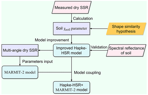
Wet soil are difficult to model because water changes how sunlight interacts with soil surfaces and alters reflectance in different viewing directions. We developed a unified physical model to simulate soil reflectance under varying moisture conditions. The results show that soil moisture not only darkens soil but also changes their directional reflectance, especially in the near-infrared region. This work can improve soil moisture retrieval and future remote sensing applications.
Hongquan Cheng, Mengqing Geng, Xuecao Li, Shijie Li, Min Zhao, Chen Lin, Jie Wang, Peng Gong, and Yuyu Zhou
Earth Syst. Sci. Data, 18, 3449–3479, https://doi.org/10.5194/essd-18-3449-2026, https://doi.org/10.5194/essd-18-3449-2026, 2026
Short summary
Short summary
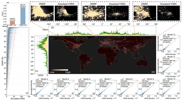
Monthly records of nighttime light are scarce, especially over long periods, yet they are vital for tracking short-term economic shifts and seasonal urban change. This study provides a temporally consistent global 500 m-resolution monthly VIIRS (Visible Infrared Imaging Radiometer Suite)-like nighttime light dataset (1992–2024). By combining DMSP (Defense Meteorological Satellite Program) and VIIRS through reconstruction and correction, a consistent long-term record is created. The dataset supports improved analysis of urban growth and economic activity worldwide.
Hao Jiang, Mengjun Ku, Xia Zhou, Qiong Zheng, Yangxiaoyue Liu, Jianhui Xu, Dan Li, Chongyang Wang, Jiayi Wei, Jing Zhang, Shuisen Chen, and Jianxi Huang
Earth Syst. Sci. Data, 17, 6703–6729, https://doi.org/10.5194/essd-17-6703-2025, https://doi.org/10.5194/essd-17-6703-2025, 2025
Short summary
Short summary
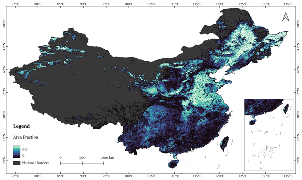
Existing cropland datasets in China show significant discrepancies. We created a high-resolution cropland map of China for 2020, using imagery from Mapbox and Google. By combining image quality assessments, active learning for semantic segmentation, and results integration. The accuracy achieved to 88.73 %, with 30 out of 32 provincial units reporting area estimates within ±10 % of official statistics. In contrast, only 9 to 1 provinces from 7 existing datasets meet the same accuracy standard.
Hui Liang, Shunlin Liang, Bo Jiang, Tao He, Feng Tian, Han Ma, Jianglei Xu, Wenyuan Li, Yichuan Ma, Fengjiao Zhang, and Husheng Fang
Earth Syst. Sci. Data, 17, 5571–5600, https://doi.org/10.5194/essd-17-5571-2025, https://doi.org/10.5194/essd-17-5571-2025, 2025
Short summary
Short summary
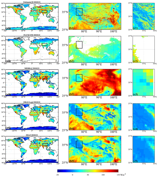
This paper describes 1 km daily mean land surface sensible heat flux (H) and land surface–air temperature difference (Ts-a) datasets on the global scale during 2000–2020. The datasets were developed using a data-driven approach and rigorously validated against in-situ observations and existing H and Ts-a datasets, demonstrating both high accuracy and exceptional spatial resolution.
Yufang Zhang, Shunlin Liang, Han Ma, Tao He, Feng Tian, Guodong Zhang, and Jianglei Xu
Earth Syst. Sci. Data, 17, 5181–5207, https://doi.org/10.5194/essd-17-5181-2025, https://doi.org/10.5194/essd-17-5181-2025, 2025
Short summary
Short summary
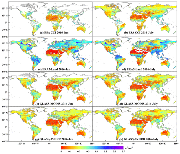
Soil moisture (SM) plays a vital role in climate, agriculture, and hydrology, yet reliable long-term, seamless global datasets remain scarce. To fill this gap, we developed a four-decade seamless global daily 5 km SM product using multi-source datasets and deep learning models. This product has long-term coverage, spatial and temporal integrity, and high accuracy, making it a valuable resource for applications like SM trend analysis, drought monitoring, and assessment of vegetation responses.
Kaiqi Du, Guilong Xiao, Jianxi Huang, Xiaoyan Kang, Xuecao Li, Yelu Zeng, Quandi Niu, Haixiang Guan, and Jianjian Song
Earth Syst. Sci. Data Discuss., https://doi.org/10.5194/essd-2024-432, https://doi.org/10.5194/essd-2024-432, 2025
Manuscript not accepted for further review
Short summary
Short summary
In this manuscript, we developed a 500-m spatial resolution monthly SIF dataset for the China region (CNSIF) from 2003 to 2022 based on high-resolution apparent reflectance and thermal infrared data. The comparison of CNSIF with tower-based SIF observations, tower-based GPP observations, MODIS GPP products, and other SIF datasets has validated CNSIF's ability to capture photosynthetic activity across different vegetation types and its potential for estimating carbon fluxes.
Yangzi Che, Xuecao Li, Xiaoping Liu, Yuhao Wang, Weilin Liao, Xianwei Zheng, Xucai Zhang, Xiaocong Xu, Qian Shi, Jiajun Zhu, Honghui Zhang, Hua Yuan, and Yongjiu Dai
Earth Syst. Sci. Data, 16, 5357–5374, https://doi.org/10.5194/essd-16-5357-2024, https://doi.org/10.5194/essd-16-5357-2024, 2024
Short summary
Short summary
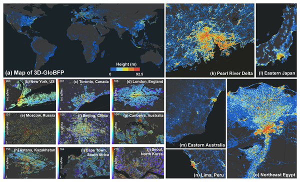
Most existing building height products are limited with respect to either spatial resolution or coverage, not to mention the spatial heterogeneity introduced by global building forms. Using Earth Observation (EO) datasets for 2020, we developed a global height dataset at the individual building scale. The dataset provides spatially explicit information on 3D building morphology, supporting both macro- and microanalysis of urban areas.
Bing Li, Shunlin Liang, Han Ma, Guanpeng Dong, Xiaobang Liu, Tao He, and Yufang Zhang
Earth Syst. Sci. Data, 16, 3795–3819, https://doi.org/10.5194/essd-16-3795-2024, https://doi.org/10.5194/essd-16-3795-2024, 2024
Short summary
Short summary
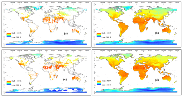
This study describes 1 km all-weather instantaneous and daily mean land surface temperature (LST) datasets on the global scale during 2000–2020. It is the first attempt to synergistically estimate all-weather instantaneous and daily mean LST data on a long global-scale time series. The generated datasets were evaluated by the observations from in situ stations and other LST datasets, and the evaluation indicated that the dataset is sufficiently reliable.
Xinyan Liu, Tao He, Shunlin Liang, Ruibo Li, Xiongxin Xiao, Rui Ma, and Yichuan Ma
Earth Syst. Sci. Data, 15, 3641–3671, https://doi.org/10.5194/essd-15-3641-2023, https://doi.org/10.5194/essd-15-3641-2023, 2023
Short summary
Short summary
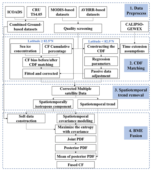
We proposed a data fusion strategy that combines the complementary features of multiple-satellite cloud fraction (CF) datasets and generated a continuous monthly 1° daytime cloud fraction product covering the entire Arctic during the sunlit months in 2000–2020. This study has positive significance for reducing the uncertainties for the assessment of surface radiation fluxes and improving the accuracy of research related to climate change and energy budgets, both regionally and globally.
Wanru He, Xuecao Li, Yuyu Zhou, Zitong Shi, Guojiang Yu, Tengyun Hu, Yixuan Wang, Jianxi Huang, Tiecheng Bai, Zhongchang Sun, Xiaoping Liu, and Peng Gong
Earth Syst. Sci. Data, 15, 3623–3639, https://doi.org/10.5194/essd-15-3623-2023, https://doi.org/10.5194/essd-15-3623-2023, 2023
Short summary
Short summary
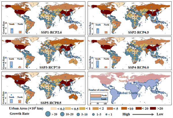
Most existing global urban products with future projections were developed in urban and non-urban categories, which ignores the gradual change of urban development at the local scale. Using annual global urban extent data from 1985 to 2015, we forecasted global urban fractional changes under eight scenarios throughout 2100. The developed dataset can provide spatially explicit information on urban fractions at 1 km resolution, which helps support various urban studies (e.g., urban heat island).
Ruoque Shen, Baihong Pan, Qiongyan Peng, Jie Dong, Xuebing Chen, Xi Zhang, Tao Ye, Jianxi Huang, and Wenping Yuan
Earth Syst. Sci. Data, 15, 3203–3222, https://doi.org/10.5194/essd-15-3203-2023, https://doi.org/10.5194/essd-15-3203-2023, 2023
Short summary
Short summary
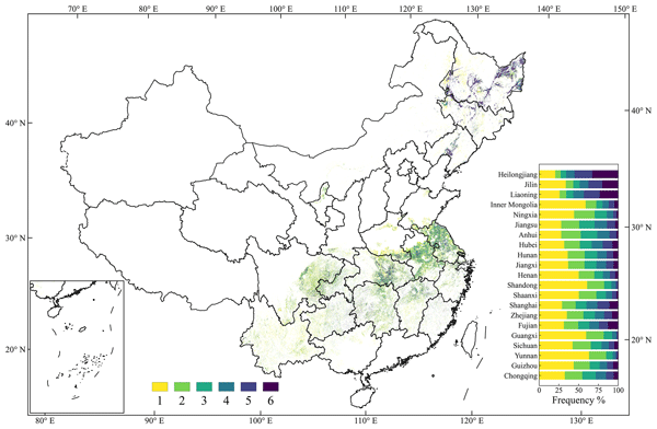
Paddy rice is the second-largest grain crop in China and plays an important role in ensuring global food security. This study developed a new rice-mapping method and produced distribution maps of single-season rice in 21 provincial administrative regions of China from 2017 to 2022 at a 10 or 20 m resolution. The accuracy was examined using 108 195 survey samples and county-level statistical data, and we found that the distribution maps have good accuracy.
Yufang Zhang, Shunlin Liang, Han Ma, Tao He, Qian Wang, Bing Li, Jianglei Xu, Guodong Zhang, Xiaobang Liu, and Changhao Xiong
Earth Syst. Sci. Data, 15, 2055–2079, https://doi.org/10.5194/essd-15-2055-2023, https://doi.org/10.5194/essd-15-2055-2023, 2023
Short summary
Short summary
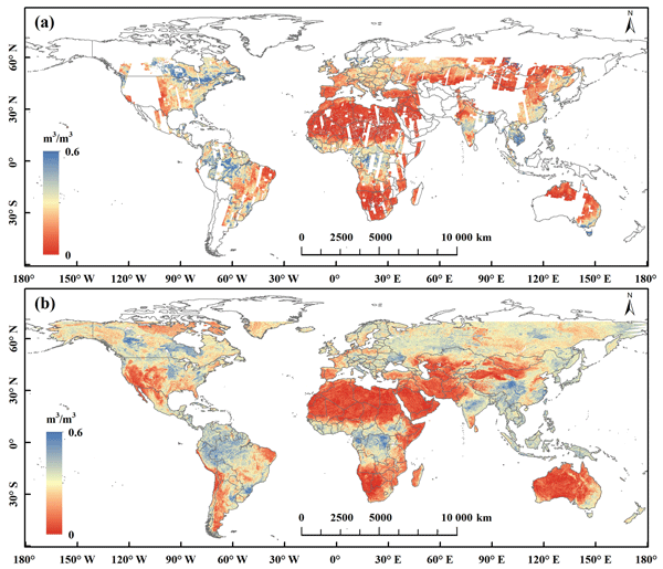
Soil moisture observations are important for a range of earth system applications. This study generated a long-term (2000–2020) global seamless soil moisture product with both high spatial and temporal resolutions (1 km, daily) using an XGBoost model and multisource datasets. Evaluation of this product against dense in situ soil moisture datasets and microwave soil moisture products showed that this product has reliable accuracy and more complete spatial coverage.
Aolin Jia, Shunlin Liang, Dongdong Wang, Lei Ma, Zhihao Wang, and Shuo Xu
Earth Syst. Sci. Data, 15, 869–895, https://doi.org/10.5194/essd-15-869-2023, https://doi.org/10.5194/essd-15-869-2023, 2023
Short summary
Short summary
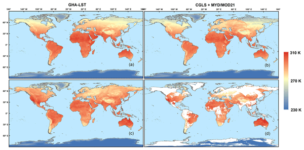
Satellites are now producing multiple global land surface temperature (LST) products; however, they suffer from data gaps caused by cloud cover, seriously restricting the applications, and few products provide gap-free global hourly LST. We produced global hourly, 5 km, all-sky LST data from 2011 to 2021 using geostationary and polar-orbiting satellite data. Based on the assessment, it has high accuracy and can be used to estimate evapotranspiration, drought, etc.
Jose Luis Gómez-Dans, Philip Edward Lewis, Feng Yin, Kofi Asare, Patrick Lamptey, Kenneth Kobina Yedu Aidoo, Dilys Sefakor MacCarthy, Hongyuan Ma, Qingling Wu, Martin Addi, Stephen Aboagye-Ntow, Caroline Edinam Doe, Rahaman Alhassan, Isaac Kankam-Boadu, Jianxi Huang, and Xuecao Li
Earth Syst. Sci. Data, 14, 5387–5410, https://doi.org/10.5194/essd-14-5387-2022, https://doi.org/10.5194/essd-14-5387-2022, 2022
Short summary
Short summary
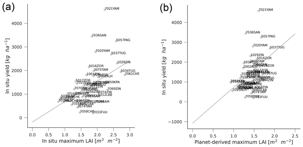
We provide a data set to support mapping croplands in smallholder landscapes in Ghana. The data set contains information on crop location on three agroecological zones for 2 years, temporal series of measurements of leaf area index and leaf chlorophyll concentration for maize canopies and yield. We demonstrate the use of these data to validate cropland masks, create a maize mask using satellite data and explore the relationship between satellite measurements and yield.
Han Ma, Shunlin Liang, Changhao Xiong, Qian Wang, Aolin Jia, and Bing Li
Earth Syst. Sci. Data, 14, 5333–5347, https://doi.org/10.5194/essd-14-5333-2022, https://doi.org/10.5194/essd-14-5333-2022, 2022
Short summary
Short summary
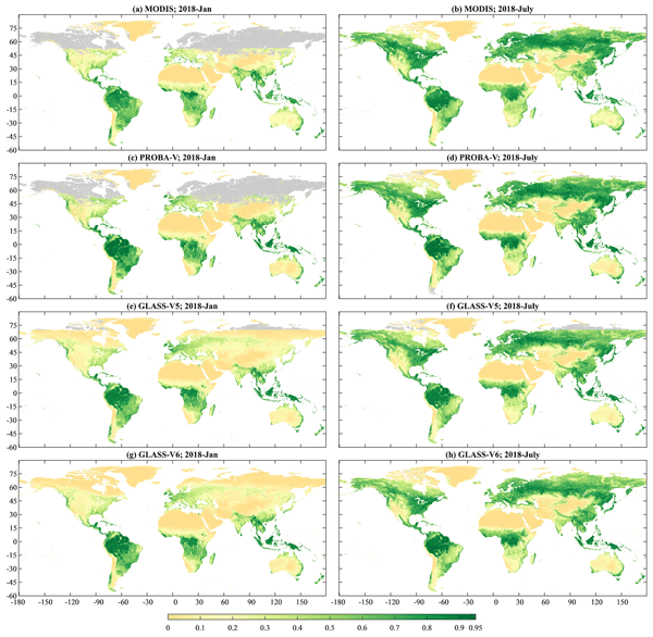
The fraction of absorbed photosynthetically active radiation (FAPAR) is one of the essential climate variables. This study generated a global land surface FAPAR product with a 250 m resolution based on a deep learning model that takes advantage of the existing FAPAR products and MODIS time series of observation information. Direct validation and intercomparison revealed that our product better meets user requirements and has a greater spatiotemporal continuity than other existing products.
Rui Ma, Jingfeng Xiao, Shunlin Liang, Han Ma, Tao He, Da Guo, Xiaobang Liu, and Haibo Lu
Geosci. Model Dev., 15, 6637–6657, https://doi.org/10.5194/gmd-15-6637-2022, https://doi.org/10.5194/gmd-15-6637-2022, 2022
Short summary
Short summary
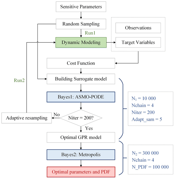
Parameter optimization can improve the accuracy of modeled carbon fluxes. Few studies conducted pixel-level parameterization because it requires a high computational cost. Our paper used high-quality spatial products to optimize parameters at the pixel level, and also used the machine learning method to improve the speed of optimization. The results showed that there was significant spatial variability of parameters and we also improved the spatial pattern of carbon fluxes.
Quandi Niu, Xuecao Li, Jianxi Huang, Hai Huang, Xianda Huang, Wei Su, and Wenping Yuan
Earth Syst. Sci. Data, 14, 2851–2864, https://doi.org/10.5194/essd-14-2851-2022, https://doi.org/10.5194/essd-14-2851-2022, 2022
Short summary
Short summary
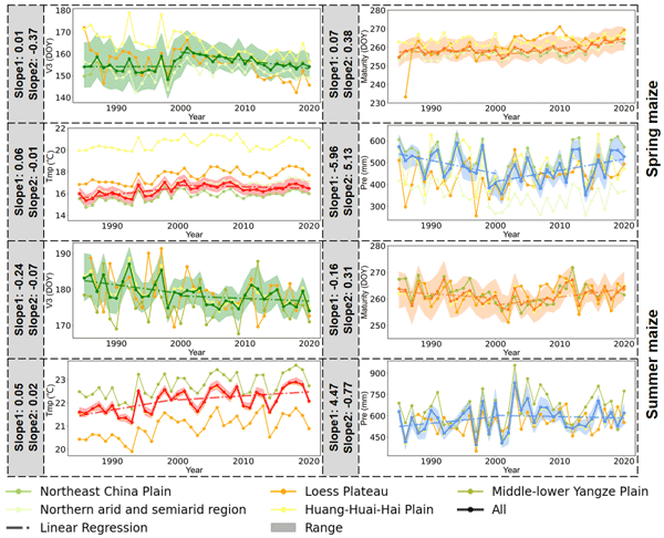
In this paper we generated the first national maize phenology product with a fine spatial resolution (30 m) and a long temporal span (1985–2020) in China, using Landsat images. The derived phenological indicators agree with in situ observations and provide more spatial details than moderate resolution phenology products. The extracted maize phenology dataset can support precise yield estimation and deepen our understanding of the response of agroecosystem to global warming in the future.
Jianglei Xu, Shunlin Liang, and Bo Jiang
Earth Syst. Sci. Data, 14, 2315–2341, https://doi.org/10.5194/essd-14-2315-2022, https://doi.org/10.5194/essd-14-2315-2022, 2022
Short summary
Short summary
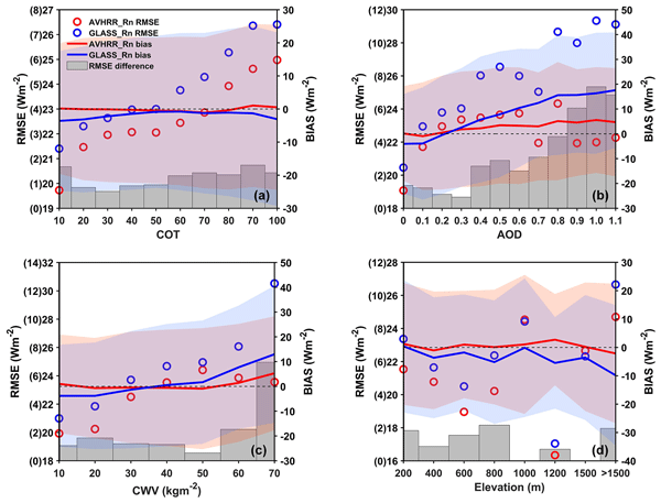
Land surface all-wave net radiation (Rn) is a key parameter in many land processes. Current products have drawbacks of coarse resolutions, large uncertainty, and short time spans. A deep learning method was used to obtain global surface Rn. A long-term Rn product was generated from 1981 to 2019 using AVHRR data. The product has the highest accuracy and a reasonable spatiotemporal variation compared to three other products. Our product will play an important role in long-term climate change.
Min Zhao, Changxiu Cheng, Yuyu Zhou, Xuecao Li, Shi Shen, and Changqing Song
Earth Syst. Sci. Data, 14, 517–534, https://doi.org/10.5194/essd-14-517-2022, https://doi.org/10.5194/essd-14-517-2022, 2022
Short summary
Short summary
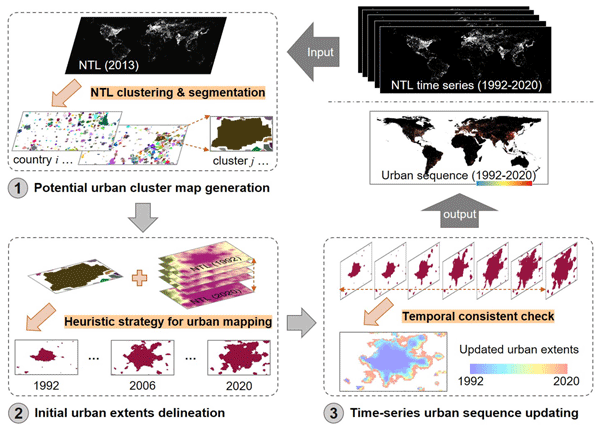
We generated a unique dataset of global annual urban extents (1992–2020) using consistent nighttime light observations and analyzed global urban dynamics over the past 3 decades. Evaluations using other urbanization-related ancillary data indicate that the derived urban areas are reliable for characterizing spatial extents associated with intensive human settlement and high-intensity socioeconomic activities. This dataset can provide unique information for studying urbanization and its impacts.
Xueyuan Gao, Shunlin Liang, Dongdong Wang, Yan Li, Bin He, and Aolin Jia
Earth Syst. Dynam., 13, 219–230, https://doi.org/10.5194/esd-13-219-2022, https://doi.org/10.5194/esd-13-219-2022, 2022
Short summary
Short summary
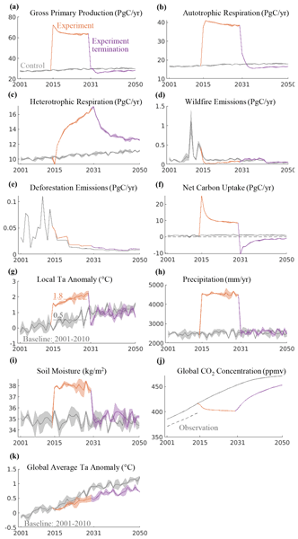
Numerical experiments with a coupled Earth system model show that large-scale nighttime artificial lighting in tropical forests will significantly increase carbon sink, local temperature, and precipitation, and it requires less energy than direct air carbon capture for capturing 1 t of carbon, suggesting that it could be a powerful climate mitigation option. Side effects include CO2 outgassing after the termination of the nighttime lighting and impacts on local wildlife.
Xiaona Chen, Shunlin Liang, Lian He, Yaping Yang, and Cong Yin
Earth Syst. Sci. Data Discuss., https://doi.org/10.5194/essd-2021-279, https://doi.org/10.5194/essd-2021-279, 2021
Preprint withdrawn
Short summary
Short summary
The present study developed a 39 year consistent 8-day 0.05 degree gap-free SCE dataset over the NH for the period 1981–2019 as part of the Global LAnd Surface Satellite dataset (GLASS) product suite based on the NOAA AVHRR-SR CDR and several contributory datasets. Compared with published SCE datasets, GLASS SCE has several advantages in snow cover studies, including long time series, finer spatial resolution (especially for years before 2000), and complete spatial coverage.

Bowen Cao, Le Yu, Xuecao Li, Min Chen, Xia Li, Pengyu Hao, and Peng Gong
Earth Syst. Sci. Data, 13, 5403–5421, https://doi.org/10.5194/essd-13-5403-2021, https://doi.org/10.5194/essd-13-5403-2021, 2021
Short summary
Short summary
In the study, the first 1 km global cropland proportion dataset for 10 000 BCE–2100 CE was produced through the harmonization and downscaling framework. The mapping result coincides well with widely used datasets at present. With improved spatial resolution, our maps can better capture the cropland distribution details and spatial heterogeneity. The dataset will be valuable for long-term simulations and precise analyses. The framework can be extended to specific regions or other land use types.
Cited articles
AAFC: Annual crop inventory 2025, https://open.canada.ca/data/en/dataset (last access: 25 August 2026), 2025.
Akanbi, O. D., Bhuvanagiri, D. C., Barcelos, E. I., Nihar, A., Gonzalez Hernandez, B., Yarus, J. M., and French, R. H.: Integrating multiscale geospatial analysis for monitoring crop growth, nutrient distribution, and hydrological dynamics in large-scale agricultural systems, J. Geovisualization Spatial Anal., 8, 9, https://doi.org/10.1007/s41651-023-00164-y, 2024.
Ashourloo, D., Nematollahi, H., Huete, A., Aghighi, H., Azadbakht, M., Shahrabi, H. S., and Goodarzdashti, S.: A new phenology-based method for mapping wheat and barley using time-series of sentinel-2 images, Remote Sens. Environ., 280, 113206, https://doi.org/10.1016/j.rse.2022.113206, 2022.
Becker-Reshef, I., Franch, B., Barker, B., Murphy, E., Santamaria-Artigas, A., Humber, M., Skakun, S., and Vermote, E.: Prior season crop type masks for winter wheat yield forecasting: a US case study, Remote Sens., 10, 1659, https://doi.org/10.3390/rs10101659, 2018.
Blickensdörfer, L., Schwieder, M., Pflugmacher, D., Nendel, C., Erasmi, S., and Hostert, P.: Mapping of crop types and crop sequences with combined time series of sentinel-1, sentinel-2 and landsat 8 data for Germany, Remote Sens. Environ., 269, 112831, https://doi.org/10.1016/j.rse.2021.112831, 2022.
Borrelli, P., Panagos, P., Alewell, C., Ballabio, C., de Oliveira Fagundes, H., Haregeweyn, N., Lugato, E., Maerker, M., Poesen, J., and Vanmaercke, M.: Policy implications of multiple concurrent soil erosion processes in European farmland, Nat. Sustain., 6, 103–112, https://doi.org/10.1038/s41893-022-00988-4, 2023.
Chen, X., Wang, D., Chen, J., Wang, C., and Shen, M.: The mixed pixel effect in land surface phenology: a simulation study, Remote Sens. Environ., 211, 338–344, https://doi.org/10.1016/j.rse.2018.04.030, 2018.
d'Andrimont, R., Verhegghen, A., Lemoine, G., Kempeneers, P., Meroni, M., and van der Velde, M.: EUCROPMAP 2018, European Commission, Joint Research Centre [data set], https://doi.org/10.2905/JRC.6ZVVSM8, 2026.
Ding, Y., Qu, Y., Peng, Z., Wang, M., and Li, X.: Estimating surface albedo of arctic sea ice using an ensemble back-propagation neural network: toward a better consideration of reflectance anisotropy and melt ponds, IEEE T. Geosci. Remote Sens., 60, 1–17, https://doi.org/10.1109/TGRS.2022.3202046, 2022.
Dong, J., Fu, Y., Wang, J., Tian, H., Fu, S., Niu, Z., Han, W., Zheng, Y., Huang, J., and Yuan, W.: Early-season mapping of winter wheat in China based on Landsat and Sentinel images, Earth Syst. Sci. Data, 12, 3081–3095, https://doi.org/10.5194/essd-12-3081-2020, 2020a.
Dong, J., Fu, Y., Wang, J., Tian, H., Fu, S., Niu, Z., Han, W., Zheng, Y., Huang, J., and Yuan, W.: 30m winter wheat distribution map of China for four years (2016–2019), figshare [data set], https://doi.org/10.6084/m9.figshare.12003990.v2, 2020b.
Fan, L., Xia, L., Yang, J., Sun, X., Wu, S., Qiu, B., Chen, J., Wu, W., and Yang, P.: A temporal-spatial deep learning network for winter wheat mapping using time-series sentinel-2 imagery, ISPRS J. Photogramm., 214, 48–64, https://doi.org/10.1016/j.isprsjprs.2024.06.005, 2024.
FAOSTAT: Crops and livestock products, https://www.fao.org/faostat/en/#data/QCL (last access: 25 August 2026), 2025.
Fu, Y., Chen, X., Song, C., Huang, X., Dong, J., Peng, Q., and Yuan, W.: High-resolution mapping of global winter-triticeae crops using a sample-free identification method, Earth Syst. Sci. Data, 17, 95–115, https://doi.org/10.5194/essd-17-95-2025, 2025.
Ghaffari, O., Valadan Zoej, M. J., and Mokhtarzade, M.: Reducing the effect of the endmembers' spectral variability by selecting the optimal spectral bands, Remote Sens., 9, 884, https://doi.org/10.3390/rs9090884, 2017.
Ghassemi, B., Dujakovic, A., Żółtak, M., Immitzer, M., Atzberger, C., and Vuolo, F.: Designing a European-wide crop type mapping approach based on machine learning algorithms using LUCAS field survey and sentinel-2 data, Remote Sens., 14, 541, https://doi.org/10.3390/rs14030541, 2022.
Guan, H., Huang, J., Li, L., Li, X., Miao, S., Su, W., Ma, Y., Niu, Q., and Huang, H.: Improved gaussian mixture model to map the flooded crops of VV and VH polarization data, Remote Sens. Environ., 295, 113714, https://doi.org/10.1016/j.rse.2023.113714, 2023.
Hao, P., Di, L., Zhang, C., and Guo, L.: Transfer learning for crop classification with cropland data layer data (CDL) as training samples, Sci. Total Environ., 733, 138869, https://doi.org/10.1016/j.scitotenv.2020.138869, 2020.
Hao, S., Ryu, D., Western, A., Perry, E., Bogena, H., and Franssen, H. J. H.: Performance of a wheat yield prediction model and factors influencing the performance: a review and meta-analysis, Agr. Syst., 194, 103278, https://doi.org/10.1016/j.agsy.2021.103278, 2021.
Harshvardhan, G. M., Gourisaria, M. K., Pandey, M., and Rautaray, S. S.: A comprehensive survey and analysis of generative models in machine learning, Comput. Sci. Rev., 38, 100285, https://doi.org/10.1016/j.cosrev.2020.100285, 2020.
Heck, E., de Beurs, K. M., Owsley, B. C., and Henebry, G. M.: Evaluation of the MODIS collections 5 and 6 for change analysis of vegetation and land surface temperature dynamics in north and South America, ISPRS J. Photogramm., 156, 121–134, https://doi.org/10.1016/j.isprsjprs.2019.07.011, 2019.
Hu, Q., Yin, H., Friedl, M. A., You, L., Li, Z., Tang, H., and Wu, W.: Integrating coarse-resolution images and agricultural statistics to generate sub-pixel crop type maps and reconciled area estimates, Remote Sens. Environ., 258, 112365, https://doi.org/10.1016/j.rse.2021.112365, 2021.
Huang, X., Huang, J., Li, X., Shen, Q., and Chen, Z.: Early mapping of winter wheat in henan province of China using time series of sentinel-2 data, GISci. Remote Sens., 59, 1534–1549, https://doi.org/10.1080/15481603.2022.2104999, 2022.
Hunt, M. L., Blackburn, G. A., Carrasco, L., Redhead, J. W., and Rowland, C. S.: High resolution wheat yield mapping using sentinel-2, Remote Sens. Environ., 233, 111410, https://doi.org/10.1016/j.rse.2019.111410, 2019.
Jiang, T., Wang, B., Xu, X., Cao, Y., Li Liu, D., He, L., Jin, N., Ma, H., Chen, S., and Zhao, K.: Identifying sources of uncertainty in wheat production projections with consideration of crop climatic suitability under future climate, Agr. Forest Meteorol., 319, 108933, https://doi.org/10.1016/j.agrformet.2022.108933, 2022.
Jin, S., Zhang, F., Zheng, Y., Zhou, L., Zuo, X., Zhang, Z., Zhao, W., Zhang, W., and Pan, X.: CSKNN: cost-sensitive K-nearest neighbor using hyperspectral imaging for identification of wheat varieties, Comput. Electr. Eng., 111, 108896, https://doi.org/10.1016/j.compeleceng.2023.108896, 2023.
Júnior, R. de S. N., Ewert, F., Webber, H., Martre, P., Hertel, T. W., van Ittersum, M. K., and Asseng, S.: Needed global wheat stock and crop management in response to the war in Ukraine, Global Food Secur., 35, 100662, https://doi.org/10.1016/j.gfs.2022.100662, 2022.
Kathirvelu, K., Yesudhas, A. V. P., and Ramanathan, S.: Spectral unmixing based random forest classifier for detecting surface water changes in multitemporal pansharpened landsat image, Expert Syst. Appl., 224, 120072, https://doi.org/10.1016/j.eswa.2023.120072, 2023.
Lei, L., Wang, X., Zhang, L., Hu, X., and Zhong, Y.: CROPUP: historical products are all you need? An end-to-end cross-year crop map updating framework without the need for in situ samples, Remote Sens. Environ., 315, 114430, https://doi.org/10.1016/j.rse.2024.114430, 2024.
Li, W., Weiss, M., Jay, S., Wei, S., Zhao, N., Comar, A., Lopez-Lozano, R., De Solan, B., Yu, Q., and Wu, W.: Daily monitoring of effective green area index and vegetation chlorophyll content from continuous acquisitions of a multi-band spectrometer over winter wheat, Remote Sens. Environ., 300, 113883, https://doi.org/10.1016/j.rse.2023.113883, 2024.
Liu, L., Xiao, X., Qin, Y., Wang, J., Xu, X., Hu, Y., and Qiao, Z.: Mapping cropping intensity in China using time series landsat and sentinel-2 images and Google earth engine, Remote Sens. Environ., 239, 111624, https://doi.org/10.1016/j.rse.2019.111624, 2020.
Liu, M., He, W., and Zhang, H.: WPS: a whole phenology-based spectral feature selection method for mapping winter crop from time-series images, ISPRS J. Photogramm., 210, 141–159, https://doi.org/10.1016/j.isprsjprs.2024.03.005, 2024.
Lobert, F., Löw, J., Schwieder, M., Gocht, A., Schlund, M., Hostert, P., and Erasmi, S.: A deep learning approach for deriving winter wheat phenology from optical and SAR time series at field level, Remote Sens. Environ., 298, 113800, https://doi.org/10.1016/j.rse.2023.113800, 2023.
Luo, Y., Zhang, Z., Cao, J., Zhang, L., Zhang, J., Han, J., Zhuang, H., Cheng, F., Xu, J., Tao, F. and Tang, Q.: Accurately estimating global wheat yields at 4-km resolution during 1982–2020 (GlobalWheatYield4km), figshare [data set], https://doi.org/10.6084/m9.figshare.10025006.v2, 2022.
Ma, L., Yang, S., Gu, Q., Li, J., Yang, X., Wang, J., and Ding, J.: Spatial and temporal mapping of cropland expansion in northwestern China with multisource remotely sensed data, Catena, 183, 104192, https://doi.org/10.1016/j.catena.2019.104192, 2019.
Masiliūnas, D., Tsendbazar, N.-E., Herold, M., Lesiv, M., Buchhorn, M., and Verbesselt, J.: Global land characterisation using land cover fractions at 100 m resolution, Remote Sens. Environ., 259, 112409, https://doi.org/10.1016/j.rse.2021.112409, 2021.
Mohammadi, S., Belgiu, M., and Stein, A.: A source-free unsupervised domain adaptation method for cross-regional and cross-time crop mapping from satellite image time series, Remote Sens. Environ., 314, 114385, https://doi.org/10.1016/j.rse.2024.114385, 2024.
Naumann, P., Kauffmann, J., and Montavon, G.: Wasserstein distances made explainable: insights into dataset shifts and transport phenomena, IEEE Trans. Pattern Anal., https://doi.org/10.1109/TPAMI.2026.3656947, 2026.
Nelson, K. S. and Burchfield, E. K.: Landscape complexity and US crop production, Nat. Food, 2, 330–338, https://doi.org/10.1038/s43016-021-00281-1, 2021.
Olofsson, P., Foody, G. M., Herold, M., Stehman, S. V., Woodcock, C. E., and Wulder, M. A.: Good practices for estimating area and assessing accuracy of land change, Remote Sens. Environ., 148, 42–57, https://doi.org/10.1016/j.rse.2014.02.015, 2014.
Pham, V.-D., Tetteh, G., Thiel, F., Erasmi, S., Schwieder, M., Frantz, D., and van der Linden, S.: Temporally transferable crop mapping with temporal encoding and deep learning augmentations, Int. J. Appl. Earth Obs., 129, 103867, https://doi.org/10.1016/j.jag.2024.103867, 2024.
Potapov, P., Turubanova, S., Hansen, M. C., Tyukavina, A., Zalles, V., Khan, A., Song, X.-P., Pickens, A., Shen, Q., and Cortez, J.: Global maps of cropland extent and change show accelerated cropland expansion in the twenty-first century, Nat. Food, 3, 19–28, https://doi.org/10.1038/s43016-021-00429-z, 2022.
Pott, L. P., Amado, T. J. C., Schwalbert, R. A., Corassa, G. M., and Ciampitti, I. A.: Satellite-based data fusion crop type classification and mapping in rio grande do sul, brazil, ISPRS J. Photogramm., 176, 196–210, https://doi.org/10.1016/j.isprsjprs.2021.04.015, 2021.
Qu, C., Li, P., and Zhang, C.: A spectral index for winter wheat mapping using multi-temporal landsat NDVI data of key growth stages, ISPRS J. Photogramm., 175, 431–447, https://doi.org/10.1016/j.isprsjprs.2021.03.015, 2021.
Ren, J., Shao, Y., Wan, H., Xie, Y., and Campos, A.: A two-step mapping of irrigated corn with multi-temporal MODIS and landsat analysis ready data, ISPRS J. Photogramm., 176, 69–82, https://doi.org/10.1016/j.isprsjprs.2021.04.007, 2021.
Ren, S., Qin, Q., and Ren, H.: Contrasting wheat phenological responses to climate change in global scale, Sci. Total Environ., 665, 620–631, https://doi.org/10.1016/j.scitotenv.2019.01.394, 2019.
Román, M. O., Justice, C., Paynter, I., Boucher, P. B., Devadiga, S., Endsley, A., Erb, A., Friedl, M., Gao, H., and Giglio, L.: Continuity between NASA MODIS collection 6.1 and VIIRS collection 2 land products, Remote Sens. Environ., 302, 113963, https://doi.org/10.1016/j.rse.2023.113963, 2024.
Rufin, P., Bey, A., Picoli, M., and Meyfroidt, P.: Large-area mapping of active cropland and short-term fallows in smallholder landscapes using PlanetScope data, Int. J. Appl. Earth Obs., 112, 102937, https://doi.org/10.1016/j.jag.2022.102937, 2022.
Schwalbert, R. A., Amado, T., Corassa, G., Pott, L. P., Prasad, P. V., and Ciampitti, I. A.: Satellite-based soybean yield forecast: integrating machine learning and weather data for improving crop yield prediction in southern Brazil, Agr. Forest Meteorol., 284, 107886, https://doi.org/10.1016/j.agrformet.2019.107886, 2020.
Shao, C., Shuai, Y., Wu, H., Deng, X., Zhang, X., and Xu, A.: Development of a spectral index for the detection of yellow-flowering vegetation, Remote Sens., 15, 1725, https://doi.org/10.3390/rs15071725, 2023.
Shen, R., Peng, Q., Li, X., Chen, X., and Yuan, W.: CCD-Rice: a long-term paddy rice distribution dataset in China at 30 m resolution, Earth Syst. Sci. Data, 17, 2193–2216, https://doi.org/10.5194/essd-17-2193-2025, 2025.
Skakun, S., Franch, B., Vermote, E., Roger, J.-C., Becker-Reshef, I., Justice, C., and Kussul, N.: Early season large-area winter crop mapping using MODIS NDVI data, growing degree days information and a gaussian mixture model, Remote Sens. Environ., 195, 244–258, https://doi.org/10.1016/j.rse.2017.04.026, 2017.
Tao, F., Zhang, L., Zhang, Z., and Chen, Y.: Climate warming outweighed agricultural managements in affecting wheat phenology across china during 1981–2018, Agr. Forest Meteorol., 316, 108865, https://doi.org/10.1016/j.agrformet.2022.108865, 2022.
Tian, H., Yang, M., Wu, F., Qin, Y., Zhang, X., Liu, J., and Yan, W.: Potentiality of landsat-9 for early-season mapping of winter garlic and winter wheat, Geo-spatial Inf. Sci., 27, 2199–2210, https://doi.org/10.1080/10095020.2024.2311868, 2024.
Tran, K. H., Zhang, H. K., McMaine, J. T., Zhang, X., and Luo, D.: 10 m crop type mapping using sentinel-2 reflectance and 30 m cropland data layer product, Int. J. Appl. Earth Obs., 107, 102692, https://doi.org/10.1016/j.jag.2022.102692, 2022.
USDA-NASS: Cropland data layer metadata, https://www.nass.usda.gov/Research_and_Science/Cropland/metadata/meta.php (last access: 25 August 2026), 2025.
Wang, Q., Shi, W., Atkinson, P. M., and Zhao, Y.: Downscaling MODIS images with area-to-point regression kriging, Remote Sens. Environ., 166, 191–204, https://doi.org/10.1016/j.rse.2015.06.003, 2015.
Wang, S., Azzari, G., and Lobell, D. B.: Crop type mapping without field-level labels: random forest transfer and unsupervised clustering techniques, Remote Sens. Environ., 222, 303–317, https://doi.org/10.1016/j.rse.2018.12.026, 2019.
Wang, S., Di Tommaso, S., Faulkner, J., Friedel, T., Kennepohl, A., Strey, R., and Lobell, D. B.: Mapping crop types in southeast India with smartphone crowdsourcing and deep learning, Remote Sens., 12, 2957, https://doi.org/10.3390/rs12182957, 2020.
Wen, Y., Li, X., Mu, H., Zhong, L., Chen, H., Zeng, Y., Miao, S., Su, W., Gong, P., Li, B., and Huang, J.: Mapping corn dynamics using limited but representative samples with adaptive strategies, ISPRS J. Photogramm., 190, 252–266, https://doi.org/10.1016/j.isprsjprs.2022.06.012, 2022.
Wen, Y., Chen, T., and Xuecao, L.: 20-years winter wheat dynamics in global primary planting areas, figshare [data set], https://doi.org/10.6084/m9.figshare.32149033.v1, 2026.
Wójcik-Gront, E.: Variables influencing yield-scaled global warming potential and yield of winter wheat production, Field Crops Res., 227, 19–29, https://doi.org/10.1016/j.fcr.2018.07.015, 2018.
Xie, Y., Nhu, A. N., Song, X.-P., Jia, X., Skakun, S., Li, H., and Wang, Z.: Accounting for spatial variability with geo-aware random forest: a case study for US major crop mapping, Remote Sens. Environ., 319, 114585, https://doi.org/10.1016/j.rse.2024.114585, 2025.
Yahiaoui, I., Bradaï, A., Douaoui, A., and Abdennour, M. A.: Performance of random forest and buffer analysis of sentinel-2 data for modelling soil salinity in the lower-cheliff plain (algeria), Int. J. Remote Sens., 42, 148–171, https://doi.org/10.1080/01431161.2020.1823515, 2021.
Yan, K., Pu, J., Park, T., Xu, B., Zeng, Y., Yan, G., Weiss, M., Knyazikhin, Y., and Myneni, R. B.: Performance stability of the MODIS and VIIRS LAI algorithms inferred from analysis of long time series of products, Remote Sens. Environ., 260, 112438, https://doi.org/10.1016/j.rse.2021.112438, 2021.
Yang, G., Li, X., Liu, P., Yao, X., Zhu, Y., Cao, W., and Cheng, T.: Automated in-season mapping of winter wheat in China with training data generation and model transfer, ISPRS J. Photogramm., 202, 422–438, https://doi.org/10.1016/j.isprsjprs.2023.07.004, 2023.
Yang, G., Li, X., Xiong, Y., He, M., Zhang, L., Jiang, C., Yao, X., Zhu, Y., Cao, W., and Cheng, T.: Annual winter wheat mapping for unveiling spatiotemporal patterns in China with a knowledge-guided approach and multi-source datasets, ISPRS J. Photogramm., 225, 163–179, https://doi.org/10.1016/j.isprsjprs.2025.04.031, 2025a.
Yang, G., Cheng, T., Li, X., Xiong, Y., He, M., Jiang, C., Yao, X., Zhu, Y., and Cao, W.: ChinaWheat30L: Long-term winter wheat maps of China at 30-m resolution from 2000 to 2023 (Version 2), Zenodo [data set], https://doi.org/10.5281/zenodo.15124014, 2025b.
You, N., Dong, J., Li, J., Huang, J., and Jin, Z.: Rapid early-season maize mapping without crop labels, Remote Sens. Environ., 290, 113496, https://doi.org/10.1016/j.rse.2023.113496, 2023.
Zhang, H., Du, H., Zhang, C., and Zhang, L.: An automated early-season method to map winter wheat using time-series sentinel-2 data: a case study of shandong, china, Comput. Electron. Agr., 182, 105962, https://doi.org/10.1016/j.compag.2020.105962, 2021.
Zhang, J., Wang, S., Pradhan, P., Zhao, W., and Fu, B.: Mapping the complexity of the food-energy-water nexus from the lens of sustainable development goals in China, Resour. Conserv. Recy., 183, 106357, https://doi.org/10.1016/j.resconrec.2022.106357, 2022a.
Zhang, Q., Men, X., Hui, C., Ge, F., and Ouyang, F.: Wheat yield losses from pests and pathogens in China, Agr. Ecosyst. Environ., 326, 107821, https://doi.org/10.1016/j.agee.2021.107821, 2022b.
Zhang, X.-W., Liu, J.-F., Qin, Z., and Fen, Q. I. N.: Winter wheat identification by integrating spectral and temporal information derived from multi-resolution remote sensing data, J. Integr. Agr., 18, 2628–2643, https://doi.org/10.1016/S2095-3119(19)62615-8, 2019.
Zhang, Z., Luo, Y., Han, J., Xu, J., and Tao, F.: Estimating global wheat yields at 4 km resolution during 1982–2020 by a spatiotemporal transferable method, Remote Sens., 16, 2342, https://doi.org/10.3390/rs16132342, 2024.
Zhao, Y., Tao, H., He, P., Yao, X., Cheng, T., Zhu, Y., Cao, W., and Tian, Y.: Annual 30 m winter wheat yield mapping in the huang-huai-hai plain using crop growth model and long-term satellite images, Comput. Electron. Agr., 214, 108335, https://doi.org/10.1016/j.compag.2023.108335, 2023.
Zhong, L., Hu, L., Zhou, H., and Tao, X.: Deep learning based winter wheat mapping using statistical data as ground references in kansas and northern texas, US, Remote Sens. Environ., 233, 111411, https://doi.org/10.1016/j.rse.2019.111411, 2019.
Zhu, X., Duan, S.-B., Li, Z.-L., Wu, P., Wu, H., Zhao, W., and Qian, Y.: Reconstruction of land surface temperature under cloudy conditions from landsat 8 data using annual temperature cycle model, Remote Sens. Environ., 281, 113261, https://doi.org/10.1016/j.rse.2022.113261, 2022.
Short summary
We developed a new method to track winter wheat growth across the world from 2001 to 2020. Using satellite data, we produced high-resolution maps (1 km) that show exactly where and how much winter wheat was planted over the last two decades. The results proved to be highly accurate when compared against international agricultural records. As the first long-term, global view of its kind, this map series is a vital tool for scientists and policymakers working to eliminate hunger.
We developed a new method to track winter wheat growth across the world from 2001 to 2020. Using...


Altmetrics
Final-revised paper
Preprint