Articles | Volume 18, issue 7
https://doi.org/10.5194/essd-18-5375-2026
© Author(s) 2026. This work is distributed under
the Creative Commons Attribution 4.0 License.
the Creative Commons Attribution 4.0 License.
https://doi.org/10.5194/essd-18-5375-2026
© Author(s) 2026. This work is distributed under
the Creative Commons Attribution 4.0 License.
the Creative Commons Attribution 4.0 License.
Data description article
| 
24 Jul 2026
Data description article |
| 24 Jul 2026
| 24 Jul 2026
Democratizing planetary-scale analysis: an ultra-lightweight Earth embedding database for accurate and flexible global land monitoring
Shuang Chen
Department of Geography, The University of Hong Kong, Hong Kong, China
Jie Wang
CORRESPONDING AUTHOR

Pengcheng Laboratory, Shenzhen 518000, China
Shuai Yuan
Department of Geography, The University of Hong Kong, Hong Kong, China
Jiayang Li
Pengcheng Laboratory, Shenzhen 518000, China
Yu Xia
Pengcheng Laboratory, Shenzhen 518000, China
Yuanhong Liao
Ministry of Education Key Laboratory for Earth System Modeling, Department of Earth System Science, Tsinghua University, Beijing 100084, China
Junbo Wei
Pengcheng Laboratory, Shenzhen 518000, China
Jincheng Yuan
Pengcheng Laboratory, Shenzhen 518000, China
Xiaoqing Xu
Pengcheng Laboratory, Shenzhen 518000, China
Xiaolin Zhu
Department of Land Surveying and Geo-Informatics, The Hong Kong Polytechnic University, Hong Kong, China
Department of Geography, The University of Hong Kong, Hong Kong, China
Hongsheng Zhang
Department of Geography, The University of Hong Kong, Hong Kong, China
Yuyu Zhou
Department of Geography, The University of Hong Kong, Hong Kong, China
Haohuan Fu
Tsinghua Shenzhen International Graduate School, Shenzhen, China
Huabing Huang
School of Geospatial Engineering and Science, Sun Yat-sen University, Guangzhou 510275, China
Department of Architecture, The University of Hong Kong, Hong Kong, China
Institute for Climate and Carbon Neutrality, The University of Hong Kong, Hong Kong, China
Fan Dai
Institute for Climate and Carbon Neutrality, The University of Hong Kong, Hong Kong, China
Peng Gong
CORRESPONDING AUTHOR
Department of Geography, The University of Hong Kong, Hong Kong, China
Institute for Climate and Carbon Neutrality, The University of Hong Kong, Hong Kong, China
Department of Earth Sciences, The University of Hong Kong, Hong Kong, China
Related authors
Yuanhong Liao, Shuang Chen, Yuqi Bai, Jie Wang, and Peng Gong
Earth Syst. Sci. Data, 18, 7071–7096, https://doi.org/10.5194/essd-18-7071-2026, https://doi.org/10.5194/essd-18-7071-2026, 2026
Short summary
Short summary
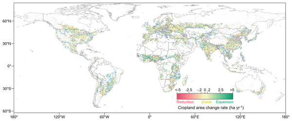
To track changes in land used for crops, we used satellite observations to create annual global maps for 2000–2024 at a resolution of 30 m. The global area used for crops increased by about 30 million hectares. Expansion was concentrated in parts of Africa and South America, while many other regions showed stability or decline. These maps help track agricultural land use and support research on food security and environmental change.
Shuang Chen, Jie Wang, Qiang Liu, Xiangan Liang, Rui Liu, Peng Qin, Jincheng Yuan, Junbo Wei, Shuai Yuan, Huabing Huang, and Peng Gong
Earth Syst. Sci. Data, 16, 5449–5475, https://doi.org/10.5194/essd-16-5449-2024, https://doi.org/10.5194/essd-16-5449-2024, 2024
Short summary
Short summary
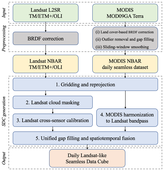
The inconsistent coverage of Landsat data due to its long revisit intervals and frequent cloud cover poses challenges to large-scale land monitoring. We developed a global 30 m 23-year (2000–2022) daily seamless data cube (SDC) of surface reflectance based on Landsat 5, 7, 8, and 9 and MODIS products. The SDC exhibits enhanced capabilities for monitoring land cover changes and robust consistency in both spatial and temporal dimensions, which are important for global environmental monitoring.
Xiangan Liang, Qiang Liu, Jie Wang, Shuang Chen, and Peng Gong
Earth Syst. Sci. Data, 16, 177–200, https://doi.org/10.5194/essd-16-177-2024, https://doi.org/10.5194/essd-16-177-2024, 2024
Short summary
Short summary
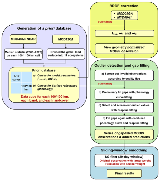
The state-of-the-art MODIS surface reflectance products suffer from temporal and spatial gaps, which make it difficult to characterize the continuous variation of the terrestrial surface. We proposed a framework for generating the first global 500 m daily seamless data cubes (SDC500), covering the period from 2000 to 2022. We believe that the SDC500 dataset can interest other researchers who study land cover mapping, quantitative remote sensing, and ecological science.
Yuanhong Liao, Shuang Chen, Yuqi Bai, Jie Wang, and Peng Gong
Earth Syst. Sci. Data, 18, 7071–7096, https://doi.org/10.5194/essd-18-7071-2026, https://doi.org/10.5194/essd-18-7071-2026, 2026
Short summary
Short summary
To track changes in land used for crops, we used satellite observations to create annual global maps for 2000–2024 at a resolution of 30 m. The global area used for crops increased by about 30 million hectares. Expansion was concentrated in parts of Africa and South America, while many other regions showed stability or decline. These maps help track agricultural land use and support research on food security and environmental change.
Dinoo Gunasekera, Zhongchang Sun, Wenjie Du, Jian Gao, Yunpeng Zhang, Yuyu Zhou, Robert Ndugwa, and Huadong Guo
Earth Syst. Sci. Data Discuss., https://doi.org/10.5194/essd-2026-381, https://doi.org/10.5194/essd-2026-381, 2026
Preprint under review for ESSD
Short summary
Short summary
Urban areas are expanding rapidly worldwide, but inconsistent definitions make cities hard to compare. This study created a new dataset mapping urban built-up areas for 1,611 cities from 2000 to 2025 using satellite imagery and population data. A unified definition of urban settlements allows fair comparisons across countries and time. The results show how land consumption and population growth are linked across regions, supporting global monitoring of sustainable development.
Yifeng Cui, Jinwei Dong, Chao Zhang, Nanshan You, Shuai Ren, Peng Zhu, Quan Duan, Ronggao Liu, and César Terrer
Earth Syst. Sci. Data Discuss., https://doi.org/10.5194/essd-2026-613, https://doi.org/10.5194/essd-2026-613, 2026
Preprint under review for ESSD
Short summary
Short summary
Crop residues left on fields can protect fertile soils, but their distribution across major black-soil farming regions is poorly known. We used Sentinel-2 images to create annual 10-meter maps of four regions from 2019 to 2024 and checked them against field observations. The maps show that residues were most common in intensively farmed areas and that corn was the main source. This dataset can guide soil conservation and help assess farming impacts on soil carbon, water resources, and climate.
Yuting Zhu, Yishan Wang, Shanshan Mu, Yingying Liu, Weijia Li, Lei Ren, Xiaofeng Li, and Haohuan Fu
Earth Syst. Sci. Data Discuss., https://doi.org/10.5194/essd-2026-465, https://doi.org/10.5194/essd-2026-465, 2026
Preprint under review for ESSD
Short summary
Short summary
Tropical cyclones near coasts can cause severe wind and flooding hazards, but detailed observations over the ocean are sparse. We built TC-SAR-Coast, an open satellite radar data set that organizes storm observations by cyclone event and links each image with storm tracks, coastal context, quality information, validation records, and wind fields. The data set helps researchers study storm structure, coastal exposure, and model performance in a reproducible way.
Yunqiu Wang, Jiapeng Huang, Yue Zhang, Yuhao Wang, Chunpeng Chen, Hongsheng Zhang, Bohao He, Jihong Chen, Qingquan Li, and Nan Xu
Earth Syst. Sci. Data Discuss., https://doi.org/10.5194/essd-2026-356, https://doi.org/10.5194/essd-2026-356, 2026
Preprint under review for ESSD
Short summary
Short summary
Mangroves protect coasts and store carbon, but their thick leaves hide the ground from satellites, making it hard to map the land beneath. We created the first detailed map of New Zealand’s mangrove floor using free satellite data and a smart learning model. By combining laser measurements with radar that "sees" through branches, we achieved high accuracy. This tool helps coastal communities predict flooding from rising seas and better understand how these vital forests fight climate change.
Hongquan Cheng, Mengqing Geng, Xuecao Li, Shijie Li, Min Zhao, Chen Lin, Jie Wang, Peng Gong, and Yuyu Zhou
Earth Syst. Sci. Data, 18, 3449–3479, https://doi.org/10.5194/essd-18-3449-2026, https://doi.org/10.5194/essd-18-3449-2026, 2026
Short summary
Short summary
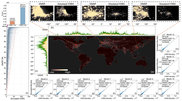
Monthly records of nighttime light are scarce, especially over long periods, yet they are vital for tracking short-term economic shifts and seasonal urban change. This study provides a temporally consistent global 500 m-resolution monthly VIIRS (Visible Infrared Imaging Radiometer Suite)-like nighttime light dataset (1992–2024). By combining DMSP (Defense Meteorological Satellite Program) and VIIRS through reconstruction and correction, a consistent long-term record is created. The dataset supports improved analysis of urban growth and economic activity worldwide.
Xiujuan He, Jiyong Eom, Sha Yu, Shu Liu, Wenru Xu, and Yuyu Zhou
Earth Syst. Sci. Data Discuss., https://doi.org/10.5194/essd-2025-709, https://doi.org/10.5194/essd-2025-709, 2025
Revised manuscript accepted for ESSD
Short summary
Short summary
Buildings consume significant energy for heating and cooling. To reduce carbon emissions, we need accurate predictions of energy demand, which depend on knowing the outdoor temperature at which buildings start heating or cooling. We used artificial intelligence to create the first global dataset of these temperature thresholds for regions worldwide. Our dataset improves energy demand prediction accuracy by 10%, supporting better energy planning and climate policy decisions.
Yaotong Cai, Peng Zhu, Xing Li, Xiaoping Liu, Yuhe Chen, Qianhui Shen, Xiaocong Xu, Honghui Zhang, Sheng Nie, Cheng Wang, Jia Wang, Bingjie Li, Changjiang Wu, and Haoming Zhuang
Earth Syst. Sci. Data, 17, 6993–7018, https://doi.org/10.5194/essd-17-6993-2025, https://doi.org/10.5194/essd-17-6993-2025, 2025
Short summary
Short summary
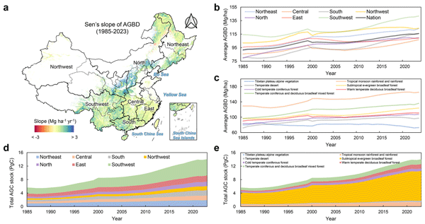
China’s forests play a crucial role in storing carbon and mitigating climate change, yet long-term high-resolution data on their biomass have been limited. We developed a 30 m annual forest aboveground biomass dataset from 1985 to 2023 using satellite data and deep learning. Our results reveal significant biomass gains, regional variations, and the impact of forest policies. This dataset provides valuable insights for climate research, conservation planning, and sustainable forest management.
Xiaojing Lv, Zhao Liu, Yuxuan Li, Shaoqing Zhang, Haohuan Fu, Xiaohui Duan, Shiming Xu, Yang Gao, Yujing Fan, Lifeng Yan, Haopeng Huang, Haitian Lu, Lingfeng Wan, Haoran Lin, Qixin Chang, Chenlin Li, Quanjie He, Yangyang Yu, Qinghui Lin, Sheng Jia, Tengda Zhao, Weiguo Liu, and Guangwen Yang
EGUsphere, https://doi.org/10.5194/egusphere-2025-5297, https://doi.org/10.5194/egusphere-2025-5297, 2025
Preprint archived
Short summary
Short summary
This study introduces a highly-efficient optimization approach that integrates automated and fine-grained optimizations for kilometer-level Earth System Models on heterogeneous many-core supercomputers. Our optimization achieves full parallel coverage for code segments exceeding 1 % of runtime. The optimized 5-km/3-km coupled model reaches 222 Simulated Days Per Day. This work signifies a pivotal advancement in ESMs, providing a robust platform for HR climate simulations.
Zixuan Pei, Xiaolin Zhu, Yang Hu, Jin Chen, and Xiaoyue Tan
Earth Syst. Sci. Data, 17, 5675–5691, https://doi.org/10.5194/essd-17-5675-2025, https://doi.org/10.5194/essd-17-5675-2025, 2025
Short summary
Short summary
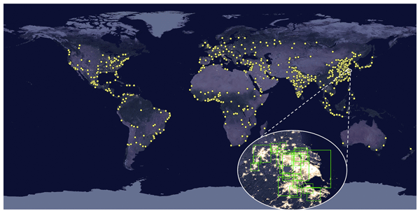
Nighttime light (NTL) data aids urban planning and disaster monitoring. Our study introduces HDNTL, a daily NTL dataset for 653 major cities (population >1 M by 2025) from 2012–2024, enhancing NASA's VNP46A2 accuracy by correcting spatial mismatches, angular effects, and filling small data holes via spatiotemporal interpolation. Validated against high-resolution NTL datasets and ground-truth records, HDNTL enables precise monitoring of nighttime human activities.
Fengxiang Guo, Fan Dai, Peng Gong, and Yuyu Zhou
Earth Syst. Sci. Data, 17, 4799–4819, https://doi.org/10.5194/essd-17-4799-2025, https://doi.org/10.5194/essd-17-4799-2025, 2025
Short summary
Short summary
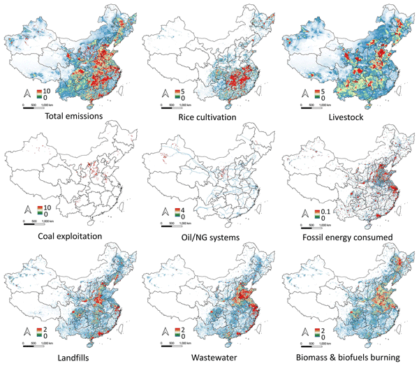
China, the world’s largest methane emitter, faces challenges in accurately tracking. CHN-CH4, a map of anthropogenic methane emissions was created by combining satellite data, national statistics, and climate guidelines. Over 30 years, China emitted about 1157 Tg of methane, peaking in the 2010s. Shanxi province had the highest emissions. CHN-CH4 helps improve tracking, informs global climate models, and strengthens collaboration between science and policy to combat climate change.
Yishuo Cui, Shouzhi Chen, Yufeng Gong, Mingwei Li, Zitong Jia, Yuyu Zhou, and Yongshuo H. Fu
Earth Syst. Sci. Data, 17, 4005–4022, https://doi.org/10.5194/essd-17-4005-2025, https://doi.org/10.5194/essd-17-4005-2025, 2025
Short summary
Short summary
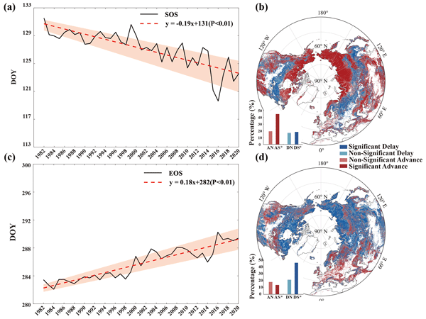
Global changes have significantly altered vegetation phenology, affecting terrestrial carbon cycles. While various remote-sensing-based phenology datasets exist, they often suffer from inconsistencies and uncertainties. To address this, we developed a new phenology dataset spanning 1982–2020 using a reliability ensemble averaging method. Validated against ground data, our dataset demonstrates substantially improved accuracy, providing a novel and reliable source for global ecological studies.
Yifan Cheng, Lei Zhao, TC Chakraborty, Keith Oleson, Matthias Demuzere, Xiaoping Liu, Yangzi Che, Weilin Liao, Yuyu Zhou, and Xinchang “Cathy” Li
Earth Syst. Sci. Data, 17, 2147–2174, https://doi.org/10.5194/essd-17-2147-2025, https://doi.org/10.5194/essd-17-2147-2025, 2025
Short summary
Short summary
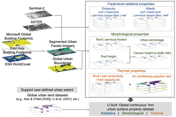
The absence of globally consistent and spatially continuous urban surface input has long hindered large-scale high-resolution urban climate modeling. Using remote sensing, cloud computing, and machine learning, we developed U-Surf, a 1 km dataset providing key urban surface properties worldwide. U-Surf enhances urban representation across scales and supports kilometer-scale urban-resolving Earth system modeling unprecedentedly, with broader applications in urban studies and beyond.
Shuang Chen, Jie Wang, Qiang Liu, Xiangan Liang, Rui Liu, Peng Qin, Jincheng Yuan, Junbo Wei, Shuai Yuan, Huabing Huang, and Peng Gong
Earth Syst. Sci. Data, 16, 5449–5475, https://doi.org/10.5194/essd-16-5449-2024, https://doi.org/10.5194/essd-16-5449-2024, 2024
Short summary
Short summary
The inconsistent coverage of Landsat data due to its long revisit intervals and frequent cloud cover poses challenges to large-scale land monitoring. We developed a global 30 m 23-year (2000–2022) daily seamless data cube (SDC) of surface reflectance based on Landsat 5, 7, 8, and 9 and MODIS products. The SDC exhibits enhanced capabilities for monitoring land cover changes and robust consistency in both spatial and temporal dimensions, which are important for global environmental monitoring.
Songchao Chen, Qi Shuai, Dominique Arrouays, Zhongxing Chen, Lingju Dai, Yongsheng Hong, Bifeng Hu, Yuyang Huang, Wenjun Ji, Shuo Li, Zongzheng Liang, Yuxin Ma, Anne C. Richer-de-Forges, Calogero Schillaci, Yang Su, Hongfen Teng, Nan Wang, Xi Wang, Yanyu Wang, Zheng Wang, Zhige Wang, Dongyun Xu, Jie Xue, Su Ye, Xianglin Zhang, Yin Zhou, Peng Zhu, and Zhou Shi
Earth Syst. Sci. Data Discuss., https://doi.org/10.5194/essd-2024-373, https://doi.org/10.5194/essd-2024-373, 2024
Manuscript not accepted for further review
Short summary
Short summary
The impact of land use and land cover change (LULCC) on soil organic carbon stock (SOCS) is uncertain due to limited global data. Despite regional efforts, a comprehensive global SOCS database has been lacking. This study introduces the Global Soil Organic Carbon Stock dataset after LULCC (GSOCS-LULCC), compiled from 639 articles covering 1,206 sites and 5,982 records across five major land uses. This open-access database enables global assessment of LULCC's effects on SOCS dynamics.
Xiaoxuan Liu, Peng Zhu, Shu Liu, Le Yu, Yong Wang, Zhenrong Du, Dailiang Peng, Ece Aksoy, Hui Lu, and Peng Gong
Earth Syst. Dynam., 15, 817–828, https://doi.org/10.5194/esd-15-817-2024, https://doi.org/10.5194/esd-15-817-2024, 2024
Short summary
Short summary
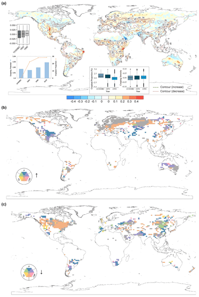
An increase of 28 % in cropland expansion since 10 000 BCE has led to a 1.2 % enhancement in the global cropping potential, with varying efficiencies across regions. The continuous expansion has altered the support for population growth and has had impacts on climate and biodiversity, highlighting the effects of climate change. It also points out the limitations of previous studies.
Jiaxu Guo, Juepeng Zheng, Yidan Xu, Haohuan Fu, Wei Xue, Lanning Wang, Lin Gan, Ping Gao, Wubing Wan, Xianwei Wu, Zhitao Zhang, Liang Hu, Gaochao Xu, and Xilong Che
Geosci. Model Dev., 17, 3975–3992, https://doi.org/10.5194/gmd-17-3975-2024, https://doi.org/10.5194/gmd-17-3975-2024, 2024
Short summary
Short summary
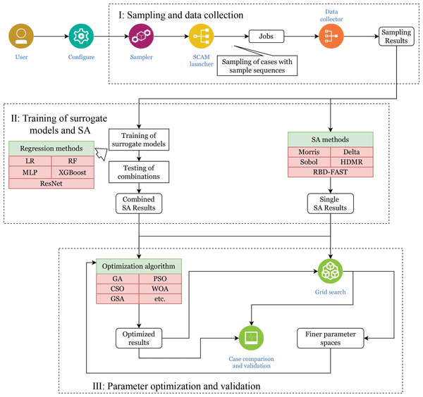
To enhance the efficiency of experiments using SCAM, we train a learning-based surrogate model to facilitate large-scale sensitivity analysis and tuning of combinations of multiple parameters. Employing a hybrid method, we investigate the joint sensitivity of multi-parameter combinations across typical cases, identifying the most sensitive three-parameter combination out of 11. Subsequently, we conduct a tuning process aimed at reducing output errors in these cases.
Ying Tu, Shengbiao Wu, Bin Chen, Qihao Weng, Yuqi Bai, Jun Yang, Le Yu, and Bing Xu
Earth Syst. Sci. Data, 16, 2297–2316, https://doi.org/10.5194/essd-16-2297-2024, https://doi.org/10.5194/essd-16-2297-2024, 2024
Short summary
Short summary
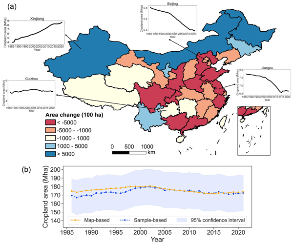
We developed the first 30 m annual cropland dataset of China (CACD) for 1986–2021. The overall accuracy of CACD reached up to 0.93±0.01 and was superior to other products. Our fine-resolution cropland maps offer valuable information for diverse applications and decision-making processes in the future.
Yangyang Yu, Shaoqing Zhang, Haohuan Fu, Dexun Chen, Yang Gao, Xiaopei Lin, Zhao Liu, and Xiaojing Lv
Geosci. Model Dev. Discuss., https://doi.org/10.5194/gmd-2024-10, https://doi.org/10.5194/gmd-2024-10, 2024
Preprint withdrawn
Short summary
Short summary
The hardware-related perturbations caused by the heterogeneous many-core architectures can blend with software or human errors, which can affect the accuracy of the model consistency verification. We develop a deep learning-based consistency test tool for ESMs on the heterogeneous systems (ESM-DCT) and evaluate it in CESM on new Sunway system. The ESM-DCT can detect the existence of software or human errors when taking hardware-related perturbations into account.
Xiangan Liang, Qiang Liu, Jie Wang, Shuang Chen, and Peng Gong
Earth Syst. Sci. Data, 16, 177–200, https://doi.org/10.5194/essd-16-177-2024, https://doi.org/10.5194/essd-16-177-2024, 2024
Short summary
Short summary
The state-of-the-art MODIS surface reflectance products suffer from temporal and spatial gaps, which make it difficult to characterize the continuous variation of the terrestrial surface. We proposed a framework for generating the first global 500 m daily seamless data cubes (SDC500), covering the period from 2000 to 2022. We believe that the SDC500 dataset can interest other researchers who study land cover mapping, quantitative remote sensing, and ecological science.
Wanru He, Xuecao Li, Yuyu Zhou, Zitong Shi, Guojiang Yu, Tengyun Hu, Yixuan Wang, Jianxi Huang, Tiecheng Bai, Zhongchang Sun, Xiaoping Liu, and Peng Gong
Earth Syst. Sci. Data, 15, 3623–3639, https://doi.org/10.5194/essd-15-3623-2023, https://doi.org/10.5194/essd-15-3623-2023, 2023
Short summary
Short summary
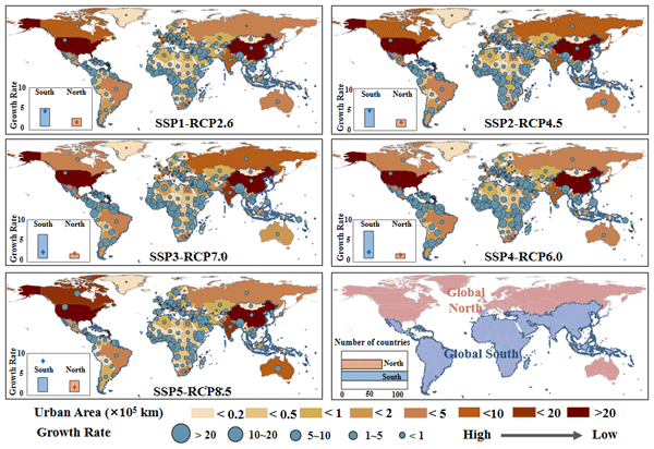
Most existing global urban products with future projections were developed in urban and non-urban categories, which ignores the gradual change of urban development at the local scale. Using annual global urban extent data from 1985 to 2015, we forecasted global urban fractional changes under eight scenarios throughout 2100. The developed dataset can provide spatially explicit information on urban fractions at 1 km resolution, which helps support various urban studies (e.g., urban heat island).
Chong Liu, Xiaoqing Xu, Xuejie Feng, Xiao Cheng, Caixia Liu, and Huabing Huang
Earth Syst. Sci. Data, 15, 133–153, https://doi.org/10.5194/essd-15-133-2023, https://doi.org/10.5194/essd-15-133-2023, 2023
Short summary
Short summary
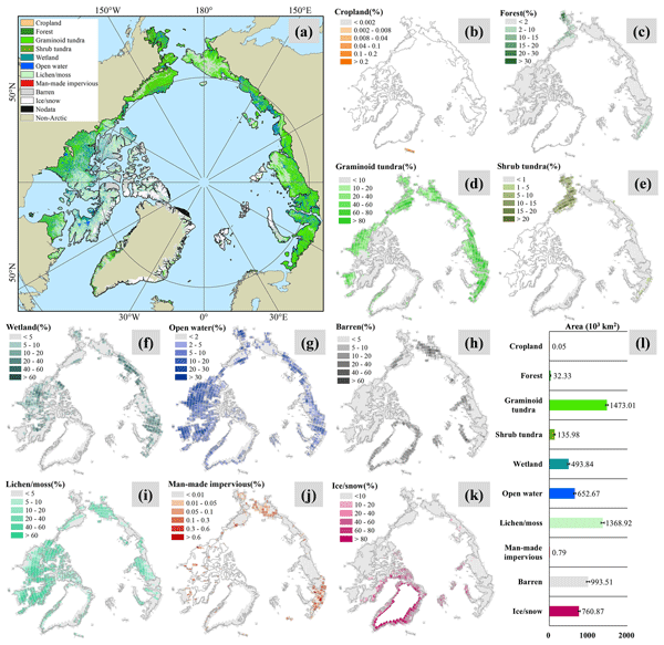
Rapid Arctic changes are increasingly influencing human society, both locally and globally. Land cover offers a basis for characterizing the terrestrial world, yet spatially detailed information on Arctic land cover is lacking. We employ multi-source data to develop a new land cover map for the circumpolar Arctic. Our product reveals regionally contrasting biome distributions not fully documented in existing studies and thus enhances our understanding of the Arctic’s terrestrial system.
Fan Wang, Gregory R. Carmichael, Jing Wang, Bin Chen, Bo Huang, Yuguo Li, Yuanjian Yang, and Meng Gao
Atmos. Chem. Phys., 22, 13341–13353, https://doi.org/10.5194/acp-22-13341-2022, https://doi.org/10.5194/acp-22-13341-2022, 2022
Short summary
Short summary
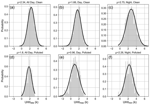
Unprecedented urbanization in China has led to serious urban heat island (UHI) issues, exerting intense heat stress on urban residents. We find diverse influences of aerosol pollution on urban heat island intensity (UHII) under different circulations. Our results also highlight the role of black carbon in aggravating UHI, especially during nighttime. It could thus be targeted for cooperative management of heat islands and aerosol pollution.
Yangyang Yu, Shaoqing Zhang, Haohuan Fu, Lixin Wu, Dexun Chen, Yang Gao, Zhiqiang Wei, Dongning Jia, and Xiaopei Lin
Geosci. Model Dev., 15, 6695–6708, https://doi.org/10.5194/gmd-15-6695-2022, https://doi.org/10.5194/gmd-15-6695-2022, 2022
Short summary
Short summary
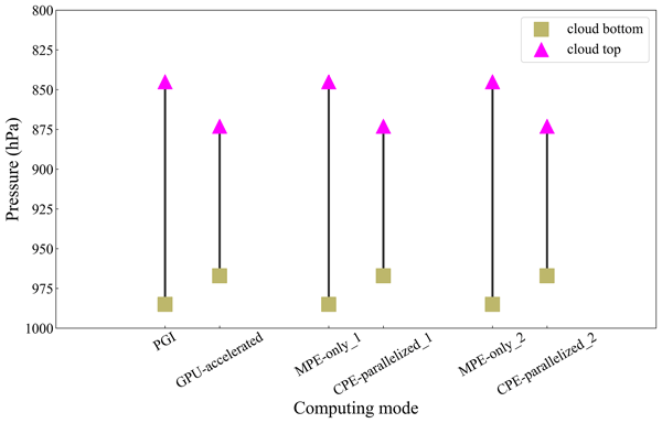
To understand the scientific consequence of perturbations caused by slave cores in heterogeneous computing environments, we examine the influence of perturbation amplitudes on the determination of the cloud bottom and cloud top and compute the probability density function (PDF) of generated clouds. A series of comparisons of the PDFs between homogeneous and heterogeneous systems show consistently acceptable error tolerances when using slave cores in heterogeneous computing environments.
Peng Zhu and Jennifer Burney
Hydrol. Earth Syst. Sci., 26, 827–840, https://doi.org/10.5194/hess-26-827-2022, https://doi.org/10.5194/hess-26-827-2022, 2022
Short summary
Short summary
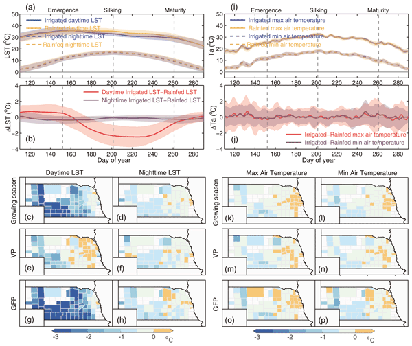
Satellite data were used to disentangle water and heat stress alleviation due to irrigation. Our findings are as follows. (1) Irrigation-induced cooling was captured by satellite LST but air temperature failed. (2) Irrigation extended maize growing season duration, especially during grain filling. (3) Water and heat stress alleviation constitutes 65 % and 35 % of the irrigation benefit. (4) The crop model simulating canopy temperature better captures the irrigation benefit.

Bowen Cao, Le Yu, Xuecao Li, Min Chen, Xia Li, Pengyu Hao, and Peng Gong
Earth Syst. Sci. Data, 13, 5403–5421, https://doi.org/10.5194/essd-13-5403-2021, https://doi.org/10.5194/essd-13-5403-2021, 2021
Short summary
Short summary
In the study, the first 1 km global cropland proportion dataset for 10 000 BCE–2100 CE was produced through the harmonization and downscaling framework. The mapping result coincides well with widely used datasets at present. With improved spatial resolution, our maps can better capture the cropland distribution details and spatial heterogeneity. The dataset will be valuable for long-term simulations and precise analyses. The framework can be extended to specific regions or other land use types.
Cited articles
Abowarda, A. S., Bai, L., Zhang, C., Long, D., Li, X., Huang, Q., and Sun, Z.: Generating surface soil moisture at 30 m spatial resolution using both data fusion and machine learning toward better water resources management at the field scale, Remote Sens. Environ., 255, 112301, https://doi.org/10.1016/j.rse.2021.112301, 2021.
Aguirre‐Gutiérrez, J., Berenguer, E., Oliveras Menor, I., Bauman, D., Corral-Rivas, J. J., Nava-Miranda, M. G., Both, S., Ndong, J. E., Ondo, F. E., Bengone, N. N., Mihinhou, V., Dalling, J. W., Heineman, K., Figueiredo, A., González-M, R., Norden, N., Hurtado-M, A. B., González, D., Salgado-Negret, B., Reis, S. M., Moraes de Seixas, M. M., Farfan-Rios, W., Shenkin, A., Riutta, T., Girardin, C. A. J., Moore, S., Abernethy, K., Asner, G. P., Bentley, L. P., Burslem, D. F. R. P., Cernusak, L. A., Enquist, B. J., Ewers, R. M., Ferreira, J., Jeffery, K. J., Joly, C. A., Marimon-Junior, B. H., Martin, R. E., Morandi, P. S., Phillips, O. L., Bennett, A. C., Lewis, S. L., Quesada, C. A., Marimon, B. S., Kissling, W. D., Silman, M., Teh, Y. A., White, L. J. T., Salinas, N., Coomes, D. A., Barlow, J., Adu-Bredu, S., and Malhi, Y.: Functional susceptibility of tropical forests to climate change, Nat. Ecol. Evol., 6, 878–889, https://doi.org/10.1038/s41559-022-01747-6, 2022.
Bengio, Y., Léonard, N., and Courville, A.: Estimating or Propagating Gradients Through Stochastic Neurons for Conditional Computation, arXiv [preprint], https://doi.org/10.48550/arXiv.1308.3432, 2013.
Bolton, D. K., Gray, J. M., Melaas, E. K., Moon, M., Eklundh, L., and Friedl, M. A.: Continental-scale land surface phenology from harmonized Landsat 8 and Sentinel-2 imagery, Remote Sens. Environ., 240, 111685, https://doi.org/10.1016/j.rse.2020.111685, 2020.
Boyte, S. P., Wylie, B. K., Rigge, M. B., and Dahal, D.: Fusing MODIS with Landsat 8 data to downscale weekly normalized difference vegetation index estimates for central Great Basin rangelands, USA, GIScience Remote Sens.g, 55, 376–399, https://doi.org/10.1080/15481603.2017.1382065, 2018.
Brown, C. F., Brumby, S. P., Guzder-Williams, B., Birch, T., Hyde, S. B., Mazzariello, J., Czerwinski, W., Pasquarella, V. J., Haertel, R., Ilyushchenko, S., Schwehr, K., Weisse, M., Stolle, F., Hanson, C., Guinan, O., Moore, R., and Tait, A. M.: Dynamic World, Near real-time global 10 m land use land cover mapping, Sci. Data, 9, 251, https://doi.org/10.1038/s41597-022-01307-4, 2022.
Brown, C. F., Kazmierski, M. R., Pasquarella, V. J., Rucklidge, W. J., Samsikova, M., Zhang, C., Shelhamer, E., Lahera, E., Wiles, O., Ilyushchenko, S., Gorelick, N., Zhang, L. L., Alj, S., Schechter, E., Askay, S., Guinan, O., Moore, R., Boukouvalas, A., and Kohli, P.: AlphaEarth Foundations: An embedding field model for accurate and efficient global mapping from sparse label data, arXiv [preprint], https://doi.org/10.48550/arXiv.2507.22291, 2025.
Chen, B., Chen, L., Huang, B., Michishita, R., and Xu, B.: Dynamic monitoring of the Poyang Lake wetland by integrating Landsat and MODIS observations, ISPRS J. Photogramm., 139, 75–87, https://doi.org/10.1016/j.isprsjprs.2018.02.021, 2018.
Chen, S.: Embedded Seamless Data: An ultra-lightweight Earth embedding database for accurate and flexible global land monitoring, iEarth DataHub [data set], https://doi.org/10.12436/iEarth.0000.20251229.000064.v1, 2025.
Chen, S., Wang, J., and Gong, P.: ROBOT: A spatiotemporal fusion model toward seamless data cube for global remote sensing applications, Remote Sens. Environ., 294, 113616, https://doi.org/10.1016/j.rse.2023.113616, 2023.
Chen, S., Wang, J., Liu, Q., Liang, X., Liu, R., Qin, P., Yuan, J., Wei, J., Yuan, S., Huang, H., and Gong, P.: Global 30 m seamless data cube (2000–2022) of land surface reflectance generated from Landsat 5, 7, 8, and 9 and MODIS Terra constellations, Earth Syst. Sci. Data, 16, 5449–5475, https://doi.org/10.5194/essd-16-5449-2024, 2024.
Chuvieco, E., Ventura, G., Martín, M. P., and Gómez, I.: Assessment of multitemporal compositing techniques of MODIS and AVHRR images for burned land mapping, Remote Sensi. Environ., 94, 450–462, https://doi.org/10.1016/j.rse.2004.11.006, 2005.
Claverie, M., Ju, J., Masek, J. G., Dungan, J. L., Vermote, E. F., Roger, J.-C., Skakun, S. V., and Justice, C.: The Harmonized Landsat and Sentinel-2 surface reflectance data set, Remote Sens. Environ., 219, 145–161, https://doi.org/10.1016/j.rse.2018.09.002, 2018.
Clay: Clay Foundation Model [WWW Document], https://github.com/Clay-foundation/model (last access: 22 July 2026), 2024.
Cong, Y., Khanna, S., Meng, C., Liu, P., Rozi, E., He, Y., Burke, M., Lobell, D. B., and Ermon, S.: SatMAE: Pre-training Transformers for Temporal and Multi-Spectral Satellite Imagery, in: Advances in Neural Information Processing Systems 35 (NeurIPS 2022), 197–211, 2022.
Czerkawski, M., Kluczek, M., and Bojanowski, J. S.: Global and Dense Embeddings of Earth: Major TOM Floating in the Latent Space, arXiv [preprint], https://doi.org/10.48550/arXiv.2412.05600, 2024.
Declaro, A. and Kanae, S.: Enhancing Surface Water Monitoring through Multi-Satellite Data-Fusion of Landsat-8/9, Sentinel-2, and Sentinel-1 SAR, Remote Sens., 16, 3329, https://doi.org/10.3390/rs16173329, 2024.
Devlin, J., Chang, M.-W., Lee, K., and Toutanova, K.: BERT: Pre-training of Deep Bidirectional Transformers for Language Understanding, arXiv [preprint], https://doi.org/10.48550/arXiv.1810.04805, 2019.
Drusch, M., Del Bello, U., Carlier, S., Colin, O., Fernandez, V., Gascon, F., Hoersch, B., Isola, C., Laberinti, P., Martimort, P., Meygret, A., Spoto, F., Sy, O., Marchese, F., and Bargellini, P.: Sentinel-2: ESA's Optical High-Resolution Mission for GMES Operational Services, Remote Sens. Environ., 120, 25–36, https://doi.org/10.1016/j.rse.2011.11.026, 2012.
Fang, H., Stewart, A. J., Corley, I., Zhu, X. X., and Azizpour, H.: Earth Embeddings as Products: Taxonomy, Ecosystem, and Standardized Access, arXiv [preprint], https://doi.org/10.48550/arXiv.2601.13134, 2026.
Feng, Z., Atzberger, C., Jaffer, S., Knezevic, J., Sormunen, S., Young, R., Lisaius, M. C., Immitzer, M., Jackson, T., Ball, J., Coomes, D. A., Madhavapeddy, A., Blake, A., and Keshav, S.: TESSERA: Temporal Embeddings of Surface Spectra for Earth Representation and Analysis, arXiv [preprint], https://doi.org/10.48550/arXiv.2506.20380, 2025.
Forzieri, G., Dakos, V., McDowell, N. G., Ramdane, A., and Cescatti, A.: Emerging signals of declining forest resilience under climate change, Nature, 608, 534–539, https://doi.org/10.1038/s41586-022-04959-9, 2022.
Francis, A. and Czerkawski, M.: Major TOM: Expandable Datasets for Earth Observation, in: IGARSS 2024–2024 IEEE International Geoscience and Remote Sensing Symposium, Athens, Greece, 2935–2940, https://doi.org/10.1109/IGARSS53475.2024.10640760, 2024.
Gao, F., Masek, J., Schwaller, M., and Hall, F.: On the blending of the Landsat and MODIS surface reflectance: predicting daily Landsat surface reflectance, IEEE T. Geosci. Remote, 44, 2207–2218, https://doi.org/10.1109/TGRS.2006.872081, 2006.
Gong, P., Liang, S., Carlton, E. J., Jiang, Q., Wu, J., Wang, L., and Remais, J. V.: Urbanisation and health in China, The Lancet, 379, 843–852, https://doi.org/10.1016/S0140-6736(11)61878-3, 2012.
Gong, P., Wang, J., Yu, Le, Zhao, Yongchao, Zhao, Yuanyuan, Liang, L., Niu, Z., Huang, X., Fu, H., Liu, S., Li, C., Li, X., Fu, W., Liu, C., Xu, Y., Wang, X., Cheng, Q., Hu, L., Yao, W., Zhang, Han, Zhu, P., Zhao, Z., Zhang, Haiying, Zheng, Y., Ji, L., Zhang, Y., Chen, H., Yan, A., Guo, J., Yu, Liang, Wang, L., Liu, X., Shi, T., Zhu, M., Chen, Y., Yang, G., Tang, P., Xu, B., Giri, C., Clinton, N., Zhu, Z., Chen, Jin, and Chen, Jun: Finer resolution observation and monitoring of global land cover: first mapping results with Landsat TM and ETM+ data, Int. J. Remote Sens., 34, 2607–2654, https://doi.org/10.1080/01431161.2012.748992, 2013.
Gong, P., Liu, H., Zhang, M., Li, C., Wang, J., Huang, H., Clinton, N., Ji, L., Li, Wenyu, Bai, Y., Chen, B., Xu, B., Zhu, Z., Yuan, C., Ping Suen, H., Guo, J., Xu, N., Li, Weijia, Zhao, Y., Yang, J., Yu, C., Wang, X., Fu, H., Yu, L., Dronova, I., Hui, F., Cheng, X., Shi, X., Xiao, F., Liu, Q., and Song, L.: Stable classification with limited sample: transferring a 30 m resolution sample set collected in 2015 to mapping 10 m resolution global land cover in 2017, Sci. Bull., 64, 370–373, https://doi.org/10.1016/j.scib.2019.03.002, 2019.
Gong, P., Li, X., Wang, J., Bai, Y., Chen, B., Hu, T., Liu, X., Xu, B., Yang, J., Zhang, W., and Zhou, Y.: Annual maps of global artificial impervious area (GAIA) between 1985 and 2018, Remote Sens. Environ., 236, 111510, https://doi.org/10.1016/j.rse.2019.111510, 2020.
Gong, P., Wang, J., and Huang, H.: Stable classification with limited samples in global land cover mapping: Theory and experiments, Sci. Bull., 69, 1862–1865, https://doi.org/10.1016/j.scib.2024.03.040, 2024.
Gorelick, N., Hancher, M., Dixon, M., Ilyushchenko, S., Thau, D., and Moore, R.: Google Earth Engine: Planetary-scale geospatial analysis for everyone, Remote Sens. Environ., 202, 18–27, https://doi.org/10.1016/j.rse.2017.06.031, 2017.
Goyena, H., Pérez-Goya, U., Montesino-SanMartin, M., Militino, A. F., Wang, Q., Atkinson, P. M., and Ugarte, M. D.: Unpaired spatio-temporal fusion of image patches (USTFIP) from cloud covered images, Remote Sens. Environ., 295, 113709, https://doi.org/10.1016/j.rse.2023.113709, 2023.
Guo, D., Shi, W., Hao, M., and Zhu, X.: FSDAF 2.0: Improving the performance of retrieving land cover changes and preserving spatial details, Remote Sens. Environ., 248, 111973, https://doi.org/10.1016/j.rse.2020.111973, 2020.
Guo, X., Lao, J., Dang, B., Zhang, Yingying, Yu, L., Ru, L., Zhong, L., Huang, Z., Wu, K., Hu, D., He, H., Wang, J., Chen, J., Yang, M., Zhang, Yongjun, and Li, Y.: SkySense: A Multi-Modal Remote Sensing Foundation Model Towards Universal Interpretation for Earth Observation Imagery, in: 2024 IEEE/CVF Conference on Computer Vision and Pattern Recognition (CVPR), Seattle, WA, USA, 27662–27673, https://doi.org/10.1109/CVPR52733.2024.02613, 2024.
Hansen, M. C., Roy, D. P., Lindquist, E., Adusei, B., Justice, C. O., and Altstatt, A.: A method for integrating MODIS and Landsat data for systematic monitoring of forest cover and change in the Congo Basin, Remote Sens. Environ., 112, 2495–2513, https://doi.org/10.1016/j.rse.2007.11.012, 2008.
Hansen, M. C., Potapov, P. V., Moore, R., Hancher, M., Turubanova, S. A., Tyukavina, A., Thau, D., Stehman, S. V., Goetz, S. J., Loveland, T. R., Kommareddy, A., Egorov, A., Chini, L., Justice, C. O., and Townshend, J. R. G.: High-Resolution Global Maps of 21st-Century Forest Cover Change, Science, 342, 850–853, https://doi.org/10.1126/science.1244693, 2013.
He, K., Chen, X., Xie, S., Li, Y., Dollar, P., and Girshick, R.: Masked Autoencoders Are Scalable Vision Learners, in: 2022 IEEE/CVF Conference on Computer Vision and Pattern Recognition (CVPR), New Orleans, LA, USA, 15979–15988, https://doi.org/10.1109/CVPR52688.2022.01553, 2022.
Hilker, T., Wulder, M. A., Coops, N. C., Linke, J., McDermid, G., Masek, J. G., Gao, F., and White, J. C.: A new data fusion model for high spatial- and temporal-resolution mapping of forest disturbance based on Landsat and MODIS, Remote Sens. Environ., 113, 1613–1627, https://doi.org/10.1016/j.rse.2009.03.007, 2009.
Huang, X., Song, Y., Yang, J., Wang, W., Ren, H., Dong, M., Feng, Y., Yin, H., and Li, J.: Toward accurate mapping of 30 m time-series global impervious surface area (GISA), Int. J. Appl. Earth Obs., 109, 102787, https://doi.org/10.1016/j.jag.2022.102787, 2022.
Huete, A., Didan, K., Miura, T., Rodriguez, E. P., Gao, X., and Ferreira, L. G.: Overview of the radiometric and biophysical performance of the MODIS vegetation indices, Remote Sens. Environ., 83, 195–213, https://doi.org/10.1016/S0034-4257(02)00096-2, 2002.
Ienco, D., Interdonato, R., Gaetano, R., and Ho Tong Minh, D.: Combining Sentinel-1 and Sentinel-2 Satellite Image Time Series for land cover mapping via a multi-source deep learning architecture, ISPRS J. Photogramm, 158, 11–22, https://doi.org/10.1016/j.isprsjprs.2019.09.016, 2019.
Jakubik, J., Roy, S., Phillips, C. E., Fraccaro, P., Godwin, D., Zadrozny, B., Szwarcman, D., Gomes, C., Nyirjesy, G., Edwards, B., Kimura, D., Simumba, N., Chu, L., Mukkavilli, S. K., Lambhate, D., Das, K., Bangalore, R., Oliveira, D., Muszynski, M., Ankur, K., Ramasubramanian, M., Gurung, I., Khallaghi, S., Hanxi, Li, Cecil, M., Ahmadi, M., Kordi, F., Alemohammad, H., Maskey, M., Ganti, R., Weldemariam, K., and Ramachandran, R.: Foundation Models for Generalist Geospatial Artificial Intelligence, arXiv [preprint], https://doi.org/10.48550/arXiv.2310.18660, 2023.
Ji, L., Gong, P., Wang, J., Shi, J., and Zhu, Z.: Construction of the 500-m Resolution Daily Global Surface Water Change Database (2001–2016), Water Resour. Res., 54, https://doi.org/10.1029/2018WR023060, 2018.
Klemmer, K., Rolf, E., Rußwurm, M., Camps-Valls, G., Ermon, S., Francis, A., Jacobs, N., Kerner, H., Mackey, L., Mai, G., Aodha, O. M., Reichstein, M., Robinson, C., Rolnick, D., Sitzmann, V., Tuia, D., and Zhu, X.: Earth Embeddings: Towards AI-centric Representations of our Planet, EarthArXiv [preprint], https://doi.org/10.31223/X5HX9S, 2025.
Li, C., Gong, P., Wang, J., Zhu, Z., Biging, G. S., Yuan, C., Hu, T., Zhang, H., Wang, Q., Li, X., Liu, X., Xu, Y., Guo, J., Liu, C., Hackman, K. O., Zhang, M., Cheng, Y., Yu, L., Yang, J., Huang, H., and Clinton, N.: The first all-season sample set for mapping global land cover with Landsat-8 data, Sci. Bull., 62, 508–515, https://doi.org/10.1016/j.scib.2017.03.011, 2017.
Liu, H., Gong, P., Wang, J., Wang, X., Ning, G., and Xu, B.: Production of global daily seamless data cubes and quantification of global land cover change from 1985 to 2020 – iMap World 1.0, Remote Sens. Environ., 258, 112364, https://doi.org/10.1016/j.rse.2021.112364, 2021.
Liu, S., Zhou, J., Qiu, Y., Chen, J., Zhu, X., and Chen, H.: The FIRST model: Spatiotemporal fusion incorrporting spectral autocorrelation, Remote Sens. Environ., 279, 113111, https://doi.org/10.1016/j.rse.2022.113111, 2022.
Manas, O., Lacoste, A., Giro-i-Nieto, X., Vazquez, D., and Rodriguez, P.: Seasonal Contrast: Unsupervised Pre-Training from Uncurated Remote Sensing Data, in: 2021 IEEE/CVF International Conference on Computer Vision (ICCV), Montreal, QC, Canada, 9394–9403, https://doi.org/10.1109/ICCV48922.2021.00928, 2021.
Markham, B. L. and Helder, D. L.: Forty-year calibrated record of earth-reflected radiance from Landsat: A review, Remote Sens. Environm., 122, 30–40, https://doi.org/10.1016/j.rse.2011.06.026, 2012.
Masek, J. G., Wulder, M. A., Markham, B., McCorkel, J., Crawford, C. J., Storey, J., and Jenstrom, D. T.: Landsat 9: Empowering open science and applications through continuity, Remote Sens. Environ., 248, 111968, https://doi.org/10.1016/j.rse.2020.111968, 2020.
Mentzer, F., Minnen, D., Agustsson, E., and Tschannen, M.: Finite Scalar Quantization: VQ-VAE Made Simple, arXiv [preprint], https://doi.org/10.48550/arXiv.2309.15505, 2023.
Morisette, J. T., Privette, J. L., and Justice, C. O.: A framework for the validation of MODIS Land products, Remote Sens. Environ., 83, 77–96, https://doi.org/10.1016/S0034-4257(02)00088-3, 2002.
NASA JPL: NASADEM Merged DEM Global 1 arc second V001, NASA Land Processes Distributed Active Archive Center [data set], https://doi.org/10.5067/MEASURES/NASADEM/NASADEM_HGT.001, 2020.
Oord, A. van den, Vinyals, O., and Kavukcuoglu, K.: Neural Discrete Representation Learning, arXiv [preprint], https://doi.org/10.48550/arXiv.1711.00937, 2018.
Pekel, J.-F., Cottam, A., Gorelick, N., and Belward, A. S.: High-resolution mapping of global surface water and its long-term changes, Nature, 540, 418–422, https://doi.org/10.1038/nature20584, 2016.
Piao, S., Liu, Q., Chen, A., Janssens, I. A., Fu, Y., Dai, J., Liu, L., Lian, X., Shen, M., and Zhu, X.: Plant phenology and global climate change: Current progresses and challenges, Glob. Change Biol., 25, 1922–1940, https://doi.org/10.1111/gcb.14619, 2019.
Pickens, A. H., Hansen, M. C., Hancher, M., Stehman, S. V., Tyukavina, A., Potapov, P., Marroquin, B., and Sherani, Z.: Mapping and sampling to characterize global inland water dynamics from 1999 to 2018 with full Landsat time-series, Remote Sens. Environ., 243, 111792, https://doi.org/10.1016/j.rse.2020.111792, 2020.
Pickens, A. H., Hansen, M. C., Stehman, S. V., Tyukavina, A., Potapov, P., Zalles, V., and Higgins, J.: Global seasonal dynamics of inland open water and ice, Remote Sens. Environ., 272, 112963, https://doi.org/10.1016/j.rse.2022.112963, 2022.
Potapov, P., Turubanova, S., Hansen, M. C., Tyukavina, A., Zalles, V., Khan, A., Song, X.-P., Pickens, A., Shen, Q., and Cortez, J.: Global maps of cropland extent and change show accelerated cropland expansion in the twenty-first century, Nat. Food, 3, 19–28, https://doi.org/10.1038/s43016-021-00429-z, 2021.
Shang, R. and Zhu, Z.: Harmonizing Landsat 8 and Sentinel-2: A time-series-based reflectance adjustment approach, Remote Sens. Environ., 235, 111439, https://doi.org/10.1016/j.rse.2019.111439, 2019.
Shang, R., Zhu, Z., Zhang, J., Qiu, S., Yang, Z., Li, T., and Yang, X.: Near-real-time monitoring of land disturbance with harmonized Landsats 7–8 and Sentinel-2 data, Remote Sens. Environ., 278, 113073, https://doi.org/10.1016/j.rse.2022.113073, 2022.
Smits, M. (Ed.): Information for a Better World: Shaping the Global Future: 17th International Conference, iConference 2022, Virtual Event, February 28 – March 4, 2022, Proceedings, Part I, Lecture Notes in Computer Science, Springer International Publishing, Cham, https://doi.org/10.1007/978-3-030-96957-8, 2022.
Soto Vega, P. J., da Costa, G. A. O. P., Feitosa, R. Q., Ortega Adarme, M. X., de Almeida, C. A., Heipke, C., and Rottensteiner, F.: An unsupervised domain adaptation approach for change detection and its application to deforestation mapping in tropical biomes, ISPRS J. Photogramm., 181, 113–128, https://doi.org/10.1016/j.isprsjprs.2021.08.026, 2021.
Szwarcman, D., Roy, S., Fraccaro, P., Gíslason, Þ. E., Blumenstiel, B., Ghosal, R., de Oliveira, P. H., Almeida, J. L. de S., Sedona, R., Kang, Y., Chakraborty, S., Wang, S., Gomes, C., Kumar, A., Truong, M., Godwin, D., Lee, H., Hsu, C.-Y., Asanjan, A. A., Mujeci, B., Shidham, D., Keenan, T., Arevalo, P., Li, W., Alemohammad, H., Olofsson, P., Hain, C., Kennedy, R., Zadrozny, B., Bell, D., Cavallaro, G., Watson, C., Maskey, M., Ramachandran, R., and Moreno, J. B.: Prithvi-EO-2.0: A Versatile Multi-Temporal Foundation Model for Earth Observation Applications, arXiv [preprint], https://doi.org/10.48550/arXiv.2412.02732, 2025.
Takida, Y., Shibuya, T., Liao, W., Lai, C.-H., Ohmura, J., Uesaka, T., Murata, N., Takahashi, S., Kumakura, T., and Mitsufuji, Y.: SQ-VAE: Variational Bayes on Discrete Representation with Self-annealed Stochastic Quantization, arXiv [preprint],https://doi.org/10.48550/arXiv.2205.07547, 2022.
Tuia, D., Schindler, K., Demir, B., Zhu, X. X., Kochupillai, M., Džeroski, S., Van Rijn, J. N., Hoos, H. H., Del Frate, F., Datcu, M., Markl, V., Le Saux, B., Schneider, R., and Camps-Valls, G.: Artificial Intelligence to Advance Earth Observation: A review of models, recent trends, and pathways forward, IEEE Geosci. Remote Sens., 2–25, https://doi.org/10.1109/MGRS.2024.3425961, 2025.
Wang, Y., Xiong, Z., Liu, C., Stewart, A.J., Dujardin, T., Bountos, N.I., Zavras, A., Gerken, F., Papoutsis, I., Leal-Taixé, L., and Zhu, X. X.: Towards a Unified Copernicus Foundation Model for Earth Vision, arXiv [preprint], https://doi.org/10.48550/arXiv.2503.11849, 2025.
Wieland, M., Martinis, S., Kiefl, R., and Gstaiger, V.: Semantic segmentation of water bodies in very high-resolution satellite and aerial images, Remote Sens. Environ., 287, 113452, https://doi.org/10.1016/j.rse.2023.113452, 2023.
Woodcock, C. E., Allen, R., Anderson, M., Belward, A., Bindschadler, R., Cohen, W., Gao, F., Goward, S. N., Helder, D., Helmer, E., Nemani, R., Oreopoulos, L., Schott, J., Thenkabail, P. S., Vermote, E. F., Vogelmann, J., Wulder, M. A., and Wynne, R.: Free access to Landsat imagery, Science, 320, 1011, https://doi.org/10.1126/science.320.5879.1011a, 2008.
Wulder, M. A., Roy, D. P., Radeloff, V. C., Loveland, T. R., Anderson, M. C., Johnson, D. M., Healey, S., Zhu, Z., Scambos, T. A., Pahlevan, N., Hansen, M., Gorelick, N., Crawford, C.J., Masek, J. G., Hermosilla, T., White, J. C., Belward, A. S., Schaaf, C., Woodcock, C. E., Huntington, J. L., Lymburner, L., Hostert, P., Gao, F., Lyapustin, A., Pekel, J.-F., Strobl, P., and Cook, B. D.: Fifty years of Landsat science and impacts, Remote Sens. Environ., 280, 113195, https://doi.org/10.1016/j.rse.2022.113195, 2022.
Xu, J., Liang, S., Ma, H., and He, T.: Generating 5 km resolution 1981–2018 daily global land surface longwave radiation products from AVHRR shortwave and longwave observations using densely connected convolutional neural networks, Remote Sens. Environ., 280, 113223, https://doi.org/10.1016/j.rse.2022.113223, 2022.
Zanaga, D., Van De Kerchove, R., Daems, D., De Keersmaecker, W., Brockmann, C., Kirches, G., Wevers, J., Cartus, O., Santoro, M., Fritz, S., Lesiv, M., Herold, M., Tsendbazar, N.-E., Xu, P., Ramoino, F., and Arino, O.: ESA WorldCover 10 m 2021 v200, Zenodo [data set], https://doi.org/10.5281/zenodo.7254221, 2022.
Zhao, Q., Yu, L., Li, X., Peng, D., Zhang, Y., and Gong, P.: Progress and Trends in the Application of Google Earth and Google Earth Engine, Remote Sens., 13, 3778, https://doi.org/10.3390/rs13183778, 2021.
Zhu, X., Chen, J., Gao, F., Chen, X., and Masek, J. G.: An enhanced spatial and temporal adaptive reflectance fusion model for complex heterogeneous regions, Remote Sens. Environ., 114, 2610–2623, https://doi.org/10.1016/j.rse.2010.05.032, 2010.
Zhu, X., Helmer, E. H., Gao, F., Liu, D., Chen, J., and Lefsky, M. A.: A flexible spatiotemporal method for fusing satellite images with different resolutions, Remote Sens. Environ., 172, 165–177, https://doi.org/10.1016/j.rse.2015.11.016, 2016.
Zhu, X., Cai, F., Tian, J., and Williams, T.: Spatiotemporal Fusion of Multisource Remote Sensing Data: Literature Survey, Taxonomy, Principles, Applications, and Future Directions, Remote Sens., 10, 527, https://doi.org/10.3390/rs10040527, 2018.
Short summary
Monitoring our planet with satellites produces massive datasets too large for researchers to handle. We created a new global database that condenses 25 years of Landsat and MODIS observations into a highly efficient format (Analysis-ready embedding vectors) using AI. By reducing data size by over 340 times while maintaining high accuracy, we allow global studies to be run on standard PC. Makes planetary research accessible to everyone and helps us better track environmental changes over time.
Monitoring our planet with satellites produces massive datasets too large for researchers to...


Altmetrics
Final-revised paper
Preprint