Articles | Volume 18, issue 7
https://doi.org/10.5194/essd-18-5117-2026
© Author(s) 2026. This work is distributed under
the Creative Commons Attribution 4.0 License.
the Creative Commons Attribution 4.0 License.
https://doi.org/10.5194/essd-18-5117-2026
© Author(s) 2026. This work is distributed under
the Creative Commons Attribution 4.0 License.
the Creative Commons Attribution 4.0 License.
Data description article
| Highlight paper
| 
20 Jul 2026
Data description article | Highlight paper |
| 20 Jul 2026
| 20 Jul 2026
The Greenland GNSS Network (GNET): geodetic grade GNSS measurements of Greenland's 3D bedrock displacement from 1995–2025

DTU Space – National Space Institute, Technical University of Denmark, Department of Geodesy and Earth Observation, 2800 Kgs. Lyngby, Denmark
Finn Bo Madsen
DTU Space – National Space Institute, Technical University of Denmark, Department of Geodesy and Earth Observation, 2800 Kgs. Lyngby, Denmark
Malte Winther-Dahl
Agency for Climate Data, 2100 København Ø, Denmark
Thomas Henry Nylen
DTU Space – National Space Institute, Technical University of Denmark, Department of Geodesy and Earth Observation, 2800 Kgs. Lyngby, Denmark
Danjal Longfors Berg
DTU Space – National Space Institute, Technical University of Denmark, Department of Geodesy and Earth Observation, 2800 Kgs. Lyngby, Denmark
Ole Bjerregaard
DTU Space – National Space Institute, Technical University of Denmark, Department of Geodesy and Earth Observation, 2800 Kgs. Lyngby, Denmark
Javed Hassan
DTU Space – National Space Institute, Technical University of Denmark, Department of Geodesy and Earth Observation, 2800 Kgs. Lyngby, Denmark
Per Knudsen
DTU Space – National Space Institute, Technical University of Denmark, Department of Geodesy and Earth Observation, 2800 Kgs. Lyngby, Denmark
Michael Bevis
School of Earth Sciences, Ohio State University, Columbus, Ohio, USA
Shfaqat Abbas Khan
DTU Space – National Space Institute, Technical University of Denmark, Department of Geodesy and Earth Observation, 2800 Kgs. Lyngby, Denmark
Related authors
No articles found.
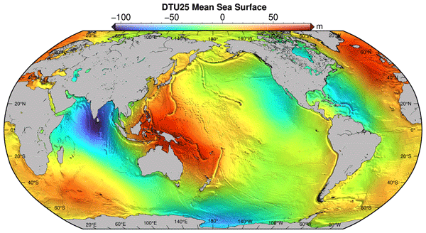
Bjarke Nilsson, Ole Baltazar Andersen, and Per Knudsen
Earth Syst. Sci. Data, 18, 5027–5051, https://doi.org/10.5194/essd-18-5027-2026, https://doi.org/10.5194/essd-18-5027-2026, 2026
Short summary
Short summary
The average height of the sea surface is important to understand if we are to accurately understand either the dynamic ocean or improve our understanding of the shape of the earth's surface. Currently we have been able to understand this to a certain degree, but with data from the new Surface Water and Ocean Topography (SWOT) satellite, we are now able to map the sea surface at a very small scale. We utilize this new data to better understand and map the shape of the global oceans.
Javed Hassan, Karina Nielsen, William Colgan, Rijan Bhakta Kayastha, Mira Khadka, and Shfaqat Abbas Khan
EGUsphere, https://doi.org/10.5194/egusphere-2026-808, https://doi.org/10.5194/egusphere-2026-808, 2026
Short summary
Short summary
High-altitude lakes in High Mountain Asia (HMA) are important sources of freshwater and sensitive indicators of environmental change. Using satellite data from 2010 to 2024, we examine water level changes in 232 lakes across HMA. Results show rising lake levels on the Tibetan Plateau, while lakes in the Himalaya are declining. These contrasting patterns highlight strong regional differences and provide valuable information for understanding water availability and associated hazards.
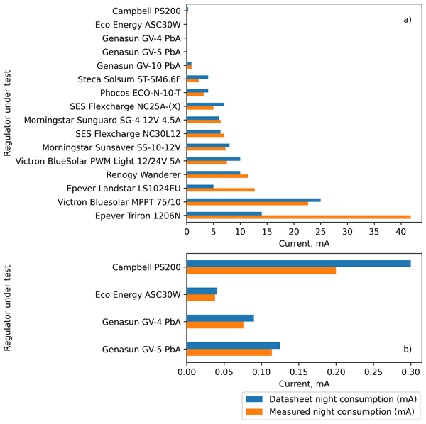
Michael R. Prior-Jones, Lisa Craw, Jonathan D. Hawkins, Elizabeth A. Bagshaw, Paul Carpenter, Thomas H. Nylen, and Joe Pettit
Geosci. Instrum. Method. Data Syst., 14, 503–512, https://doi.org/10.5194/gi-14-503-2025, https://doi.org/10.5194/gi-14-503-2025, 2025
Short summary
Short summary
We tested solar regulators to find their suitability for use in powering instruments in the polar regions. We found that some models waste a lot of power and may result in instruments failing during the wintertime. We developed a model to illustrate this effect, and use it to show that a good choice of solar regulator means a greater chance of successful winter data collection and allows the use of a smaller, lighter, cheaper battery.
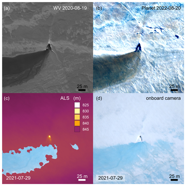
Angelika Humbert, Veit Helm, Ole Zeising, Niklas Neckel, Matthias H. Braun, Shfaqat Abbas Khan, Martin Rückamp, Holger Steeb, Julia Sohn, Matthias Bohnen, and Ralf Müller
The Cryosphere, 19, 3009–3032, https://doi.org/10.5194/tc-19-3009-2025, https://doi.org/10.5194/tc-19-3009-2025, 2025
Short summary
Short summary
We study the evolution of a massive lake on the Greenland Ice Sheet using satellite and airborne data and some modelling. The lake is emptying rapidly. Water flows to the glacier's base through cracks and triangular-shaped moulins that remain visible over the years. Some of them become reactivated. We find features inside the glacier that stem from drainage events with a width of even 1 km. These features are persistent over the years, although they are changing in shape.
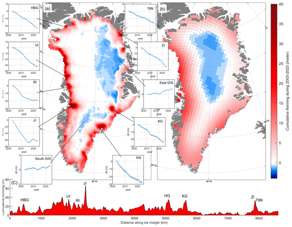
Shfaqat A. Khan, Helene Seroussi, Mathieu Morlighem, William Colgan, Veit Helm, Gong Cheng, Danjal Berg, Valentina R. Barletta, Nicolaj K. Larsen, William Kochtitzky, Michiel van den Broeke, Kurt H. Kjær, Andy Aschwanden, Brice Noël, Jason E. Box, Joseph A. MacGregor, Robert S. Fausto, Kenneth D. Mankoff, Ian M. Howat, Kuba Oniszk, Dominik Fahrner, Anja Løkkegaard, Eigil Y. H. Lippert, Alicia Bråtner, and Javed Hassan
Earth Syst. Sci. Data, 17, 3047–3071, https://doi.org/10.5194/essd-17-3047-2025, https://doi.org/10.5194/essd-17-3047-2025, 2025
Short summary
Short summary
The surface elevation of the Greenland Ice Sheet is changing due to surface mass balance processes and ice dynamics, each exhibiting distinct spatiotemporal patterns. Here, we employ satellite and airborne altimetry data with fine spatial (1 km) and temporal (monthly) resolutions to document this spatiotemporal evolution from 2003 to 2023. This dataset of fine-resolution altimetry data in both space and time will support studies of ice mass loss and be useful for GIS ice sheet modeling.
Nazir Ahmed Bazai, Paul A. Carling, Peng Cui, Wang Hao, Zhang Guotao, Liu Dingzhu, and Javed Hassan
The Cryosphere, 18, 5921–5938, https://doi.org/10.5194/tc-18-5921-2024, https://doi.org/10.5194/tc-18-5921-2024, 2024
Short summary
Short summary
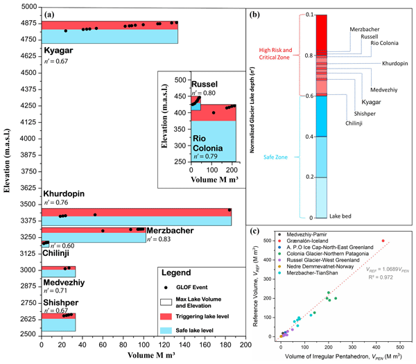
We explored the growing threat of glacier lake outburst floods (GLOFs) driven by glacier surges in the Karakoram. Using advanced remote sensing and field data, we identified key lake volumes and depths that indicate potential GLOFs. Our findings improve early warning systems by providing rapid methods to assess lake volumes in remote areas. This research seeks to protect vulnerable communities and contribute to global efforts in predicting and mitigating catastrophic flood risks.
Anja Løkkegaard, Kenneth D. Mankoff, Christian Zdanowicz, Gary D. Clow, Martin P. Lüthi, Samuel H. Doyle, Henrik H. Thomsen, David Fisher, Joel Harper, Andy Aschwanden, Bo M. Vinther, Dorthe Dahl-Jensen, Harry Zekollari, Toby Meierbachtol, Ian McDowell, Neil Humphrey, Anne Solgaard, Nanna B. Karlsson, Shfaqat A. Khan, Benjamin Hills, Robert Law, Bryn Hubbard, Poul Christoffersen, Mylène Jacquemart, Julien Seguinot, Robert S. Fausto, and William T. Colgan
The Cryosphere, 17, 3829–3845, https://doi.org/10.5194/tc-17-3829-2023, https://doi.org/10.5194/tc-17-3829-2023, 2023
Short summary
Short summary
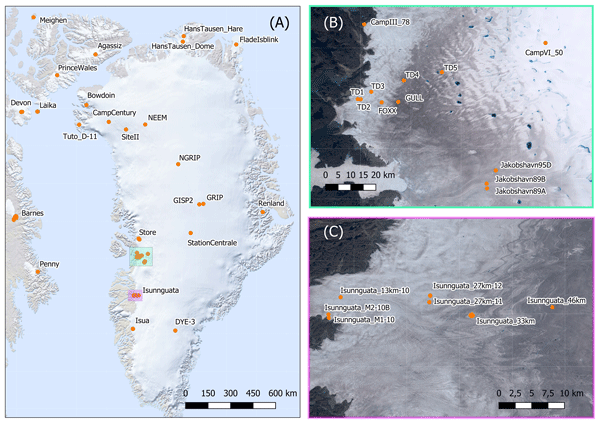
This study presents a database compiling 95 ice temperature profiles from the Greenland ice sheet and peripheral ice caps. Ice viscosity and hence ice flow are highly sensitive to ice temperature. To highlight the value of the database in evaluating ice flow simulations, profiles from the Greenland ice sheet are compared to a modeled temperature field. Reoccurring discrepancies between modeled and observed temperatures provide insight on the difficulties faced when simulating ice temperatures.
Angelika Humbert, Veit Helm, Niklas Neckel, Ole Zeising, Martin Rückamp, Shfaqat Abbas Khan, Erik Loebel, Jörg Brauchle, Karsten Stebner, Dietmar Gross, Rabea Sondershaus, and Ralf Müller
The Cryosphere, 17, 2851–2870, https://doi.org/10.5194/tc-17-2851-2023, https://doi.org/10.5194/tc-17-2851-2023, 2023
Short summary
Short summary
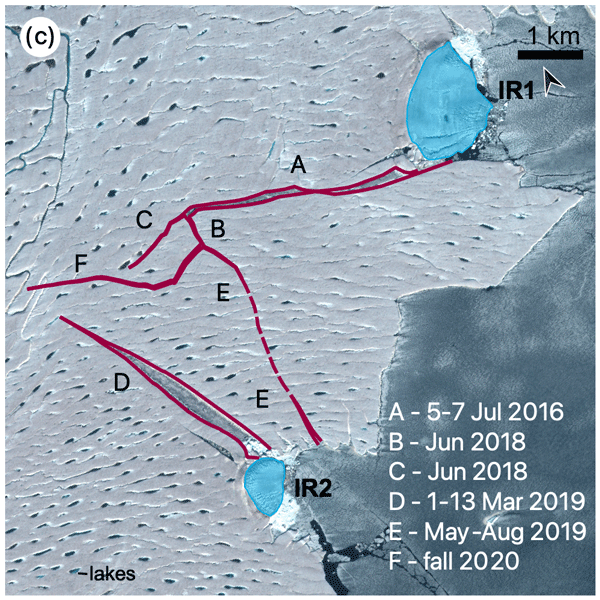
The largest floating glacier mass in Greenland, the 79° N Glacier, is showing signs of instability. We investigate how crack formation at the glacier's calving front has changed over the last decades by using satellite imagery and airborne data. The calving front is about to lose contact to stabilizing ice islands. Simulations show that the glacier will accelerate as a result of this, leading to an increase in ice discharge of more than 5.1 % if its calving front retreats by 46 %.
Inès N. Otosaka, Andrew Shepherd, Erik R. Ivins, Nicole-Jeanne Schlegel, Charles Amory, Michiel R. van den Broeke, Martin Horwath, Ian Joughin, Michalea D. King, Gerhard Krinner, Sophie Nowicki, Anthony J. Payne, Eric Rignot, Ted Scambos, Karen M. Simon, Benjamin E. Smith, Louise S. Sørensen, Isabella Velicogna, Pippa L. Whitehouse, Geruo A, Cécile Agosta, Andreas P. Ahlstrøm, Alejandro Blazquez, William Colgan, Marcus E. Engdahl, Xavier Fettweis, Rene Forsberg, Hubert Gallée, Alex Gardner, Lin Gilbert, Noel Gourmelen, Andreas Groh, Brian C. Gunter, Christopher Harig, Veit Helm, Shfaqat Abbas Khan, Christoph Kittel, Hannes Konrad, Peter L. Langen, Benoit S. Lecavalier, Chia-Chun Liang, Bryant D. Loomis, Malcolm McMillan, Daniele Melini, Sebastian H. Mernild, Ruth Mottram, Jeremie Mouginot, Johan Nilsson, Brice Noël, Mark E. Pattle, William R. Peltier, Nadege Pie, Mònica Roca, Ingo Sasgen, Himanshu V. Save, Ki-Weon Seo, Bernd Scheuchl, Ernst J. O. Schrama, Ludwig Schröder, Sebastian B. Simonsen, Thomas Slater, Giorgio Spada, Tyler C. Sutterley, Bramha Dutt Vishwakarma, Jan Melchior van Wessem, David Wiese, Wouter van der Wal, and Bert Wouters
Earth Syst. Sci. Data, 15, 1597–1616, https://doi.org/10.5194/essd-15-1597-2023, https://doi.org/10.5194/essd-15-1597-2023, 2023
Short summary
Short summary
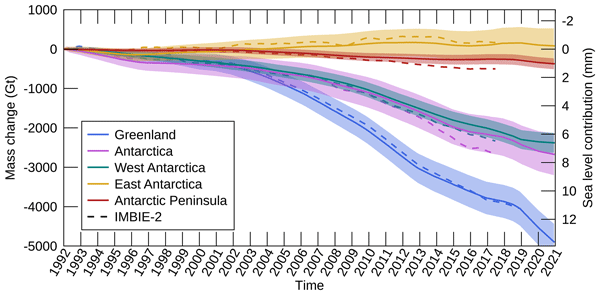
By measuring changes in the volume, gravitational attraction, and ice flow of Greenland and Antarctica from space, we can monitor their mass gain and loss over time. Here, we present a new record of the Earth’s polar ice sheet mass balance produced by aggregating 50 satellite-based estimates of ice sheet mass change. This new assessment shows that the ice sheets have lost (7.5 x 10¹²) t of ice between 1992 and 2020, contributing 21 mm to sea level rise.

Mads Dømgaard, Kristian K. Kjeldsen, Flora Huiban, Jonathan L. Carrivick, Shfaqat A. Khan, and Anders A. Bjørk
The Cryosphere, 17, 1373–1387, https://doi.org/10.5194/tc-17-1373-2023, https://doi.org/10.5194/tc-17-1373-2023, 2023
Short summary
Short summary
Sudden releases of meltwater from glacier-dammed lakes can influence ice flow, cause flooding hazards and landscape changes. This study presents a record of 14 drainages from 2007–2021 from a lake in west Greenland. The time series reveals how the lake fluctuates between releasing large and small amounts of drainage water which is caused by a weakening of the damming glacier following the large events. We also find a shift in the water drainage route which increases the risk of flooding hazards.
William Colgan, Agnes Wansing, Kenneth Mankoff, Mareen Lösing, John Hopper, Keith Louden, Jörg Ebbing, Flemming G. Christiansen, Thomas Ingeman-Nielsen, Lillemor Claesson Liljedahl, Joseph A. MacGregor, Árni Hjartarson, Stefan Bernstein, Nanna B. Karlsson, Sven Fuchs, Juha Hartikainen, Johan Liakka, Robert S. Fausto, Dorthe Dahl-Jensen, Anders Bjørk, Jens-Ove Naslund, Finn Mørk, Yasmina Martos, Niels Balling, Thomas Funck, Kristian K. Kjeldsen, Dorthe Petersen, Ulrik Gregersen, Gregers Dam, Tove Nielsen, Shfaqat A. Khan, and Anja Løkkegaard
Earth Syst. Sci. Data, 14, 2209–2238, https://doi.org/10.5194/essd-14-2209-2022, https://doi.org/10.5194/essd-14-2209-2022, 2022
Short summary
Short summary
We assemble all available geothermal heat flow measurements collected in and around Greenland into a new database. We use this database of point measurements, in combination with other geophysical datasets, to model geothermal heat flow in and around Greenland. Our geothermal heat flow model is generally cooler than previous models of Greenland, especially in southern Greenland. It does not suggest any high geothermal heat flows resulting from Icelandic plume activity over 50 million years ago.
Martin Horwath, Benjamin D. Gutknecht, Anny Cazenave, Hindumathi Kulaiappan Palanisamy, Florence Marti, Ben Marzeion, Frank Paul, Raymond Le Bris, Anna E. Hogg, Inès Otosaka, Andrew Shepherd, Petra Döll, Denise Cáceres, Hannes Müller Schmied, Johnny A. Johannessen, Jan Even Øie Nilsen, Roshin P. Raj, René Forsberg, Louise Sandberg Sørensen, Valentina R. Barletta, Sebastian B. Simonsen, Per Knudsen, Ole Baltazar Andersen, Heidi Ranndal, Stine K. Rose, Christopher J. Merchant, Claire R. Macintosh, Karina von Schuckmann, Kristin Novotny, Andreas Groh, Marco Restano, and Jérôme Benveniste
Earth Syst. Sci. Data, 14, 411–447, https://doi.org/10.5194/essd-14-411-2022, https://doi.org/10.5194/essd-14-411-2022, 2022
Short summary
Short summary
Global mean sea-level change observed from 1993 to 2016 (mean rate of 3.05 mm yr−1) matches the combined effect of changes in water density (thermal expansion) and ocean mass. Ocean-mass change has been assessed through the contributions from glaciers, ice sheets, and land water storage or directly from satellite data since 2003. Our budget assessments of linear trends and monthly anomalies utilise new datasets and uncertainty characterisations developed within ESA's Climate Change Initiative.
Cited articles
Altamimi, Z., Rebischung, P., Collilieux, X., Métivier, L., and Chanard, K.: ITRF2020: an augmented reference frame refining the modeling of nonlinear station motions, J. Geodesy, 97, 47, https://doi.org/10.1007/s00190-023-01738-w, 2023. a
Aster, R. C., Borchers, B., and Thurber, C.: Parameter Estimation and Inverse Problems, Tech. rep., https://doi.org/10.1016/C2015-0-02458-3, 2004. a
Barletta, V. R., Bordoni, A., and Khan, S. A.: GNET Derived Mass Balance and Glacial Isostatic Adjustment Constraints for Greenland, Geophys. Res. Lett., 51, https://doi.org/10.1029/2023GL106891, 2024. a, b
Berg, D., Barletta, V. R., Hassan, J., Lippert, E. Y., Colgan, W., Bevis, M., Steffen, R., and Khan, S. A.: Vertical Land Motion Due To Present-Day Ice Loss From Greenland's and Canada's Peripheral Glaciers, Geophys. Res. Lett., 51, https://doi.org/10.1029/2023GL104851, 2024. a, b
Berg, D. L., Adhikari, S., Hassan, J., Steffen, R., Steffen, H., Willis, M., and Khan, S. A.: Estimation and Attribution of Horizontal Land Motion Measured by the Greenland GNSS Network, J. Geophys. Res.-Sol. Ea., 130, https://doi.org/10.1029/2024JB030847, 2025. a, b
Bertiger, W., Bar-Sever, Y., Dorsey, A., Haines, B., Harvey, N., Hemberger, D., Heflin, M., Lu, W., Miller, M., Moore, A. W., Murphy, D., Ries, P., Romans, L., Sibois, A., Sibthorpe, A., Szilagyi, B., Vallisneri, M., and Willis, P.: GipsyX/RTGx, a new tool set for space geodetic operations and research, Adv. Space Res., 66, 469–489, https://doi.org/10.1016/j.asr.2020.04.015, 2020. a, b, c, d
Bevis, M. and Brown, A.: Trajectory models and reference frames for crustal motion geodesy, J. Geodesy, 88, 283–311, https://doi.org/10.1007/s00190-013-0685-5, 2014. a
Bevis, M., Wahr, J., Khan, S. A., Bo Madsen, F., Brown, A., Willis, M., Kendrick, E., Knudsen, P., Box, J. E., van Dam, T., Caccamise II, D. J., Johns, B., Nylen, T., Abbott, R., White, S., Miner, J., Forsberg, R., Zhou, H., Wang, J., Wilson, T., Bromwich, D., and Francis, O.: Bedrock displacements in Greenland manifest ice mass variations, climate cycles and climate change, P. Ntl. Acad. Sci., 109, https://doi.org/10.1073/pnas.1204664109, 2012. a
Bevis, M., Harig, C., Khan, S. A., Brown, A., Simons, F. J., Willis, M., Fettweis, X., Van Den Broeke, M. R., Madsen, F. B., Kendrick, E., Caccamise, D. J., Van Dam, T., Knudsen, P., and Nylen, T.: Accelerating changes in ice mass within Greenland, and the ice sheet's sensitivity to atmospheric forcing, P. Natl. Acad. Sci. USA, 116, 1934–1939, https://doi.org/10.1073/pnas.1806562116, 2019. a
Bian, Y., Li, Z., Huang, Z., He, B., Shi, L., and Miao, S.: Combined GRACE and GPS to Analyze the Seasonal Variation of Surface Vertical Deformation in Greenland and Its Influence, Remote Sens., 15, https://doi.org/10.3390/rs15020511, 2023. a
Blewitt, G., Hammond, W. C., and Kreemer, C.: Harnessing the GPS Data Explosion for Interdisciplinary Science, Eos, 99, https://doi.org/10.1029/2018EO104623, 2018. a, b
Boehm, J., Niell, A., Tregoning, P., and Schuh, H.: Global Mapping Function (GMF): A new empirical mapping function based on numerical weather model data, Geophys. Res. Lett., 33, https://doi.org/10.1029/2005GL025546, 2006. a
Buchta, E., Scheinert, M., King, M. A., Wilson, T., Koulali, A., Clarke, P. J., Gómez, D., Kendrick, E., Knöfel, C., and Busch, P.: Advancing geodynamic research in Antarctica: reprocessing GNSS data to infer consistent coordinate time series (GIANT-REGAIN), Earth Syst. Sci. Data, 17, 1761–1780, https://doi.org/10.5194/essd-17-1761-2025, 2025. a
Carrére, L., Lyard, F., Cancet, M., Guillot, A., and Picot, N.: FES 2014, a new tidal model – validation results and perspectives for improvements, in: Proceedings of the ESA Living Planet Symposium, Prague, Czech Republic, 9–13, https://meetingorganizer.copernicus.org/EGU2015/EGU2015-5481-1.pdf (last access: 10 February 2026), 2016. a
DTU Space: GNSS data of KLSQ00GRL, Kangerlussuaq, Greenland, Royal Observatory of Belgium [data set], https://doi.org/10.24414/ROB-EUREF-KLSQ00GRL, 2025a. a
DTU Space: GNSS data of QAQ100GRL, Qaqortoq / Julianehaab, Greenland, Royal Observatory of Belgium (ROB) [data set], https://doi.org/10.24414/ROB-EUREF-QAQ100GRL, 2025b. a
DTU Space: GNSS data of SCOR00GRL, Scoresbysund/Ittoqqoormiit, Greenland, Royal Observatory of Belgium (ROB) [data set], https://doi.org/10.24414/ROB-EUREF-SCOR00GRL, 2025c. a
DTU Space: GNSS data of THU200GRL, Thule Airbase, Greenland, Royal Observatory of Belgium (ROB) [data set], https://doi.org/10.24414/ROB-EUREF-THU200GRL, 2025d. a
Fisher, M., Stafford, T., Moon, T., and Thurber, A.: QGreenland, Zenodo [code], https://doi.org/10.5281/zenodo.8326507, 2023. a
Goudarzi, M. A., Cocard, M., and Santerre, R.: Noise behavior in CGPS position time series: The Eastern North America case study, Journal of Geodetic Science, 5, 119–147, https://doi.org/10.1515/jogs-2015-0013, 2015. a, b, c
Greene, C. A., Gardner, A. S., Wood, M., and Cuzzone, J. K.: Ubiquitous acceleration in Greenland Ice Sheet calving from 1985 to 2022, Nature, 625, 523–528, https://doi.org/10.1038/s41586-023-06863-2, 2024. a
Hawley, R. and Brunt, K.: The Future Shape of the Greenland Geodetic Network (GNET), Arctic Research Consortium of the United States (ARCUS), https://www.arcus.org/witness-the-arctic/2019/12/highlight/1 (last access: 15 February 2026), 2019. a
Hawley, R., Ivins, E., Neumann, T., Adhikari, S., Andrews, L., Babonis, G., Bevis, M., Bromwich, D., Chew, C., Christensen, S., Crain, R., Csatho, B., Forsberg, R., Grapenthin, R., Khan, S. A., Kjeldsen, K. K., Knudsen, P., Larour, E., Bo Madsen, F., Mattiolli, G., Nylen, T., Dev Singh, K., van Dam, T., and Willis, M.: GNET 2017 Forward: The Future Shape of a Greenland GNSS Observation Network, Tech. rep., NASA Goddard Space Flight Center/National Science Foundation Workshop, https://go-gnet.org/Media/638059156160053022/GNETwhitepaper.pdf (last access: 1 March 2026), 2017. a, b
Heflin, M., Donnellan, A., Parker, J., Lyzenga, G., Moore, A., Ludwig, L. G., Rundle, J., Wang, J., and Pierce, M.: Automated Estimation and Tools to Extract Positions, Velocities, Breaks, and Seasonal Terms From Daily GNSS Measurements: Illuminating Nonlinear Salton Trough Deformation, Earth and Space Science, 7, https://doi.org/10.1029/2019EA000644, 2020. a, b, c
International GNSS Service: IGS Network, https://network.igs.org/, last access: 16 March 2026. a
International GNSS Service (IGS): Guidelines for Continuously Operating Reference Stations in the IGS, https://files.igs.org/pub/resource/guidelines/Procedure_for_Becoming_an_IGS_Station.pdf (last access: 6 July 2026), 2023. a
KDS: GNSS data of KULL00GRL, Kullorsuaq, Greenland, EPOS [data set], https://doi.org/10.60888/EPOS-GNSS-KULL00GRL, 2026a. a
KDS: GNSS data of KULU00GRL, Kulusuk, Greenland, EPOS [data set], https://doi.org/10.60888/EPOS-GNSS-KULU00GRL, 2026b. a
KDS: GNSS data of QAAR00GRL, Quaarsuut, Greenland, EPOS [data set], https://doi.org/10.60888/EPOS-GNSS-QAAR00GRL, 2026c. a
KDS: GNSS data of AASI00GRL, Aasiaat, Greenland, EPOS [data set], https://doi.org/10.60888/EPOS-GNSS-AASI00GRL, 2026d. a
KDS: GNSS data of AASI00GRL, Aasiaat, Greenland, EPOS [data set], https://doi.org/10.60888/EPOS-GNSS-AASI00GRL, 2026e. a
KDS: GNSS data of AVAN00GRL, Avannarliit, Greenland, EPOS [data set], https://doi.org/10.60888/EPOS-GNSS-AVAN00GRL, 2026f. a
KDS: GNSS data of DMHN00GRL, Danmarkshavn, Greenland, EPOS [data set], https://doi.org/10.60888/EPOS-GNSS-DMHN00GRL, 2026g. a
KDS: GNSS data of EQNU00GRL, Eqaluit Nunataat, Greenland, NSF GAGE Facility [data set], https://doi.org/10.60888/EPOS-GNSS-EQNU00GRL, 2026h. a
KDS: GNSS data of ILUL00GRL, Ilulissat, Greenland, EPOS [data set], https://doi.org/10.60888/EPOS-GNSS-ILUL00GRL, 2026i. a
KDS: GNSS data of ISOR00GRL, Isortoq, Greenland, EPOS [data set], https://doi.org/10.60888/EPOS-GNSS-ISOR00GRL, 2026j. a
KDS: GNSS data of KAPI00GRL, Kapisillit, Greenland, EPOS [data set], https://doi.org/10.60888/EPOS-GNSS-KAPI00GRL, 2026k. a
KDS: GNSS data of KELY00GRL, Kangerlussuaq, Greenland, Royal Observatory of Belgium [data set], https://doi.org/10.24414/ROB-EUREF-KELY00GRL, 2026l. a
KDS: GNSS data of KLQ300GRL, Kangerlussuaq, Greenland, EPOS [data set], https://doi.org/10.60888/EPOS-GNSS-KLQ300GRL, 2026m. a
KDS: GNSS data of KLY200GRL, Kellyville 2, Greenland, EPOS [data set], https://doi.org/10.60888/EPOS-GNSS-KLY200GRL, 2026n. a
KDS: GNSS data of KSUT00GRL, Nuuk, Greenland, EPOS [data set], https://doi.org/10.60888/EPOS-GNSS-KSUT00GRL, 2026o. a
KDS: GNSS data of NGFJ00GRL, Ingolf Fjord, Greenland, EPOS [data set], https://doi.org/10.60888/EPOS-GNSS-NGFJ00GRL, 2026p. a
KDS: GNSS data of NORD00GRL, Station Nord, Greenland, EPOS [data set], https://doi.org/10.60888/EPOS-GNSS-NORD00GRL, 2026q. a
KDS: GNSS data of NUNA00GRL, Nunatarsuaq, Greenland, EPOS [data set], https://doi.org/10.60888/EPOS-GNSS-NUNA00GRL, 2026r. a
KDS: GNSS data of NUUK00GRL, Nuuk, Greenland, EPOS [data set], https://doi.org/10.60888/EPOS-GNSS-NUUK00GRL, 2026s. a
KDS: GNSS data of PAMI00GRL, Paamiut, Greenland, EPOS [data set], https://doi.org/10.60888/EPOS-GNSS-PAMI00GRL, 2026t. a
KDS: GNSS data of QENU00GRL, Qeqetaarsunnguit Nunataat, Greenland, EPOS [data set], https://doi.org/10.60888/EPOS-GNSS-QENU00GRL, 2026u. a
KDS: GNSS data of QEQE00GRL, Qeqertarsuaq (Godhavn), Greenland, EPOS [data set], https://doi.org/10.60888/EPOS-GNSS-QEQE00GRL, 2026v. a
KDS: GNSS data of SCO400GRL, Scoresbysund/Ittoqqoormiit, Greenland, EPOS [data set], https://doi.org/10.60888/EPOS-GNSS-SCO400GRL, 2026w. a
KDS: GNSS data of SISI00GRL, Sisimiut, Greenland, EPOS [data set], https://doi.org/10.60888/EPOS-GNSS-SISI00GRL, 2026x. a
KDS: GNSS data of TIN100GRL, Tininnilik, Greenland, EPOS [data set], https://doi.org/10.60888/EPOS-GNSS-TIN100GRL, 2026y. a
KDS: GNSS data of UPAK00GRL, Uippak, Greenland, EPOS [data set], https://doi.org/10.60888/EPOS-GNSS-UPAK00GRL, 2026z. a
KDS, UNAVCO Community, Fahnestock, M., and Truffer, M.: Greenland GNSS Network – KAGA-Kangia North P.S. – GPS/GNSS Observations Dataset, NSF GAGE Facility [data set], https://doi.org/10.7283/FQGY-4535, 2006. a
KDS, UNAVCO Community, and Bevis, M.: Greenland GNSS Network – ASKY-Astrup Kystland P.S. – GPS/GNSS Observations Dataset, NSF GAGE Facility [data set], https://doi.org/10.7283/W70R-JA23, 2007a. a
KDS, UNAVCO Community, and Bevis, M.: Greenland GNSS Network – DKSG-Doecker Smith Gletscher P.S. – GPS/GNSS Observations Dataset, NSF GAGE Facility [data set], https://doi.org/10.7283/C4AR-3924, 2007b. a
KDS, UNAVCO Community, and Bevis, M.: Greenland GNSS Network – HEL2-Helheim Glacier P.S. – GPS/GNSS Observations Dataset, NSF GAGE Facility [data set], https://doi.org/10.7283/7PB0-2Z53, 2007c. a
KDS, UNAVCO Community, and Bevis, M.: Greenland GNSS Network – HJOR-Hjornefjeldet P.S. – GPS/GNSS Observations Dataset, NSF GAGE Facility [data set], https://doi.org/10.7283/J6TF-HA29, 2007d. a
KDS, UNAVCO Community, and Bevis, M.: Greenland GNSS Network – KAGZ-Kap Agassiz P.S. – GPS/GNSS Observations Dataset, NSF GAGE Facility [data set], https://doi.org/10.7283/B6AB-0X85, 2007e. a
KDS, UNAVCO Community, and Bevis, M.: Greenland GNSS Network – KBUG-Koge Bugt P.S. – GPS/GNSS Observations Dataset, NSF GAGE Facility [data set], https://doi.org/10.7283/KYQM-YH78, 2007f. a
KDS, UNAVCO Community, and Bevis, M.: Greenland GNSS Network – KMOR-Kap Morton P.S. – GPS/GNSS Observations Dataset, NSF GAGE Facility [data set], https://doi.org/10.7283/5A7T-P404, 2007g. a
KDS, UNAVCO Community, and Bevis, M.: Greenland GNSS Network – KSNB-Steenstrup Nordre Brae P.S. – GPS/GNSS Observations Dataset, NSF GAGE Facility [data set], https://doi.org/10.7283/RHVV-9P67, 2007h. a
KDS, UNAVCO Community, and Bevis, M.: Greenland GNSS Network – LYNS-Lynaes P.S. – GPS/GNSS Observations Dataset, NSF GAGE Facility [data set], https://doi.org/10.7283/B41P-6468, 2007i. a
KDS, UNAVCO Community, and Bevis, M.: Greenland GNSS Network – MARG-Marie Gletscher P.S. – GPS/GNSS Observations Dataset, NSF GAGE Facility [data set], https://doi.org/10.7283/432P-NT47, 2007j. a
KDS, UNAVCO Community, and Bevis, M.: Greenland GNSS Network – NNVN-North Niviarsiat Nunatak P.S. – GPS/GNSS Observations Dataset, NSF GAGE Facility [data set], https://doi.org/10.7283/T5PH-B743, 2007k. a
KDS, UNAVCO Community, and Bevis, M.: Greenland GNSS Network – PLPK-Pilappik P.S. – GPS/GNSS Observations Dataset, https://doi.org/10.7283/QQJP-4H93, 2007l. a
KDS, UNAVCO Community, and Bevis, M.: Greenland GNSS Network – RINK-Rinks Isbrae P.S. – GPS/GNSS Observations Dataset, NSF GAGE Facility [data set], https://doi.org/10.7283/NAQ5-7H44, 2007m. a
KDS, UNAVCO Community, and Bevis, M.: Greenland GNSS Network – SCBY-Kap Schoubye P.S. – GPS/GNSS Observations Dataset, NSF GAGE Facility [data set], https://doi.org/10.7283/EWF4-Z744, 2007n. a
KDS, UNAVCO Community, and Bevis, M.: Greenland GNSS Network – SRMP-Sermip Nuunataa P.S. – GPS/GNSS Observations Dataset, NSF GAGE Facility [data set], https://doi.org/10.7283/PJRV-T540, 2007o. a
KDS, UNAVCO Community, and Bevis, M.: Greenland GNSS Network – TIMM-Timmiarmiut P.S. – GPS/GNSS Observations Dataset, NSF GAGE Facility [data set], https://doi.org/10.7283/QDN6-X096, 2007p. a
KDS, UNAVCO Community, and Bevis, M.: Greenland GNSS Network – TREO-Trefoldighedens O P.S. – GPS/GNSS Observations Dataset, NSF GAGE Facility [data set], https://doi.org/10.7283/VH5H-PX24, 2007q. a
KDS, UNAVCO Community, and Bevis, M.: Greenland GNSS Network – UTMG-Upper Timmiarmiit Glacier P.S. – GPS/GNSS Observations Dataset, NSF GAGE Facility [data set], https://doi.org/10.7283/0ZZ3-VV92, 2007r. a
KDS, UNAVCO Community, and Bevis, M.: Greenland GNSS Network – BLAS-Blaasor P.S. – GPS/GNSS Observations Dataset, NSF GAGE Facility [data set], https://doi.org/10.7283/SCBP-5753, 2008a. a
KDS, UNAVCO Community, and Bevis, M.: Greenland GNSS Network – GROK-Gronne Nunatak P.S. – GPS/GNSS Observations Dataset, NSF GAGE Facility [data set], https://doi.org/10.7283/SPX7-V408, 2008b. a
KDS, UNAVCO Community, and Bevis, M.: Greenland GNSS Network – HRDG-Harder Gletscher P.S. – GPS/GNSS Observations Dataset, NSF GAGE Facility [data set], https://doi.org/10.7283/FXP4-4M53, 2008c. a
KDS, UNAVCO Community, and Bevis, M.: Greenland GNSS Network – JGBL-Jorgen Bronlund P.S. – GPS/GNSS Observations Dataset, NSF GAGE Facility [data set], https://doi.org/10.7283/RDME-K197, 2008d. a
KDS, UNAVCO Community, and Bevis, M.: Greenland GNSS Network – JWLF-Jewell Fjord P.S. – GPS/GNSS Observations Dataset, NSF GAGE Facility [data set], https://doi.org/10.7283/XTG2-A936, 2008e. a
KDS, UNAVCO Community, and Bevis, M.: Greenland GNSS Network – KMJP-Kap Morris Jessup P.S. – GPS/GNSS Observations Dataset, NSF GAGE Facility [data set], https://doi.org/10.7283/HR4C-EC55, 2008f. a
KDS, UNAVCO Community, and Bevis, M.: Greenland GNSS Network – LEFN-Leffingwell Nunatak P.S. – GPS/GNSS Observations Dataset, NSF GAGE Facility [data set], https://doi.org/10.7283/NW2Q-7G38, 2008g. a
KDS, UNAVCO Community, and Bevis, M.: Greenland GNSS Network – NRSK-Norske Oye P.S. – GPS/GNSS Observations Dataset, NSF GAGE Facility [data set], https://doi.org/10.7283/T7MX-RH72, 2008h. a
KDS, UNAVCO Community, and Bevis, M.: Greenland GNSS Network – SENU-Sermip Nunataa P.S. – GPS/GNSS Observations Dataset, NSF GAGE Facility [data set], https://doi.org/10.7283/NVG7-3K93, 2008i. a
KDS, UNAVCO Community, and Bevis, M.: Greenland GNSS Network – DANE-Daneborg P.S. – GPS/GNSS Observations Dataset, NSF GAGE Facility [data set], https://doi.org/10.7283/J5AS-ZN66, 2009a. a
KDS, UNAVCO Community, and Bevis, M.: Greenland GNSS Network – DGJG-Daugaard Jensen Gletshcer P.S. – GPS/GNSS Observations Dataset, NSF GAGE Facility [data set], https://doi.org/10.7283/T51Z42GD, 2009b. a
KDS, UNAVCO Community, and Bevis, M.: Greenland GNSS Network – GMMA-Gamma O P.S. – GPS/GNSS Observations Dataset, NSF GAGE Facility [data set], https://doi.org/10.7283/B78A-BZ29, 2009c. a
KDS, UNAVCO Community, and Bevis, M.: Greenland GNSS Network – HMBG-Hamburg Gletshcer P.S. – GPS/GNSS Observations Dataset, NSF GAGE Facility [data set], https://doi.org/10.7283/6224-KD23, 2009d. a
KDS, UNAVCO Community, and Bevis, M.: Greenland GNSS Network – KUAQ-Kangerdlussuaq Gletshcer P.S. – GPS/GNSS Observations Dataset, NSF GAGE Facility [data set], https://doi.org/10.7283/HQ0D-3D69, 2009e. a
KDS, UNAVCO Community, and Bevis, M.: Greenland GNSS Network – LBIB-L. Bistrup Is Brae P.S. – GPS/GNSS Observations Dataset, NSF GAGE Facility [data set], https://doi.org/10.7283/JJJP-BC78, 2009f. a
KDS, UNAVCO Community, and Bevis, M.: Greenland GNSS Network – MIK2-Mikis Fjord P.S. – GPS/GNSS Observations Dataset, NSF GAGE Facility [data set], https://doi.org/10.7283/ABT9-NF76, 2009g. a
KDS, UNAVCO Community, and Bevis, M.: Greenland GNSS Network – MSVG-Mestersvig P.S. – GPS/GNSS Observations Dataset, NSF GAGE Facility [data set], https://doi.org/10.7283/SMV9-Y888, 2009h. a
KDS, UNAVCO Community, and Bevis, M.: Greenland GNSS Network – VFDG-Vestfjord Gletscher P.S. – GPS/GNSS Observations Dataset, NSF GAGE Facility [data set], https://doi.org/10.7283/VT9V-WH52, 2009i. a
KDS, UNAVCO Community, and Bevis, M.: Greenland GNSS Network – WTHG-Walterhausen Gletshcer P.S. – GPS/GNSS Observations Dataset, NSF GAGE Facility [data set], https://doi.org/10.7283/12FV-AQ34, 2009j. a
KDS, UNAVCO Community, and Bevis, M.: Greenland GNSS Network – YMER-Ymer Nunatak P.S. – GPS/GNSS Observations Dataset, NSF GAGE Facility [data set], https://doi.org/10.7283/2GBV-B806, 2009k. a
Khan, S. A., Liu, L., Wahr, J., Howat, I., Joughin, I., Van Dam, T., and Fleming, K.: GPS measurements of crustal uplift near Jakobshavn Isbræ due to glacial ice mass loss, J. Geophys. Res.-Sol. Ea., 115, https://doi.org/10.1029/2010JB007490, 2010a. a
Khan, S. A., Wahr, J., Bevis, M., Velicogna, I., and Kendrick, E.: Spread of ice mass loss into northwest Greenland observed by GRACE and GPS, Geophys. Res. Lett., 37, https://doi.org/10.1029/2010GL042460, 2010b. a
Khan, S. A., Sasgen, I., Bevis, M., Van Dam, T., Bamber, J. L., Willis, M., Kjær, K. H., Wouters, B., Helm, V., Csatho, B., Fleming, K., Bjørk, A. A., Aschwanden, A., Knudsen, P., and Munneke, P. K.: Geodetic measurements reveal similarities between post–Last Glacial Maximum and present-day mass loss from the Greenland ice sheet, Science Advances, 2, https://doi.org/10.1126/sciadv.1600931, 2016. a, b
Kjeldsen, K. K., Khan, S. A., Wahr, J., Korsgaard, N. J., Kjær, K. H., Bjørk, A. A., Hurkmans, R., Van Den Broeke, M. R., Bamber, J. L., and Van Angelen, J. H.: Improved ice loss estimate of the northwestern Greenland ice sheet, J. Geophys. Res.-Sol. Ea., 118, 698–708, https://doi.org/10.1029/2012JB009684, 2013. a
Larson, K. M., Ray, R. D., Nievinski, F. G., and Freymueller, J. T.: The accidental tide gauge: A GPS reflection case study from kachemak bay, Alaska, IEEE Geosci. Remote S., 10, 1200–1204, https://doi.org/10.1109/LGRS.2012.2236075, 2013. a
Liu, L., Khan, S. A., van Dam, T., Ma, J. H. Y., and Bevis, M.: Annual variations in GPS-measured vertical displacements near Upernavik Isstrøm (Greenland) and contributions from surface mass loading, J. Geophys. Res.-Sol. Ea., 122, 677–691, https://doi.org/10.1002/2016JB013494, 2017. a
Materna, K., Feng, L., Lindsey, E. O., Hill, E. M., Ahsan, A., Alam, A. K., Oo, K. M., Than, O., Aung, T., Khaing, S. N., and Bürgmann, R.: GNSS characterization of hydrological loading in South and Southeast Asia, Geophys. J. Int., 224, 1742–1752, https://doi.org/10.1093/gji/ggaa500, 2021. a
NASA Jet Propulsion Laboratory: JPL GPS Time Series (repro2018a), https://sideshow.jpl.nasa.gov/pub/JPL_GPS_Timeseries/repro2018a/post/point/ (last access: 5 March 2026), 2018. a
Nielsen, K., Khan, S. A., Korsgaard, N. J., Kjær, K. H., Wahr, J., Bevis, M., Stearns, L. A., and Timm, L. H.: Crustal uplift due to ice mass variability on Upernavik Isstrøm, west Greenland, Earth Planet. Sc. Lett., 353–354, 182–189, https://doi.org/10.1016/j.epsl.2012.08.024, 2012. a
Seeber, G.: Seeber ⋅ Satellite Geodesy, de Gruyter, 2nd edn., ISBN 3-11-017569-5, 2003. a
Simpson, M. J., Wake, L., Milne, G. A., and Huybrechts, P.: The influence of decadal- to millennial-scale ice mass changes on present-day vertical land motion in Greenland: Implications for the interpretation of GPS observations, J. Geophys. Res.-Sol. Ea., 116, https://doi.org/10.1029/2010JB007776, 2011. a
Solgaard, C.: CSolgaard/GNET_data_paper_2026: ESSD GNET data paper 2026 (Solgaard et. al, 2026) (Version V1), Zenodo [code], https://doi.org/10.5281/zenodo.21227009, 2026. a
Solgaard, C., Nordmann Winther-Dahl, M., Nylen, T., Madsen, F. B., Hansen, O. B., Berg, D. L., Hassan, J., Knudsen, P., Bevis, M., and Khan, S. A.: Daily coordinate time series from the Greenland GNSS Network (GNET) from 1995–2025, DTU [data set], https://doi.org/10.11583/DTU.31397901, 2026a. a, b, c
Solgaard, C., Nordmann Winther-Dahl, M., Nylen, T., Madsen, F. B., Hansen, O. B., Berg, D. L., Hassan, J., Knudsen, P., Bevis, M., and Khan, S. A.: SCOB daily RINEX2 30s files from 1997–2005 [Dataset], https://doi.org/10.11583/DTU.31678426, 2026b. a
Solgaard, C., Nordmann Winther-Dahl, M., Nylen, T., Madsen, F. B., Hansen, O. B., Berg, D. L., Hassan, J., Knudsen, P., Bevis, M., and Khan, S. A.: THU1 daily RINEX2 30s files from 1995–2003 [Dataset], https://doi.org/10.11583/DTU.31673032, 2026c. a
The Danish Agency for Climate Data (Klimadatastyrelsen): GNET – Greenland GNSS Network, https://www.eng.klimadatastyrelsen.dk/green-transition-and-climate-adaptation/gnet (last access: 1 October 2025), 2026a. a
The Danish Agency for Climate Data (KDS): GNSS data of UPVK00GRL, Upernavik, Greenland, EPOS [data set], https://doi.org/10.60888/EPOS-GNSS-UPVK00GRL, 2026c. a
UNAVCO Inc.: NSF GAGE – Measuring Our Changing Earth, https://www.unavco.org/, last access: 1 February 2026. a
White, A. M., Gardner, W. P., Borsa, A. A., Argus, D. F., and Martens, H. R.: A Review of GNSS/GPS in Hydrogeodesy: Hydrologic Loading Applications and Their Implications for Water Resource Research, Water Resour. Res., https://doi.org/10.1029/2022WR032078, 2022. a
Editorial statement
This paper, for the first time, covers more than 20 years of GNSS data from across Greenland and provides the most complete GNSS solution for Greenland. The results are valuable for various research themes in geodesy, geophysics, and glaciology.
This paper, for the first time, covers more than 20 years of GNSS data from across Greenland and...
Short summary
The Greenland GNSS (Global Navigation Satellite Systems) Network consists of more than 70 high-grade GNSS stations placed along the perimeter of Greenland. With this work, we present the processed position solutions for the 20+ year record in a daily resolution. Along with the processed time series, we also publish the extensive metadata record for the network and raw data. A comparison with other subsets of the data showed an increased stability in the full processed dataset we publish here.
The Greenland GNSS (Global Navigation Satellite Systems) Network consists of more than 70...


Altmetrics
Final-revised paper
Preprint