Articles | Volume 18, issue 9
https://doi.org/10.5194/essd-18-7071-2026
© Author(s) 2026. This work is distributed under
the Creative Commons Attribution 4.0 License.
the Creative Commons Attribution 4.0 License.
https://doi.org/10.5194/essd-18-7071-2026
© Author(s) 2026. This work is distributed under
the Creative Commons Attribution 4.0 License.
the Creative Commons Attribution 4.0 License.
Data description article
| 
25 Sep 2026
Data description article |
| 25 Sep 2026
| 25 Sep 2026
Global 30 m annual cropland extent dynamics (2000–2024): a harmonized baseline of structural evolution and regional disparities
Yuanhong Liao
Department of Earth System Science, Institute for Global Change Studies, Ministry of Education Ecological Field Station for East Asian Migratory Birds, Tsinghua University, Beijing 100084, China
Tsinghua Urban Institute, Tsinghua University, Beijing 100084, China
Shuang Chen
Department of Geography, The University of Hong Kong, Hong Kong, China
Yuqi Bai
CORRESPONDING AUTHOR

Department of Earth System Science, Institute for Global Change Studies, Ministry of Education Ecological Field Station for East Asian Migratory Birds, Tsinghua University, Beijing 100084, China
Tsinghua Urban Institute, Tsinghua University, Beijing 100084, China
Jie Wang
CORRESPONDING AUTHOR
Pengcheng Laboratory, Shenzhen 518000, China
Peng Gong
CORRESPONDING AUTHOR
Department of Geography, The University of Hong Kong, Hong Kong, China
Institute for Climate and Carbon Neutrality and Department of Earth Sciences, The University of Hong Kong, Hong Kong, China
Related authors
Shuang Chen, Jie Wang, Shuai Yuan, Jiayang Li, Yu Xia, Yuanhong Liao, Junbo Wei, Jincheng Yuan, Xiaoqing Xu, Xiaolin Zhu, Peng Zhu, Hongsheng Zhang, Yuyu Zhou, Haohuan Fu, Huabing Huang, Bin Chen, Fan Dai, and Peng Gong
Earth Syst. Sci. Data, 18, 5375–5398, https://doi.org/10.5194/essd-18-5375-2026, https://doi.org/10.5194/essd-18-5375-2026, 2026
Short summary
Short summary
Monitoring our planet with satellites produces massive datasets too large for researchers to handle. We created a new global database that condenses 25 years of Landsat and MODIS observations into a highly efficient format (Analysis-ready embedding vectors) using AI. By reducing data size by over 340 times while maintaining high accuracy, we allow global studies to be run on standard PC. Makes planetary research accessible to everyone and helps us better track environmental changes over time.
Shuang Chen, Jie Wang, Shuai Yuan, Jiayang Li, Yu Xia, Yuanhong Liao, Junbo Wei, Jincheng Yuan, Xiaoqing Xu, Xiaolin Zhu, Peng Zhu, Hongsheng Zhang, Yuyu Zhou, Haohuan Fu, Huabing Huang, Bin Chen, Fan Dai, and Peng Gong
Earth Syst. Sci. Data, 18, 5375–5398, https://doi.org/10.5194/essd-18-5375-2026, https://doi.org/10.5194/essd-18-5375-2026, 2026
Short summary
Short summary
Monitoring our planet with satellites produces massive datasets too large for researchers to handle. We created a new global database that condenses 25 years of Landsat and MODIS observations into a highly efficient format (Analysis-ready embedding vectors) using AI. By reducing data size by over 340 times while maintaining high accuracy, we allow global studies to be run on standard PC. Makes planetary research accessible to everyone and helps us better track environmental changes over time.
Hongquan Cheng, Mengqing Geng, Xuecao Li, Shijie Li, Min Zhao, Chen Lin, Jie Wang, Peng Gong, and Yuyu Zhou
Earth Syst. Sci. Data, 18, 3449–3479, https://doi.org/10.5194/essd-18-3449-2026, https://doi.org/10.5194/essd-18-3449-2026, 2026
Short summary
Short summary
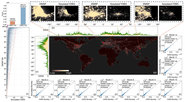
Monthly records of nighttime light are scarce, especially over long periods, yet they are vital for tracking short-term economic shifts and seasonal urban change. This study provides a temporally consistent global 500 m-resolution monthly VIIRS (Visible Infrared Imaging Radiometer Suite)-like nighttime light dataset (1992–2024). By combining DMSP (Defense Meteorological Satellite Program) and VIIRS through reconstruction and correction, a consistent long-term record is created. The dataset supports improved analysis of urban growth and economic activity worldwide.
Fengxiang Guo, Fan Dai, Peng Gong, and Yuyu Zhou
Earth Syst. Sci. Data, 17, 4799–4819, https://doi.org/10.5194/essd-17-4799-2025, https://doi.org/10.5194/essd-17-4799-2025, 2025
Short summary
Short summary
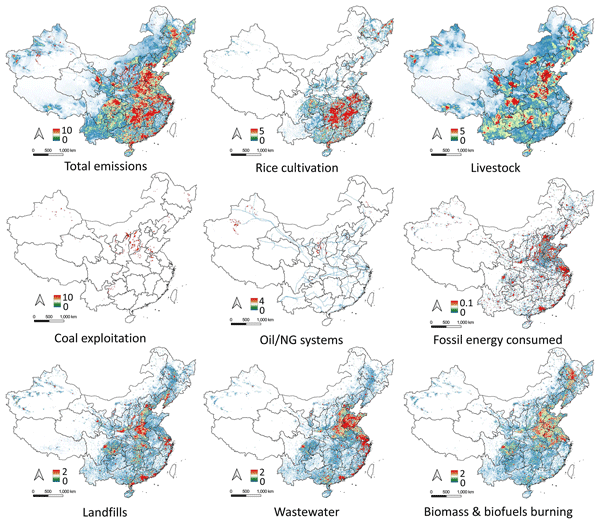
China, the world’s largest methane emitter, faces challenges in accurately tracking. CHN-CH4, a map of anthropogenic methane emissions was created by combining satellite data, national statistics, and climate guidelines. Over 30 years, China emitted about 1157 Tg of methane, peaking in the 2010s. Shanxi province had the highest emissions. CHN-CH4 helps improve tracking, informs global climate models, and strengthens collaboration between science and policy to combat climate change.
Shuang Chen, Jie Wang, Qiang Liu, Xiangan Liang, Rui Liu, Peng Qin, Jincheng Yuan, Junbo Wei, Shuai Yuan, Huabing Huang, and Peng Gong
Earth Syst. Sci. Data, 16, 5449–5475, https://doi.org/10.5194/essd-16-5449-2024, https://doi.org/10.5194/essd-16-5449-2024, 2024
Short summary
Short summary
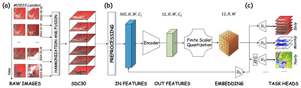
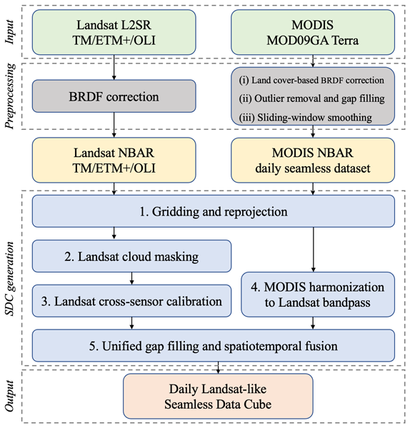
The inconsistent coverage of Landsat data due to its long revisit intervals and frequent cloud cover poses challenges to large-scale land monitoring. We developed a global 30 m 23-year (2000–2022) daily seamless data cube (SDC) of surface reflectance based on Landsat 5, 7, 8, and 9 and MODIS products. The SDC exhibits enhanced capabilities for monitoring land cover changes and robust consistency in both spatial and temporal dimensions, which are important for global environmental monitoring.
Ying Tu, Shengbiao Wu, Bin Chen, Qihao Weng, Yuqi Bai, Jun Yang, Le Yu, and Bing Xu
Earth Syst. Sci. Data, 16, 2297–2316, https://doi.org/10.5194/essd-16-2297-2024, https://doi.org/10.5194/essd-16-2297-2024, 2024
Short summary
Short summary
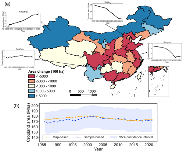
We developed the first 30 m annual cropland dataset of China (CACD) for 1986–2021. The overall accuracy of CACD reached up to 0.93±0.01 and was superior to other products. Our fine-resolution cropland maps offer valuable information for diverse applications and decision-making processes in the future.
Xiangan Liang, Qiang Liu, Jie Wang, Shuang Chen, and Peng Gong
Earth Syst. Sci. Data, 16, 177–200, https://doi.org/10.5194/essd-16-177-2024, https://doi.org/10.5194/essd-16-177-2024, 2024
Short summary
Short summary
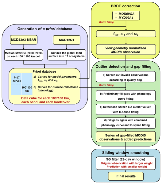
The state-of-the-art MODIS surface reflectance products suffer from temporal and spatial gaps, which make it difficult to characterize the continuous variation of the terrestrial surface. We proposed a framework for generating the first global 500 m daily seamless data cubes (SDC500), covering the period from 2000 to 2022. We believe that the SDC500 dataset can interest other researchers who study land cover mapping, quantitative remote sensing, and ecological science.
Wanru He, Xuecao Li, Yuyu Zhou, Zitong Shi, Guojiang Yu, Tengyun Hu, Yixuan Wang, Jianxi Huang, Tiecheng Bai, Zhongchang Sun, Xiaoping Liu, and Peng Gong
Earth Syst. Sci. Data, 15, 3623–3639, https://doi.org/10.5194/essd-15-3623-2023, https://doi.org/10.5194/essd-15-3623-2023, 2023
Short summary
Short summary
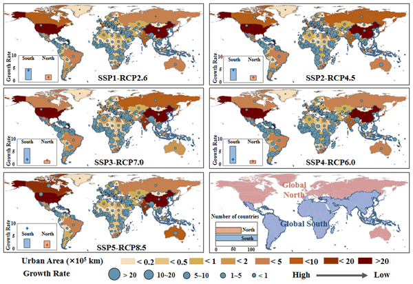
Most existing global urban products with future projections were developed in urban and non-urban categories, which ignores the gradual change of urban development at the local scale. Using annual global urban extent data from 1985 to 2015, we forecasted global urban fractional changes under eight scenarios throughout 2100. The developed dataset can provide spatially explicit information on urban fractions at 1 km resolution, which helps support various urban studies (e.g., urban heat island).

Bowen Cao, Le Yu, Xuecao Li, Min Chen, Xia Li, Pengyu Hao, and Peng Gong
Earth Syst. Sci. Data, 13, 5403–5421, https://doi.org/10.5194/essd-13-5403-2021, https://doi.org/10.5194/essd-13-5403-2021, 2021
Short summary
Short summary
In the study, the first 1 km global cropland proportion dataset for 10 000 BCE–2100 CE was produced through the harmonization and downscaling framework. The mapping result coincides well with widely used datasets at present. With improved spatial resolution, our maps can better capture the cropland distribution details and spatial heterogeneity. The dataset will be valuable for long-term simulations and precise analyses. The framework can be extended to specific regions or other land use types.
Cited articles
Bégué, A., Arvor, D., Bellon, B., Betbeder, J., de Abelleyra, D., Ferraz, R. P. D., Lebourgeois, V., Lelong, C., Simões, M., and Verón, S. R.: Remote sensing and cropping practices: a review, Remote Sens.-Basel, 10, 99, https://doi.org/10.3390/rs10010099, 2018.
Camps-Valls, G., Campos-Taberner, M., Moreno-Martínez, Á., Walther, S., Duveiller, G., Cescatti, A., Mahecha, M. D., Muñoz-Marí, J., García-Haro, F. J., Guanter, L., Jung, M., Gamon, J. A., Reichstein, M., and Running, S. W.: A unified vegetation index for quantifying the terrestrial biosphere, Sci. Adv., 7, eabc7447, https://doi.org/10.1126/sciadv.abc7447, 2021.
Ceaușu, S., Leclère, D., and Newbold, T.: Geography and availability of natural habitat determine whether cropland intensification or expansion is more detrimental to biodiversity, Nat. Ecol. Evol., 9, 993–1008, https://doi.org/10.1038/s41559-025-02691-x, 2025.
Chen, S., Wang, J., and Gong, P.: ROBOT: a spatiotemporal fusion model toward seamless data cube for global remote sensing applications, Remote Sens. Environ., 294, 113616, https://doi.org/10.1016/j.rse.2023.113616, 2023.
Chen, S., Wang, J., Liu, Q., Liang, X., Liu, R., Qin, P., Yuan, J., Wei, J., Yuan, S., Huang, H., and Gong, P.: Global 30 m seamless data cube (2000–2022) of land surface reflectance generated from Landsat 5, 7, 8, and 9 and MODIS Terra constellations, Earth Syst. Sci. Data, 16, 5449–5475, https://doi.org/10.5194/essd-16-5449-2024, 2024.
Chen, S., Liao, Y., Bai, Y., Wang, J., and Gong, P.: Global 30 m Annual Cropland Extent Dynamics (GACED30) (2000–2024), version 1.0, Zenodo [data set], https://doi.org/10.5281/zenodo.18199675, 2026.
Claverie, M., Ju, J., Masek, J. G., Dungan, J. L., Vermote, E. F., Roger, J.-C., Skakun, S. V., and Justice, C.: The Harmonized Landsat and Sentinel-2 surface reflectance data set, Remote Sens. Environ., 219, 145–161, https://doi.org/10.1016/j.rse.2018.09.002, 2018.
Damianidis, C., Santiago-Freijanes, J. J., den Herder, M., Burgess, P. J., Mosquera-Losada, M. R., Graves, A., Papadopoulos, A., Pisanelli, A., Camilli, F., Rois-Díaz, M., Kay, S., Palma, J. H. N., and Pantera, A.: Agroforestry as a sustainable land use option to reduce wildfires risk in European Mediterranean areas, Agroforest Syst., 95, 919–929, https://doi.org/10.1007/s10457-020-00482-w, 2021.
d'Andrimont, R., Yordanov, M., Martinez-Sanchez, L., Eiselt, B., Palmieri, A., Dominici, P., Gallego, J., Reuter, H. I., Joebges, C., Lemoine, G., and van der Velde, M.: Harmonised LUCAS in-situ land cover and use database for field surveys from 2006 to 2018 in the European Union, Sci. Data, 7, 352, https://doi.org/10.1038/s41597-020-00675-z, 2020.
d'Andrimont, R., Yordanov, M., Sedano, F., Verhegghen, A., Strobl, P., Zachariadis, S., Camilleri, F., Palmieri, A., Eiselt, B., Rubio Iglesias, J. M., and van der Velde, M.: Advances in LUCAS Copernicus 2022: enhancing Earth observations with comprehensive in situ data on EU land cover and use, Earth Syst. Sci. Data, 16, 5723–5735, https://doi.org/10.5194/essd-16-5723-2024, 2024.
Di Gregorio, A. and Jansen, L. J. M.: Land Cover Classification System (LCCS): classification concepts and user manual, software version 2, Food and Agriculture Organization of the United Nations, Rome, Italy, ISBN 978-92-5-105327-0, 2005.
Drusch, M., Del Bello, U., Carlier, S., Colin, O., Fernandez, V., Gascon, F., Hoersch, B., Isola, C., Laberinti, P., Martimort, P., Meygret, A., Spoto, F., Sy, O., Marchese, F., and Bargellini, P.: Sentinel-2: ESA's optical high-resolution mission for GMES operational services, Remote Sens. Environ., 120, 25–36, https://doi.org/10.1016/j.rse.2011.11.026, 2012.
FAO and IIASA: Global Agro-Ecological Zones version 4 (GAEZ v4), Food and Agriculture Organization of the United Nations and International Institute for Applied Systems Analysis [data set], https://gaez.fao.org/ (last access: 15 August 2026), 2021.
Foley, J. A., Ramankutty, N., Brauman, K. A., Cassidy, E. S., Gerber, J. S., Johnston, M., Mueller, N. D., O'Connell, C., Ray, D. K., West, P. C., Balzer, C., Bennett, E. M., Carpenter, S. R., Hill, J., Monfreda, C., Polasky, S., Rockström, J., Sheehan, J., Siebert, S., Tilman, D., and Zaks, D. P. M.: Solutions for a cultivated planet, Nature, 478, 337–342, https://doi.org/10.1038/nature10452, 2011.
Food and Agriculture Organization of the United Nations (FAO): The future of food and agriculture – Trends and challenges, FAO, Rome, Italy, ISBN 978-92-5-109551-5, 2017.
Food and Agriculture Organization of the United Nations (FAO): Land use statistics and indicators: global, regional and country trends, 2000–2020, FAOSTAT Analytical Brief Series No. 49, FAO, Rome, Italy, https://doi.org/10.4060/cc0963en, 2022.
Food and Agriculture Organization of the United Nations (FAO): Tracking progress on food and agriculture-related SDG indicators 2025, FAO, Rome, Italy, https://doi.org/10.4060/cd5832en, 2025.
Godfray, H. C. J., Beddington, J. R., Crute, I. R., Haddad, L., Lawrence, D., Muir, J. F., Pretty, J., Robinson, S., Thomas, S. M., and Toulmin, C.: Food security: the challenge of feeding 9 billion people, Science, 327, 812–818, https://doi.org/10.1126/science.1185383, 2010.
Gong, P., Liu, H., Zhang, M., Li, C., Wang, J., Huang, H., Clinton, N., Ji, L., Li, W., Bai, Y., Chen, B., Xu, B., Zhu, Z., Yuan, C., Suen, H. P., Guo, J., Xu, N., Li, W., Zhao, Y., Yang, J., Yu, C., Wang, X., Fu, H., Yu, L., Dronova, I., Hui, F., Cheng, X., Shi, X., Xiao, F., Liu, Q., and Song, L.: Stable classification with limited sample: transferring a 30 m resolution sample set collected in 2015 to mapping 10 m resolution global land cover in 2017, Sci. Bull., 64, 370–373, https://doi.org/10.1016/j.scib.2019.03.002, 2019.
Gong, P., Wang, J., and Huang, H.: Stable classification with limited samples in global land cover mapping: theory and experiments, Sci. Bull., 69, 1862–1865, 2024.
Gorelick, N., Hancher, M., Dixon, M., Ilyushchenko, S., Thau, D., and Moore, R.: Google Earth Engine: planetary-scale geospatial analysis for everyone, Remote Sens. Environ., 202, 18–27, https://doi.org/10.1016/j.rse.2017.06.031, 2017.
Hurtt, G. C., Chini, L., Sahajpal, R., Frolking, S., Bodirsky, B. L., Calvin, K., Doelman, J. C., Fisk, J., Fujimori, S., Klein Goldewijk, K., Hasegawa, T., Havlik, P., Heinimann, A., Humpenöder, F., Jungclaus, J., Kaplan, J. O., Kennedy, J., Krisztin, T., Lawrence, D., Lawrence, P., Ma, L., Mertz, O., Pongratz, J., Popp, A., Poulter, B., Riahi, K., Shevliakova, E., Stehfest, E., Thornton, P., Tubiello, F. N., van Vuuren, D. P., and Zhang, X.: Harmonization of global land use change and management for the period 850–2100 (LUH2) for CMIP6, Geosci. Model Dev., 13, 5425–5464, https://doi.org/10.5194/gmd-13-5425-2020, 2020.
Karra, K., Kontgis, C., Statman-Weil, Z., Mazzariello, J. C., Mathis, M., and Brumby, S. P.: Global land use/land cover with Sentinel 2 and deep learning, in: 2021 IEEE International Geoscience and Remote Sensing Symposium (IGARSS), 4704–4707, https://doi.org/10.1109/IGARSS47720.2021.9553499, 2021.
Killough, B.: Overview of the Open Data Cube initiative, in: IGARSS 2018 – 2018 IEEE International Geoscience and Remote Sensing Symposium, 8629–8632, https://doi.org/10.1109/IGARSS.2018.8517694, 2018.
Killough, B., Siqueira, A., and Dyke, G.: Advancements in the Open Data Cube and analysis ready data – past, present and future, in: IGARSS 2020 – 2020 IEEE International Geoscience and Remote Sensing Symposium, 3373–3375, https://doi.org/10.1109/IGARSS39084.2020.9324712, 2020.
Lesiv, M., Fritz, S., Dürauer, M., Georgieva, I., Buchhorn, M., Bertels, L., Tsendbazar, N., Van De Kerchove, R., Zanaga, D., Schepaschenko, D., See, L., Herold, M., Smets, B., Cherlet, M., Brink, A., and McCallum, I.: A global reference data set for land cover mapping at 10 m resolution, Earth Syst. Sci. Data, 17, 6149–6155, https://doi.org/10.5194/essd-17-6149-2025, 2025.
Li, C., Gong, P., Wang, J., Zhu, Z., Biging, G. S., Yuan, C., Hu, T., Zhang, H., Wang, Q., and Li, X.: The first all-season sample set for mapping global land cover with Landsat-8 data, Sci. Bull., 62, 508–515, https://doi.org/10.1016/j.scib.2017.03.011, 2017.
Liang, X., Liu, Q., Wang, J., Chen, S., and Gong, P.: Global 500 m seamless dataset (2000–2022) of land surface reflectance generated from MODIS products, Earth Syst. Sci. Data, 16, 177–200, https://doi.org/10.5194/essd-16-177-2024, 2024.
Liao, Y., Bai, Y., You, Y., Wang, J., Chen, S., Lin, M., Chen, J., Chen, J. M., Xu, B., and Gong, P.: Surface reflectance in homogeneous regions follows a Gamma distribution: principles, validation and applications, ISPRS J. Photogramm., 234, 72–92, https://doi.org/10.1016/j.isprsjprs.2026.02.007, 2026a.
Liao, Y., Bai, Y., Chen, S., Wang, J., You, Y., Chen, Z., Wu, H., Huang, H., Li, W., Zang, M., Wang, Z., Zhang, X., Xu, B., and Gong, P.: The scaling law in remote sensing mapping for model performance forecasting and reference sample optimization, Remote Sens. Environ., 344, 115529, https://doi.org/10.1016/j.rse.2026.115529, 2026b.
Liu, H., Gong, P., Wang, J., Wang, X., Ning, G., and Xu, B.: Production of global daily seamless data cubes and quantification of global land cover change from 1985 to 2020: iMap World 1.0, Remote Sens. Environ., 258, 112364, https://doi.org/10.1016/j.rse.2021.112364, 2021.
Mueller-Warrant, G. W., Whittaker, G. W., Griffith, S. M., Banowetz, G. M., Dugger, B. D., Garcia, T. S., Giannico, G., Boyer, K. L., and McComb, B. C.: Remote sensing classification of grass seed cropping practices in western Oregon, Int. J. Remote Sens., 32, 2451–2480, https://doi.org/10.1080/01431161003698351, 2011.
NASA JPL: NASADEM Merged DEM Global 1 arc second V001, NASA EOSDIS Land Processes DAAC [data set], https://doi. org/10.5067/MEaSUREs/NASADEM/NASADEM_HGT.001, 2020.
Northcutt, C. G., Jiang, L., and Chuang, I. L.: Confident learning: estimating uncertainty in dataset labels, J. Artif. Intell. Res., 70, 1373–1411, https://doi.org/10.1613/jair.1.12125, 2021.
Olofsson, P., Foody, G. M., Herold, M., Stehman, S. V., Woodcock, C. E., and Wulder, M. A.: Good practices for estimating area and assessing accuracy of land change, Remote Sens. Environ., 148, 42–57, https://doi.org/10.1016/j.rse.2014.02.015, 2014.
Pax-Lenney, M. and Woodcock, C. E.: The effect of spatial resolution on the ability to monitor the status of agricultural lands, Remote Sens. Environ., 61, 210–220, https://doi.org/10.1016/S0034-4257(97)00003-5, 1997.
Potapov, P., Turubanova, S., Hansen, M. C., Tyukavina, A., Zalles, V., Khan, A., Song, X.-P., Pickens, A., Shen, Q., and Cortez, J.: Global maps of cropland extent and change show accelerated cropland expansion in the twenty-first century, Nat. Food, 3, 19–28, https://doi.org/10.1038/s43016-021-00429-z, 2022.
Pretty, J.: Intensification for redesigned and sustainable agricultural systems, Science, 362, eaav0294, https://doi.org/10.1126/science.aav0294, 2018.
Prokhorenkova, L., Gusev, G., Vorobev, A., Dorogush, A. V., and Gulin, A.: CatBoost: unbiased boosting with categorical features, Adv. Neur. In., 31, 6638–6648, https://proceedings.neurips.cc/paper/2018/hash/14491b756b3a51daac41c24863285549-Abstract.html (last access: 22 September 2026), 2018.
State Council Third National Land Survey Leading Group Office, Ministry of Natural Resources of the People's Republic of China, and National Bureau of Statistics of China: Main data bulletin of the Third National Land Survey, 25 August 2021, https://www.mnr.gov.cn/dt/ywbb/202108/t20210826_2678340.html (last access: 15 August 2026), 2021.
Thenkabail, P. S., Teluguntla, P. G., Xiong, J., Oliphant, A., Congalton, R. G., Ozdogan, M., Gumma, M. K., Tilton, J. C., Giri, C., Milesi, C., Phalke, A., Massey, R., Yadav, K., Sankey, T., Zhong, Y., Aneece, I., and Foley, D.: Global Cropland-Extent Product at 30 m Resolution (GCEP30) Derived from Landsat Satellite Time-Series Data for the Year 2015 Using Multiple Machine-Learning Algorithms on Google Earth Engine Cloud, U. S. Geological Survey Professional Paper 1868, https://doi.org/10.3133/pp1868, 2021.
Tilman, D., Balzer, C., Hill, J., and Befort, B. L.: Global food demand and the sustainable intensification of agriculture, P. Natl. Acad. Sci. USA, 108, 20260–20264, https://doi.org/10.1073/pnas.1116437108, 2011.
Tu, Y., Wu, S., Chen, B., Weng, Q., Bai, Y., Yang, J., Yu, L., and Xu, B.: A 30 m annual cropland dataset of China from 1986 to 2021, Earth Syst. Sci. Data, 16, 2297–2316, https://doi.org/10.5194/essd-16-2297-2024, 2024.
Tubiello, F. N., Wanner, N., Asprooth, L., Mueller, M., Ignaciuk, A., Khan, A. A., and Rosero Moncayo, J.: Measuring progress towards sustainable agriculture, Food and Agriculture Organization of the United Nations, Rome, Italy, https://doi.org/10.4060/cb4549en, 2021.
Tubiello, F. N., Conchedda, G., Casse, L., Hao, P., De Santis, G., and Chen, Z.: A new cropland area database by country circa 2020, Earth Syst. Sci. Data, 15, 4997–5015, https://doi.org/10.5194/essd-15-4997-2023, 2023a.
Tubiello, F. N., Conchedda, G., Casse, L., Hao, P., Chen, Z., De Santis, G., Fritz, S., and Muchoney, D.: Measuring the world's cropland area, Nat. Food, 4, 30–32, 2023b.
Tyukavina, A., Stehman, S. V., Pickens, A. H., Potapov, P., and Hansen, M. C.: Practical global sampling methods for estimating area and map accuracy of land cover and change, Remote Sens. Environ., 324, 114714, https://doi.org/10.1016/j.rse.2025.114714, 2025.
Van Tricht, K., Degerickx, J., Gilliams, S., Zanaga, D., Battude, M., Grosu, A., Brombacher, J., Lesiv, M., Bayas, J. C. L., Karanam, S., Fritz, S., Becker-Reshef, I., Franch, B., Mollà-Bononad, B., Boogaard, H., Pratihast, A. K., Koetz, B., and Szantoi, Z.: WorldCereal: a dynamic open-source system for global-scale, seasonal, and reproducible crop and irrigation mapping, Earth Syst. Sci. Data, 15, 5491–5515, https://doi.org/10.5194/essd-15-5491-2023, 2023.
Whitcraft, A. K., Vermote, E. F., Becker-Reshef, I., and Justice, C. O.: Cloud cover throughout the agricultural growing season: impacts on passive optical earth observations, Remote Sens. Environ., 156, 438–447, https://doi.org/10.1016/j.rse.2014.10.023, 2015.
Wulder, M. A., Masek, J. G., Cohen, W. B., Loveland, T. R., and Woodcock, C. E.: Opening the archive: how free data has enabled the science and monitoring promise of Landsat, Remote Sens. Environ., 122, 2–10, https://doi.org/10.1016/j.rse.2012.01.010, 2012.
Xie, Y., Gibbs, H. K., and Lark, T. J.: Landsat-based Irrigation Dataset (LANID): 30 m resolution maps of irrigation distribution, frequency, and change for the US, 1997–2017, Earth Syst. Sci. Data, 13, 5689–5710, https://doi.org/10.5194/essd-13-5689-2021, 2021.
Xie, Z., Zhao, Y., Jiang, R., Zhang, M., Hammer, G., Chapman, S., Brider, J., and Potgieter, A. B.: Seasonal dynamics of fallow and cropping lands in the broadacre cropping region of Australia, Remote Sens. Environ., 305, 114070, https://doi.org/10.1016/j.rse.2024.114070, 2024.
Yu, L., Wang, J., Clinton, N., Xin, Q., Zhong, L., Chen, Y., and Gong, P.: FROM-GC: 30 m global cropland extent derived through multisource data integration, Int. J. Digit. Earth, 6, 521–533, 2013.
Zanaga, D., Van De Kerchove, R., Daems, D., De Keersmaecker, W., Brockmann, C., Kirches, G., Wevers, J., Cartus, O., Santoro, M., and Fritz, S.: ESA WorldCover 10 m 2021 v200, Zenodo [data set], https://doi.org/10.5281/zenodo.7254221, 2022.
Zhang, C., Kerner, H., Wang, S., Hao, P., Li, Z., Hunt, K. A., Abernethy, J., Zhao, H., Gao, F., and Di, L.: Remote sensing for crop mapping: a perspective on current and future crop-specific land cover data products, Remote Sens. Environ., 330, 114995, https://doi.org/10.1016/j.rse.2025.114995, 2025a.
Zhang, L., Xie, Y., Zhu, X., Ma, Q., and Brocca, L.: CIrrMap250: annual maps of China's irrigated cropland from 2000 to 2020 developed through multisource data integration, Earth Syst. Sci. Data, 16, 5207–5226, https://doi.org/10.5194/essd-16-5207-2024, 2024a.
Zhang, X., Zhao, T., Xu, H., Liu, W., Wang, J., Chen, X., and Liu, L.: GLC_FCS30D: the first global 30 m land-cover dynamics monitoring product with a fine classification system for the period from 1985 to 2022 generated using dense-time-series Landsat imagery and the continuous change-detection method, Earth Syst. Sci. Data, 16, 1353–1381, https://doi.org/10.5194/essd-16-1353-2024, 2024b.
Zhang, X., Wan, W., and Estoque, R. C.: Impacts of urban and cropland expansions on natural habitats in Southeast Asia, Nat. Commun., 16, 8479, https://doi.org/10.1038/s41467-025-63384-4, 2025b.
Zhang, X., Liu, L., Zhao, T., Zhang, W., Guan, L., Bai, M., and Chen, X.: GLC_FCS10: a global 10 m land-cover dataset with a fine classification system from Sentinel-1 and Sentinel-2 time-series data in Google Earth Engine, Earth Syst. Sci. Data, 17, 4039–4062, https://doi.org/10.5194/essd-17-4039-2025, 2025c.
Zhu, X. X., Tuia, D., Mou, L., Xia, G.-S., Zhang, L., Xu, F., and Fraundorfer, F.: Deep learning in remote sensing: a comprehensive review and list of resources, IEEE Geosci. Remote Sens. Mag., 5, 8–36, https://doi.org/10.1109/MGRS.2017.2762307, 2017.
Short summary
To track changes in land used for crops, we used satellite observations to create annual global maps for 2000–2024 at a resolution of 30 m. The global area used for crops increased by about 30 million hectares. Expansion was concentrated in parts of Africa and South America, while many other regions showed stability or decline. These maps help track agricultural land use and support research on food security and environmental change.
To track changes in land used for crops, we used satellite observations to create annual global...


Altmetrics
Final-revised paper
Preprint