Articles | Volume 18, issue 7
https://doi.org/10.5194/essd-18-4833-2026
© Author(s) 2026. This work is distributed under
the Creative Commons Attribution 4.0 License.
the Creative Commons Attribution 4.0 License.
https://doi.org/10.5194/essd-18-4833-2026
© Author(s) 2026. This work is distributed under
the Creative Commons Attribution 4.0 License.
the Creative Commons Attribution 4.0 License.
Data description article
| 
13 Jul 2026
Data description article |
| 13 Jul 2026
| 13 Jul 2026
Long-term irrigation water use datasets from multiple Earth Observation-based methods in major irrigated regions
Pierre Laluet
CORRESPONDING AUTHOR

Department of Geodesy and Geoinformation, TU Wien, Vienna, Austria
Jacopo Dari
Department of Civil and Environmental Engineering, University of Perugia, Perugia, Italy
Research Institute for Geo-Hydrological Protection, National Research Council, Perugia, Italy
Louise Busschaert
Department of Earth and Environmental Sciences, KU Leuven, Leuven, Belgium
Zdenko Heyvaert
Department of Earth and Environmental Sciences, KU Leuven, Leuven, Belgium
currently at: ECMWF, Research Department, Reading, RG2 9AX, UK
Gabrielle De Lannoy
Department of Earth and Environmental Sciences, KU Leuven, Leuven, Belgium
Pia Langhans
Department of Geodesy and Geoinformation, TU Wien, Vienna, Austria
Sara Modanesi
Research Institute for Geo-Hydrological Protection, National Research Council, Perugia, Italy
Christian Massari
Research Institute for Geo-Hydrological Protection, National Research Council, Perugia, Italy
Luca Brocca
Research Institute for Geo-Hydrological Protection, National Research Council, Perugia, Italy
Carla Saltalippi
Department of Civil and Environmental Engineering, University of Perugia, Perugia, Italy
Renato Morbidelli
Department of Civil and Environmental Engineering, University of Perugia, Perugia, Italy
Clément Albergel
European Space Agency Climate Office, ECSAT, Didcot, UK
Wouter Dorigo
Department of Geodesy and Geoinformation, TU Wien, Vienna, Austria
Related authors
Oscar M. Baez-Villanueva, Alfredo Crespo-Otero, Sara Modanesi, Pierre Laluet, Sergio Vicente-Serrano, Jaap Schellekens, Jacopo Dari, Hylke E. Beck, Wouter Dorigo, Christian Massari, Chiara Corbari, Joppe Massant, Kwint Delbare, Olivier Bonte, Aaron Boone, Diego Fernández-Prieto, and Diego G. Miralles
EGUsphere, https://doi.org/10.5194/egusphere-2026-1856, https://doi.org/10.5194/egusphere-2026-1856, 2026
Short summary
Short summary
We developed a new method to estimate daily land evaporation at high resolution across the Iberian Peninsula, explicitly accounting for irrigation. By combining satellite and meteorological data, we show that irrigation can strongly increase evaporation in agricultural areas. The results better match ground observations and improve understanding of water use. This approach can support farming decisions and water management at the regional scale, and will be extended to global applications.
Pierre Laluet, Chiara Corbari, Oscar Baez-Villanueva, Sophia Walther, Yongqiang Zhang, Joaquín Muñoz-Sabater, Clément Albergel, and Wouter Dorigo
Hydrol. Earth Syst. Sci., 30, 1779–1799, https://doi.org/10.5194/hess-30-1779-2026, https://doi.org/10.5194/hess-30-1779-2026, 2026
Short summary
Short summary
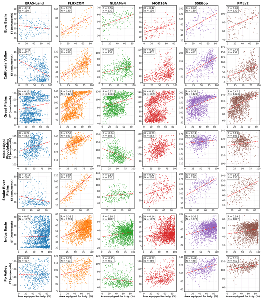
We examined how well global datasets estimate evapotranspiration, the water moving from land to the air, in irrigated areas. We compared six widely used products with irrigation maps, satellite estimates, and field measurements across different climate regions. Some datasets better capture irrigation effects, especially those using temperature and vegetation satellite data. This work helps guide dataset selection and supports better inclusion of irrigation in hydrological and climate models.
Pierre Laluet, Luis Olivera-Guerra, Víctor Altés, Vincent Rivalland, Alexis Jeantet, Julien Tournebize, Omar Cenobio-Cruz, Anaïs Barella-Ortiz, Pere Quintana-Seguí, Josep Maria Villar, and Olivier Merlin
Hydrol. Earth Syst. Sci., 28, 3695–3716, https://doi.org/10.5194/hess-28-3695-2024, https://doi.org/10.5194/hess-28-3695-2024, 2024
Short summary
Short summary
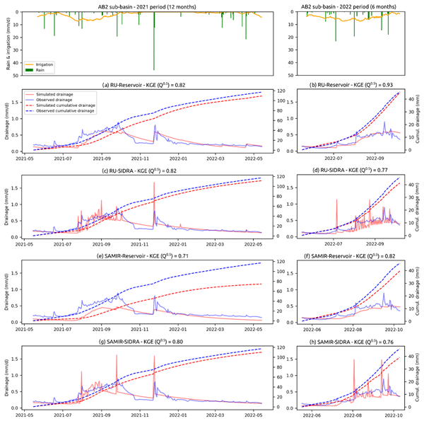
Monitoring agricultural drainage flow in irrigated areas is key to water and soil management. In this paper, four simple drainage models are evaluated on two irrigated sub-basins where drainage flow is measured daily. The evaluation of their precision shows that they simulate drainage very well when calibrated with drainage data and that one of them is slightly better. The evaluation of their accuracy shows that only one model can provide rough drainage estimates without calibration data.
Ruxandra-Maria Zotta, Moritz Clemens Müller, Raul Lezameta, Sophia Walther, Matthias Forkel, and Wouter Dorigo
EGUsphere, https://doi.org/10.5194/egusphere-2026-6254, https://doi.org/10.5194/egusphere-2026-6254, 2026
This preprint is open for discussion and under review for Biogeosciences (BG).
Short summary
Short summary
We developed a satellite-based method to estimate how much carbon plants take up through photosynthesis worldwide from 2002 to 2020. Using microwave observations, land cover and machine learning, we found that land-cover information improved estimates most, while deeper soil moisture better captured water-related changes in short vegetation. The approach complements existing products, but the total amount of plant carbon uptake remains uncertain.
Marco Dionigi, Tommaso Moramarco, Domenico De Santis, Christian Massari, Silvia Barbetta, and Stefania Camici
EGUsphere, https://doi.org/10.5194/egusphere-2026-5965, https://doi.org/10.5194/egusphere-2026-5965, 2026
This preprint is open for discussion and under review for Natural Hazards and Earth System Sciences (NHESS).
Short summary
Short summary
Flood forecasting is challenging in river basins with sparse monitoring networks. We developed a database of pre-computed flood simulations for the Crati River basin in southern Italy, combining stochastically generated rainfall and air temperature with a hydrological model run under different soil moisture conditions. Satellite soil moisture observations select the most relevant simulations, providing river flows in real time. The same approach could be applied to other poorly gauged basins.
Malak Sadki, Gaëtan Noual, Simon Munier, Vanessa Pedinotti, Kaushlendra Verma, Clément Albergel, Sylvain Biancamaria, and Alice Andral
Hydrol. Earth Syst. Sci., 30, 6159–6187, https://doi.org/10.5194/hess-30-6159-2026, https://doi.org/10.5194/hess-30-6159-2026, 2026
Short summary
Short summary
his study explores how 20 years of European Space Agency Climate Change Initiative discharge products improve large-scale hydrological simulations through data assimilation. Tests in two contrasting models across Niger and Congo basins show that temporally dense discharge data reduces bias and improves internal variability. Although product quality, sampling, and basin processes control gain reliability, the findings support these datasets' value in refining models for climate studies.
Diaa Sheishah, Enas Abdelsamei, Viktoria Blanka-Vegi, Károly Barta, Ahmed M. Ali, Khaldoun Abualhin, Djamil Al-Halbouni, Wouter Dorigo, and Gyorgy Sipos
Earth Syst. Sci. Data Discuss., https://doi.org/10.5194/essd-2026-563, https://doi.org/10.5194/essd-2026-563, 2026
Preprint under review for ESSD
Short summary
Short summary
Soil moisture controls drought, crop water supply, and groundwater recharge, but it is difficult to monitor below the surface. We used national monitoring data from 117 stations and six soil depths to build an open database that links soil moisture, soil type, water retention, and expected electromagnetic responses. The results identify a key mid-depth buffering zone and provide a practical reference for future drought monitoring, irrigation planning, and non-invasive soil-water surveys.
Nunzio Romano, Harry Vereecken, Heye R. Bogena, Giorgio Cassiani, Matteo Censini, Giovanna Armiento, Marco Proposito, Lorenzo De Silvestri, Eyal Ben Dor, Nicolas Francos, Christian Massari, János Mészáros, Tünde Takáts, Caterina Mazzitelli, Benedetto Sica, Ugo Lazzaro, and Paolo Nasta
Earth Syst. Sci. Data Discuss., https://doi.org/10.5194/essd-2026-725, https://doi.org/10.5194/essd-2026-725, 2026
Preprint under review for ESSD
Short summary
Short summary
Understanding how climate and land-use change affect water resources requires observations that connect processes from soils and vegetation to groundwater and streams. The Alento dataset is presented that integrates environmental monitoring with targeted field observations across multiple Critical Zone components and scales. The dataset offers a distinctive resource for studying water storage and movement, evaluating environmental models, and improving understanding of water-limited regions.
Rémi Madelon, K. Arthur Endsley, John S. Kimball, Gabriëlle J. M. De Lannoy, Oliver Sonnentag, Haley Alcock, Alex Mavrovic, Scott N. Williamson, Vincent Maire, Arnaud Mialon, and Alexandre Roy
Biogeosciences, 23, 6359–6407, https://doi.org/10.5194/bg-23-6359-2026, https://doi.org/10.5194/bg-23-6359-2026, 2026
Short summary
Short summary
This study aims to improve estimates of carbon dioxide release and uptake in the North American Arctic and subarctic regions. Several modeling approaches were tested, showing that a better representation of sunlight and temperature effects on ecosystems leads to improved estimates. This work provides new perspectives to better assess whether these regions act as sources or sinks of greenhouse gases and how they may influence the climate system by amplifying or slowing global warming.
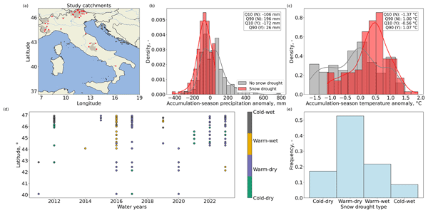
Francesco Avanzi, Stefano Terzi, Mariapina Castelli, Francesca Munerol, Margherita Andreaggi, Marta Galvagno, Andrea Galletti, Tessa Maurer, Christian Massari, Grace Carlson, Manuela Girotto, Giacomo Bertoldi, Edoardo Cremonese, Simone Gabellani, Umberto Morra di Cella, Marco Altamura, Lauro Rossi, and Luca Ferraris
Hydrol. Earth Syst. Sci., 30, 5769–5790, https://doi.org/10.5194/hess-30-5769-2026, https://doi.org/10.5194/hess-30-5769-2026, 2026
Short summary
Short summary
Snow droughts are periods with below-average snow accumulation and are becoming more frequent in a warming climate, yet their ecosystem and societal impacts remain poorly known. Using 13 years of data from 38 Italian catchments, we show that snow droughts reduced snow duration, increased winter melt-out events, and cut summer runoff by ~50 %. Photosynthesis increased by up to 10 % due to earlier meltout. These events also caused widespread water-supply reductions, especially in foothills.
Jawairia A. Ahmad, Christopher M. Taylor, Bethan L. Harris, Dávid D. Kovács, Seonaid Anderson, Adrià Amell, Colin Moldenhauer, Steven Wells, and Wouter Dorigo
EGUsphere, https://doi.org/10.5194/egusphere-2026-4687, https://doi.org/10.5194/egusphere-2026-4687, 2026
This preprint is open for discussion and under review for Hydrology and Earth System Sciences (HESS).
Short summary
Short summary
Evaluating the ability of satellite-observed soil moisture products to represent fine-scale land surface information shows that active microwave radar based product from ASCAT captures spatial variability at fine resolution which passive microwave based products miss. Rainfall dataset evaluation using fine-scale soil moisture information highlights the limitations in ERA5 precipitation. Further, fine-scale soil moisture information improves nowcasting of convective storms over dry regions.
Esmaeel Adrah, Luca Brocca, Emine Senkardesler, and He Yin
Earth Syst. Sci. Data Discuss., https://doi.org/10.5194/essd-2026-603, https://doi.org/10.5194/essd-2026-603, 2026
Preprint under review for ESSD
Short summary
Short summary
The eastern Mediterranean is a hotspot for drought, extreme water scarcity, and geopolitical tension, yet long-term data on irrigation is missing. To address this, we used twenty-six years of satellite imagery to track soil moisture and map winter and summer irrigated lands. This freely available data reveals irrigation changes across the region over time, and support managing scarce water resources, understanding climate impacts, and improving regional food security.
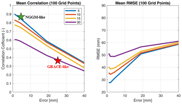
Muhammad Usman Liaqat, Stefania Camici, Francesco Leopardi, Jaime Gaona, and Luca Brocca
Hydrol. Earth Syst. Sci., 30, 4969–4983, https://doi.org/10.5194/hess-30-4969-2026, https://doi.org/10.5194/hess-30-4969-2026, 2026
Short summary
Short summary
Tracking land water storage helps examine extreme events and manage water resources. GRACE (Gravity Recovery and Climate Experiment) missions observe changes, but coarse resolution in space and time challenges effective management. New gravity mission called MAGIC (Mass Change And Geosciences International Constellation) can offers better accuracy. This study tested MAGIC’s potential to estimate precipitation using the SM2RAIN approach. Results show SM2RAIN works well with frequent, accurate data but deteriorates with noisy/sparse data, emphasizing the need for precise gravity missions.
Julia Pfeffer, Benoît Meyssignac, Rory Bingham, Alejandro Blazquez, Marie Bouih, Carla Braitenberg, Luca Brocca, Henryk Dobslaw, Ramiro Ferrari, Ehsan Forootan, Helena Gerdener, Muhammad Tahir Javed, Laura Jensen, Volker Klemann, Anna Kremer, Jürgen Kusche, Gilles Larnicol, Muhammad Usman Liaqat, Francesco Leopardi, Elisavet-Maria Mamagiannou, Gerardo Maurizio, Roland Pail, Isabelle Panet, Thomas Papanikolaou, Peyman Saemian, Ingo Sasgen, Maike Schumacher, Marius Schlaak, Linus Shihora, Alireza Sobouti, Nico Sneeuw, Mohammad Javad Tourian, Dimitrios Tsoulis, Georgios Vergos, Bert Wouters, Fan Yang, and Ilias Daras
EGUsphere, https://doi.org/10.5194/egusphere-2026-4642, https://doi.org/10.5194/egusphere-2026-4642, 2026
This preprint is open for discussion and under review for Earth Observation (EO).
Short summary
Short summary
The ESA SING project demonstrates how the future satellite gravity missions NGGM and MAGIC will improve observations of continental water storage, oceans, glaciers, sea level, earthquakes, and climate change. Their more accurate, higher-resolution gravity measurements will enhance Earth system monitoring, improve climate and hazard assessments, and strengthen operational services for water management, disaster preparedness, and environmental decision-making.
Francesco Avanzi, Hans Lievens, Michael Matiu, Paolo Filippucci, Oscar M. Baez Villanueva, Simone Gabellani, Fabio Delogu, Lorenzo Alfieri, Andrea Libertino, Pere Quintana-Seguì, Diego G. Miralles, Luca Brocca, Christian Massari, and Gabriëlle J. M. De Lannoy
EGUsphere, https://doi.org/10.5194/egusphere-2026-2851, https://doi.org/10.5194/egusphere-2026-2851, 2026
Short summary
Short summary
We developed a new system to map and monitor snow and stored water across large mountain regions using satellite data and computer simulations. Tested in four major European river basins, the system reproduced snow conditions with high accuracy and realistically captured how snow changes with elevation. Because it does not rely on ground measurements, it can help provide consistent information on snow-water resources worldwide, supporting water management and climate adaptation.
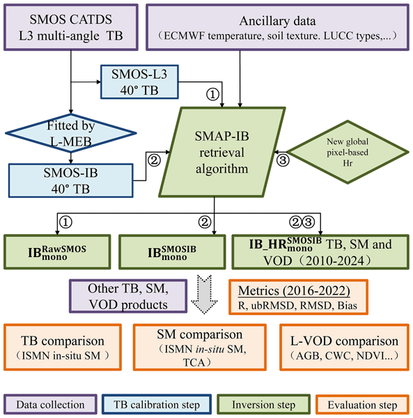
Zanpin Xing, Xiaojun Li, Frédéric Frappart, Gabrielle De Lannoy, Thomas Jagdhuber, Jian Peng, Lei Fan, Hongliang Ma, Lanka Karthikeyan, Xiangzhuo Liu, Mengjia Wang, Lin Zhao, Yongqin Liu, and Jean-Pierre Wigneron
Earth Syst. Sci. Data, 18, 4047–4073, https://doi.org/10.5194/essd-18-4047-2026, https://doi.org/10.5194/essd-18-4047-2026, 2026
Short summary
Short summary
Microwave satellite observations of Earth’s land surface are important for tracking global soil moisture and vegetation water content. We use data from the Soil Moisture and Ocean Salinity satellite to first reduce noise and contamination in microwave signals, then produce more reliable long-term records of these variables. Tests against ground stations and other satellites show that the new record performs better than existing products and supports drought, freeze-thaw, and carbon monitoring.
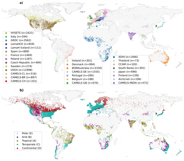
Ather Abbas, Yuan Yang, Ming Pan, Yves Tramblay, Chaopeng Shen, Haoyu Ji, Solomon H. Gebrechorkos, Florian Pappenberger, JongCheol Pyo, Dapeng Feng, George Huffman, Phu Nguyen, Christian Massari, Luca Brocca, Jackson Tan, and Hylke E. Beck
Hydrol. Earth Syst. Sci., 30, 3399–3423, https://doi.org/10.5194/hess-30-3399-2026, https://doi.org/10.5194/hess-30-3399-2026, 2026
Short summary
Short summary
Our study evaluated 24 precipitation datasets using a hydrological model at global scale to assess their suitability and accuracy. We found that MSWEP (Multi-Source Weighted-Ensemble Precipitation) V2.8 excels due to its ability to integrate data from multiple sources, while others, such as IMERG (Integrated Multi-satellitE Retrievals for Global Precipitation Mission) and GDAS (Global Data Assimilation System), demonstrated strong regional performances. This research assists in selecting the appropriate dataset for applications in water resource management, hazard assessment, agriculture, and environmental monitoring.
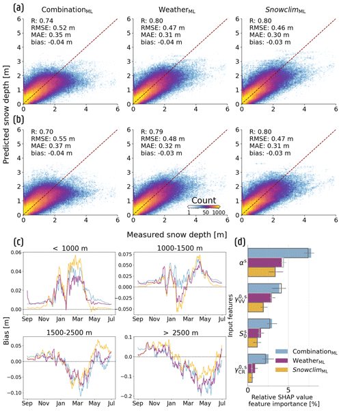
Lucas Boeykens, Devon Dunmire, Jonas-Frederik Jans, Willem Waegeman, Gabriëlle De Lannoy, Ezra Beernaert, Niko E. C. Verhoest, and Hans Lievens
The Cryosphere, 20, 3187–3216, https://doi.org/10.5194/tc-20-3187-2026, https://doi.org/10.5194/tc-20-3187-2026, 2026
Short summary
Short summary
We used AI to better estimate the height of the snowpack present on the ground across the European Alps, by using novel satellite data, complemented by weather information or snow depth estimates from a computer model. We found that both combinations improve the accuracy of our AI-based snow depth estimates, performing almost equally well. This helps us better monitor how much water is stored as snow, which is vital for drinking water, farming, and clean energy production in Europe.
Peyman Afrasiabikia, Atefeh Parvaresh Rizi, and Luca Brocca
ISPRS Ann. Photogramm. Remote Sens. Spatial Inf. Sci., X-4-W8-2025, 33–38, https://doi.org/10.5194/isprs-annals-X-4-W8-2025-33-2026, https://doi.org/10.5194/isprs-annals-X-4-W8-2025-33-2026, 2026
Süleyman Selim Çallı, Kübra Özdemir Çallı, Brahim Akdim, Bruno Arfib, Aleksey Benderev, Sandra Beranger, Avi Burg, Onur Can, Jean-Baptiste Charlier, Mehmet Çelik, Arda Melih Çetin, Fehdi Chemseddine, Miroslava Deliyska, Lucio Di Matteo, Marco Dionigi, Romeo Eftimi, Jutta Eybl, Davide Fronzi, Nico Goldscheider, Ergin Gökkaya, Jorge Jodar, Herve Jourde, Eva Kaminsky, Konstantina Katsanou, Alireza Kavousi, Melike Kaya, David Labat, Tanja Liesch, Peter Malik, Christian Massari, Cyril Mayaud, Naomi Mazzilli, Pavel Pracny, Natasa Ravbar, Nathan Rispal, Simon Seelig, Vianney Sivelle, Marc Steinmann, Daniela Valigi, Gerfried Winkler, Ahmet Kemal Yahşi, and Andreas Hartmann
Earth Syst. Sci. Data Discuss., https://doi.org/10.5194/essd-2026-281, https://doi.org/10.5194/essd-2026-281, 2026
Revised manuscript under review for ESSD
Short summary
Short summary
Karst groundwater systems are vital but highly sensitive to climate change. Their complex underground flow makes them hard to manage without good data, so we gathered 118 high-quality records of spring discharge across Mediterranean mountain ranges. With an average of 19 years of data – including one nearly century-long record – this collection provides the detailed information needed to better predict water availability and protect these vulnerable groundwater sources.
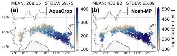
Louise Busschaert, Michel Bechtold, Sara Modanesi, Christian Massari, Dirk Raes, Sujay V. Kumar, and Gabriëlle J. M. De Lannoy
Hydrol. Earth Syst. Sci., 30, 2579–2611, https://doi.org/10.5194/hess-30-2579-2026, https://doi.org/10.5194/hess-30-2579-2026, 2026
Short summary
Short summary
Two models, AquaCrop (crop model) and Noah-MP (land surface model), were compared estimating irrigation in Italy's Po Valley. Noah-MP simulated higher water use (434 mm/yr) than AquaCrop (268 mm/yr), mainly due to extra water losses like runoff. Once losses were accounted for, both aligned with basin-scale reports of around 500 to 600 mm/yr. The study highlights how complex irrigation modeling is, and the need for better observational data to validate results.
Oscar M. Baez-Villanueva, Alfredo Crespo-Otero, Sara Modanesi, Pierre Laluet, Sergio Vicente-Serrano, Jaap Schellekens, Jacopo Dari, Hylke E. Beck, Wouter Dorigo, Christian Massari, Chiara Corbari, Joppe Massant, Kwint Delbare, Olivier Bonte, Aaron Boone, Diego Fernández-Prieto, and Diego G. Miralles
EGUsphere, https://doi.org/10.5194/egusphere-2026-1856, https://doi.org/10.5194/egusphere-2026-1856, 2026
Short summary
Short summary
We developed a new method to estimate daily land evaporation at high resolution across the Iberian Peninsula, explicitly accounting for irrigation. By combining satellite and meteorological data, we show that irrigation can strongly increase evaporation in agricultural areas. The results better match ground observations and improve understanding of water use. This approach can support farming decisions and water management at the regional scale, and will be extended to global applications.
Ehsan Modiri, Oldrich Rakovec, Pallav Kumar Shrestha, Almudena García-García, Leandro Avila, Katie Blackford, Elizabeth Cooper, Bram Droppers, Paolo Filippucci, Milan Fischer, Matěj Orság, Pietro Stradiotti, Luca Brocca, Douglas B. Clark, Wouter Dorigo, Stefan Kollet, Jian Peng, Niko Wanders, and Luis Samaniego
EGUsphere, https://doi.org/10.5194/egusphere-2026-1012, https://doi.org/10.5194/egusphere-2026-1012, 2026
Short summary
Short summary
Drought impacts water supply, agriculture, and ecosystems, yet hydrological models often disagree on when and where drought occurs. This study tested whether satellite observations can improve how models represent soil moisture drought in the Rhine River basin. Using several models and major drought events, we show that satellite data improve spatial realism and reveal important differences among models, helping to better understand uncertainty in drought monitoring and early warning.
Pierre Laluet, Chiara Corbari, Oscar Baez-Villanueva, Sophia Walther, Yongqiang Zhang, Joaquín Muñoz-Sabater, Clément Albergel, and Wouter Dorigo
Hydrol. Earth Syst. Sci., 30, 1779–1799, https://doi.org/10.5194/hess-30-1779-2026, https://doi.org/10.5194/hess-30-1779-2026, 2026
Short summary
Short summary
We examined how well global datasets estimate evapotranspiration, the water moving from land to the air, in irrigated areas. We compared six widely used products with irrigation maps, satellite estimates, and field measurements across different climate regions. Some datasets better capture irrigation effects, especially those using temperature and vegetation satellite data. This work helps guide dataset selection and supports better inclusion of irrigation in hydrological and climate models.
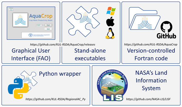
Gabriëlle J. M. De Lannoy, Louise Busschaert, Michel Bechtold, Niccolò Lanfranco, Shannon de Roos, Zdenko Heyvaert, Martynas Bielinis, Jonas Mortelmans, Samuel A. Scherrer, Maxime Van den Bossche, Sujay Kumar, David M. Mocko, Eric Kemp, Lee Heng, Pasquale Steduto, and Dirk Raes
Geosci. Model Dev., 19, 2551–2575, https://doi.org/10.5194/gmd-19-2551-2026, https://doi.org/10.5194/gmd-19-2551-2026, 2026
Short summary
Short summary
The AquaCrop model has been incorporated into the NASA Land Information System, to advance regional crop growth simulations at any spatial resolution, with a range of different input sources for meteorology, soil and crop parameters. This system also facilitates the assimilation of satellite data to update the crop and water conditions during model simulations. We present three exploratory applications to highlight pathways for future research on regional-scale crop estimation.
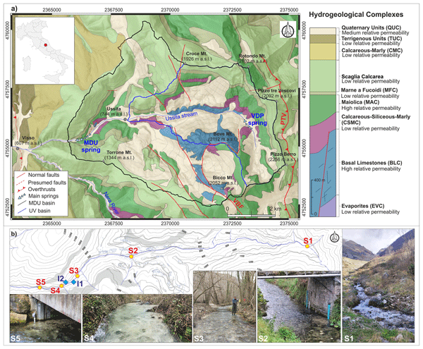
Sofia Ortenzi, Lucio Di Matteo, Daniela Valigi, Marco Donnini, Marco Dionigi, Davide Fronzi, Josie Geris, Fabio Guadagnano, Ivan Marchesini, Paolo Filippucci, Francesco Avanzi, Daniele Penna, and Christian Massari
Hydrol. Earth Syst. Sci., 30, 1755–1778, https://doi.org/10.5194/hess-30-1755-2026, https://doi.org/10.5194/hess-30-1755-2026, 2026
Short summary
Short summary
The study presents an integrated approach to analyze groundwater–surface water interactions in a Central Italy catchment, combining hydrological, hydrochemical–isotopic, thermal drone, and satellite data. Results indicate that fractured limestone aquifers sustain streamflow, with snowmelt accounting for about 18 % of recharge. The workflow is transferable and suitable for similar data-scarce Mediterranean basins.
Roland Hohensinn, Junyang Gou, Ulrich Meyer, Vincent Humphrey, Wouter Dorigo, Eva Boergens, Benedikt Soja, Alexander Gruber, Laura Jensen, Annette Eicker, Michael Rast, and Andreas Güntner
EGUsphere, https://doi.org/10.5194/egusphere-2026-975, https://doi.org/10.5194/egusphere-2026-975, 2026
Short summary
Short summary
This study provides a statistically traceable, uncertainty-aware assessment of global terrestrial and groundwater storage trends based on 21.5 years of GRACE/-FO observations using the Global Gravity-based Groundwater Product (G3P). By accounting for long-range memory and interannual variability, we isolate robust trends from climate variability and noise. The analysis refines continental budgets and identifies emerging groundwater gains alongside widespread persistent decline.
Shima Azimi, Manuela Girotto, Riccardo Rigon, Gaia Roati, Silvia Barbetta, and Christian Massari
EGUsphere, https://doi.org/10.5194/egusphere-2026-793, https://doi.org/10.5194/egusphere-2026-793, 2026
Short summary
Short summary
Even ground-based precipitation observations, often considered the most reliable, can introduce substantial uncertainty into snow modeling due to sparse gauge coverage at high elevations in mountainous catchments.This challenge motivates the present study, in which we propose a data assimilation framework that integrates satellite-based snow depth into a hydrological model to correct snowfall estimates over the Italian Alps, with implications for water management in data-scarce mountain regions.
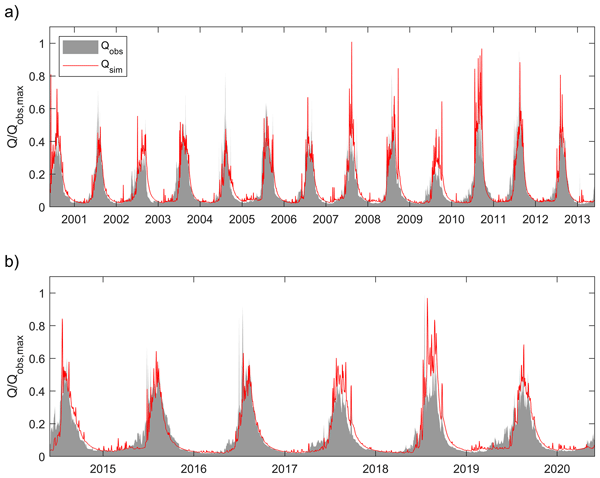
Domenico De Santis, Silvia Barbetta, Sumit Sen, Viviana Maggioni, Farhad Bahmanpouri, Ashutosh Sharma, Ankit Agarwal, Sagar Gupta, Francesco Avanzi, and Christian Massari
Nat. Hazards Earth Syst. Sci., 26, 1075–1104, https://doi.org/10.5194/nhess-26-1075-2026, https://doi.org/10.5194/nhess-26-1075-2026, 2026
Short summary
Short summary
A conceptual, semi-distributed hydrological model was tailored to simulate high flows in monsoon-dominated, glacier-influenced and flood-prone Himalayan basins. Multi-data calibration using satellite-based glacier mass loss and evapotranspiration estimates improved process realism in data-scarce environments. The proposed modelling approach captured key streamflow features despite significant input uncertainties, proving to be a useful tool for exploring the local hydrological response dynamics.
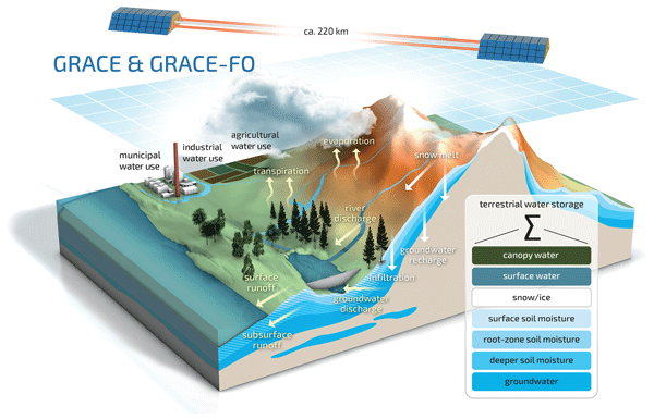
Anne Springer, Gabriëlle De Lannoy, Matthew Rodell, Yorck Ewerdwalbesloh, Helena Gerdener, Mehdi Khaki, Bailing Li, Fupeng Li, Maike Schumacher, Natthachet Tangdamrongsub, Mohammad J. Tourian, Wanshu Nie, and Jürgen Kusche
Hydrol. Earth Syst. Sci., 30, 985–1022, https://doi.org/10.5194/hess-30-985-2026, https://doi.org/10.5194/hess-30-985-2026, 2026
Short summary
Short summary
The GRACE (Gravity Recovery and Climate Experiment) and GRACE Follow-On satellites monitor changes in Earth's water storage by observing gravity variations. By integrating these observations into hydrological models through data assimilation, estimates of groundwater, soil moisture, and hydrological trends are improved, helping to monitor droughts, floods, and human water use. This review highlights recent advances in GRACE data assimilation, identifies key challenges, and discusses future directions with upcoming satellite missions.
Senna Bouabdelli, Martin Morlot, Christian Massari, and Giuseppe Formetta
EGUsphere, https://doi.org/10.5194/egusphere-2026-464, https://doi.org/10.5194/egusphere-2026-464, 2026
Short summary
Short summary
Drought is becoming more common in the Alps as warmer winters reduce snow and alter river flow. We used hydrological model simulations in the Adige basin to understand when and why droughts occur. Results show that droughts are happening earlier, becoming more intense, and increasingly driven by lack of rain instead of melting snow at high elevations. This shift toward lower-elevation river behaviour calls for new strategies to manage water for hydropower, agriculture, and tourism.
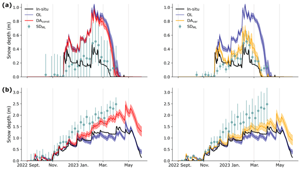
Devon Dunmire, Michel Bechtold, Lucas Boeykens, and Gabriëlle J. M. De Lannoy
The Cryosphere, 20, 609–628, https://doi.org/10.5194/tc-20-609-2026, https://doi.org/10.5194/tc-20-609-2026, 2026
Short summary
Short summary
Snow is vital for society and the climate, yet estimates of snowpack remain uncertain due to observational and modeling limitations. Data assimilation (DA) helps by integrating observations with models. Here, we integrate snow depth retrievals into a physically-based snow model across the European Alps. This work offers advancements for snow data assimilation, such as incorporating a dynamic observational uncertainty, which is essential for forecasting and water resource management.
Andreas Güntner, Ehsan Sharifi, Julian Haas, Eva Boergens, Feifei Cao, Christoph Dahle, Neda Darbeheshti, Henryk Dobslaw, Inés Dussaillant, Wouter Dorigo, Frank Flechtner, Adrian Jäggi, Miriam Kosmale, Martin Lasser, Kari Luojus, Ulrich Meyer, Adam Pasik, Wolfgang Preimersberger, Claudia Ruz Vargas, and Michael Zemp
Earth Syst. Sci. Data Discuss., https://doi.org/10.5194/essd-2025-797, https://doi.org/10.5194/essd-2025-797, 2026
Revised manuscript accepted for ESSD
Short summary
Short summary
We provide a data set that illustrates how the amount of water that is stored in the subsurface as groundwater varies in time over the continents of the Earth. A main source of the data are observations with satellites that weigh the changing amount of water by its mass attraction effect. The data allow for assessing how groundwater as the most important freshwater resource for mankind and ecosystems is affected by climate variability, climate change and withdrawal by human activities.
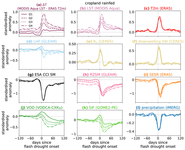
Bethan L. Harris, Christopher M. Taylor, Wouter Dorigo, Ruxandra-Maria Zotta, Darren Ghent, and Iván Noguera
Hydrol. Earth Syst. Sci., 29, 6917–6933, https://doi.org/10.5194/hess-29-6917-2025, https://doi.org/10.5194/hess-29-6917-2025, 2025
Short summary
Short summary
An improved understanding of land-atmosphere coupling processes during flash (rapid-onset) droughts is needed to aid the development of forecasts for these events. We use satellite observations to investigate the surface energy budget during flash droughts globally. The most intense events show a perturbed surface energy budget months before onset. In some regions, vegetation observations 1–2 months before onset provide information on the likelihood of heat extremes during an event.
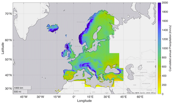
Paolo Filippucci, Luca Brocca, Luca Ciabatta, Hamidreza Mosaffa, Francesco Avanzi, and Christian Massari
Earth Syst. Sci. Data, 17, 5221–5258, https://doi.org/10.5194/essd-17-5221-2025, https://doi.org/10.5194/essd-17-5221-2025, 2025
Short summary
Short summary
Accurate rainfall data is essential, yet measuring daily precipitation worldwide is challenging. This research presents HYdroclimatic PERformance-enhanced Precipitation (HYPER-P), a dataset combining satellite, ground, and reanalysis data to estimate precipitation at a 1 km scale from 2000 to 2022. HYPER-P improves accuracy, especially in areas with few rain gauges. This dataset supports scientists and decision-makers in understanding and managing water resources more effectively.
Xiangmei Liu, Peng Shen, Jiaqi Chen, David Andrew Barry, Christian Massari, Jiansheng Chen, Mingming Feng, Xi Zhang, Fenyan Ma, Fei Yang, and Haixia Jin
EGUsphere, https://doi.org/10.5194/egusphere-2025-4263, https://doi.org/10.5194/egusphere-2025-4263, 2025
Preprint archived
Short summary
Short summary
Our research in the Songnen Basin of Northeast China has revealed why numerous lakes remain unfrozen during winter. By studying Lake Chagan, we discovered that deep groundwater sustains these lakes, likely flowing through subterranean channels from the Tibetan Plateau. When earthquakes disrupt these conduits, water rises along fault lines to replenish the lakes. This finding challenges the theory that graben lakes primarily depend on local precipitation.
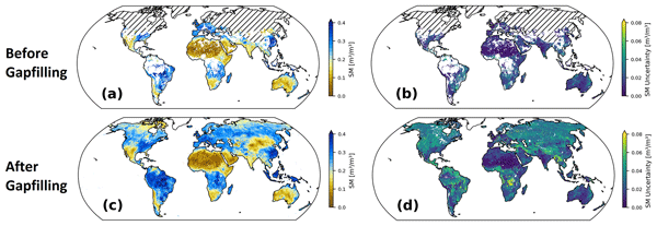
Wolfgang Preimesberger, Pietro Stradiotti, and Wouter Dorigo
Earth Syst. Sci. Data, 17, 4305–4329, https://doi.org/10.5194/essd-17-4305-2025, https://doi.org/10.5194/essd-17-4305-2025, 2025
Short summary
Short summary
We introduce the official ESA CCI Soil Moisture GAPFILLED climate data record. A univariate interpolation algorithm is applied to predict missing data points without relying on ancillary variables. The dataset includes gap-free uncertainty estimates for all predictions and was validated with independent in situ reference measurements. Our data record is recommended for applications which require global long-term gap-free satellite soil moisture data.
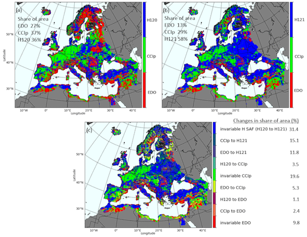
Jaime Gaona, Davide Bavera, Guido Fioravanti, Sebastian Hahn, Pietro Stradiotti, Paolo Filippucci, Stefania Camici, Luca Ciabatta, Hamidreza Mosaffa, Silvia Puca, Nicoletta Roberto, and Luca Brocca
Hydrol. Earth Syst. Sci., 29, 3865–3888, https://doi.org/10.5194/hess-29-3865-2025, https://doi.org/10.5194/hess-29-3865-2025, 2025
Short summary
Short summary
Soil moisture is crucial for the water cycle since it is at the front line of drought. Satellite, model and in situ data help identify soil moisture stress but are challenged by data uncertainties. This study evaluates trends and data coherence of common active/passive microwave sensors and model-based soil moisture data against in situ stations across Europe from 2007 to 2022. Data reliability is increasing, but combining data types improves soil moisture monitoring capabilities.
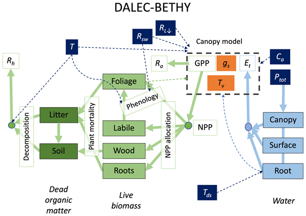
Wolfgang Knorr, Matthew Williams, Tea Thum, Thomas Kaminski, Michael Voßbeck, Marko Scholze, Tristan Quaife, T. Luke Smallman, Susan C. Steele-Dunne, Mariette Vreugdenhil, Tim Green, Sönke Zaehle, Mika Aurela, Alexandre Bouvet, Emanuel Bueechi, Wouter Dorigo, Tarek S. El-Madany, Mirco Migliavacca, Marika Honkanen, Yann H. Kerr, Anna Kontu, Juha Lemmetyinen, Hannakaisa Lindqvist, Arnaud Mialon, Tuuli Miinalainen, Gaétan Pique, Amanda Ojasalo, Shaun Quegan, Peter J. Rayner, Pablo Reyes-Muñoz, Nemesio Rodríguez-Fernández, Mike Schwank, Jochem Verrelst, Songyan Zhu, Dirk Schüttemeyer, and Matthias Drusch
Geosci. Model Dev., 18, 2137–2159, https://doi.org/10.5194/gmd-18-2137-2025, https://doi.org/10.5194/gmd-18-2137-2025, 2025
Short summary
Short summary
When it comes to climate change, the land surface is where the vast majority of impacts happen. The task of monitoring those impacts across the globe is formidable and must necessarily rely on satellites – at a significant cost: the measurements are only indirect and require comprehensive physical understanding. We have created a comprehensive modelling system that we offer to the research community to explore how satellite data can be better exploited to help us capture the changes that happen on our lands.
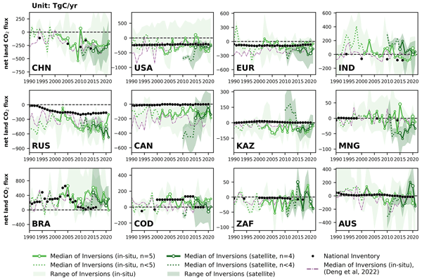
Zhu Deng, Philippe Ciais, Liting Hu, Adrien Martinez, Marielle Saunois, Rona L. Thompson, Kushal Tibrewal, Wouter Peters, Brendan Byrne, Giacomo Grassi, Paul I. Palmer, Ingrid T. Luijkx, Zhu Liu, Junjie Liu, Xuekun Fang, Tengjiao Wang, Hanqin Tian, Katsumasa Tanaka, Ana Bastos, Stephen Sitch, Benjamin Poulter, Clément Albergel, Aki Tsuruta, Shamil Maksyutov, Rajesh Janardanan, Yosuke Niwa, Bo Zheng, Joël Thanwerdas, Dmitry Belikov, Arjo Segers, and Frédéric Chevallier
Earth Syst. Sci. Data, 17, 1121–1152, https://doi.org/10.5194/essd-17-1121-2025, https://doi.org/10.5194/essd-17-1121-2025, 2025
Short summary
Short summary
This study reconciles national greenhouse gas (GHG) inventories with updated atmospheric inversion results to evaluate discrepancies for three principal GHG fluxes at the national level. Compared to our previous study, new satellite-based CO2 inversions were included and an updated mask of managed lands was used, improving agreement for Brazil and Canada. The proposed methodology can be regularly applied as a check to assess the gap between top-down inversions and bottom-up inventories.
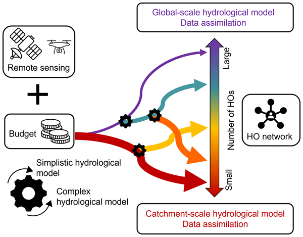
Paolo Nasta, Günter Blöschl, Heye R. Bogena, Steffen Zacharias, Roland Baatz, Gabriëlle De Lannoy, Karsten H. Jensen, Salvatore Manfreda, Laurent Pfister, Ana M. Tarquis, Ilja van Meerveld, Marc Voltz, Yijian Zeng, William Kustas, Xin Li, Harry Vereecken, and Nunzio Romano
Hydrol. Earth Syst. Sci., 29, 465–483, https://doi.org/10.5194/hess-29-465-2025, https://doi.org/10.5194/hess-29-465-2025, 2025
Short summary
Short summary
The Unsolved Problems in Hydrology (UPH) initiative has emphasized the need to establish networks of multi-decadal hydrological observatories to tackle catchment-scale challenges on a global scale. This opinion paper provocatively discusses two endmembers of possible future hydrological observatory (HO) networks for a given hypothesized community budget: a comprehensive set of moderately instrumented observatories or, alternatively, a small number of highly instrumented supersites.
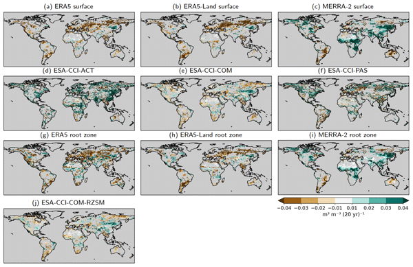
Martin Hirschi, Pietro Stradiotti, Bas Crezee, Wouter Dorigo, and Sonia I. Seneviratne
Hydrol. Earth Syst. Sci., 29, 397–425, https://doi.org/10.5194/hess-29-397-2025, https://doi.org/10.5194/hess-29-397-2025, 2025
Short summary
Short summary
We investigate the potential of long-term satellite and reanalysis products for characterising soil drying by analysing their 2000–2022 soil moisture trends and their representation of agroecological drought events of this period. Soil moisture trends are globally diverse and partly contradictory between products. This also affects the products' drought-detection capacity. Based on the best-estimate products, consistent soil drying is observed over more than 40 % of the land area covered.
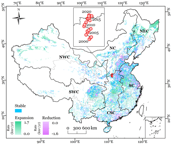
Ling Zhang, Yanhua Xie, Xiufang Zhu, Qimin Ma, and Luca Brocca
Earth Syst. Sci. Data, 16, 5207–5226, https://doi.org/10.5194/essd-16-5207-2024, https://doi.org/10.5194/essd-16-5207-2024, 2024
Short summary
Short summary
This study presented new annual maps of irrigated cropland in China from 2000 to 2020 (CIrrMap250). These maps were developed by integrating remote sensing data, irrigation statistics and surveys, and an irrigation suitability map. CIrrMap250 achieved high accuracy and outperformed currently available products. The new irrigation maps revealed a clear expansion of China’s irrigation area, with the majority (61%) occurring in the water-unsustainable regions facing severe to extreme water stress.
Louise Busschaert, Michel Bechtold, Sara Modanesi, Christian Massari, Dirk Raes, Sujay V. Kumar, and Gabrielle J. M. De Lannoy
EGUsphere, https://doi.org/10.2139/ssrn.4974019, https://doi.org/10.2139/ssrn.4974019, 2024
Preprint archived
Short summary
Short summary
This study estimates irrigation in the Po Valley using AquaCrop and Noah-MP models with sprinkler irrigation. Noah-MP shows higher annual rates than AquaCrop due to more water losses. After adjusting, both align with reported irrigation ranges (500–600 mm/yr). Soil moisture estimates from both models match satellite data, though both have limitations in vegetation and evapotranspiration modeling. The study emphasizes the need for observations to improve irrigation estimates.

Ruxandra-Maria Zotta, Leander Moesinger, Robin van der Schalie, Mariette Vreugdenhil, Wolfgang Preimesberger, Thomas Frederikse, Richard de Jeu, and Wouter Dorigo
Earth Syst. Sci. Data, 16, 4573–4617, https://doi.org/10.5194/essd-16-4573-2024, https://doi.org/10.5194/essd-16-4573-2024, 2024
Short summary
Short summary
VODCA v2 is a dataset providing vegetation indicators for long-term ecosystem monitoring. VODCA v2 comprises two products: VODCA CXKu, spanning 34 years of observations (1987–2021), suitable for monitoring upper canopy dynamics, and VODCA L (2010–2021), for above-ground biomass monitoring. VODCA v2 has lower noise levels than the previous product version and provides valuable insights into plant water dynamics and biomass changes, even in areas where optical data are limited.
Pierre Laluet, Luis Olivera-Guerra, Víctor Altés, Vincent Rivalland, Alexis Jeantet, Julien Tournebize, Omar Cenobio-Cruz, Anaïs Barella-Ortiz, Pere Quintana-Seguí, Josep Maria Villar, and Olivier Merlin
Hydrol. Earth Syst. Sci., 28, 3695–3716, https://doi.org/10.5194/hess-28-3695-2024, https://doi.org/10.5194/hess-28-3695-2024, 2024
Short summary
Short summary
Monitoring agricultural drainage flow in irrigated areas is key to water and soil management. In this paper, four simple drainage models are evaluated on two irrigated sub-basins where drainage flow is measured daily. The evaluation of their precision shows that they simulate drainage very well when calibrated with drainage data and that one of them is slightly better. The evaluation of their accuracy shows that only one model can provide rough drainage estimates without calibration data.
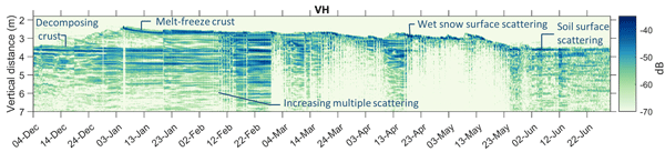
Isis Brangers, Hans-Peter Marshall, Gabrielle De Lannoy, Devon Dunmire, Christian Mätzler, and Hans Lievens
The Cryosphere, 18, 3177–3193, https://doi.org/10.5194/tc-18-3177-2024, https://doi.org/10.5194/tc-18-3177-2024, 2024
Short summary
Short summary
To better understand the interactions between C-band radar waves and snow, a tower-based experiment was set up in the Idaho Rocky Mountains. The reflections were collected in the time domain to measure the backscatter profile from the various snowpack and ground surface layers. The results demonstrate that C-band radar is sensitive to seasonal patterns in snow accumulation but that changes in microstructure, stratigraphy and snow wetness may complicate satellite-based snow depth retrievals.
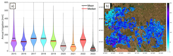
Jacopo Dari, Paolo Filippucci, and Luca Brocca
Hydrol. Earth Syst. Sci., 28, 2651–2659, https://doi.org/10.5194/hess-28-2651-2024, https://doi.org/10.5194/hess-28-2651-2024, 2024
Short summary
Short summary
We have developed the first operational system (10 d latency) for estimating irrigation water use from accessible satellite and reanalysis data. As a proof of concept, the method has been implemented over an irrigated area fed by the Kakhovka Reservoir, in Ukraine, which collapsed on June 6, 2023. Estimates for the period 2015–2023 reveal that, as expected, the irrigation season of 2023 was characterized by the lowest amounts of irrigation.
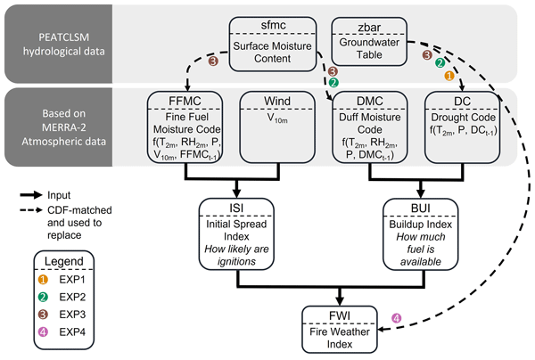
Jonas Mortelmans, Anne Felsberg, Gabriëlle J. M. De Lannoy, Sander Veraverbeke, Robert D. Field, Niels Andela, and Michel Bechtold
Nat. Hazards Earth Syst. Sci., 24, 445–464, https://doi.org/10.5194/nhess-24-445-2024, https://doi.org/10.5194/nhess-24-445-2024, 2024
Short summary
Short summary
With global warming increasing the frequency and intensity of wildfires in the boreal region, accurate risk assessments are becoming more crucial than ever before. The Canadian Fire Weather Index (FWI) is a renowned system, yet its effectiveness in peatlands, where hydrology plays a key role, is limited. By incorporating groundwater data from numerical models and satellite observations, our modified FWI improves the accuracy of fire danger predictions, especially over summer.
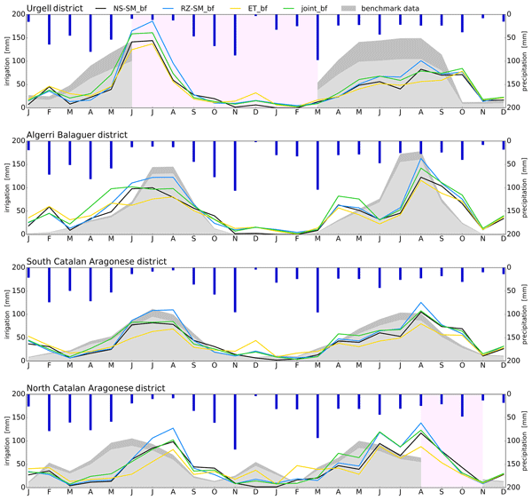
Søren Julsgaard Kragh, Jacopo Dari, Sara Modanesi, Christian Massari, Luca Brocca, Rasmus Fensholt, Simon Stisen, and Julian Koch
Hydrol. Earth Syst. Sci., 28, 441–457, https://doi.org/10.5194/hess-28-441-2024, https://doi.org/10.5194/hess-28-441-2024, 2024
Short summary
Short summary
This study provides a comparison of methodologies to quantify irrigation to enhance regional irrigation estimates. To evaluate the methodologies, we compared various approaches to quantify irrigation using soil moisture, evapotranspiration, or both within a novel baseline framework, together with irrigation estimates from other studies. We show that the synergy from using two equally important components in a joint approach within a baseline framework yields better irrigation estimates.
Shima Azimi, Christian Massari, Giuseppe Formetta, Silvia Barbetta, Alberto Tazioli, Davide Fronzi, Sara Modanesi, Angelica Tarpanelli, and Riccardo Rigon
Hydrol. Earth Syst. Sci., 27, 4485–4503, https://doi.org/10.5194/hess-27-4485-2023, https://doi.org/10.5194/hess-27-4485-2023, 2023
Short summary
Short summary
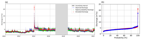
We analyzed the water budget of nested karst catchments using simple methods and modeling. By utilizing the available data on precipitation and discharge, we were able to determine the response lag-time by adopting new techniques. Additionally, we modeled snow cover dynamics and evapotranspiration with the use of Earth observations, providing a concise overview of the water budget for the basin and its subbasins. We have made the data, models, and workflows accessible for further study.
Anne Felsberg, Zdenko Heyvaert, Jean Poesen, Thomas Stanley, and Gabriëlle J. M. De Lannoy
Nat. Hazards Earth Syst. Sci., 23, 3805–3821, https://doi.org/10.5194/nhess-23-3805-2023, https://doi.org/10.5194/nhess-23-3805-2023, 2023
Short summary
Short summary
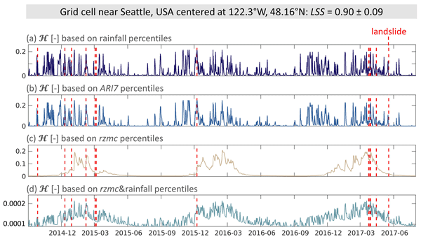
The Probabilistic Hydrological Estimation of LandSlides (PHELS) model combines ensembles of landslide susceptibility and of hydrological predictor variables to provide daily, global ensembles of hazard for hydrologically triggered landslides. Testing different hydrological predictors showed that the combination of rainfall and soil moisture performed best, with the lowest number of missed and false alarms. The ensemble approach allowed the estimation of the associated prediction uncertainty.
Samuel Scherrer, Gabriëlle De Lannoy, Zdenko Heyvaert, Michel Bechtold, Clement Albergel, Tarek S. El-Madany, and Wouter Dorigo
Hydrol. Earth Syst. Sci., 27, 4087–4114, https://doi.org/10.5194/hess-27-4087-2023, https://doi.org/10.5194/hess-27-4087-2023, 2023
Short summary
Short summary
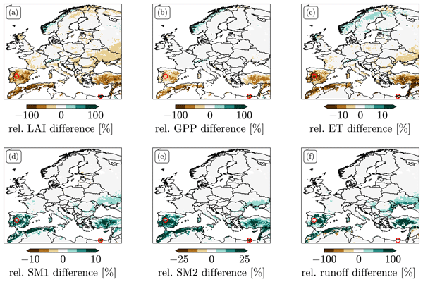
We explored different options for data assimilation (DA) of the remotely sensed leaf area index (LAI). We found strong biases between LAI predicted by Noah-MP and observations. LAI DA that does not take these biases into account can induce unphysical patterns in the resulting LAI and flux estimates and leads to large changes in the climatology of root zone soil moisture. We tested two bias-correction approaches and explored alternative solutions to treating bias in LAI DA.
Adam Pasik, Alexander Gruber, Wolfgang Preimesberger, Domenico De Santis, and Wouter Dorigo
Geosci. Model Dev., 16, 4957–4976, https://doi.org/10.5194/gmd-16-4957-2023, https://doi.org/10.5194/gmd-16-4957-2023, 2023
Short summary
Short summary
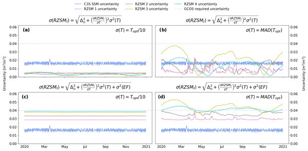
We apply the exponential filter (EF) method to satellite soil moisture retrievals to estimate the water content in the unobserved root zone globally from 2002–2020. Quality assessment against an independent dataset shows satisfactory results. Error characterization is carried out using the standard uncertainty propagation law and empirically estimated values of EF model structural uncertainty and parameter uncertainty. This is followed by analysis of temporal uncertainty variations.
Jacopo Dari, Luca Brocca, Sara Modanesi, Christian Massari, Angelica Tarpanelli, Silvia Barbetta, Raphael Quast, Mariette Vreugdenhil, Vahid Freeman, Anaïs Barella-Ortiz, Pere Quintana-Seguí, David Bretreger, and Espen Volden
Earth Syst. Sci. Data, 15, 1555–1575, https://doi.org/10.5194/essd-15-1555-2023, https://doi.org/10.5194/essd-15-1555-2023, 2023
Short summary
Short summary
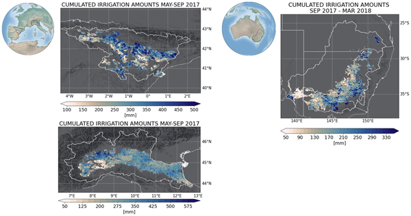
Irrigation is the main source of global freshwater consumption. Despite this, a detailed knowledge of irrigation dynamics (i.e., timing, extent of irrigated areas, and amounts of water used) are generally lacking worldwide. Satellites represent a useful tool to fill this knowledge gap and monitor irrigation water from space. In this study, three regional-scale and high-resolution (1 and 6 km) products of irrigation amounts estimated by inverting the satellite soil moisture signals are presented.
Remi Madelon, Nemesio J. Rodríguez-Fernández, Hassan Bazzi, Nicolas Baghdadi, Clement Albergel, Wouter Dorigo, and Mehrez Zribi
Hydrol. Earth Syst. Sci., 27, 1221–1242, https://doi.org/10.5194/hess-27-1221-2023, https://doi.org/10.5194/hess-27-1221-2023, 2023
Short summary
Short summary
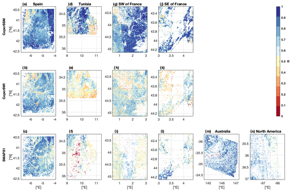
We present an approach to estimate soil moisture (SM) at 1 km resolution using Sentinel-1 and Sentinel-3 satellites. The estimates were compared to other high-resolution (HR) datasets over Europe, northern Africa, Australia, and North America, showing good agreement. However, the discrepancies between the different HR datasets and their lower performances compared with in situ measurements and coarse-resolution datasets show the remaining challenges for large-scale HR SM mapping.
Luisa Schmidt, Matthias Forkel, Ruxandra-Maria Zotta, Samuel Scherrer, Wouter A. Dorigo, Alexander Kuhn-Régnier, Robin van der Schalie, and Marta Yebra
Biogeosciences, 20, 1027–1046, https://doi.org/10.5194/bg-20-1027-2023, https://doi.org/10.5194/bg-20-1027-2023, 2023
Short summary
Short summary
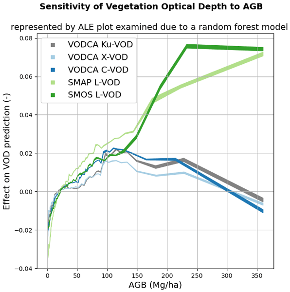
Vegetation attenuates natural microwave emissions from the land surface. The strength of this attenuation is quantified as the vegetation optical depth (VOD) parameter and is influenced by the vegetation mass, structure, water content, and observation wavelength. Here we model the VOD signal as a multi-variate function of several descriptive vegetation variables. The results help in understanding the effects of ecosystem properties on VOD.
Taylor Smith, Ruxandra-Maria Zotta, Chris A. Boulton, Timothy M. Lenton, Wouter Dorigo, and Niklas Boers
Earth Syst. Dynam., 14, 173–183, https://doi.org/10.5194/esd-14-173-2023, https://doi.org/10.5194/esd-14-173-2023, 2023
Short summary
Short summary
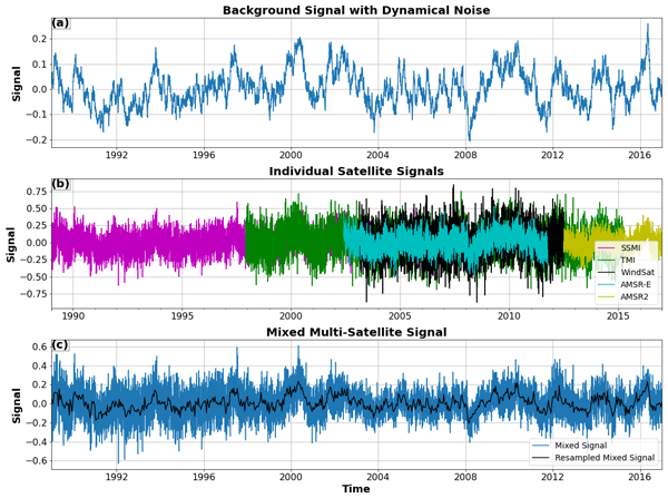
Multi-instrument records with varying signal-to-noise ratios are becoming increasingly common as legacy sensors are upgraded, and data sets are modernized. Induced changes in higher-order statistics such as the autocorrelation and variance are not always well captured by cross-calibration schemes. Here we investigate using synthetic examples how strong resulting biases can be and how they can be avoided in order to make reliable statements about changes in the resilience of a system.
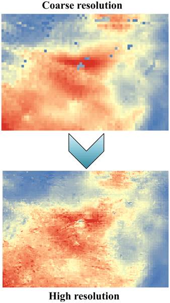
Kunlong He, Wei Zhao, Luca Brocca, and Pere Quintana-Seguí
Hydrol. Earth Syst. Sci., 27, 169–190, https://doi.org/10.5194/hess-27-169-2023, https://doi.org/10.5194/hess-27-169-2023, 2023
Short summary
Short summary
In this study, we developed a soil moisture-based precipitation downscaling (SMPD) method for spatially downscaling the GPM daily precipitation product by exploiting the connection between surface soil moisture and precipitation according to the soil water balance equation. Based on this physical method, the spatial resolution of the daily precipitation product was downscaled to 1 km and the SMPD method shows good potential for the development of the high-resolution precipitation product.
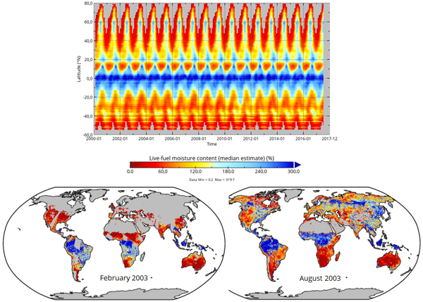
Matthias Forkel, Luisa Schmidt, Ruxandra-Maria Zotta, Wouter Dorigo, and Marta Yebra
Hydrol. Earth Syst. Sci., 27, 39–68, https://doi.org/10.5194/hess-27-39-2023, https://doi.org/10.5194/hess-27-39-2023, 2023
Short summary
Short summary
The live fuel moisture content (LFMC) of vegetation canopies is a driver of wildfires. We investigate the relation between LFMC and passive microwave satellite observations of vegetation optical depth (VOD) and develop a method to estimate LFMC from VOD globally. Our global VOD-based estimates of LFMC can be used to investigate drought effects on vegetation and fire risks.
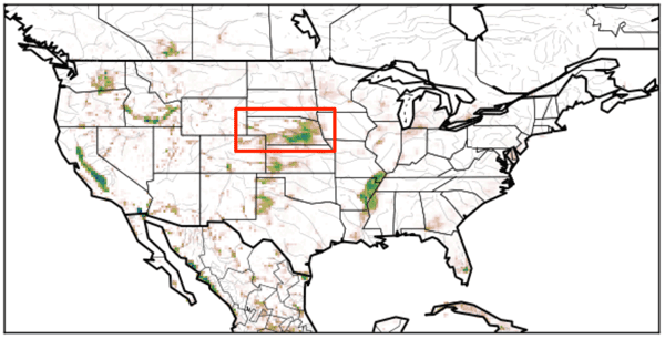
Arsène Druel, Simon Munier, Anthony Mucia, Clément Albergel, and Jean-Christophe Calvet
Geosci. Model Dev., 15, 8453–8471, https://doi.org/10.5194/gmd-15-8453-2022, https://doi.org/10.5194/gmd-15-8453-2022, 2022
Short summary
Short summary
Crop phenology and irrigation is implemented into a land surface model able to work at a global scale. A case study is presented over Nebraska (USA). Simulations with and without the new scheme are compared to different satellite-based observations. The model is able to produce a realistic yearly irrigation water amount. The irrigation scheme improves the simulated leaf area index, gross primary productivity, evapotransipiration, and land surface temperature.
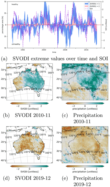
Leander Moesinger, Ruxandra-Maria Zotta, Robin van der Schalie, Tracy Scanlon, Richard de Jeu, and Wouter Dorigo
Biogeosciences, 19, 5107–5123, https://doi.org/10.5194/bg-19-5107-2022, https://doi.org/10.5194/bg-19-5107-2022, 2022
Short summary
Short summary
The standardized vegetation optical depth index (SVODI) can be used to monitor the vegetation condition, such as whether the vegetation is unusually dry or wet. SVODI has global coverage, spans the past 3 decades and is derived from multiple spaceborne passive microwave sensors of that period. SVODI is based on a new probabilistic merging method that allows the merging of normally distributed data even if the data are not gap-free.
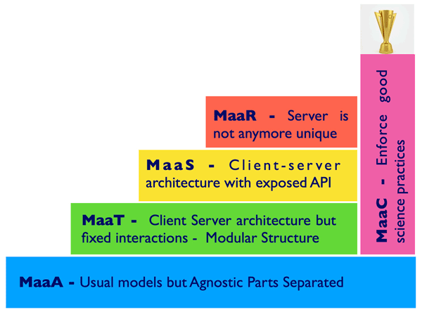
Riccardo Rigon, Giuseppe Formetta, Marialaura Bancheri, Niccolò Tubini, Concetta D'Amato, Olaf David, and Christian Massari
Hydrol. Earth Syst. Sci., 26, 4773–4800, https://doi.org/10.5194/hess-26-4773-2022, https://doi.org/10.5194/hess-26-4773-2022, 2022
Short summary
Short summary
The
Digital Earth(DE) metaphor is very useful for both end users and hydrological modelers. We analyse different categories of models, with the view of making them part of a Digital eARth Twin Hydrology system (called DARTH). We also stress the idea that DARTHs are not models in and of themselves, rather they need to be built on an appropriate information technology infrastructure. It is remarked that DARTHs have to, by construction, support the open-science movement and its ideas.
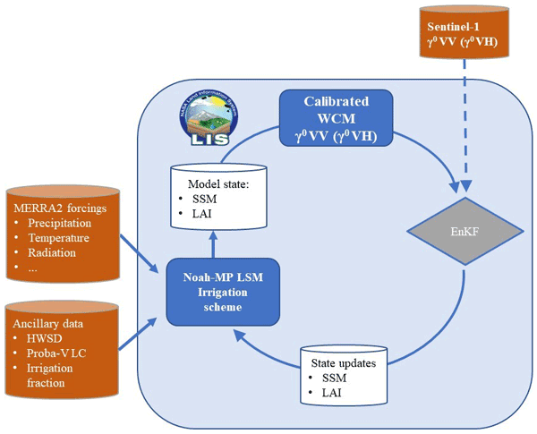
Sara Modanesi, Christian Massari, Michel Bechtold, Hans Lievens, Angelica Tarpanelli, Luca Brocca, Luca Zappa, and Gabriëlle J. M. De Lannoy
Hydrol. Earth Syst. Sci., 26, 4685–4706, https://doi.org/10.5194/hess-26-4685-2022, https://doi.org/10.5194/hess-26-4685-2022, 2022
Short summary
Short summary
Given the crucial impact of irrigation practices on the water cycle, this study aims at estimating irrigation through the development of an innovative data assimilation system able to ingest high-resolution Sentinel-1 radar observations into the Noah-MP land surface model. The developed methodology has important implications for global water resource management and the comprehension of human impacts on the water cycle and identifies main challenges and outlooks for future research.
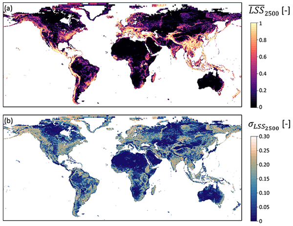
Anne Felsberg, Jean Poesen, Michel Bechtold, Matthias Vanmaercke, and Gabriëlle J. M. De Lannoy
Nat. Hazards Earth Syst. Sci., 22, 3063–3082, https://doi.org/10.5194/nhess-22-3063-2022, https://doi.org/10.5194/nhess-22-3063-2022, 2022
Short summary
Short summary
In this study we assessed global landslide susceptibility at the coarse 36 km spatial resolution of global satellite soil moisture observations to prepare for a subsequent combination of the two. Specifically, we focus therefore on the susceptibility of hydrologically triggered landslides. We introduce ensemble techniques, common in, for example, meteorology but not yet in the landslide community, to retrieve reliable estimates of the total prediction uncertainty.

Stefania Camici, Gabriele Giuliani, Luca Brocca, Christian Massari, Angelica Tarpanelli, Hassan Hashemi Farahani, Nico Sneeuw, Marco Restano, and Jérôme Benveniste
Geosci. Model Dev., 15, 6935–6956, https://doi.org/10.5194/gmd-15-6935-2022, https://doi.org/10.5194/gmd-15-6935-2022, 2022
Short summary
Short summary
This paper presents an innovative approach, STREAM (SaTellite-based Runoff Evaluation And Mapping), to derive daily river discharge and runoff estimates from satellite observations of soil moisture, precipitation, and terrestrial total water storage anomalies. Potentially useful for multiple operational and scientific applications, the added value of the STREAM approach is the ability to increase knowledge on the natural processes, human activities, and their interactions on the land.
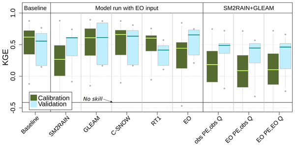
Lorenzo Alfieri, Francesco Avanzi, Fabio Delogu, Simone Gabellani, Giulia Bruno, Lorenzo Campo, Andrea Libertino, Christian Massari, Angelica Tarpanelli, Dominik Rains, Diego G. Miralles, Raphael Quast, Mariette Vreugdenhil, Huan Wu, and Luca Brocca
Hydrol. Earth Syst. Sci., 26, 3921–3939, https://doi.org/10.5194/hess-26-3921-2022, https://doi.org/10.5194/hess-26-3921-2022, 2022
Short summary
Short summary
This work shows advances in high-resolution satellite data for hydrology. We performed hydrological simulations for the Po River basin using various satellite products, including precipitation, evaporation, soil moisture, and snow depth. Evaporation and snow depth improved a simulation based on high-quality ground observations. Interestingly, a model calibration relying on satellite data skillfully reproduces observed discharges, paving the way to satellite-driven hydrological applications.

Louise Busschaert, Shannon de Roos, Wim Thiery, Dirk Raes, and Gabriëlle J. M. De Lannoy
Hydrol. Earth Syst. Sci., 26, 3731–3752, https://doi.org/10.5194/hess-26-3731-2022, https://doi.org/10.5194/hess-26-3731-2022, 2022
Short summary
Short summary
Increasing amounts of water are used for agriculture. Therefore, we looked into how irrigation requirements will evolve under a changing climate over Europe. Our results show that, by the end of the century and under high emissions, irrigation water will increase by 30 % on average compared to the year 2000. Also, the irrigation requirement is likely to vary more from 1 year to another. However, if emissions are mitigated, these effects are reduced.
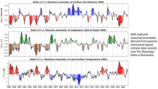
Robin van der Schalie, Mendy van der Vliet, Clément Albergel, Wouter Dorigo, Piotr Wolski, and Richard de Jeu
Hydrol. Earth Syst. Sci., 26, 3611–3627, https://doi.org/10.5194/hess-26-3611-2022, https://doi.org/10.5194/hess-26-3611-2022, 2022
Short summary
Short summary
Climate data records of surface soil moisture, vegetation optical depth, and land surface temperature can be derived from passive microwave observations. The ability of these datasets to properly detect anomalies and extremes is very valuable in climate research and can especially help to improve our insight in complex regions where the current climate reanalysis datasets reach their limitations. Here, we present a case study over the Okavango Delta, where we focus on inter-annual variability.
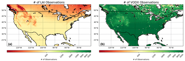
Anthony Mucia, Bertrand Bonan, Clément Albergel, Yongjun Zheng, and Jean-Christophe Calvet
Biogeosciences, 19, 2557–2581, https://doi.org/10.5194/bg-19-2557-2022, https://doi.org/10.5194/bg-19-2557-2022, 2022
Short summary
Short summary
For the first time, microwave vegetation optical depth data are assimilated in a land surface model in order to analyze leaf area index and root zone soil moisture. The advantage of microwave products is the higher observation frequency. A large variety of independent datasets are used to verify the added value of the assimilation. It is shown that the assimilation is able to improve the representation of soil moisture, vegetation conditions, and terrestrial water and carbon fluxes.
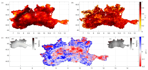
Paolo Filippucci, Luca Brocca, Raphael Quast, Luca Ciabatta, Carla Saltalippi, Wolfgang Wagner, and Angelica Tarpanelli
Hydrol. Earth Syst. Sci., 26, 2481–2497, https://doi.org/10.5194/hess-26-2481-2022, https://doi.org/10.5194/hess-26-2481-2022, 2022
Short summary
Short summary
A high-resolution (1 km) rainfall product with 10–30 d temporal resolution was obtained starting from SM data from Sentinel-1. Good performances are achieved using observed data (gauge and radar) over the Po River Valley, Italy, as a benchmark. The comparison with a product characterized by lower spatial resolution (25 km) highlights areas where the high spatial resolution of Sentinel-1 has great benefits. Possible applications include water management, agriculture and index-based insurances.
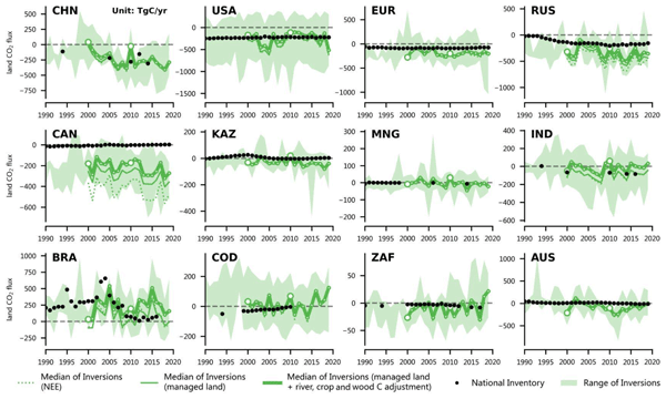
Zhu Deng, Philippe Ciais, Zitely A. Tzompa-Sosa, Marielle Saunois, Chunjing Qiu, Chang Tan, Taochun Sun, Piyu Ke, Yanan Cui, Katsumasa Tanaka, Xin Lin, Rona L. Thompson, Hanqin Tian, Yuanzhi Yao, Yuanyuan Huang, Ronny Lauerwald, Atul K. Jain, Xiaoming Xu, Ana Bastos, Stephen Sitch, Paul I. Palmer, Thomas Lauvaux, Alexandre d'Aspremont, Clément Giron, Antoine Benoit, Benjamin Poulter, Jinfeng Chang, Ana Maria Roxana Petrescu, Steven J. Davis, Zhu Liu, Giacomo Grassi, Clément Albergel, Francesco N. Tubiello, Lucia Perugini, Wouter Peters, and Frédéric Chevallier
Earth Syst. Sci. Data, 14, 1639–1675, https://doi.org/10.5194/essd-14-1639-2022, https://doi.org/10.5194/essd-14-1639-2022, 2022
Short summary
Short summary
In support of the global stocktake of the Paris Agreement on climate change, we proposed a method for reconciling the results of global atmospheric inversions with data from UNFCCC national greenhouse gas inventories (NGHGIs). Here, based on a new global harmonized database that we compiled from the UNFCCC NGHGIs and a comprehensive framework presented in this study to process the results of inversions, we compared their results of carbon dioxide (CO2), methane (CH4), and nitrous oxide (N2O).

Christian Massari, Francesco Avanzi, Giulia Bruno, Simone Gabellani, Daniele Penna, and Stefania Camici
Hydrol. Earth Syst. Sci., 26, 1527–1543, https://doi.org/10.5194/hess-26-1527-2022, https://doi.org/10.5194/hess-26-1527-2022, 2022
Short summary
Short summary
Droughts are a creeping disaster, meaning that their onset, duration and recovery are challenging to monitor and forecast. Here, we provide further evidence of an additional challenge of droughts, i.e. the fact that the deficit in water supply during droughts is generally much more than expected based on the observed decline in precipitation. At a European scale we explain this with enhanced evapotranspiration, sustained by higher atmospheric demand for moisture during such dry periods.
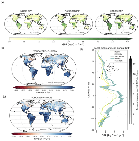
Benjamin Wild, Irene Teubner, Leander Moesinger, Ruxandra-Maria Zotta, Matthias Forkel, Robin van der Schalie, Stephen Sitch, and Wouter Dorigo
Earth Syst. Sci. Data, 14, 1063–1085, https://doi.org/10.5194/essd-14-1063-2022, https://doi.org/10.5194/essd-14-1063-2022, 2022
Short summary
Short summary
Gross primary production (GPP) describes the conversion of CO2 to carbohydrates and can be seen as a filter for our atmosphere of the primary greenhouse gas CO2. We developed VODCA2GPP, a GPP dataset that is based on vegetation optical depth from microwave remote sensing and temperature. Thus, it is mostly independent from existing GPP datasets and also available in regions with frequent cloud coverage. Analysis showed that VODCA2GPP is able to complement existing state-of-the-art GPP datasets.

Stefan Schlaffer, Marco Chini, Wouter Dorigo, and Simon Plank
Hydrol. Earth Syst. Sci., 26, 841–860, https://doi.org/10.5194/hess-26-841-2022, https://doi.org/10.5194/hess-26-841-2022, 2022
Short summary
Short summary
Prairie wetlands are important for biodiversity and water availability. Knowledge about their variability and spatial distribution is of great use in conservation and water resources management. In this study, we propose a novel approach for the classification of small water bodies from satellite radar images and apply it to our study area over 6 years. The retrieved dynamics show the different responses of small and large wetlands to dry and wet periods.
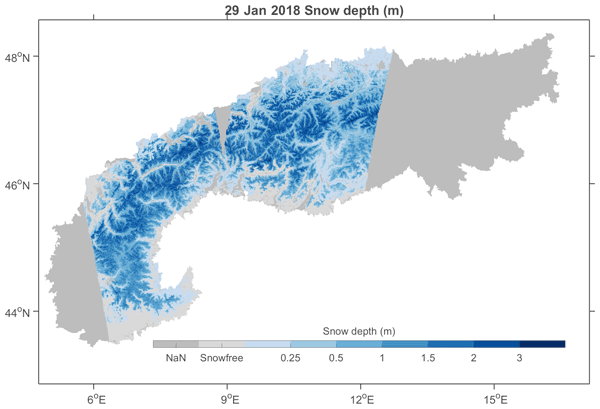
Hans Lievens, Isis Brangers, Hans-Peter Marshall, Tobias Jonas, Marc Olefs, and Gabriëlle De Lannoy
The Cryosphere, 16, 159–177, https://doi.org/10.5194/tc-16-159-2022, https://doi.org/10.5194/tc-16-159-2022, 2022
Short summary
Short summary
Snow depth observations at high spatial resolution from the Sentinel-1 satellite mission are presented over the European Alps. The novel observations can improve our knowledge of seasonal snow mass in areas with complex topography, where satellite-based estimates are currently lacking, and benefit a number of applications including water resource management, flood forecasting, and numerical weather prediction.
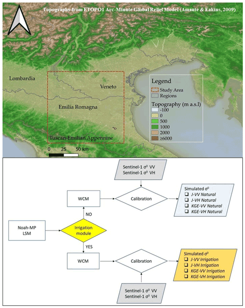
Sara Modanesi, Christian Massari, Alexander Gruber, Hans Lievens, Angelica Tarpanelli, Renato Morbidelli, and Gabrielle J. M. De Lannoy
Hydrol. Earth Syst. Sci., 25, 6283–6307, https://doi.org/10.5194/hess-25-6283-2021, https://doi.org/10.5194/hess-25-6283-2021, 2021
Short summary
Short summary
Worldwide, the amount of water used for agricultural purposes is rising and the quantification of irrigation is becoming a crucial topic. Land surface models are not able to correctly simulate irrigation. Remote sensing observations offer an opportunity to fill this gap as they are directly affected by irrigation. We equipped a land surface model with an observation operator able to transform Sentinel-1 backscatter observations into realistic vegetation and soil states via data assimilation.
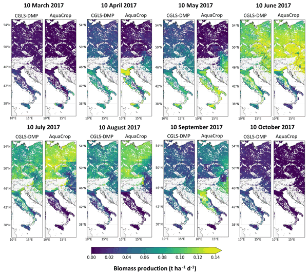
Shannon de Roos, Gabriëlle J. M. De Lannoy, and Dirk Raes
Geosci. Model Dev., 14, 7309–7328, https://doi.org/10.5194/gmd-14-7309-2021, https://doi.org/10.5194/gmd-14-7309-2021, 2021
Short summary
Short summary
A spatially distributed version of the field-scale crop model AquaCrop v6.1 was developed for applications at various spatial scales. Multi-year 1 km simulations over central Europe were evaluated against biomass and surface soil moisture products derived from optical and microwave satellite missions, as well as in situ observations of soil moisture. The regional version of the AquaCrop model provides a suitable setup for subsequent satellite-based data assimilation.
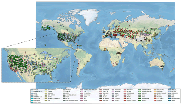
Wouter Dorigo, Irene Himmelbauer, Daniel Aberer, Lukas Schremmer, Ivana Petrakovic, Luca Zappa, Wolfgang Preimesberger, Angelika Xaver, Frank Annor, Jonas Ardö, Dennis Baldocchi, Marco Bitelli, Günter Blöschl, Heye Bogena, Luca Brocca, Jean-Christophe Calvet, J. Julio Camarero, Giorgio Capello, Minha Choi, Michael C. Cosh, Nick van de Giesen, Istvan Hajdu, Jaakko Ikonen, Karsten H. Jensen, Kasturi Devi Kanniah, Ileen de Kat, Gottfried Kirchengast, Pankaj Kumar Rai, Jenni Kyrouac, Kristine Larson, Suxia Liu, Alexander Loew, Mahta Moghaddam, José Martínez Fernández, Cristian Mattar Bader, Renato Morbidelli, Jan P. Musial, Elise Osenga, Michael A. Palecki, Thierry Pellarin, George P. Petropoulos, Isabella Pfeil, Jarrett Powers, Alan Robock, Christoph Rüdiger, Udo Rummel, Michael Strobel, Zhongbo Su, Ryan Sullivan, Torbern Tagesson, Andrej Varlagin, Mariette Vreugdenhil, Jeffrey Walker, Jun Wen, Fred Wenger, Jean Pierre Wigneron, Mel Woods, Kun Yang, Yijian Zeng, Xiang Zhang, Marek Zreda, Stephan Dietrich, Alexander Gruber, Peter van Oevelen, Wolfgang Wagner, Klaus Scipal, Matthias Drusch, and Roberto Sabia
Hydrol. Earth Syst. Sci., 25, 5749–5804, https://doi.org/10.5194/hess-25-5749-2021, https://doi.org/10.5194/hess-25-5749-2021, 2021
Short summary
Short summary
The International Soil Moisture Network (ISMN) is a community-based open-access data portal for soil water measurements taken at the ground and is accessible at https://ismn.earth. Over 1000 scientific publications and thousands of users have made use of the ISMN. The scope of this paper is to inform readers about the data and functionality of the ISMN and to provide a review of the scientific progress facilitated through the ISMN with the scope to shape future research and operations.
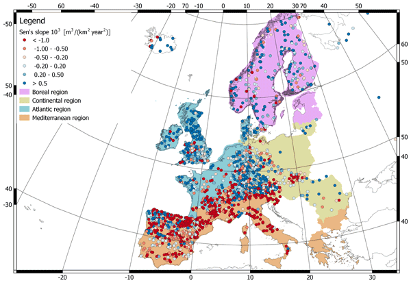
Daniele Masseroni, Stefania Camici, Alessio Cislaghi, Giorgio Vacchiano, Christian Massari, and Luca Brocca
Hydrol. Earth Syst. Sci., 25, 5589–5601, https://doi.org/10.5194/hess-25-5589-2021, https://doi.org/10.5194/hess-25-5589-2021, 2021
Short summary
Short summary
We evaluate 63 years of changes in annual streamflow volume across Europe, using a data set of more than 3000 stations, with a special focus on the Mediterranean basin. The results show decreasing (increasing) volumes in the southern (northern) regions. These trends are strongly consistent with the changes in temperature and precipitation.
Cited articles
Ajaz, A., Karimi, P., Cai, X., De Fraiture, C., and Akhter, M. S.: Statistical Data Collection Methodologies of Irrigated Areas and Their Limitations: A Review, Irrig. Drain., 68, 702–713, https://doi.org/10.1002/ird.2365, 2019. a
Ambika, A. K., Wardlow, B., and Mishra, V.: Remotely sensed high resolution irrigated area mapping in India for 2000 to 2015, Sci. Data, 3, 160 118, https://doi.org/10.1038/sdata.2016.118, 2016. a
Arboleda-Obando, P. F., Ducharne, A., Yin, Z., and Ciais, P.: Validation of a new global irrigation scheme in the land surface model ORCHIDEE v2.2, Geosci. Model Dev., 17, 2141–2164, https://doi.org/10.5194/gmd-17-2141-2024, 2024. a
Asoka, A., Wada, Y., Fishman, R., and Mishra, V.: Strong linkage between precipitation intensity and monsoon season groundwater recharge in India, Geophys. Res. Lett., 45, 5536–5544, https://doi.org/10.1029/2018GL078466, 2018. a
Bretreger, D., Yeo, I.-Y., Hancock, G., and Willgoose, G.: Monitoring irrigation using Landsat observations and climate data over regional scales in the Murray–Darling Basin, J. Hydrol., 590, 125356, https://doi.org/10.1016/j.jhydrol.2020.125356, 2020. a, b
Brocca, L., Ciabatta, L., Massari, C., Moramarco, T., Hahn, S., Hasenauer, S., Kidd, R., Dorigo, W., Wagner, W., and Levizzani, V.: Soil as a natural rain gauge: Estimating global rainfall from satellite soil moisture data, J. Geophys. Res.-Atmos., 119, 5128–5141, https://doi.org/10.1002/2014JD021489, 2014. a
Chen, F. and Dudhia, J.: Coupling an Advanced Land Surface–Hydrology Model with the Penn State–NCAR MM5 Modeling System. Part I: Model Implementation and Sensitivity, Mon. Weather Rev., 129, 569–585, https://doi.org/10.1175/1520-0493(2001)129<0569:CAALSH>2.0.CO;2, 2001. a
Confederaci´n Hidrográfica del Ebro (CHE): Sistema Automático de Información Hidrológica (SAIH) del Ebro – Datos: Canales, http://www.saihebro.com/saihebro/index.php?url=/datos/canales, last access: 6 July 2026. a
Corbari, C., Paciolla, N., Sheffield, J., Labbassi, K., Dos Santos Araujo, D. C., Berendsen, S., and Szantoi, Z.: Estimates of Irrigation Water Volume by Assimilation of Satellite Land Surface Temperature or Soil Moisture Into a Water-Energy Balance Model in Morocco, Water Resour. Res., 61, e2024WR038926, https://doi.org/10.1029/2024WR038926, 2025. a
Cosby, B. J., Hornberger, G. M., Clapp, R. B., and Ginn, T. R.: A Statistical Exploration of the Relationships of Soil Moisture Characteristics to the Physical Properties of Soils, Water Resour. Res., 20, 682–690, https://doi.org/10.1029/WR020i006p00682, 1984. a
Crow, W. T., Anderson, M. C., Volk, J. M., and Colliander, A.: Value of microwave soil moisture and thermal-infrared evapotranspiration retrievals for the mapping of irrigation coverage, Int. J. Appl. Earth Obs., 143, 104773, https://doi.org/10.1016/j.jag.2025.104773, 2025. a, b
Dari, J., Brocca, L., Quintana-Seguí, P., Escorihuela, M. J., Stefan, V., and Morbidelli, R.: Exploiting High-Resolution Remote Sensing Soil Moisture to Estimate Irrigation Water Amounts over a Mediterranean Region, Remote Sens., 12, 2593, https://doi.org/10.3390/rs12162593, 2020. a, b
Dari, J., Brocca, L., Modanesi, S., Massari, C., Tarpanelli, A., Barbetta, S., Quast, R., Vreugdenhil, M., Freeman, V., Barella-Ortiz, A., Quintana-Seguí, P., Bretreger, D., and Volden, E.: Regional data sets of high-resolution (1 and 6 km) irrigation estimates from space, Earth Syst. Sci. Data, 15, 1555–1575, https://doi.org/10.5194/essd-15-1555-2023, 2023. a, b, c, d
Dari, J., Morbidelli, R., Quintana-Seguí, P., and Brocca, L.: The Temporal-Stability-Based Irrigation MAPping (TSIMAP) Method: A Virtuous Trade-Off between Accuracy, Flexibility, and Facility for End-Users, Water, 16, 644, https://doi.org/10.3390/w16050644, 2024. a
Dari, J., Brocca, L., Laluet, P., Morbidelli, R., Saltalippi, C., Modanesi, S., Dorigo, W. A., and Albergel, C.: Satellite-based estimates of irrigation water use versus modeling reconstructions: how much do they differ?, ESS Open Archive [preprint], https://doi.org/10.22541/essoar.176218923.33215210/v1, 2025a. a
Dari, J., Presti, S. L., and Brocca, L.: Irrigation monitoring from satellite at hyper-high resolution: Paving the way for remote-sensing-based agricultural water management support services, Agr. Water Manage., 317, 109627, https://www.sciencedirect.com/science/article/pii/S0378377425003415 (last access: 6 July 2026), 2025b. a
De Lannoy, G. J. M., Bechtold, M., Busschaert, L., Heyvaert, Z., Modanesi, S., Dunmire, D., Lievens, H., Getirana, A., and Massari, C.: Contributions of Irrigation Modeling, Soil Moisture and Snow Data Assimilation to High-Resolution Water Budget Estimates Over the Po Basin: Progress Towards Digital Replicas, J. Adv. Model. Earth Sy., 16, e2024MS004433, https://doi.org/10.1029/2024MS004433, 2024. a, b
Deines, J. M., Kendall, A. D., Crowley, M. A., Rapp, J., Cardille, J. A., and Hyndman, D. W.: Mapping three decades of annual irrigation across the US High Plains Aquifer using Landsat and Google Earth Engine, Remote Sens. Environ., 233, 111400, https://doi.org/10.1016/j.rse.2019.111400, 2019. a
Dorigo, W., Wagner, W., Albergel, C., Albrecht, F., Balsamo, G., Brocca, L., Chung, D., Ertl, M., Forkel, M., Gruber, A., Haas, E., Hamer, P. D., Hirschi, M., Ikonen, J., de Jeu, R., Kidd, R., Lahoz, W., Liu, Y. Y., Miralles, D., Mistelbauer, T., Nicolai-Shaw, N., Parinussa, R., Pratola, C., Reimer, C., van der Schalie, R., Seneviratne, S. I., Smolander, T., and Lecomte, P.: ESA CCI Soil Moisture for improved Earth system understanding: State-of-the art and future directions, Remote Sens. Environ., 203, 185–215, https://doi.org/10.1016/j.rse.2017.07.001, 2017. a
Dorigo, W., Dietrich, S., Aires, F., Brocca, L., Carter, S., Cretaux, J.-F., Dunkerley, D., Enomoto, H., Forsberg, R., Güntner, A., Hegglin, M. I., Hollmann, R., Hurst, D. F., Johannessen, J. A., Kummerow, C., Lee, T., Luojus, K., Looser, U., Miralles, D. G., Pellet, V., Recknagel, T., Vargas, C. R., Schneider, U., Schoeneich, P., Schröder, M., Tapper, N., Vuglinsky, V., Wagner, W., Yu, L., Zappa, L., Zemp, M., and Aich, V.: Closing the Water Cycle from Observations across Scales: Where Do We Stand?, B. Am. Meteorol. Soc., 102, E1897–E1935, https://doi.org/10.1175/BAMS-D-19-0316.1, 2021. a
Dorigo, W., Preimesberger, W., Hahn, S., Van der Schalie, R., De Jeu, R., Kidd, R., Rodriguez-Fernandez, N., Hirschi, M., Stradiotti, P., Frederikse, T., Gruber, A., and Madelon, R.: ESA Soil Moisture Climate Change Initiative (Soil_Moisture_cci): Version 08.1 data collection, http://catalogue.ceda.ac.uk/uuid/ff890589c21f4033803aa550f52c980c ( last access: 20 October 2025), 2023. a
Elliott, J., Deryng, D., Müller, C., Frieler, K., Konzmann, M., Gerten, D., Glotter, M., Flörke, M., Wada, Y., Best, N., Eisner, S., Fekete, B. M., Folberth, C., Foster, I., Gosling, S. N., Haddeland, I., Khabarov, N., Ludwig, F., Masaki, Y., Olin, S., Rosenzweig, C., Ruane, A. C., Satoh, Y., Schmid, E., Stacke, T., Tang, Q., and Wisser, D.: Constraints and potentials of future irrigation water availability on agricultural production under climate change, P. Natl. Acad. Sci. USA, 111, 3239–3244, https://doi.org/10.1073/pnas.1222474110, 2014. a
Entekhabi, D., Njoku, E. G., O'Neill, P. E., Kellogg, K. H., Crow, W. T., Edelstein, W. N., Entin, J. K., Goodman, S. D., Jackson, T. J., Johnson, J., Kimball, J., Piepmeier, J. R., Koster, R. D., Martin, N., McDonald, K. C., Moghaddam, M., Moran, S., Reichle, R., Shi, J. C., Spencer, M. W., Thurman, S. W., Tsang, L., and Van Zyl, J.: The Soil Moisture Active Passive (SMAP) Mission, Proc. IEEE, 98, 704–716, https://doi.org/10.1109/JPROC.2010.2043918, 2010. a
Escorihuela, M. J. and Quintana-Seguí, P.: Comparison of remote sensing and simulated soil moisture datasets in Mediterranean landscapes, Remote Sens. Environ., 180, 99–114, https://doi.org/10.1016/j.rse.2016.02.046, 2016. a
Evett, S. R., Colaizzi, P. D., Lamm, F. R., O'Shaughnessy, S. A., Heeren, D. M., Trout, T. J., Kranz, W. L., and Lin, X.: Past, Present, and Future of Irrigation on the U.S. Great Plains, T. ASABE, 63, 703–729, https://doi.org/10.13031/trans.13620, 2020. a
FAO: Crop Calendar, https://cropcalendar.apps.fao.org/ (last access: 20 August 2025), 2010. a
FAO: Harmonized World Soil Database version 2.0, FAO, International Institute for Applied Systems Analysis (IIASA), ISBN 978-92-5-137499-3, https://openknowledge.fao.org/handle/20.500.14283/cc3823en (last access: 6 July 2026), 2023. a
FAO: AQUASTAT – FAO's Global Information System on Water and Agriculture, https://www.fao.org/aquastat (last access: 21 August 2025), 2025. a
García-García, A., Stradiotti, A., Delogu, F., Jonas, M., Tzounis, G. I. G., Raja, P., Rakovec, V. A., Beck, H. E., Dorigo, W., Pôças, C., and Martens, B.: Intercomparison of Earth Observation products for hyper-resolution hydrological modelling over Europe, Remote Sens. Environ., 333, 115131, https://doi.org/10.1016/j.rse.2025.115131, 2026. a
Gutman, G. and Ignatov, A.: The derivation of the green vegetation fraction from NOAA/AVHRR data for use in numerical weather prediction models, Int. J. Remote Sens., 19, 1533–1543, https://doi.org/10.1080/014311698215333, 1998. a, b
Hersbach, H., Bell, B., Berrisford, P., Hirahara, S., Horányi, A., Muñoz-Sabater, J., Nicolas, J., Peubey, C., Radu, R., Schepers, D., Simmons, A., Soci, C., Abdalla, S., Abellan, X., Balsamo, G., Bechtold, P., Biavati, G., Bidlot, J., Bonavita, M., De Chiara, G., Dahlgren, P., Dee, D., Diamantakis, M., Dragani, R., Flemming, J., Forbes, R., Fuentes, M., Geer, A., Haimberger, L., Healy, S., Hogan, R. J., Hólm, E., Janisková, M., Keeley, S., Laloyaux, P., Lopez, P., Lupu, C., Radnoti, G., de Rosnay, P., Rozum, I., Vamborg, F., Villaume, S., and Thépaut, J.-N.: The ERA5 global reanalysis, Q. J. Roy. Meteor. Soc., 146, 1999–2049, https://doi.org/10.1002/qj.3803, 2020. a
Jalilvand, E., Tajrishy, M., Ghazi Zadeh Hashemi, S. A., and Brocca, L.: Quantification of irrigation water using remote sensing of soil moisture in a semi-arid region, Remote Sens. Environ., 231, 111226, https://doi.org/10.1016/j.rse.2019.111226, 2019. a
Jalilvand, E., Kumar, S. V., Truong, C., Haacker, E., and Mahanama, S.: Characterization of irrigation timing using thermal satellite observations, a data-driven approach, Remote Sens. Environ., 333, 115153, https://doi.org/10.1016/j.rse.2025.115153, 2026. a
Jung, M., Koirala, S., Weber, U., Ichii, K., Gans, F., Camps-Valls, G., Papale, D., Schwalm, C., Tramontana, G., and Reichstein, M.: The FLUXCOM ensemble of global land-atmosphere energy fluxes, Sci. Data, 6, 74, https://doi.org/10.1038/s41597-019-0076-8, 2019. a
Kebede, E. A., Oluoch, K. O., Siebert, S., Mehta, P., Hartman, S., Jägermeyr, J., Ray, D., Ali, T., Brauman, K. A., Deng, Q., Xie, W., and Davis, K. F.: A global open-source dataset of monthly irrigated and rainfed cropped areas (MIRCA-OS) for the 21st century, Sci. Data, 12, 208, https://doi.org/10.1038/s41597-024-04313-w, 2025. a
Kerr, Y. H., Al-Yaari, A., Rodriguez-Fernandez, N., Parrens, M., Molero, B., Leroux, D., Bircher, S., Mahmoodi, A., Mialon, A., Richaume, P., Delwart, S., Al Bitar, A., Pellarin, T., Bindlish, R., Jackson, T. J., Rüdiger, C., Waldteufel, P., Mecklenburg, S., and Wigneron, J. P.: Overview of SMOS performance in terms of global soil moisture monitoring after six years in operation, Remote Sens. Environ., 180, 40–63, https://doi.org/10.1016/j.rse.2016.02.042, 2016. a
Kragh, S. J., Fensholt, R., Stisen, S., and Koch, J.: The precision of satellite-based net irrigation quantification in the Indus and Ganges basins, Hydrol. Earth Syst. Sci., 27, 2463–2478, https://doi.org/10.5194/hess-27-2463-2023, 2023. a, b, c, d
Kumar, S. V., Peters-Lidard, C. D., Tian, Y., Houser, P. R., Geiger, J., Olden, S., Lighty, L., Eastman, J. L., Doty, B., Dirmeyer, P., Adams, J., Mitchell, K., Wood, E. F., and Sheffield, J.: Land information system: An interoperable framework for high resolution land surface modeling, Environ. Modell. Softw., 21, 1402–1415, https://doi.org/10.1016/j.envsoft.2005.07.004, 2006. a
Kumar, S. V., Reichle, R. H., Peters-Lidard, C. D., Koster, R. D., Zhan, X., Crow, W. T., Eylander, J. B., and Houser, P. R.: A land surface data assimilation framework using the land information system: Description and applications, Adv. Water Resour., 31, 1419–1432, https://doi.org/10.1016/j.advwatres.2008.01.013, 2008. a
Laluet, P., Olivera-Guerra, L. E., Altés, V., Paolini, G., Ouaadi, N., Rivalland, V., Jarlan, L., Villar, J. M., and Merlin, O.: Retrieving the irrigation actually applied at district scale: Assimilating high-resolution Sentinel-1-derived soil moisture data into a FAO-56-based model, Agr. Water Manage., 293, 108704, https://doi.org/10.1016/j.agwat.2024.108704, 2024. a
Laluet, P., Dari, J., Busschaert, L., Heyvaert, Z., Brocca, L., Massari, C., Modanesi, S., Dorigo, W., Langhans, P., De Lannoy, G., Bechtold, M., Saltalippi, C., Morbidelli, R., Rulli, M. C., Chiarelli, D. D., and Galli, N.: Regional datasets of long-term and coarse resolution irrigation estimates from space, Zenodo [data set], https://doi.org/10.5281/zenodo.14988197, 2025. a, b
Laluet, P., Corbari, C., Baez-Villanueva, O., Walther, S., Zhang, Y., Muñoz-Sabater, J., Albergel, C., and Dorigo, W.: Assessing the suitability of global evapotranspiration products over irrigated areas, Hydrol. Earth Syst. Sci., 30, 1779–1799, https://doi.org/10.5194/hess-30-1779-2026, 2026. a, b, c
Lawston, P. M., Santanello Jr, J. A., and Kumar, S. V.: Irrigation Signals Detected From SMAP Soil Moisture Retrievals, Geophys. Res. Lett., 44, 11860–11867, https://doi.org/10.1002/2017GL075733, 2017. a
Lunel, T., Boone, A. A., and Le Moigne, P.: Irrigation strongly influences near-surface conditions and induces breeze circulation: Observational and model-based evidence, Q. J. Roy. Meteor. Soc., 150, 2798–2819, https://doi.org/10.1002/qj.4736, 2024. a
Martens, B., Miralles, D. G., Lievens, H., van der Schalie, R., de Jeu, R. A. M., Fernández-Prieto, D., Beck, H. E., Dorigo, W. A., and Verhoest, N. E. C.: GLEAM v3: satellite-based land evaporation and root-zone soil moisture, Geosci. Model Dev., 10, 1903–1925, https://doi.org/10.5194/gmd-10-1903-2017, 2017. a
Massari, C., Modanesi, S., Dari, J., Gruber, A., De Lannoy, G. J. M., Girotto, M., Quintana-Seguí, P., Le Page, M., Jarlan, L., Zribi, M., Ouaadi, N., Vreugdenhil, M., Zappa, L., Dorigo, W., Wagner, W., Brombacher, J., Pelgrum, H., Jaquot, P., Freeman, V., Volden, E., Fernandez Prieto, D., Tarpanelli, A., Barbetta, S., and Brocca, L.: A Review of Irrigation Information Retrievals from Space and Their Utility for Users, Remote Sens., 13, 4112, https://doi.org/10.3390/rs13204112, 2021. a
McDermid, S., Nocco, M., Lawston-Parker, P., Keune, J., Pokhrel, Y., Jain, M., Jägermeyr, J., Brocca, L., Massari, C., Jones, A. D., Vahmani, P., Thiery, W., Yao, Y., Bell, A., Chen, L., Dorigo, W., Hanasaki, N., Jasechko, S., Lo, M.-H., Mahmood, R., Mishra, V., Mueller, N. D., Niyogi, D., Rabin, S. S., Sloat, L., Wada, Y., Zappa, L., Chen, F., Cook, B. I., Kim, H., Lombardozzi, D., Polcher, J., Ryu, D., Santanello, J., Satoh, Y., Seneviratne, S., Singh, D., and Yokohata, T.: Irrigation in the Earth system, Nat. Rev. Earth Environ., 4, 435–453, https://doi.org/10.1038/s43017-023-00438-5, 2023. a
Mehta, P., Siebert, S., Kummu, M., Deng, Q., Ali, T., Marston, L., Xie, W., and Davis, K. F.: Half of twenty-first century global irrigation expansion has been in water-stressed regions, Nature Water, 2, 254–261, https://doi.org/10.1038/s44221-024-00206-9, 2024. a, b
Modanesi, S., Massari, C., Bechtold, M., Lievens, H., Tarpanelli, A., Brocca, L., Zappa, L., and De Lannoy, G. J. M.: Challenges and benefits of quantifying irrigation through the assimilation of Sentinel-1 backscatter observations into Noah-MP, Hydrol. Earth Syst. Sci., 26, 4685–4706, https://doi.org/10.5194/hess-26-4685-2022, 2022. a, b, c
Modanesi, S., Busschaert, L., Lannoy, G. D., Santis, D. D., Natali, M., Dari, J., Quintana-Seguí, P., Castelli, M., Grasso, F. M., and Massari, C.: Accounting for scaling effects on irrigation optimization within a land surface model using satellite observations: impacts on water and carbon cycle dynamics, ESS Open Archive [preprint], https://doi.org/10.22541/essoar.174721778.84342159/v1, 2025. a
Muñoz-Sabater, J., Dutra, E., Agustí-Panareda, A., Albergel, C., Arduini, G., Balsamo, G., Boussetta, S., Choulga, M., Harrigan, S., Hersbach, H., Martens, B., Miralles, D. G., Piles, M., Rodríguez-Fernández, N. J., Zsoter, E., Buontempo, C., and Thépaut, J.-N.: ERA5-Land: a state-of-the-art global reanalysis dataset for land applications, Earth Syst. Sci. Data, 13, 4349–4383, https://doi.org/10.5194/essd-13-4349-2021, 2021. a
Niu, G.-Y., Yang, Z.-L., Mitchell, K. E., Chen, F., Ek, M. B., Barlage, M., Kumar, A., Manning, K., Niyogi, D., Rosero, E., Tewari, M., and Xia, Y.: The community Noah land surface model with multiparameterization options (Noah-MP): 1. Model description and evaluation with local-scale measurements, J. Geophys. Res.-Atmos., 116, https://doi.org/10.1029/2010JD015139, 2011. a, b
Olivera-Guerra, L.-E., Laluet, P., Altés, V., Ollivier, C., Pageot, Y., Paolini, G., Chavanon, E., Rivalland, V., Boulet, G., Villar, J.-M., and Merlin, O.: Modeling actual water use under different irrigation regimes at district scale: Application to the FAO-56 dual crop coefficient method, Agr. Water Manage., 278, 108119, https://doi.org/10.1016/j.agwat.2022.108119, 2023. a
Ozdogan, M., Rodell, M., Beaudoing, H. K., and Toll, D. L.: Simulating the Effects of Irrigation over the United States in a Land Surface Model Based on Satellite-Derived Agricultural Data, J. Hydrometeorol., 11, 171–184, https://doi.org/10.1175/2009JHM1116.1, 2010. a, b, c
Paolini, G., Escorihuela, M. J., Merlin, O., Laluet, P., Bellvert, J., and Pellarin, T.: Estimating multi-scale irrigation amounts using multi-resolution soil moisture data: A data-driven approach using PrISM, Agr. Water Manage., 290, 108594, https://doi.org/10.1016/j.agwat.2023.108594, 2023. a
Puy, A., Borgonovo, E., Lo Piano, S., Levin, S. A., and Saltelli, A.: Irrigated areas drive irrigation water withdrawals, Nat. Commun., 12, 4525, https://doi.org/10.1038/s41467-021-24508-8, 2021. a
Puy, A., Lankford, B., Meier, J., van der Kooij, S., and Saltelli, A.: Large variations in global irrigation withdrawals caused by uncertain irrigation efficiencies, Environ. Res. Lett., 17, 044014, https://doi.org/10.1088/1748-9326/ac5768, 2022. a
Puy, A., Linga, S. N., Wei, N., Flinders, S., Callow, B., Allen, G., Cross, B., Aguiló-Rivera, C., and Lankford, B.: Widely cited global irrigation statistics lack empirical support, PNAS Nexus, 4, pgaf323, https://doi.org/10.1093/pnasnexus/pgaf323, 2025. a
Scanlon, B. R., Faunt, C. C., Longuevergne, L., Reedy, R. C., Alley, W. M., McGuire, V. L., and McMahon, P. B.: Groundwater depletion and sustainability of irrigation in the U.S. High Plains and Central Valley, P. Natl. Acad. Sci. USA, 109, 9320–9325, https://doi.org/10.1073/pnas.1200311109, 2012. a
Senay, G.: Satellite Psychrometric Formulation of the Operational Simplified Surface Energy Balance (SSEBop) Model for Quantifying and Mapping Evapotranspiration, Appl. Eng. Agr., 34, 555–566, https://doi.org/10.13031/aea.12614, 2018. a
Seneviratne, S. I. and Hauser, M.: Regional Climate Sensitivity of Climate Extremes in CMIP6 Versus CMIP5 Multimodel Ensembles, Earth's Future, 8, e2019EF001474, https://doi.org/10.1029/2019EF001474, 2020. a
Siebert, S., Henrich, V., Frenken, K., and Burke, J.: Update of the digital global map of irrigation areas to version 5, Technical Report, https://doi.org/10.13140/2.1.2660.6728, 2013. a, b, c
Teluguntla, P., Thenkabail, P., Oliphant, A., Gumma, M., Aneece, I., Foley, D., and McCormick, R.: Landsat-derived Global Rainfed and Irrigated-Cropland Product @ 30-m (LGRIP30) of the World (GFSADLGRIP30WORLD), The Land Processes Distributed Active Archive Center (LP DAAC) of NASA and USGS, iP-148728, https://doi.org/10.5067/Community/LGRIP/LGRIP30.001, 2023. a
Thiery, W., Davin, E. L., Lawrence, D. M., Hirsch, A. L., Hauser, M., and Seneviratne, S. I.: Present-day irrigation mitigates heat extremes, J. Geophys. Res.-Atmos., 122, 1403–1422, https://doi.org/10.1002/2016JD025740, 2017. a
Thiery, W., Visser, A. J., Fischer, E. M., Hauser, M., Hirsch, A. L., Lawrence, D. M., Lejeune, Q., Davin, E. L., and Seneviratne, S. I.: Warming of hot extremes alleviated by expanding irrigation, Nat. Commun., 11, 290, https://doi.org/10.1038/s41467-019-14075-4, 2020. a
Wada, Y., Wisser, D., and Bierkens, M. F. P.: Global modeling of withdrawal, allocation and consumptive use of surface water and groundwater resources, Earth Syst. Dynam., 5, 15–40, https://doi.org/10.5194/esd-5-15-2014, 2014. a
Wagner, W., Hahn, S., Kidd, R., Melzer, T., Bartalis, Z., Hasenauer, S., Figa-Saldaña, J., de Rosnay, P., Jann, A., Schneider, S., Komma, J., Kubu, G., Brugger, K., Aubrecht, C., Züger, J., Gangkofner, U., Kienberger, S., Brocca, L., Wang, Y., Blöschl, G., Eitzinger, J., and Steinnocher, K.: The ASCAT Soil Moisture Product: A Review of its Specifications, Validation Results, and Emerging Applications, Meteorol. Z., 5–33, https://doi.org/10.1127/0941-2948/2013/0399, 2013. a
Zappa, L., Schlaffer, S., Bauer-Marschallinger, B., Nendel, C., Zimmerman, B., and Dorigo, W.: Detection and Quantification of Irrigation Water Amounts at 500 m Using Sentinel-1 Surface Soil Moisture, Remote Sens., 13, 1727, https://doi.org/10.3390/rs13091727, 2021. a, b
Zappa, L., Schlaffer, S., Brocca, L., Vreugdenhil, M., Nendel, C., and Dorigo, W.: How accurately can we retrieve irrigation timing and water amounts from (satellite) soil moisture?, Int. J. Appl. Earth Obs., 113, 102979, https://doi.org/10.1016/j.jag.2022.102979, 2022. a
Zappa, L., Dari, J., Modanesi, S., Quast, R., Brocca, L., De Lannoy, G., Massari, C., Quintana-Seguí, P., Barella-Ortiz, A., and Dorigo, W.: Benefits and pitfalls of irrigation timing and water amounts derived from satellite soil moisture, Agr. Water Manage., 295, 108773, https://doi.org/10.1016/j.agwat.2024.108773, 2024. a, b
Zaussinger, F., Dorigo, W., Gruber, A., Tarpanelli, A., Filippucci, P., and Brocca, L.: Estimating irrigation water use over the contiguous United States by combining satellite and reanalysis soil moisture data, Hydrol. Earth Syst. Sci., 23, 897–923, https://doi.org/10.5194/hess-23-897-2019, 2019. a, b, c, d, e, f
Zhang, C. and Long, D.: Estimating Spatially Explicit Irrigation Water Use Based on Remotely Sensed Evapotranspiration and Modeled Root Zone Soil Moisture, Water Resour. Res., 57, e2021WR031382, https://doi.org/10.1029/2021WR031382, 2021. a, b
Zipper, S., Kastens, J., Foster, T., Wilson, B. B., Melton, F., Grinstead, A., Deines, J. M., Butler, J. J., and Marston, L. T.: Estimating irrigation water use from remotely sensed evapotranspiration data: Accuracy and uncertainties at field, water right, and regional scales, Agr. Water Manage., 303, 109036, https://doi.org/10.1016/j.agwat.2024.109036, 2024. a
Zohaib, M. and Choi, M.: Satellite-based global-scale irrigation water use and its contemporary trends, Sci. Total Environ., 714, 136719, https://doi.org/10.1016/j.scitotenv.2020.136719, 2020. a
Short summary
We developed a long-term dataset collection of irrigation water use based on about two decades of satellite observations, three distinct approaches, and many input datasets. The collection provides monthly estimates for major agricultural regions and helps describe how irrigation varies across locations, seasons, and years. It offers a foundation for improving how irrigation is quantified, compared across methods, and integrated into large-scale hydrological and climate studies.
We developed a long-term dataset collection of irrigation water use based on about two decades...


Altmetrics
Final-revised paper
Preprint