Articles | Volume 18, issue 10
https://doi.org/10.5194/essd-18-7269-2026
© Author(s) 2026. This work is distributed under
the Creative Commons Attribution 4.0 License.
the Creative Commons Attribution 4.0 License.
https://doi.org/10.5194/essd-18-7269-2026
© Author(s) 2026. This work is distributed under
the Creative Commons Attribution 4.0 License.
the Creative Commons Attribution 4.0 License.
Data description article
| 
05 Oct 2026
Data description article |
| 05 Oct 2026
| 05 Oct 2026
A benchmark dataset of water levels and waves for SWOT validation in the St. Lawrence Estuary and Saguenay Fjord, Quebec, Canada

Numerical Modelling and Prediction Research Division, Environment and Climate Change Canada, Quebec City, QC, G1J 0C3, Canada
Xavier Chartrand
Numerical Modelling and Prediction Research Division, Environment and Climate Change Canada, Quebec City, QC, G1J 0C3, Canada
Institut des Sciences de la Mer, Université du Québec à Rimouski, Rimouski, QC, G5L 3A1, Canada
David Purnell
Department of Civil and Water Engineering, Université Laval, Quebec City, QC, G1V 0A6, Canada
Precipice Sensors Inc., Montreal, QC, H2S 2P7, Canada
Marc Simard
Jet Propulsion Laboratory, California Institute of Technology, Pasadena, CA, 91109, USA
Alexandra Christensen
Jet Propulsion Laboratory, California Institute of Technology, Pasadena, CA, 91109, USA
Francis Fortin-Legault
Canadian Hydrographic Service, Fisheries and Oceans Canada, Mont-Joli, QC, G5H 3Z4, Canada
Jonathan Morin
Canadian Hydrographic Service, Fisheries and Oceans Canada, Mont-Joli, QC, G5H 3Z4, Canada
Yann Côté-Nadeau
Canadian Hydrographic Service, Fisheries and Oceans Canada, Mont-Joli, QC, G5H 3Z4, Canada
Élaine Desrosiers
Canadian Hydrographic Service, Fisheries and Oceans Canada, Mont-Joli, QC, G5H 3Z4, Canada
Anthony Ouellet
Science Advice, Information and Support Branch, Fisheries and Oceans Canada, Mont-Joli, QC, G5H 3Z4, Canada
Cédric Chavanne
Institut des Sciences de la Mer, Université du Québec à Rimouski, Rimouski, QC, G5L 3A1, Canada
François Anctil
Department of Civil and Water Engineering, Université Laval, Quebec City, QC, G1V 0A6, Canada
Gabriela Siles
Department of Geomatics Sciences, Université Laval, Quebec City, QC, G1V 0A6, Canada
Scott Bedart
Department of Geomatics Sciences, Université Laval, Quebec City, QC, G1V 0A6, Canada
Silvia Innocenti
Numerical Modelling and Prediction Research Division, Environment and Climate Change Canada, Quebec City, QC, G1J 0C3, Canada
Mohammed Dabboor
Earth System Research and Integration Division, Environment and Climate Change Canada, Dorval, QC, H9P 1J3, Canada
Daniel L. Peters
Freshwater and Cryosphere Modelling Division, Environment and Climate Change Canada, Victoria, BC, V8N 1V8, Canada
Mélanie Trudel
Department of Civil Engineering and Building, University of Sherbrooke, Sherbrooke, QC, J1K 2R1, Canada
Related authors
Joris J. G. W. Beemster, Pascal Matte, Silvia Innocenti, Bas D. S. van Maren, and Ton A. J. F. Hoitink
EGUsphere, https://doi.org/10.5194/egusphere-2026-2651, https://doi.org/10.5194/egusphere-2026-2651, 2026
Short summary
Short summary
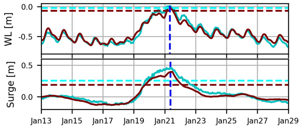
Tidal analysis typically relies on continuous water-level data, but many historical records contain only high and low water. We show that these sparse observations can accurately reconstruct tides using a new approach that models peak timing and height directly. The method matches modern high-resolution analyses, is robust to noisy or incomplete data, and enables improved tidal prediction and analysis in shallow and estuarine systems.
Pascal Matte, John Wilkin, and Joanna Staneva
State Planet, 5-opsr, 19, https://doi.org/10.5194/sp-5-opsr-19-2025, https://doi.org/10.5194/sp-5-opsr-19-2025, 2025
Short summary
Short summary
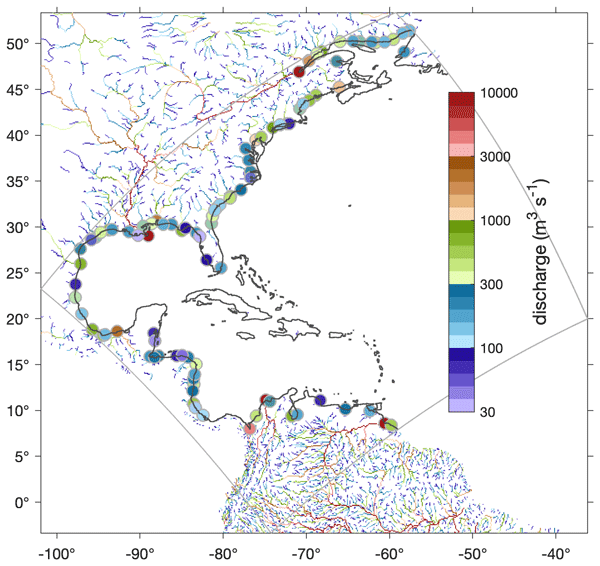
Rivers, vital to the Earth's system, connect the ocean with the land, governing hydrological and biogeochemical contributions and influencing processes like upwelling and mixing. This paper reviews methods to represent river runoff in operational ocean forecasting systems, from coarse-resolution models to coastal coupling approaches. It discusses river data sources and examines how river forcing is treated in global to coastal operational systems, highlighting challenges and future directions.
Angelique Melet, Begoña Pérez Gómez, and Pascal Matte
State Planet, 5-opsr, 11, https://doi.org/10.5194/sp-5-opsr-11-2025, https://doi.org/10.5194/sp-5-opsr-11-2025, 2025
Short summary
Short summary
Forecasting the sea level is crucial for supporting coastal management through early warning systems and for adopting adaptation strategies to mitigate climate change impacts. We provide here an overview on models commonly used for sea level forecasting, which can be based on storm surge models or ocean circulation ones, integrated on structured or unstructured grids, including an outlook on new approaches based on ensemble methods.
Joanna Staneva, Angelique Melet, Jennifer Veitch, and Pascal Matte
State Planet, 5-opsr, 4, https://doi.org/10.5194/sp-5-opsr-4-2025, https://doi.org/10.5194/sp-5-opsr-4-2025, 2025
Short summary
Short summary
Coastal services are essential to society, requiring accurate prediction of ocean variables in complex, high-resolution environments. This paper outlines key aspects of coastal modelling and emphasizes the importance of capturing nonlinear interactions and feedbacks. Advances in coastal modelling, observational integration, and predictive skills are highlighted as being vital for supporting sustainability and strengthening climate resilience.
Aida Jabbari, Biljana Music, David Huard, James Craig, Richard Turcotte, Mohammad Bizhanimanzar, Simon Lachance-Cloutier, Charles Malenfant, and François Anctil
EGUsphere, https://doi.org/10.5194/egusphere-2026-4806, https://doi.org/10.5194/egusphere-2026-4806, 2026
This preprint is open for discussion and under review for Geoscientific Model Development (GMD).
Short summary
Short summary
Reliable streamflow predictions are important for managing water resources and preparing for floods. We developed and tested 48 versions of a hydrological model to explore how differences in model design and weather data affect predictions. We found that combining several models and accounting for uncertainty in weather data produced more reliable predictions while using fewer models. This approach can support more robust water management and flood forecasting.
Amal Mzoughi, Mélanie Trudel, Pascale M. Biron, Guénolé Choné, and Gabriela L. Siles
Hydrol. Earth Syst. Sci., 30, 4141–4155, https://doi.org/10.5194/hess-30-4141-2026, https://doi.org/10.5194/hess-30-4141-2026, 2026
Short summary
Short summary
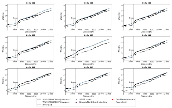
This study examines how observations from the Surface Water and Ocean Topography satellite can support hydraulic modelling. Using a major 2023 flood in Quebec, we compared the satellite’s water surface elevation (WSE) data with hydraulic simulations and ground measurements. The results show that satellite observations can provide valuable information for understanding floods where monitoring data are scarce.
Joris J. G. W. Beemster, Pascal Matte, Silvia Innocenti, Bas D. S. van Maren, and Ton A. J. F. Hoitink
EGUsphere, https://doi.org/10.5194/egusphere-2026-2651, https://doi.org/10.5194/egusphere-2026-2651, 2026
Short summary
Short summary
Tidal analysis typically relies on continuous water-level data, but many historical records contain only high and low water. We show that these sparse observations can accurately reconstruct tides using a new approach that models peak timing and height directly. The method matches modern high-resolution analyses, is robust to noisy or incomplete data, and enables improved tidal prediction and analysis in shallow and estuarine systems.
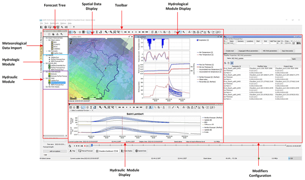
Kh Rahat Usman, Rodolfo Alvarado Montero, Tadros Ghobrial, François Anctil, and Arnejan van Loenen
Geosci. Model Dev., 19, 1559–1580, https://doi.org/10.5194/gmd-19-1559-2026, https://doi.org/10.5194/gmd-19-1559-2026, 2026
Short summary
Short summary
Rivers in cold climate regions such as Canada undergo freeze up during winters which makes the estimation forecasting of under-ice discharge very challenging and uncertain since there is no reliable method other than direct measurements. The current study explored the potential of deploying a coupled modelling framework for the estimation and forecasting of this parameter. The framework showed promising potential in addressing the challenge of estimating and forecasting the under-ice discharge.
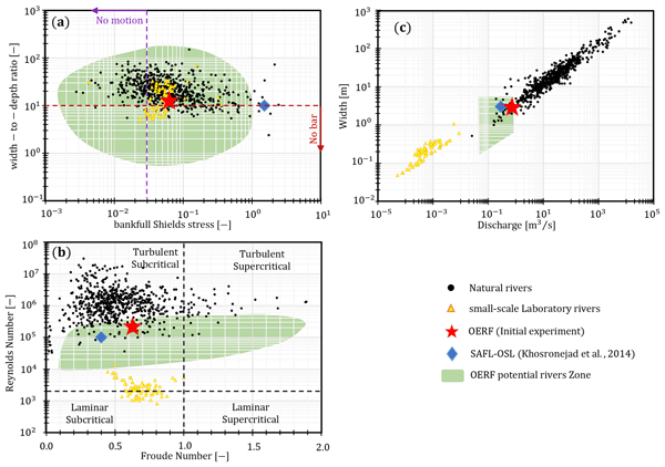
Basem M. M. Mahmoud, Emily Dickson, André Renault, Mélanie Trudel, Pascale M. Biron, Leonard S. Sklar, and Jay Lacey
Earth Surf. Dynam., 14, 175–190, https://doi.org/10.5194/esurf-14-175-2026, https://doi.org/10.5194/esurf-14-175-2026, 2026
Short summary
Short summary
Herein, we introduce a new large outdoor river research facility to study how rivers change shape at near-real scales. Initial experiments on a straight channel resulted in little bank erosion even when the flow was perturbed by the placement of an in-channel artificial bar/pool. The results point to a narrow operational window for bar growth and bank mobility which informs on the initial conditions of future bank erosion experiments.
Clarence Gagnon, Daniel F. Nadeau, Alejandro Di Luca, Benoit Brault, Romane Hamon, Nicolas L. Roy, Marc-André Bourgault, and François Anctil
EGUsphere, https://doi.org/10.5194/egusphere-2025-6192, https://doi.org/10.5194/egusphere-2025-6192, 2026
Short summary
Short summary
This article studies the contribution of extratropical cyclones to nearly 500 river floods that caused material damage in the province of Quebec, in eastern Canada, between 1991 and 2020. By bringing significant amounts of precipitation, extratropical cyclones played a key role in the majority of floods. During the period, over half of the flood-contributing storms originated in the central United States and the Gulf of Mexico, and just a handful caused most of the financial damage observed.

Raphaël Savelli, Dustin Carroll, Dimitris Menemenlis, Jonathan M. Lauderdale, Clément Bertin, Stephanie Dutkiewicz, Manfredi Manizza, A. Anthony Bloom, Karel Castro-Morales, Charles E. Miller, Marc Simard, Kevin W. Bowman, and Hong Zhang
Geosci. Model Dev., 19, 867–885, https://doi.org/10.5194/gmd-19-867-2026, https://doi.org/10.5194/gmd-19-867-2026, 2026
Short summary
Short summary
Accounting for carbon and nutrients in rivers is essential for resolving carbon dioxide (CO2) exchanges between the ocean and the atmosphere. In this study, we add the effect of present-day rivers to a pioneering global-ocean biogeochemistry model. This study highlights the challenge for global ocean numerical models to cover the complexity of the flow of water and carbon across the Land-to-Ocean Aquatic Continuum.
Pascal Matte, John Wilkin, and Joanna Staneva
State Planet, 5-opsr, 19, https://doi.org/10.5194/sp-5-opsr-19-2025, https://doi.org/10.5194/sp-5-opsr-19-2025, 2025
Short summary
Short summary
Rivers, vital to the Earth's system, connect the ocean with the land, governing hydrological and biogeochemical contributions and influencing processes like upwelling and mixing. This paper reviews methods to represent river runoff in operational ocean forecasting systems, from coarse-resolution models to coastal coupling approaches. It discusses river data sources and examines how river forcing is treated in global to coastal operational systems, highlighting challenges and future directions.
Angelique Melet, Begoña Pérez Gómez, and Pascal Matte
State Planet, 5-opsr, 11, https://doi.org/10.5194/sp-5-opsr-11-2025, https://doi.org/10.5194/sp-5-opsr-11-2025, 2025
Short summary
Short summary
Forecasting the sea level is crucial for supporting coastal management through early warning systems and for adopting adaptation strategies to mitigate climate change impacts. We provide here an overview on models commonly used for sea level forecasting, which can be based on storm surge models or ocean circulation ones, integrated on structured or unstructured grids, including an outlook on new approaches based on ensemble methods.
Joanna Staneva, Angelique Melet, Jennifer Veitch, and Pascal Matte
State Planet, 5-opsr, 4, https://doi.org/10.5194/sp-5-opsr-4-2025, https://doi.org/10.5194/sp-5-opsr-4-2025, 2025
Short summary
Short summary
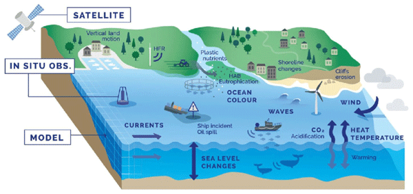
Coastal services are essential to society, requiring accurate prediction of ocean variables in complex, high-resolution environments. This paper outlines key aspects of coastal modelling and emphasizes the importance of capturing nonlinear interactions and feedbacks. Advances in coastal modelling, observational integration, and predictive skills are highlighted as being vital for supporting sustainability and strengthening climate resilience.
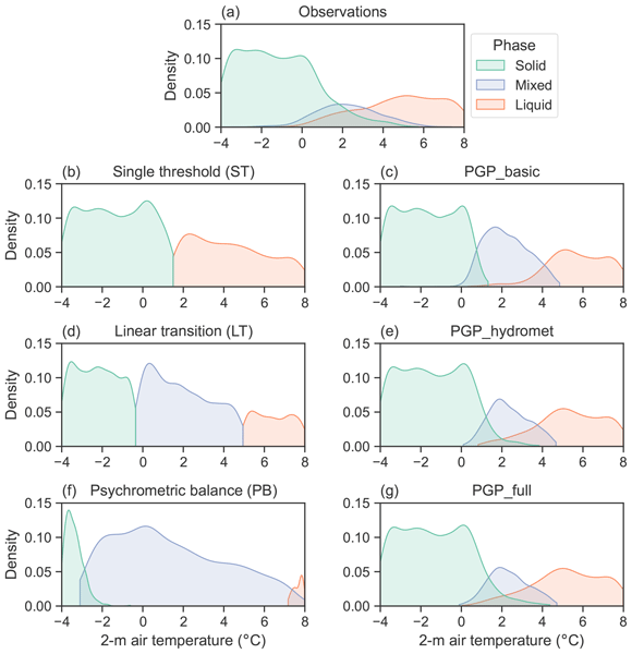
Alexis Bédard-Therrien, François Anctil, Julie M. Thériault, Olivier Chalifour, Fanny Payette, Alexandre Vidal, and Daniel F. Nadeau
Hydrol. Earth Syst. Sci., 29, 1135–1158, https://doi.org/10.5194/hess-29-1135-2025, https://doi.org/10.5194/hess-29-1135-2025, 2025
Short summary
Short summary
Precipitation data from an automated observational network in eastern Canada showed a temperature interval where rain and snow could coexist. Random forest models were developed to classify the precipitation phase using meteorological data to evaluate operational applications. The models demonstrated significantly improved phase classification and reduced error compared to benchmark operational models. However, accurate prediction of mixed-phase precipitation remains challenging.
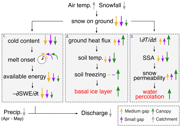
Benjamin Bouchard, Daniel F. Nadeau, Florent Domine, François Anctil, Tobias Jonas, and Étienne Tremblay
Hydrol. Earth Syst. Sci., 28, 2745–2765, https://doi.org/10.5194/hess-28-2745-2024, https://doi.org/10.5194/hess-28-2745-2024, 2024
Short summary
Short summary
Observations and simulations from an exceptionally low-snow and warm winter, which may become the new norm in the boreal forest of eastern Canada, show an earlier and slower snowmelt, reduced soil temperature, stronger vertical temperature gradients in the snowpack, and a significantly lower spring streamflow. The magnitude of these effects is either amplified or reduced with regard to the complex structure of the canopy.
Dipti Tiwari, Mélanie Trudel, and Robert Leconte
Hydrol. Earth Syst. Sci., 28, 1127–1146, https://doi.org/10.5194/hess-28-1127-2024, https://doi.org/10.5194/hess-28-1127-2024, 2024
Short summary
Short summary
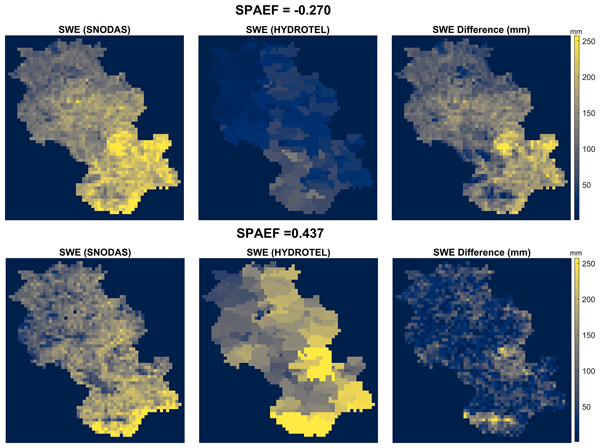
Calibrating hydrological models with multi-objective functions enhances model robustness. By using spatially distributed snow information in the calibration, the model performance can be enhanced without compromising the outputs. In this study the HYDROTEL model was calibrated in seven different experiments, incorporating the SPAEF (spatial efficiency) metric alongside Nash–Sutcliffe efficiency (NSE) and root-mean-square error (RMSE), with the aim of identifying the optimal calibration strategy.
Luca Cortese, Carmine Donatelli, Xiaohe Zhang, Justin A. Nghiem, Marc Simard, Cathleen E. Jones, Michael Denbina, Cédric G. Fichot, Joshua P. Harringmeyer, and Sergio Fagherazzi
Biogeosciences, 21, 241–260, https://doi.org/10.5194/bg-21-241-2024, https://doi.org/10.5194/bg-21-241-2024, 2024
Short summary
Short summary
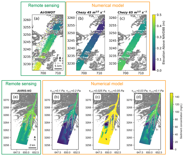
This study shows that numerical models in coastal areas can greatly benefit from the spatial information provided by remote sensing. Three Delft3D numerical models in coastal Louisiana are calibrated using airborne SAR and hyperspectral remote sensing products from the recent NASA Delta-X mission. The comparison with the remote sensing allows areas where the models perform better to be spatially verified and yields more representative parameters for the entire area.
Simon Ricard, Philippe Lucas-Picher, Antoine Thiboult, and François Anctil
Hydrol. Earth Syst. Sci., 27, 2375–2395, https://doi.org/10.5194/hess-27-2375-2023, https://doi.org/10.5194/hess-27-2375-2023, 2023
Short summary
Short summary
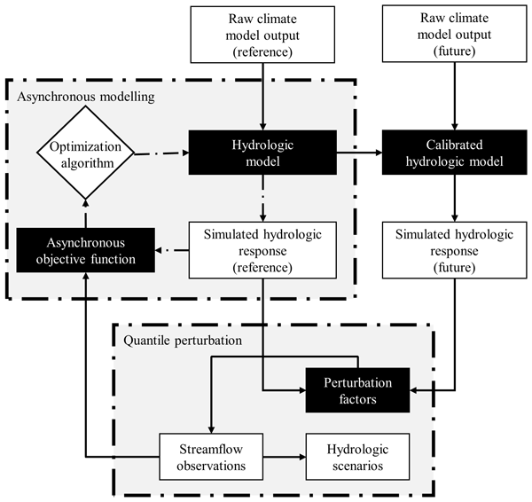
A simplified hydroclimatic modelling workflow is proposed to quantify the impact of climate change on water discharge without resorting to meteorological observations. Results confirm that the proposed workflow produces equivalent projections of the seasonal mean flows in comparison to a conventional hydroclimatic modelling approach. The proposed approach supports the participation of end-users in interpreting the impact of climate change on water resources.
Graig Sutherland, Victor de Aguiar, Lars-Robert Hole, Jean Rabault, Mohammed Dabboor, and Øyvind Breivik
The Cryosphere, 16, 2103–2114, https://doi.org/10.5194/tc-16-2103-2022, https://doi.org/10.5194/tc-16-2103-2022, 2022
Short summary
Short summary
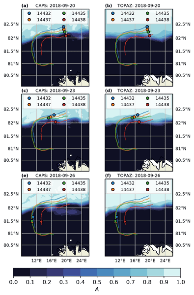
The marginal ice zone (MIZ), which is the transition region between the open ocean and the dense pack ice, is a very dynamic region comprising a mixture of ice and ocean conditions. Using novel drifters deployed in various ice conditions in the MIZ, several material transport models are tested with two operational ice–ocean prediction systems. A new general transport equation, which uses both the ice and ocean solutions, is developed that reduces the error in drift prediction for our case study.
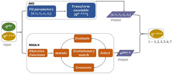
Jing Xu, François Anctil, and Marie-Amélie Boucher
Hydrol. Earth Syst. Sci., 26, 1001–1017, https://doi.org/10.5194/hess-26-1001-2022, https://doi.org/10.5194/hess-26-1001-2022, 2022
Short summary
Short summary
The performance of the non-dominated sorting genetic algorithm II (NSGA-II) is compared with a conventional post-processing method of affine kernel dressing. NSGA-II showed its superiority in improving the forecast skill and communicating trade-offs with end-users. It allows the enhancement of the forecast quality since it allows for setting multiple specific objectives from scratch. This flexibility should be considered as a reason to implement hydrologic ensemble prediction systems (H-EPSs).
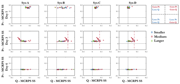
Emixi Sthefany Valdez, François Anctil, and Maria-Helena Ramos
Hydrol. Earth Syst. Sci., 26, 197–220, https://doi.org/10.5194/hess-26-197-2022, https://doi.org/10.5194/hess-26-197-2022, 2022
Short summary
Short summary
We investigated how a precipitation post-processor interacts with other tools for uncertainty quantification in a hydrometeorological forecasting chain. Four systems were implemented to generate 7 d ensemble streamflow forecasts, which vary from partial to total uncertainty estimation. Overall analysis showed that post-processing and initial condition estimation ensure the most skill improvements, in some cases even better than a system that considers all sources of uncertainty.
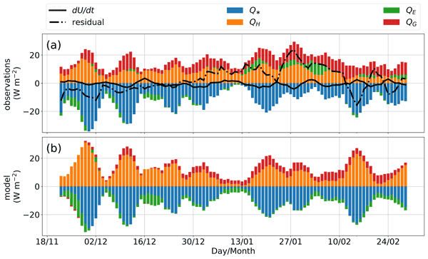
Georg Lackner, Florent Domine, Daniel F. Nadeau, Annie-Claude Parent, François Anctil, Matthieu Lafaysse, and Marie Dumont
The Cryosphere, 16, 127–142, https://doi.org/10.5194/tc-16-127-2022, https://doi.org/10.5194/tc-16-127-2022, 2022
Short summary
Short summary
The surface energy budget is the sum of all incoming and outgoing energy fluxes at the Earth's surface and has a key role in the climate. We measured all these fluxes for an Arctic snowpack and found that most incoming energy from radiation is counterbalanced by thermal radiation and heat convection while sublimation was negligible. Overall, the snow model Crocus was able to simulate the observed energy fluxes well.
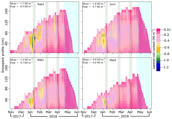
Achut Parajuli, Daniel F. Nadeau, François Anctil, and Marco Alves
The Cryosphere, 15, 5371–5386, https://doi.org/10.5194/tc-15-5371-2021, https://doi.org/10.5194/tc-15-5371-2021, 2021
Short summary
Short summary
Cold content is the energy required to attain an isothermal (0 °C) state and resulting in the snow surface melt. This study focuses on determining the multi-layer cold content (30 min time steps) relying on field measurements, snow temperature profile, and empirical formulation in four distinct forest sites of Montmorency Forest, eastern Canada. We present novel research where the effect of forest structure, local topography, and meteorological conditions on cold content variability is explored.
Cited articles
Belzile, M., Galbraith, P. S., and Bourgault, D.: Water renewals in the Saguenay Fjord, J. Geophys. Res.-Oceans, 121, 638–657, 2016. a
Bizhanimanzar, M., Rondeau-Genesse, G., Caron, L. P., Lefaivre, D., and Mailhot, E.: Joint Occurrence of Extreme Water Level and River Flows in St. Lawrence River Coasts Under Present and Sea Level Rise Conditions, Earth's Future, 12, e2023EF004027, https://doi.org/10.1029/2023EF004027, 2024. a
Bourgault, D. and Kelley, D. E.: Wave-induced boundary mixing in a partially mixed estuary, J. Mar. Res., 61, 553–576, 2003. a
Bourgault, D. and Matte, P.: A Physically Based Method for Real-Time Monitoring of Tidal River Discharges From Water Level Observations, With an Application to the St. Lawrence River, J. Geophys. Res.-Oceans, 125, e2019JC015992, https://doi.org/10.1029/2019JC015992, 2020. a
Bourgault, D., Chavanne, C., Dumont, D., Morin, E., Galbraith, P., and Gostiaux, L.: Le point sur les marées d'équinoxes dans l'estuaire du Saint-Laurent, Nat. Can., 140, 73–84, 2016a. a
Bourgault, D., Galbraith, P. S., and Chavanne, C.: Generation of internal solitary waves by frontally forced intrusions in geophysical flows, Nat. Commun., 7, 13606, https://doi.org/10.1038/ncomms13606, 2016b. a
Bushnell, M.: Manual for Real-Time Quality Control of In-Situ Surface Wave Data: A Guide to Quality Control and Quality Assurance of In-Situ Surface Wave Observations Version 2.1., https://doi.org/10.25923/7yc5-vs69, 2019. a
Chartrand, X.: xavier-chartrand/AZMP: ESSD AZMP (Version v1.0), Zenodo [code], https://doi.org/10.5281/zenodo.22961661, 2026a. a
Chartrand, X.: xavier-chartrand/Spotter: ESSD Spotter (Version v1.0), Zenodo [code], https://doi.org/10.5281/zenodo.22961954, 2026b. a
D’Ovidio, F., Pascual, A., Wang, J., Doglioli, A.M., Jing, Z., Moreau, S., Grégori, G., Swart, S., Speich, S., Cyr, F., Legresy, B., Chao, Y., Fu, L., and Morrow, R. A.: Frontiers in Fine-Scale in situ Studies: Opportunities During the SWOT Fast Sampling Phase, Front. Mar. Sci., 6, 168, https://doi.org/10.3389/fmars.2019.00168, 2019. a
Durand, M., Chen, C., de Moraes Frasson, R. P., Pavelsky, T. M., Williams, B., Yang, X., and Fore, A.: How will radar layover impact SWOT measurements of water surface elevation and slope, and estimates of river discharge?, Remote Sens. Environ., 247, 111883, https://doi.org/10.1016/j.rse.2020.111883, 2020. a
Elmi, O., Tourian, M. J., Saemian, P., and Sneeuw, N.: Remote Sensing-Based Extension of GRDC Discharge Time Series-A Monthly Product with Uncertainty Estimates, Sci. Data, 11, 240, https://doi.org/10.1038/s41597-024-03078-6, 2024. a
El-Sabh, M. I., Lie, H.-J., and Koutitonsky, V. G.: Variability of the Near-Surface Residual Current in the Lower St. Lawrence Estuary, J. Geophys. Res.-Oceans, 87, 9589–9600, 1982. a
Forrester, W. D.: Internal tides in St. Lawrence estuary, J. Mar. Res., 32, 55–66, 1974. a
Fu, L.-L., Pavelsky, T., Cretaux, J.-F., Morrow, R., Farrar, J. T., Vaze, P., Sengenes, P., Vinogradova-Shiffer, N., Sylvestre-Baron, A., Picot, N., and Dibarboure, G.: The Surface Water and Ocean Topography Mission: A breakthrough in radar remote sensing of the ocean and land surface water, Geophys. Res. Lett., 51, e2023GL107652, https://doi.org/10.1029/2023GL107652, 2024. a
Godin, G.: The Propagation of Tides up Rivers with Special Considerations on the Upper Saint Lawrence River, Estuar. Coast. Shelf S., 48, 307–324, 1999. a
Haigh, I. D., Marcos, M., Talke, S. A., Woodworth, P. L., Hunter, J. R., Hague, B. S., Arns, A., Bradshaw, E., and Thompson, P.: GESLA version 3: A Major Update to the Global Higher-Frequency Sea-Level Dataset, Geosci. Data J., 10, 293–314, 2023. a
Hanson, J. L. and Phillips, O. M.: Automated analysis of ocean surface directional wave spectra, J. Atmos. Ocean. Tech., 18, 277–293, 2001. a
Hopkinson, C., Crasto, N., Marsh, P., Forbes, D., and Lesack, L.: Investigating the spatial distribution of water levels in the Mackenzie Delta using airborne LiDAR, Hydrol. Process., 25, 2995–3011, 2011. a
Hsu, S. A., Meindl, E. A., and Gilhousen, D. B.: Determining the power-law wind-profile exponent under near-neutral stability conditions at sea, J. Appl. Meteorol., 757–765, https://doi.org/10.1175/1520-0450(1994)033<0757:DTPLWP>2.0.CO;2, 1994. a
JPL D-109532, Revision A: SWOT Science Data Products User Handbook, Jet Propulsion Laboratory Internal Document, Pasadena, CA, https://archive.podaac.earthdata.nasa.gov/podaac-ops-cumulus-docs/web-misc/swot_mission_docs/D-109532_SWOT_UserHandbook_RevA_20250311_sig-final.pdf (last access: 26 September 2026), 2025. a, b, c
Kim, S. K., Lee, E., Park, J., and Shin, S.: Feasibility Analysis of GNSS-Reflectometry for Monitoring Coastal Hazards, Remote Sens., 13, 976, https://doi.org/10.3390/rs13050976, 2021. a
Little, S., Lewis, J. P., and Pietkiewicz, H.: Defining Estuarine Squeeze: The Loss of Upper Estuarine Transitional Zones Against In-Channel Barriers Through Saline Intrusion, Estuar. Coast. Shelf S., 278, 108107, https://doi.org/10.1016/j.ecss.2022.108107, 2022. a
Matte, P., Secretan, Y., and Morin, J.: Hydrodynamic Modeling of the St. Lawrence Fluvial Estuary. I: Model Setup, Calibration, and Validation, J. Waterw. Port C., 143, 04017010, https://doi.org/10.1061/(ASCE)WW.1943-5460.0000397, 2017a. a
Matte, P., Secretan, Y., and Morin, J.: Hydrodynamic Modeling of the St. Lawrence Fluvial Estuary. II: Reproduction of Spatial and Temporal Patterns, J. Waterw. Port C., 143, 04017011, https://doi.org/10.1061/(ASCE)WW.1943-5460.0000394, 2017b. a
Matte, P., Secretan, Y., and Morin, J.: Drivers of residual and tidal flow variability in the St. Lawrence fluvial estuary: Influence on tidal wave propagation, Cont. Shelf Res., 174, 158–173, 2019. a
Matte, P., Chartrand, X., and Purnell, D.: Benchmark dataset of water levels and waves in the St. Lawrence Estuary and Saguenay Fjord, Quebec, Canada (1.0.0), Zenodo [data set], https://doi.org/10.5281/zenodo.18225504, 2026. a, b, c
Meran, G., Siehlow, M., and von Hirschhausen: Integrated Water Resource Management: Principles and Applications, The Economics of Water: Rules and Institutions, 23–121, https://doi.org/10.1007/978-3-030-48485-9_3, 2021. a
Mertz, G. and Gratton, Y.: Topographic Waves and Topographically Induced Motions in the St. Lawrence Estuary BT – Oceanography of a Large-Scale Estuarine System: The St. Lawrence, in: Oceanography of a Large-Scale Estuarine System: The St. Lawrence, edited by: El-Sabh, M. I. and Silverberg, N., Springer New York, 94–108, ISBN 978-1-4615-7534-4, https://doi.org/10.1007/978-1-4615-7534-4_5, 1990. a
Mertz, G., El-Sabh, M. I., Proulx, D., and Condal, A. R.: Instability of a Buoyancy-Driven Coastal Jet: The Gaspé Current and its St. Lawrence Precursor, J. Geophys. Res.-Oceans, 93, 6885–6893, 1988. a
Mishra, A. K. and Coulibaly, P.: Developments in Hydrometric Network Design: A review, Rev. Geophys., 47, https://doi.org/10.1029/2007RG000243, 2009. a
Moftakhari, H. R., Jay, D. A., and Talke, S. A.: Estimating river discharge using multiple-tide gauges distributed along a channel, J. Geophys. Res.-Oceans, 121, 2078–2097, 2016. a
Mulligan, R. P., Swatridge, L., Cantelon, J. A., Kurylyk, B. L., George, E., and Houser, C.: Local and Remote Storm Surge Contributions to Total Water Levels in the Gulf of St. Lawrence During Hurricane Fiona, J. Geophys. Res.-Oceans, 128, e2023JC019910, https://doi.org/10.1029/2023JC019910, 2023. a
Nikolaidou, T., Santos, M. C., Williams, S. D. P., and Geremia-Nievinski, F.: Raytracing atmospheric delays in ground-based GNSS reflectometry, J. Geodesy, 94, 68, https://doi.org/10.1007/s00190-020-01390-8, 2020. a
Nikolaidou, T., Santos, M. C., Williams, S. D. P., and Geremia-Nievinski, F.: Development and Validation of Comprehensive Closed Formulas for Atmospheric Delay and Altimetry Correction in Ground-Based GNSS-R, IEEE T. Geosci. Remote, 61, 1–7, 2023. a
Purnell, D., Gomez, N., Chan, N. H., Strandberg, J., Holland, D. M., and Hobiger, T.: Quantifying the Uncertainty in Ground-Based GNSS-Reflectometry Sea Level Measurements, IEEE J. Sel. Top. Appl., 13, 4419–4428, 2020. a
Purnell, D. J., Gomez, N., Minarik, W., Porter, D., and Langston, G.: Precise water level measurements using low-cost GNSS antenna arrays, Earth Surf. Dynam., 9, 673–685, https://doi.org/10.5194/esurf-9-673-2021, 2021. a
Purnell, D., Dabboor, M., Matte, P., Peters, D., Anctil, F., Ghobrial, T., and Pierre, A.: Observations of River Ice Breakup Using GNSS-IR, SAR and Machine Learning, IEEE T. Geosci. Remote, 62, 1–13, https://doi.org/10.1109/TGRS.2024.3380554, 2024a. a, b, c, d
Raghukumar, K., Chang, G., Spada, F., Jones, C., Janssen, T., and Gans, A.: Performance characteristics of “Spotter”, a newly developed real-time wave measurement buoy, J. Atmos. Ocean. Tech., 36, 1127–1141, 2019. a
Ruest, B., Neumeier, U., Dumont, D., and Lambert, A.: Wave climate evaluation in the Gulf of St. Lawrence with a parametric wave model, in: Proceedings of Coastal Dynamics 2013: Coastal Dynamics Research Emphasizing Practical Applications, edited by: Bonneton, P. and Garlan, T., Arcachon, France, 24–28 June 2013, Brest, 1363–1374, 2013. a
Ruiz-Martinez, G.: Seawater density from salinity, temperature and pressure, MATLAB central file exchange, https://www.mathworks.com/matlabcentral/fileexchange/85900-seawater-density-from-salinity-temperature-and-pressure (last access: 26 September 2026), 2023. a
Salameh, E., Desroches, D., Deloffre, J., Fjørtoft, R., Mendoza, E. T., Turki, I., Froideval, L., Levaillant, R., Déchamps, S., Picot, N., Laignel, B., and Frappart, F.: Evaluating SWOT's interferometric capabilities for mapping intertidal topography, Remote Sens. Environ., 314, 114401, https://doi.org/10.1016/j.rse.2024.114401, 2024. a
Sassi, M. G., Hoitink, A. J. F., De Brye, B., Vermeulen, B., and Deleersnijder, E.: Tidal impact on the division of river discharge over distributary channels in the Mahakam Delta, Ocean Dynam., 61, 2211–2228, 2011. a
Simard, M., Chao, R., Christensen, A., Denbina, M., and Matte, P.: AirSWOT flies Cal/Val Campaign over the St. Lawrence Estuary, Airborne Science Newsletter, 4–6, https://airbornescience.nasa.gov/sites/default/files/documents/ASPnewsletter_Fall_2023_0.pdf (last access: 26 September 2026), 2023. a, b
Simons, R. D., Monismith, S. G., Saucier, F. J., Johnson, L. E., and Winkler, G.: Modelling Stratification and Baroclinic Flow in the Estuarine Transition Zone of the St. Lawrence Estuary, Atmos.-Ocean, 48, 132–146, 2010. a
Song, M., He, X., Jia, D., Xiao, R., Asgarimehr, M., Wickert, J., Wang, X., and Zhang, Z.: Sea Surface States Detection in Polar Regions Using Measurements of Ground-Based GNSS Interferometric Reflectometry, IEEE T. Geosci. Remote, 60, 1–14, 2022. a
Ward, N. D., Megonigal, J. P., Bond-Lamberty, B., Bailey, V. L., Butman, D., Canuel, E. A., Diefenderfer, H., Ganju, N. K., Goñi, M. A., Graham, E. B., Hopkinson, C. S., Khangaonkar, T., Langley, J. A., McDowell, N. G., Myers-Pigg, A. N., Neumann, R. B., Osburn, C. L., Price, R. M., Rowland, J., Sengupta, A., Simard, M., Thornton, P. E., Tzortziou, M., Vargas, R., Weisenhorn, P. B., and Windham-Myers, L.: Representing the function and sensitivity of coastal interfaces in Earth system models, Nat. Commun., 11, 2458, https://doi.org/10.1038/s41467-020-16236-2, 2020. a
Short summary
We present a new public collection of water-level and wave measurements from the St. Lawrence Estuary and Saguenay Fjord in Canada, based on the densest observation network ever deployed in the region. Collected to assess the accuracy of the Surface Water and Ocean Topography satellite, these carefully processed data will help researchers better understand floods, coastal water-level changes, and other estuarine processes as climate and sea levels change.
We present a new public collection of water-level and wave measurements from the St. Lawrence...


Altmetrics
Final-revised paper
Preprint