Articles | Volume 18, issue 9
https://doi.org/10.5194/essd-18-7021-2026
© Author(s) 2026. This work is distributed under
the Creative Commons Attribution 4.0 License.
the Creative Commons Attribution 4.0 License.
https://doi.org/10.5194/essd-18-7021-2026
© Author(s) 2026. This work is distributed under
the Creative Commons Attribution 4.0 License.
the Creative Commons Attribution 4.0 License.
Data description article
| 
24 Sep 2026
Data description article |
| 24 Sep 2026
| 24 Sep 2026
Italian Fluvial Sediment Transport Database: a comprehensive hub for archiving and analyzing hydrological data
Marco Luppichini
CORRESPONDING AUTHOR

Department of Earth Sciences, University of Pisa, Via S. Maria 52, 56126 Pisa, Italy
Francesco Comiti
University of Padua, Padua, Italy
Andrea Andreoli
Free University of Bozen-Bolzano, Bolzano, Italy
Barbara Aldighieri
Consiglio Nazionale delle Ricerche – Istituto di Geoscienze (CNR-GEO),Via Mario Bianco 9, 20131 Milano, Italy
Paolo Billi
Department of Physics and Earth Sciences, Università degli Studi di Ferrara,Via Saragat 1, 44122 Ferrara, Italy
Irene Maria Bollati
Earth Science Department “A. Desio”, Università degli Studi di Milano, Milan, Italy
Andrea Brenna
Earth Science Department “A. Desio”, Università degli Studi di Milano, Milan, Italy
Diletta Chirici
Department of Agricultural, Food, Environmental and Forestry Sciences and Technologies, University of Florence, Via San Bonaventura 13, 50145 Firenze, Florence, Italy
Paolo Ciavola
Department of Physics and Earth Sciences, Università degli Studi di Ferrara,Via Saragat 1, 44122 Ferrara, Italy
Silvia Cilli
Department of Physics and Earth Sciences, Università degli Studi di Ferrara,Via Saragat 1, 44122 Ferrara, Italy
Consorzio di Bonifica della Romagna, Via R. Lambruschini, 195, 47521 Cesena (FC), Italy
Marco Donnini
Consiglio Nazionale delle Ricerche – Istituto di Geoscienze (CNR-GEO),Via della Madonna Alta 126, 06128 Perugia, Italy
Simona Francalanci
Department of Civil and Environmental Engineering, University of Florence,Via S. Marta 3, 50139 Florence, Italy
Lorenzo Innocenti
Department of Civil and Environmental Engineering, University of Florence,Via S. Marta 3, 50139 Florence, Italy
Laura Longoni
Department of Civil and Environmental Engineering, Politecnico di Milano,Piazza Leonardo da Vinci 32, 20133 Milan, Italy
Luca Mao
Department of Geography, Climate, Catchments, Coasts and Communities Research Group, University of Lincoln, Brayford Pool, Lincoln LN67TS, UK
Ivan Marchesini
Consiglio Nazionale delle Ricerche – Istituto di Geoscienze (CNR-GEO),Via della Madonna Alta 126, 06128 Perugia, Italy
Ilenia Murgia
Department of Agricultural, Food, Environmental and Forestry Sciences and Technologies, University of Florence, Via San Bonaventura 13, 50145 Firenze, Florence, Italy
Giacomo Pellegrini
Department of Geography, Climate, Catchments, Coasts and Communities Research Group, University of Lincoln, Brayford Pool, Lincoln LN67TS, UK
Daniele Penna
Department of Agricultural, Food, Environmental and Forestry Sciences and Technologies, University of Florence, Via San Bonaventura 13, 50145 Firenze, Florence, Italy
Consiglio Nazionale delle Ricerche – Istituto di Geoscienze (CNR-GEO),Via della Madonna Alta 126, 06128 Perugia, Italy
Forest Engineering Resources and Management Department, Oregon State University, Corvallis, OR, USA
Lorenzo Picco
University of Padua, Padua, Italy
Riccardo Rainato
Regione Veneto, Venice, Italy
Leonardo Schippa
Department of Engineering, University of Ferrara, Via Saragat 1, 44122 Ferrara, Italy
Luca Solari
Department of Civil and Environmental Engineering, University of Florence,Via S. Marta 3, 50139 Florence, Italy
Gianluca Tronti
Earth Science Department “A. Desio”, Università degli Studi di Milano, Milan, Italy
Bruno Testa
Consiglio Nazionale delle Ricerche – Istituto di Geoscienze (CNR-GEO),Via Mario Bianco 9, 20131 Milano, Italy
Matteo Verdone
Department of Agricultural, Food, Environmental and Forestry Sciences and Technologies, University of Florence, Via San Bonaventura 13, 50145 Firenze, Florence, Italy
Monica Bini
Department of Earth Sciences, University of Pisa, Via S. Maria 52, 56126 Pisa, Italy
CIRSEC – Centro Interdipartimentale di Ricerca per lo Studio degli Effetti del Cambiamento Climatico, University of Pisa, Pisa, Italy
Related authors
No articles found.
Federica Gaspari, Marco Gentile, Daniela Carrion, Riccardo Barzaghi, Lorenzo Panzeri, and Laura Longoni
Int. Arch. Photogramm. Remote Sens. Spatial Inf. Sci., XLIX-B4-2026, 485–491, https://doi.org/10.5194/isprs-archives-XLIX-B4-2026-485-2026, https://doi.org/10.5194/isprs-archives-XLIX-B4-2026-485-2026, 2026
Han Fu, Ming Gao, Huijie Li, Daniele Penna, Junming Liu, Bingcheng Si, and Wenxiu Zou
Hydrol. Earth Syst. Sci., 30, 1951–1968, https://doi.org/10.5194/hess-30-1951-2026, https://doi.org/10.5194/hess-30-1951-2026, 2026
Short summary
Short summary
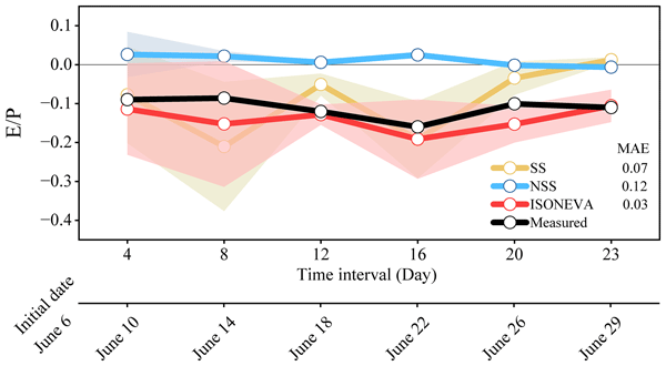
We present ISONEVA, a new isotope-based framework for estimating soil water evaporation that explicitly accounts for dynamic soil water storage and non-evaporative fluxes. Numerical and field validations demonstrate that ISONEVA substantially improves evaporation estimates compared to traditional steady-state and non-steady-state approaches, and provides a robust basis for assessing long-term average evaporation to precipitation (E/P) ratios.
Sofia Ortenzi, Lucio Di Matteo, Daniela Valigi, Marco Donnini, Marco Dionigi, Davide Fronzi, Josie Geris, Fabio Guadagnano, Ivan Marchesini, Paolo Filippucci, Francesco Avanzi, Daniele Penna, and Christian Massari
Hydrol. Earth Syst. Sci., 30, 1755–1778, https://doi.org/10.5194/hess-30-1755-2026, https://doi.org/10.5194/hess-30-1755-2026, 2026
Short summary
Short summary
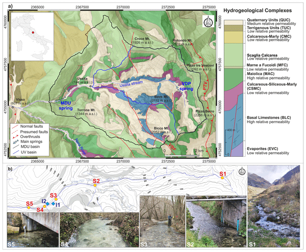
The study presents an integrated approach to analyze groundwater–surface water interactions in a Central Italy catchment, combining hydrological, hydrochemical–isotopic, thermal drone, and satellite data. Results indicate that fractured limestone aquifers sustain streamflow, with snowmelt accounting for about 18 % of recharge. The workflow is transferable and suitable for similar data-scarce Mediterranean basins.
Antonis Chatzipavlis, Daniele Trogu, Andrea Ruju, Juan Montes, Antonio Usai, Marco Porta, Giovanni Coco, Sandro De Muro, and Paolo Ciavola
Nat. Hazards Earth Syst. Sci., 26, 1573–1601, https://doi.org/10.5194/nhess-26-1573-2026, https://doi.org/10.5194/nhess-26-1573-2026, 2026
Short summary
Short summary
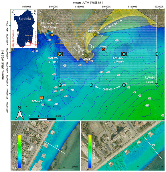
This study evaluates the performance of an EWS (Early Warning System) for coastal flooding operating at a beach scale. The system captures total water level exceedances based on predefined morphological thresholds and trigger timely warnings, particularly under energetic conditions. Its forecasts are found to align well with selected overtopping events of varying magnitude and duration, leading to flooding of the berm-dune zone, which have been monitored by on-site coastal videocameras.
Marco M. Lehmann, Josie Geris, Ilja van Meerveld, Daniele Penna, Youri Rothfuss, Matteo Verdone, Pertti Ala-Aho, Matyas Arvai, Alise Babre, Philippe Balandier, Fabian Bernhard, Lukrecija Butorac, Simon D. Carrière, Natalie C. Ceperley, Zuosinan Chen, Alicia Correa, Haoyu Diao, David Dubbert, Maren Dubbert, Fabio Ercoli, Marius G. Floriancic, Alligin Ghazoul, Teresa E. Gimeno, Damien Gounelle, Frank Hagedorn, Christophe Hissler, Frédéric Huneau, Alberto Iraheta, Tamara Jakovljević, Nerantzis Kazakis, Zoltan Kern, Laura Kinzinger, Karl Knaebel, Johannes Kobler, Jiri Kocum, Charlotte Koeber, Gerbrand Koren, Angelika Kübert, Dawid Kupka, Samuel Le Gall, Aleksi Lehtonen, Thomas Leydier, Philippe Malagoli, Francesca Sofia Manca di Villahermosa, Chiara Marchina, Núria Martínez-Carreras, Nicolas Martin-StPaul, Hannu Marttila, Aline Meyer Oliveira, Gael Monvoisin, Natalie Orlowski, Kadi Palmik-Das, Aurel Persoiu, Andrei Popa, Egor Prikaziuk, Cécile Quantin, Katja T. Rinne-Garmston, Clara Rohde, Martin Sanda, Matthias Saurer, Daniel Schulz, Michael P. Stockinger, Christine Stumpp, Jean-Stéphane Vénisse, Lukas Vlcek, Stylianos Voudouris, Björn Weeser, Mark E. Wilkinson, Giulia Zuecco, and Katrin Meusburger
Earth Syst. Sci. Data, 17, 6129–6147, https://doi.org/10.5194/essd-17-6129-2025, https://doi.org/10.5194/essd-17-6129-2025, 2025
Short summary
Short summary
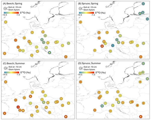
This study describes a unique large-scale isotope dataset to study water dynamics in European forests. Researchers collected data from 40 beech and spruce forest sites in spring and summer 2023, using a standardized method to ensure consistency. The results show that water sources for trees change between seasons and vary by tree species. This large dataset offers valuable information for understanding plant water use, improving ecohydrological models, and mapping water cycles across Europe.
Marco Donnini, Francesco Bucci, Michele Santangelo, Mauro Cardinali, and Paola Reichenbach
EGUsphere, https://doi.org/10.5194/egusphere-2025-2096, https://doi.org/10.5194/egusphere-2025-2096, 2025
Preprint archived
Short summary
Short summary
The lack of standard for estimating landslide hazard severely impacts practical applications for territorial management. Using a new method, this work highlights the impact of landslide mapping on hazard estimation, focusing on the key role of recognizing and treating complex landslide clusters. While the results encourage future widespread tests and application, they raise questions on the reliability and availability of landslide inventory maps, shedding light on future research needs.
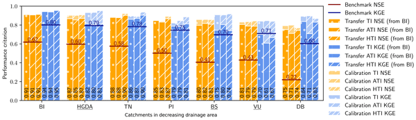
Anne-Laure Argentin, Pascal Horton, Bettina Schaefli, Jamal Shokory, Felix Pitscheider, Leona Repnik, Mattia Gianini, Simone Bizzi, Stuart N. Lane, and Francesco Comiti
Hydrol. Earth Syst. Sci., 29, 1725–1748, https://doi.org/10.5194/hess-29-1725-2025, https://doi.org/10.5194/hess-29-1725-2025, 2025
Short summary
Short summary
In this article, we show that by taking the optimal parameters calibrated with a semi-lumped model for the discharge at a catchment's outlet, we can accurately simulate runoff at various points within the study area, including three nested and three neighboring catchments. In addition, we demonstrate that employing more intricate melt models, which better represent physical processes, enhances the transfer of parameters in the simulation, until we observe overparameterization.
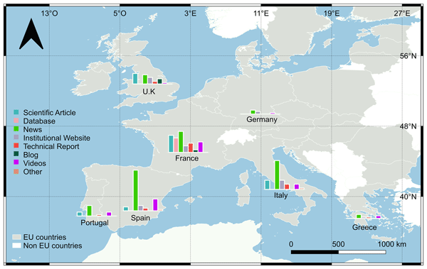
Paola Emilia Souto-Ceccon, Juan Montes, Enrico Duo, Paolo Ciavola, Tomás Fernández-Montblanc, and Clara Armaroli
Earth Syst. Sci. Data, 17, 1041–1054, https://doi.org/10.5194/essd-17-1041-2025, https://doi.org/10.5194/essd-17-1041-2025, 2025
Short summary
Short summary
This dataset supports the growing need for information on coastal storm impacts. It covers different European countries and is an open-access tool that can be exploited, updated, or complemented by different users and for different purposes. Via labelling with unique identifiers, the database allows for a quick and consistent retrieval of all of the resources associated with a storm event. The adopted approach can be easily exported to all European countries and beyond.
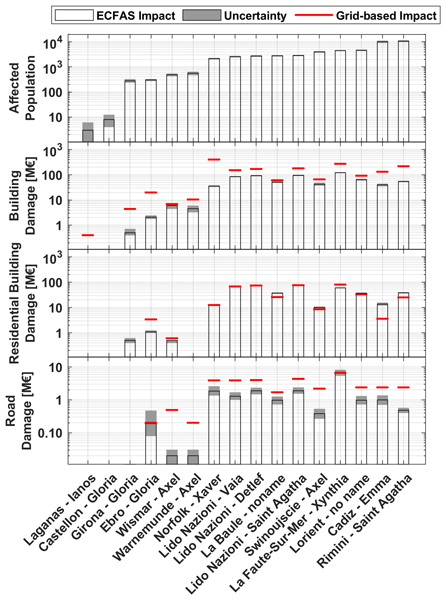
Enrico Duo, Juan Montes, Marine Le Gal, Tomás Fernández-Montblanc, Paolo Ciavola, and Clara Armaroli
Nat. Hazards Earth Syst. Sci., 25, 13–39, https://doi.org/10.5194/nhess-25-13-2025, https://doi.org/10.5194/nhess-25-13-2025, 2025
Short summary
Short summary
The present work, developed within the EU H2020 European Coastal Flood Awareness System (ECFAS) project, presents an approach used to estimate direct impacts of coastal flood on population, buildings, and roads along European coasts. The findings demonstrate that the ECFAS impact approach offers valuable estimates for affected populations, reliable damage assessments for buildings and roads, and improved accuracy compared to traditional grid-based approaches.
Harin Aiyanna Cheriyanda Raveendra, Lorenzo Picco, and Francesco Pirotti
Int. Arch. Photogramm. Remote Sens. Spatial Inf. Sci., XLVIII-3-2024, 63–70, https://doi.org/10.5194/isprs-archives-XLVIII-3-2024-63-2024, https://doi.org/10.5194/isprs-archives-XLVIII-3-2024-63-2024, 2024
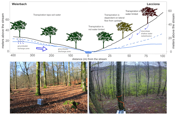
Ginevra Fabiani, Julian Klaus, and Daniele Penna
Hydrol. Earth Syst. Sci., 28, 2683–2703, https://doi.org/10.5194/hess-28-2683-2024, https://doi.org/10.5194/hess-28-2683-2024, 2024
Short summary
Short summary
There is a limited understanding of the role that topography and climate play in tree water use. Through a cross-site comparison in Luxembourg and Italy, we investigated beech water use along slopes in different climates. Our findings indicate that in landscapes characterized by stronger hydraulic and climatic gradients there is greater spatial variation in tree physiological responses. This highlights how differing growing conditions across landscapes can lead to contrasting tree performances.
Théo St. Pierre Ostrander, Thomé Kraus, Bruno Mazzorana, Johannes Holzner, Andrea Andreoli, Francesco Comiti, and Bernhard Gems
Nat. Hazards Earth Syst. Sci., 24, 1607–1634, https://doi.org/10.5194/nhess-24-1607-2024, https://doi.org/10.5194/nhess-24-1607-2024, 2024
Short summary
Short summary
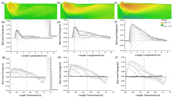
Mountain river confluences are hazardous during localized flooding events. A physical model was used to determine the dominant controls over mountain confluences. Contrary to lowland confluences, in mountain regions, the channel discharges and (to a lesser degree) the tributary sediment concentration control morphological patterns. Applying conclusions drawn from lowland confluences could misrepresent depositional and erosional patterns and the related flood hazard at mountain river confluences.
Andrea Abbate, Leonardo Mancusi, Francesco Apadula, Antonella Frigerio, Monica Papini, and Laura Longoni
Nat. Hazards Earth Syst. Sci., 24, 501–537, https://doi.org/10.5194/nhess-24-501-2024, https://doi.org/10.5194/nhess-24-501-2024, 2024
Short summary
Short summary
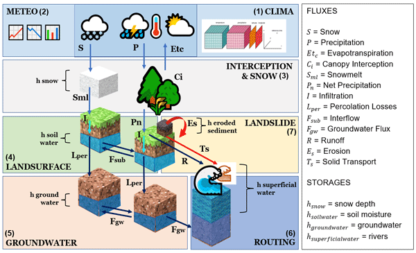
CRHyME (Climatic Rainfall Hydrogeological Modelling Experiment) is a new physically based and spatially distributed rainfall-runoff model. The main novelties consist of reproducing rainfall-induced geo-hydrological hazards such as shallow landslide, debris flow and watershed erosion through a multi-hazard approach. CRHyME was written in Python, works at a high spatial and temporal resolution, and is a tool suitable for quantifying extreme rainfall consequences at the basin scale.
V. Yordanov, X. Q. Truong, M. Corti, L. Longoni, and M. A. Brovelli
Int. Arch. Photogramm. Remote Sens. Spatial Inf. Sci., XLVIII-1-W2-2023, 1089–1096, https://doi.org/10.5194/isprs-archives-XLVIII-1-W2-2023-1089-2023, https://doi.org/10.5194/isprs-archives-XLVIII-1-W2-2023-1089-2023, 2023
Marine Le Gal, Tomás Fernández-Montblanc, Enrico Duo, Juan Montes Perez, Paulo Cabrita, Paola Souto Ceccon, Véra Gastal, Paolo Ciavola, and Clara Armaroli
Nat. Hazards Earth Syst. Sci., 23, 3585–3602, https://doi.org/10.5194/nhess-23-3585-2023, https://doi.org/10.5194/nhess-23-3585-2023, 2023
Short summary
Short summary
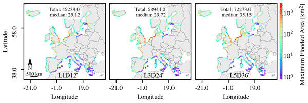
Assessing coastal hazards is crucial to mitigate flooding disasters. In this regard, coastal flood databases are valuable tools. This paper describes a new coastal flood map catalogue covering the entire European coastline, as well as the methodology to build it and its accuracy. The catalogue focuses on frequent extreme events and relies on synthetic scenarios estimated from local storm conditions. Flood-prone areas and regions sensitive to storm duration and water level peak were identified.
Renee van Dongen, Dirk Scherler, Dadiyorto Wendi, Eric Deal, Luca Mao, Norbert Marwan, and Claudio I. Meier
EGUsphere, https://doi.org/10.5194/egusphere-2022-1234, https://doi.org/10.5194/egusphere-2022-1234, 2022
Preprint archived
Short summary
Short summary
El Niño Southern Oscillation (ENSO) is a climatic phenomenon that causes abnormal climatic conditions in Chile. We investigated how ENSO affects catchment hydrology and found strong seasonal and spatial differences in the hydrological response to ENSO which was caused by different hydrological processes in catchments that are dominated by snowmelt-generated runoff or rainfall-generated runoff. These results are relevant for water resources management and ENSO mitigation in Chile.
Francesco Bucci, Michele Santangelo, Lorenzo Fongo, Massimiliano Alvioli, Mauro Cardinali, Laura Melelli, and Ivan Marchesini
Earth Syst. Sci. Data, 14, 4129–4151, https://doi.org/10.5194/essd-14-4129-2022, https://doi.org/10.5194/essd-14-4129-2022, 2022
Short summary
Short summary
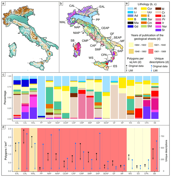
The paper describes a new lithological map of Italy at a scale of 1 : 100 000 obtained from classification of a digital database following compositional and geomechanical criteria. The map represents the national distribution of the lithological classes at high resolution. The outcomes of this study can be relevant for a wide range of applications, including statistical and physically based modelling of slope stability assessment and other geoenvironmental studies.

Txomin Bornaetxea, Ivan Marchesini, Sumit Kumar, Rabisankar Karmakar, and Alessandro Mondini
Nat. Hazards Earth Syst. Sci., 22, 2929–2941, https://doi.org/10.5194/nhess-22-2929-2022, https://doi.org/10.5194/nhess-22-2929-2022, 2022
Short summary
Short summary
One cannot know if there is a landslide or not in an area that one has not observed. This is an obvious statement, but when landslide inventories are obtained by field observation, this fact is seldom taken into account. Since fieldwork campaigns are often done following the roads, we present a methodology to estimate the visibility of the terrain from the roads, and we demonstrate that fieldwork-based inventories are underestimating landslide density in less visible areas.
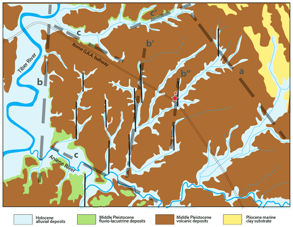
Fabrizio Marra, Alberto Frepoli, Dario Gioia, Marcello Schiattarella, Andrea Tertulliani, Monica Bini, Gaetano De Luca, and Marco Luppichini
Nat. Hazards Earth Syst. Sci., 22, 2445–2457, https://doi.org/10.5194/nhess-22-2445-2022, https://doi.org/10.5194/nhess-22-2445-2022, 2022
Short summary
Short summary
Through the analysis of the morphostructural setting in which the seismicity of Rome is framed, we explain why the city should not expect to suffer damage from a big earthquake.
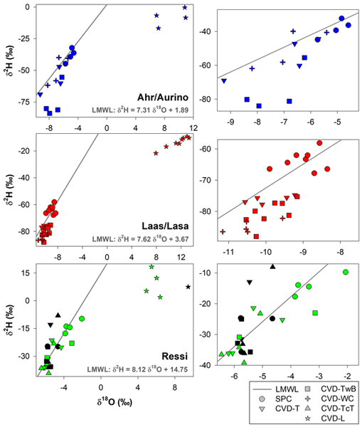
Giulia Zuecco, Anam Amin, Jay Frentress, Michael Engel, Chiara Marchina, Tommaso Anfodillo, Marco Borga, Vinicio Carraro, Francesca Scandellari, Massimo Tagliavini, Damiano Zanotelli, Francesco Comiti, and Daniele Penna
Hydrol. Earth Syst. Sci., 26, 3673–3689, https://doi.org/10.5194/hess-26-3673-2022, https://doi.org/10.5194/hess-26-3673-2022, 2022
Short summary
Short summary
We analyzed the variability in the isotopic composition of plant water extracted by two different methods, i.e., cryogenic vacuum distillation (CVD) and Scholander-type pressure chamber (SPC). Our results indicated that the isotopic composition of plant water extracted by CVD and SPC was significantly different. We concluded that plant water extraction by SPC is not an alternative for CVD as SPC mostly extracts the mobile plant water whereas CVD retrieves all water stored in the sampled tissue.

Christian Massari, Francesco Avanzi, Giulia Bruno, Simone Gabellani, Daniele Penna, and Stefania Camici
Hydrol. Earth Syst. Sci., 26, 1527–1543, https://doi.org/10.5194/hess-26-1527-2022, https://doi.org/10.5194/hess-26-1527-2022, 2022
Short summary
Short summary
Droughts are a creeping disaster, meaning that their onset, duration and recovery are challenging to monitor and forecast. Here, we provide further evidence of an additional challenge of droughts, i.e. the fact that the deficit in water supply during droughts is generally much more than expected based on the observed decline in precipitation. At a European scale we explain this with enhanced evapotranspiration, sustained by higher atmospheric demand for moisture during such dry periods.
Cited articles
Asselman, N. E. M.: The impact of climate change on suspended sediment transport in the river Rhine, in: Studies in Environmental Science, vol. 65, edited by: Zwerver, S., van Rompaey, R. S. A. R., Kok, M. T. J., and Berk, M. M., Elsevier, 937–942, https://doi.org/10.1016/S0166-1116(06)80119-6, 1995.
Bailo, D., Paciello, R., Michálek, J., Cocco, M., Freda, C., Jeffery, K., and Atakan, K.: The EPOS multi-disciplinary Data Portal for integrated access to solid Earth science datasets, Sci. Data, 10, https://doi.org/10.1038/s41597-023-02697-9, 2023.
Battista, G., Molnar, P., and Burlando, P.: Modelling impacts of spatially variable erosion drivers on suspended sediment dynamics, Earth Surf. Dynam., 8, 619–635, https://doi.org/10.5194/esurf-8-619-2020, 2020.
Billi, P. and Spalevic, V.: Suspended sediment yield in Italian rivers, Catena, 212, 106119, https://doi.org/10.1016/j.catena.2022.106119, 2022.
Bonfrisco, M., Coviello, V., Vignoli, G., Miyata, S., Piantini, M., Engel, M., Nadalet, R., Dinale, R., and Comiti, F.: Temporal variability of bedload vs suspended sediment load and respective hysteresis cycles in a glacier-fed Alpine river, J. Hydrol., 660, https://doi.org/10.1016/j.jhydrol.2025.133215, 2025.
Cho, G. and Crompvoets, J.: The INSPIRE directive: some observations on the legal framework and implementation, Surv. Rev., 51, 310–317, https://doi.org/10.1080/00396265.2018.1454686, 2019.
Cox, J., Huismans, Y., Knaake, S., Leuven, J., Vellinga, N., Vegt, M., Hoitink, A., and Kleinhans, M.: Anthropogenic Effects on the Contemporary Sediment Budget of the Lower Rhine‐Meuse Delta Channel Network, Earth's Future, 9, https://doi.org/10.1029/2020ef001869, 2021.
Do, H. X., Gudmundsson, L., Leonard, M., and Westra, S.: The Global Streamflow Indices and Metadata Archive (GSIM) – Part 1: The production of a daily streamflow archive and metadata, Earth Syst. Sci. Data, 10, 765–785, https://doi.org/10.5194/essd-10-765-2018, 2018.
Ellingsen, K., Yoccoz, N., Tveraa, T., Hewitt, J., and Thrush, S.: Long-term environmental monitoring for assessment of change: measurement inconsistencies over time and potential solutions, Environ. Monit. Assess., 189, 1–16, https://doi.org/10.1007/s10661-017-6317-4, 2017.
European Commission: Common Implementation Strategy For The Water Framework Directive (2000/60/EC) Integrated sediment management Guidelines and good practices in the context of the Water Framework Directive, https://environment.ec.europa.eu/system/files/2022-09/CISdocumentsedimentfinalTO_BE_PUBLISHED_1430554724.pdf (last access: 21 September 2026), 2022.
Färber, C., Plessow, H., Mischel, S. A., Kratzert, F., Addor, N., Shalev, G., and Looser, U.: GRDC-Caravan: extending Caravan with data from the Global Runoff Data Centre, Earth Syst. Sci. Data, 17, 4613–4625, https://doi.org/10.5194/essd-17-4613-2025, 2025.
Favaro, E. A. and Lamoureux, S. F.: Downstream patterns of suspended sediment transport in a High Arctic river influenced by permafrost disturbance and recent climate change, Geomorphology, 246, 359–369, https://doi.org/10.1016/j.geomorph.2015.06.038, 2015.
Fortesa, J., Ricci, G., García-Comendador, J., Gentile, F., Estrany, J., Sauquet, E., Datry, T., and De Girolamo, A.: Analysing hydrological and sediment transport regime in two Mediterranean intermittent rivers, Catena, 196, 104865, https://doi.org/10.1016/j.catena.2020.104865, 2021.
Francalanci, S., Paris, E., and Solari, L.: A combined field sampling-modeling approach for computing sediment transport during flash floods in a gravel-bed stream, Water Resour. Res., 49, 6642–6655, https://doi.org/10.1002/wrcr.20544, 2013.
Fratianni, S. and Acquaotta, F.: The Climate of Italy, in: Landscapes and Landforms of Italy, edited by: Soldati, M. and Marchetti, M., Springer International Publishing, Cham, 29–38, https://doi.org/10.1007/978-3-319-26194-2_4, 2017.
Fredi, P. and Lupia Palmieri, E.: Morphological Regions of Italy, in: Landscapes and Landforms of Italy, edited by: Soldati, M. and Marchetti, M., Springer International Publishing, Cham, 39–74, https://doi.org/10.1007/978-3-319-26194-2_5, 2017.
Fryirs, K.: (Dis)Connectivity in catchment sediment cascades: a fresh look at the sediment delivery problem, Earth Surf. Process. Landf., 38, 30–46, https://doi.org/10.1002/esp.3242, 2013.
Gurnell, A. M., Piegay, H., Swanson, F. J., and Gregory, S. V.: Large wood and fluvial processes, Freshw. Biol., 47, 601–619, https://doi.org/10.1046/j.1365-2427.2002.00916.x, 2002.
Hooke, J. M.: Human impacts on fluvial systems in the Mediterranean region, Geomorphology, 79, 311–335, https://doi.org/10.1016/j.geomorph.2006.06.036, 2006.
Jacob, D., Ehrenmann, F., David, R., Tran, J., Mirande-Ney, C., and Chaumeil, P.: An ecosystem for producing and sharing metadata within the web of FAIR Data, Gigascience, 14, https://doi.org/10.1093/gigascience/giae111, 2025.
Jadhav, H., Kandekar, A., and Das, S.: Climatic and Anthropogenic Influences on Long-Term Discharge and Sediment Load Changes in the Second-Largest Peninsular Indian Catchment, Water, https://doi.org/10.3390/w16243648, 2024.
Leatherman, S. P., Zhang, K., and Douglas, B. C.: Sea level rise shown to drive coastal erosion, Eos, Transactions American Geophysical Union, 81, 55–57, https://doi.org/10.1029/00EO00034, 2000.
Luppichini, M. and Bini, M.: 40-Year shoreline evolution in Italy: Critical challenges in river delta regions, Estuar. Coast. Shelf Sci., 315, 109166, https://doi.org/10.1016/j.ecss.2025.109166, 2025.
Luppichini, M., Lazzarotti, M., and Bini, M.: Climate change as main driver of centennial decline in river sediment transport across the Mediterranean region, J. Hydrol., 636, 131266, https://doi.org/10.1016/j.jhydrol.2024.131266, 2024.
Luppichini, M., Comiti, F., Andreoli, A., Aldighieri, B., Billi, P., Bollati, I. M., Brenna, A., Chirici, D., Ciavola, P., Cilli, S., Donnini, M., Francalanci, S., Innocenti, L., Longoni, L., Mao, L., Marchesini, I., Murgia, I., Pellegrini, G., Penna, D., Picco, L., Rainato, R., Schippa, L., Solari, L., Tronti, G., Testa, B., Verdone, M., and Bini, M.: Italian Fluvial Sediment Transport Database (version 1.0), Zenodo [data set], https://doi.org/10.5281/zenodo.18799025, 2026.
Naik, P. K. and Jay, D. A.: Distinguishing human and climate influences on the Columbia River: Changes in mean flow and sediment transport, J. Hydrol., 404, 259–277, https://doi.org/10.1016/j.jhydrol.2011.04.035, 2011.
Nejad, A. S., Alaiz-Rodríguez, R., McCarthy, G., Kelleher, B., Grey, A., and Parnell, A.: SERT: A transformer based model for multivariate temporal sensor data with missing values for environmental monitoring, Comput. Geosci., 188, 105601, https://doi.org/10.1016/j.cageo.2024.105601, 2024.
Parsons, M. A. and Fox, P. A.: Is Data Publication the Right Metaphor?, Data Sci. J., https://doi.org/10.2481/dsj.WDS-042, 2013.
Pellegrini, G., Mao, L., Rainato, R., and Picco, L.: Surprising suspended sediment dynamics of an alpine basin affected by a large infrequent disturbance, J. Hydrol., 617, 128933, https://doi.org/10.1016/j.jhydrol.2022.128933, 2023.
Rainato, R., Mao, L., García-Rama, A., Picco, L., Cesca, M., Vianello, A., Preciso, E., Scussel, G. R., and Lenzi, M. A.: Three decades of monitoring in the Rio Cordon instrumented basin: Sediment budget and temporal trend of sediment yield, Geomorphology, 291, 45–56, https://doi.org/10.1016/j.geomorph.2016.03.012, 2017.
Rainato, R., Pellegrini, G., Lenzi, M. A., and Picco, L.: Interaction between climatic conditions, water- and sediment-fluxes in an alpine basin: Long-term monthly and seasonal analysis, Geomorphology, 472, 109590, https://doi.org/10.1016/j.geomorph.2024.109590, 2025.
Rodríguez-Blanco, M. L., Arias, R., Taboada-Castro, M. M., Nunes, J. P., Keizer, J. J., and Taboada-Castro, M. T.: Potential impact of climate change on suspended sediment yield in NW Spain: A case study on the corbeira catchment, Water, 8, https://doi.org/10.3390/w8100444, 2016.
Strobl, C.: PostGIS, in: Encyclopedia of GIS, edited by: Shekhar, S. and Xiong, H., Springer US, Boston, MA, 891–898, https://doi.org/10.1007/978-0-387-35973-1_1012, 2008.
Surian, N. and Rinaldi, M.: Channel adjustments in response to human alteration of sediment fluxes: examples from Italian rivers, IAHS-Aish. P., 288, 276–282, 2004.
Syvitski, J. P. M., Vörösmarty, C. J., Kettner, A. J., and Green, P.: Impact of Humans on the Flux of Terrestrial Sediment to the Global Coastal Ocean, Science, 308, 376–380, https://doi.org/10.1126/science.1109454, 2005.
Thodsen, H., Hasholt, B., and Kjærsgaard, J. H.: The influence of climate change on suspended sediment transport in Danish rivers, Hydrol. Process., 22, 764–774, https://doi.org/10.1002/hyp.6652, 2008.
Vercruysse, K., Grabowski, R., and Rickson, R.: Suspended sediment transport dynamics in rivers: Multi-scale drivers of temporal variation, Earth Sci. Rev., 166, 38–52, https://doi.org/10.1016/j.earscirev.2016.12.016, 2017.
Vitolo, C., El-Khatib, Y., Reusser, D., Macleod, C., and Buytaert, W.: Web technologies for environmental Big Data, Environ. Model. Softw., 63, 185–198, https://doi.org/10.1016/j.envsoft.2014.10.007, 2015.
Walling, D. E.: Human impact on land–ocean sediment transfer by the world's rivers, Geomorphology, 79, 192–216, https://doi.org/10.1016/j.geomorph.2006.06.019, 2006.
Walling, D. E. and Fang, D.: Recent trends in the suspended sediment loads of the world's rivers, Glob. Planet. Change, 39, 111–126, https://doi.org/10.1016/S0921-8181(03)00020-1, 2003.
Wang, J., Haining, R., Zhang, T., Xu, C., Hu, M., Yin, Q., Li, L., Zhou, C., Li, G., and Chen, H.: Statistical Modeling of Spatially Stratified Heterogeneous Data, Ann. Am. Assoc. Geogr., 114, 499–519, https://doi.org/10.1080/24694452.2023.2289982, 2022.
Wei, D., Liu, S., Wu, Y., Feng, S., Gao, H., Qin, C., Ren, D., Tang, W., and Zhang, Y.: Impacts of human activities and climate change on water and sediment evolution in four large subtropical river basins in China, Ecol. Indic., https://doi.org/10.1016/j.ecolind.2023.110958, 2023.
Zarfl, C. and Dunn, F.: The delicate balance of river sediments, Science, 376, 1385–1386, https://doi.org/10.1126/science.abq6986, 2022.
Zhang, J., Wang, J., Zhao, N., Shi, J., and Wang, Y.: Analysis of Changes in Runoff and Sediment Load and Their Attribution in the Kuye River Basin of the Middle Yellow River Based on the Slope Change Ratio of Cumulative Quantity Method, Water, https://doi.org/10.3390/w16070944, 2024.
Zhang, K., Douglas, B. C., and Leatherman, S. P.: Global Warming And Coastal Erosion, https://link.springer.com/article/10.1023/B:CLIM.0000024690.32682.48 (last access: 21 September 2026), 2004.
Short summary
Rivers carry sediment that shapes landscapes and coasts, but in Italy these data are scattered and often incomplete. We created a national database and online platform to gather and organize past and present sediment measurements in one place. By linking data with clear information about where, when, and how they were collected, we made them easier to explore and compare over time.
Rivers carry sediment that shapes landscapes and coasts, but in Italy these data are scattered...


Altmetrics
Final-revised paper
Preprint