Articles | Volume 18, issue 9
https://doi.org/10.5194/essd-18-6995-2026
© Author(s) 2026. This work is distributed under
the Creative Commons Attribution 4.0 License.
the Creative Commons Attribution 4.0 License.
https://doi.org/10.5194/essd-18-6995-2026
© Author(s) 2026. This work is distributed under
the Creative Commons Attribution 4.0 License.
the Creative Commons Attribution 4.0 License.
Data description article
| 
23 Sep 2026
Data description article |
| 23 Sep 2026
| 23 Sep 2026
AGPC: an Annual 500 m Gridded Population (1990–2020) for China incorporating 3D building volume dynamics
Xiaocong Xu
Guangdong Key Laboratory for Urbanization and Geo-simulation, School of Geography and Planning, Sun Yat-sen University, Guangzhou, 510275, China
Southern Marine Science and Engineering Guangdong Laboratory (Zhuhai), Zhuhai, 519082, China
National Engineering Research Centre of South China Sea Marine Biotechnology, Zhuhai, 519082, China
Shiyu He
Guangdong Key Laboratory for Urbanization and Geo-simulation, School of Geography and Planning, Sun Yat-sen University, Guangzhou, 510275, China
Jinpei Ou
CORRESPONDING AUTHOR

Guangdong Key Laboratory for Urbanization and Geo-simulation, School of Geography and Planning, Sun Yat-sen University, Guangzhou, 510275, China
Yan Zhou
CORRESPONDING AUTHOR
Guangdong Key Laboratory for Urbanization and Geo-simulation, School of Geography and Planning, Sun Yat-sen University, Guangzhou, 510275, China
Xiaoping Liu
Guangdong Key Laboratory for Urbanization and Geo-simulation, School of Geography and Planning, Sun Yat-sen University, Guangzhou, 510275, China
Southern Marine Science and Engineering Guangdong Laboratory (Zhuhai), Zhuhai, 519082, China
Related authors
Yaotong Cai, Peng Zhu, Xing Li, Xiaoping Liu, Yuhe Chen, Qianhui Shen, Xiaocong Xu, Honghui Zhang, Sheng Nie, Cheng Wang, Jia Wang, Bingjie Li, Changjiang Wu, and Haoming Zhuang
Earth Syst. Sci. Data, 17, 6993–7018, https://doi.org/10.5194/essd-17-6993-2025, https://doi.org/10.5194/essd-17-6993-2025, 2025
Short summary
Short summary
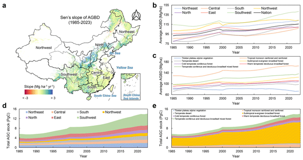
China’s forests play a crucial role in storing carbon and mitigating climate change, yet long-term high-resolution data on their biomass have been limited. We developed a 30 m annual forest aboveground biomass dataset from 1985 to 2023 using satellite data and deep learning. Our results reveal significant biomass gains, regional variations, and the impact of forest policies. This dataset provides valuable insights for climate research, conservation planning, and sustainable forest management.
Yangzi Che, Xuecao Li, Xiaoping Liu, Yuhao Wang, Weilin Liao, Xianwei Zheng, Xucai Zhang, Xiaocong Xu, Qian Shi, Jiajun Zhu, Honghui Zhang, Hua Yuan, and Yongjiu Dai
Earth Syst. Sci. Data, 16, 5357–5374, https://doi.org/10.5194/essd-16-5357-2024, https://doi.org/10.5194/essd-16-5357-2024, 2024
Short summary
Short summary
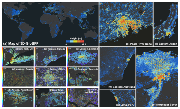
Most existing building height products are limited with respect to either spatial resolution or coverage, not to mention the spatial heterogeneity introduced by global building forms. Using Earth Observation (EO) datasets for 2020, we developed a global height dataset at the individual building scale. The dataset provides spatially explicit information on 3D building morphology, supporting both macro- and microanalysis of urban areas.
Bingjie Li, Xiaocong Xu, Xiaoping Liu, Qian Shi, Haoming Zhuang, Yaotong Cai, and Da He
Earth Syst. Sci. Data, 15, 2347–2373, https://doi.org/10.5194/essd-15-2347-2023, https://doi.org/10.5194/essd-15-2347-2023, 2023
Short summary
Short summary
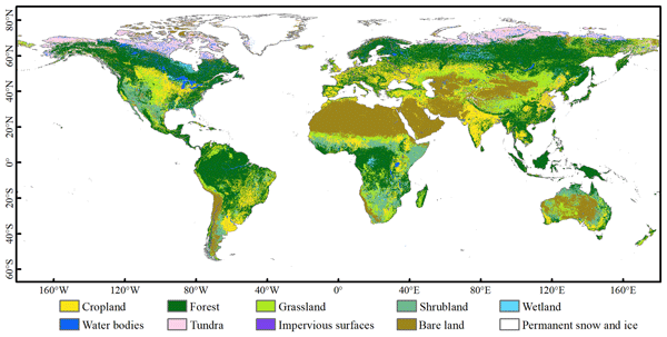
A global land cover map with fine spatial resolution is important for climate and environmental studies, food security, or biodiversity conservation. In this study, we developed an improved global land cover map in 2015 with 30 m resolution (GLC-2015) by fusing the existing land cover products based on the Dempster–Shafer theory of evidence on the Google Earth Engine platform. The GLC-2015 performed well, with an OA of 79.5 % (83.6 %) assessed with the global point-based (patch-based) samples.
Yaotong Cai, Baoni Li, Xiaoye Liu, Xin Jiang, Yakun Zhu, Shuxin Luo, Yingzuo Qin, Shudi Xie, Jianhuai Ye, Huizhong Shen, Zhilin Guo, Xiaoping Liu, and Zhenzhong Zeng
Earth Syst. Sci. Data Discuss., https://doi.org/10.5194/essd-2026-78, https://doi.org/10.5194/essd-2026-78, 2026
Preprint under review for ESSD
Short summary
Short summary
Persistent clouds and small farm sizes in Southeast Asia have historically hindered accurate mapping. We combined satellite imagery with advanced artificial intelligence to produce the first 10-meter annual cropland map for the region (2019–2024). Achieving over 92 % accuracy, our dataset reveals three to four times more farming on steep slopes than previously reported, providing a vital baseline for monitoring food security and deforestation risks.
Yaotong Cai, Peng Zhu, Xing Li, Xiaoping Liu, Yuhe Chen, Qianhui Shen, Xiaocong Xu, Honghui Zhang, Sheng Nie, Cheng Wang, Jia Wang, Bingjie Li, Changjiang Wu, and Haoming Zhuang
Earth Syst. Sci. Data, 17, 6993–7018, https://doi.org/10.5194/essd-17-6993-2025, https://doi.org/10.5194/essd-17-6993-2025, 2025
Short summary
Short summary
China’s forests play a crucial role in storing carbon and mitigating climate change, yet long-term high-resolution data on their biomass have been limited. We developed a 30 m annual forest aboveground biomass dataset from 1985 to 2023 using satellite data and deep learning. Our results reveal significant biomass gains, regional variations, and the impact of forest policies. This dataset provides valuable insights for climate research, conservation planning, and sustainable forest management.
Weilin Liao, Yanman Li, Xiaoping Liu, Yuhao Wang, Yangzi Che, Ledi Shao, Guangzhao Chen, Hua Yuan, Ning Zhang, and Fei Chen
Earth Syst. Sci. Data, 17, 2535–2551, https://doi.org/10.5194/essd-17-2535-2025, https://doi.org/10.5194/essd-17-2535-2025, 2025
Short summary
Short summary
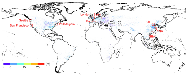
The currently available urban canopy parameter (UCP) datasets are limited to just a few cities for urban climate simulations by the Weather Research and Forecasting (WRF) model. To address this gap, we develop a global 1 km spatially continuous UCP dataset (GloUCP) which provides superior spatial coverage and higher accuracy in capturing urban morphology across diverse regions. It has great potential to support further advancements in urban climate modeling and related applications.
Yifan Cheng, Lei Zhao, TC Chakraborty, Keith Oleson, Matthias Demuzere, Xiaoping Liu, Yangzi Che, Weilin Liao, Yuyu Zhou, and Xinchang “Cathy” Li
Earth Syst. Sci. Data, 17, 2147–2174, https://doi.org/10.5194/essd-17-2147-2025, https://doi.org/10.5194/essd-17-2147-2025, 2025
Short summary
Short summary
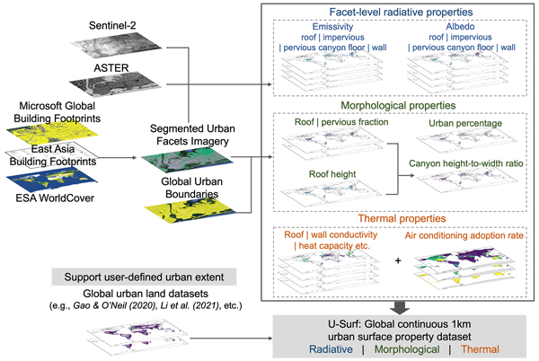
The absence of globally consistent and spatially continuous urban surface input has long hindered large-scale high-resolution urban climate modeling. Using remote sensing, cloud computing, and machine learning, we developed U-Surf, a 1 km dataset providing key urban surface properties worldwide. U-Surf enhances urban representation across scales and supports kilometer-scale urban-resolving Earth system modeling unprecedentedly, with broader applications in urban studies and beyond.
Yangzi Che, Xuecao Li, Xiaoping Liu, Yuhao Wang, Weilin Liao, Xianwei Zheng, Xucai Zhang, Xiaocong Xu, Qian Shi, Jiajun Zhu, Honghui Zhang, Hua Yuan, and Yongjiu Dai
Earth Syst. Sci. Data, 16, 5357–5374, https://doi.org/10.5194/essd-16-5357-2024, https://doi.org/10.5194/essd-16-5357-2024, 2024
Short summary
Short summary
Most existing building height products are limited with respect to either spatial resolution or coverage, not to mention the spatial heterogeneity introduced by global building forms. Using Earth Observation (EO) datasets for 2020, we developed a global height dataset at the individual building scale. The dataset provides spatially explicit information on 3D building morphology, supporting both macro- and microanalysis of urban areas.
Wanru He, Xuecao Li, Yuyu Zhou, Zitong Shi, Guojiang Yu, Tengyun Hu, Yixuan Wang, Jianxi Huang, Tiecheng Bai, Zhongchang Sun, Xiaoping Liu, and Peng Gong
Earth Syst. Sci. Data, 15, 3623–3639, https://doi.org/10.5194/essd-15-3623-2023, https://doi.org/10.5194/essd-15-3623-2023, 2023
Short summary
Short summary
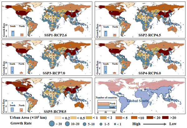
Most existing global urban products with future projections were developed in urban and non-urban categories, which ignores the gradual change of urban development at the local scale. Using annual global urban extent data from 1985 to 2015, we forecasted global urban fractional changes under eight scenarios throughout 2100. The developed dataset can provide spatially explicit information on urban fractions at 1 km resolution, which helps support various urban studies (e.g., urban heat island).
Bingjie Li, Xiaocong Xu, Xiaoping Liu, Qian Shi, Haoming Zhuang, Yaotong Cai, and Da He
Earth Syst. Sci. Data, 15, 2347–2373, https://doi.org/10.5194/essd-15-2347-2023, https://doi.org/10.5194/essd-15-2347-2023, 2023
Short summary
Short summary
A global land cover map with fine spatial resolution is important for climate and environmental studies, food security, or biodiversity conservation. In this study, we developed an improved global land cover map in 2015 with 30 m resolution (GLC-2015) by fusing the existing land cover products based on the Dempster–Shafer theory of evidence on the Google Earth Engine platform. The GLC-2015 performed well, with an OA of 79.5 % (83.6 %) assessed with the global point-based (patch-based) samples.
Qian Shi, Mengxi Liu, Andrea Marinoni, and Xiaoping Liu
Earth Syst. Sci. Data, 15, 555–577, https://doi.org/10.5194/essd-15-555-2023, https://doi.org/10.5194/essd-15-555-2023, 2023
Short summary
Short summary
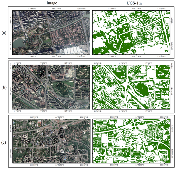
A large-scale and high-resolution urban green space (UGS) product with 1 m of 31 major cities in China (UGS-1m) is generated based on a deep learning framework to provide basic UGS information for relevant UGS research, such as distribution, area, and UGS rate. Moreover, an urban green space dataset (UGSet) with a total of 4454 samples of 512 × 512 in size are also supplied as the benchmark to support model training and algorithm comparison.
Y. Cai, Q. Shi, and X. Liu
Int. Arch. Photogramm. Remote Sens. Spatial Inf. Sci., XLVIII-3-W1-2022, 1–6, https://doi.org/10.5194/isprs-archives-XLVIII-3-W1-2022-1-2022, https://doi.org/10.5194/isprs-archives-XLVIII-3-W1-2022-1-2022, 2022
Cited articles
Bai, Z., Wang, J., Wang, M., Gao, M., and Sun, J.: Accuracy Assessment of Multi-Source Gridded Population Distribution Datasets in China, Sustainability, 10, 1363, https://doi.org/10.3390/su10051363, 2018.
Balk, D. L., Deichmann, U., Yetman, G., Pozzi, F., Hay, S. I., and Nelson, A.: Determining Global Population Distribution: Methods, Applications and Data, in: Advances in Parasitology, edited by: Hay, S. I., Graham, A., and Rogers, D. J., Academic Press, 119–156, https://doi.org/10.1016/S0065-308X(05)62004-0, 2006.
Bondarenko, M., Priyatikanto, R., Tejedor-Garavito, N., Zhang, W., McKeen, T., Cunningham, A., Woods, T., Hilton, J., Cihan, D., Nosatiuk, B., Brinkhoff, T., Tatem A., and A., S.: Constrained estimates of 2015-2030 total number of people per grid square at a resolution of 3 arc (approximately 100m at the equator) R2024B version v1, WorldPop - School of Geography and Environmental Science, University of Southampton [data set], https://hub.worldpop.org/doi/10.5258/SOTON/WP00803 (last access: 9 September 2026), 2025.
Breiman, L.: Random forests, Mach. Learn., 45, 5–32, https://doi.org/10.1023/A:1010933404324, 2001.
Chen, M., Xian, Y., Huang, Y., Zhang, X., Hu, M., Guo, S., Chen, L., and Liang, L.: Fine-scale population spatialization data of China in 2018 based on real location-based big data, Scientific Data, 9, 624, https://doi.org/10.1038/s41597-022-01740-5, 2022.
Chen, T. and Guestrin, C.: Xgboost: A scalable tree boosting system, Proceedings of the 22nd ACM SIGKDD International Conference on Knowledge Discovery and Data Mining, San Francisco, USA, 785–794, https://doi.org/10.1145/2939672.2939785, 2016.
Chen, Y., Zhang, R., Ge, Y., Jin, Y., and Xia, Z.: Downscaling census data for gridded population mapping with geographically weighted area-to-point regression kriging, IEEE Access, 7, 149132-+149141, https://doi.org/10.1109/ACCESS.2019.2945000, 2019.
Chen, Y., Li, X., Huang, K., Luo, M., and Gao, M.: High-Resolution Gridded Population Projections for China Under the Shared Socioeconomic Pathways, Earth's Future, 8, e2020EF001491, https://doi.org/10.1029/2020EF001491, 2020.
Chen, Y., Wu, G., Chen, Y., and Xia, Z.: Spatial Location Optimization of Fire Stations with Traffic Status and Urban Functional Areas, Appl. Spat. Anal. Polic., 16, 771–788, https://doi.org/10.1007/s12061-023-09502-5, 2023.
Chen, Y., Xu, C., Ge, Y., Zhang, X., and Zhou, Y.: A 100 m gridded population dataset of China's seventh census using ensemble learning and big geospatial data, Earth Syst. Sci. Data, 16, 3705–3718, https://doi.org/10.5194/essd-16-3705-2024, 2024.
Cheng, Z., Wang, J., and Ge, Y.: Mapping monthly population distribution and variation at 1-km resolution across China, Int. J. Geogr. Inf. Sci., 36, 1166–1184, https://doi.org/10.1080/13658816.2020.1854767, 2022.
CIESIN: Gridded Population of the World, Version 4 (GPWv4): Population Count Adjusted to Match 2015 Revision of UN WPP Country Totals, Revision 11 (Version 4.11), NASA Socioeconomic Data and Applications Center (SEDAC) [data set], https://doi.org/10.7927/H4PN93PB, 2018.
Dobson, J. E., Bright, E. A., Coleman, P. R., Durfee, R. C., and Worley, B. A.: LandScan: a global population database for estimating populations at risk, Photogramm. Eng. Rem. S., 66, 849–857, https://doi.org/10.1201/9781482264678-24, 2000.
Doocy, S., Gorokhovich, Y., Burnham, G., Balk, D., and Robinson, C.: Tsunami Mortality Estimates and Vulnerability Mapping in Aceh, Indonesia, Am. J. Public Health, 97, S146–S151, https://doi.org/10.2105/ajph.2006.095240, 2007.
Doxsey-Whitfield, E., MacManus, K., Adamo, S. B., Pistolesi, L., Squires, J., Borkovska, O., and Baptista, S. R.: Taking Advantage of the Improved Availability of Census Data: A First Look at the Gridded Population of the World, Version 4, Papers in Applied Geography, 1, 226–234, https://doi.org/10.1080/23754931.2015.1014272, 2015.
Feng, L., Yang, S., Zhou, Y., and Shuai, L.: Exploring the effects of the spatial arrangement and leaf area density of trees on building wall temperature, Build. Environ., 205, 108295, https://doi.org/10.1016/j.buildenv.2021.108295, 2021.
Halkia, S. and Carneiro Freire, S.: GHSL application in Europe: Towards new population grids, European Forum for Geography and Statistics 2014 Conference, Krakow, Poland, European Commission, Joint Research Centre (JRC), JRC90728, https://publications.jrc.ec.europa.eu/repository/handle/JRC90728 (last access: 9 September 2026), 2014.
Freire, S., Schiavina, M., Florczyk, A. J., MacManus, K., Pesaresi, M., Corbane, C., Borkovska, O., Mills, J., Pistolesi, L., and Squires, J.: Enhanced data and methods for improving open and free global population grids: putting 'leaving no one behind' into practice, Int. J. Digit. Earth, 13, 61-77, https://doi.org/10.1080/17538947.2018.1548656, 2020.
Goodchild, M. F. and Lam, N. S.-N.: Areal interpolation: A variant of the traditional spatial problem, Geo-Processing, 1, 297–312, 1980.
He, S.: AGPC population mapping code, version 1.0, Zenodo [code], https://doi.org/10.5281/zenodo.22671624, 2026.
Lei, Z., Zhou, S., Cheng, P., and Xie, Y.: Improved population mapping for china using the 3d building, nighttime light, points-of-interest, and land use/cover data within a multiscale geographically weighted regression model, ISPRS Int. J. Geo-Inf., 13, 335, https://doi.org/10.3390/ijgi13090335, 2024.
Leyk, S., Gaughan, A. E., Adamo, S. B., de Sherbinin, A., Balk, D., Freire, S., Rose, A., Stevens, F. R., Blankespoor, B., Frye, C., Comenetz, J., Sorichetta, A., MacManus, K., Pistolesi, L., Levy, M., Tatem, A. J., and Pesaresi, M.: The spatial allocation of population: a review of large-scale gridded population data products and their fitness for use, Earth Syst. Sci. Data, 11, 1385–1409, https://doi.org/10.5194/essd-11-1385-2019, 2019.
Li, B., Liu, X., and Xu, X.: Global 30 meter resolution annual land cover dataset AGLC (1985-2022), National Tibetan Plateau Data Center [data set], https://doi.org/10.11888/Terre.tpdc.302477, 2026a.
Li, B., Xu, X., Zhuang, H., Zhang, H., Che, Y., Zheng, Y., Cai, Y., Liu, X., and Li, X.: Annual global land cover mapping at 30 m resolution from 1985 to 2022 with high temporal consistency, Sci. Bull., 71, 2726–2730, https://doi.org/10.1016/j.scib.2026.01.027, 2026b.
Li, Z., Chen, B., Huang, Y., Wang, H., Wang, Y., Yuan, Y., Li, X., Chen, J. M., Xu, B., and Gong, P.: Enhanced mapping of essential urban land use categories in China (EULUC-China 2.0): integrating multimodal deep learning with multisource geospatial data, Sci. Bull., 70, 3029–3041, https://doi.org/10.1016/j.scib.2025.07.006, 2025.
Liu, X., Wu, X., Li, X., Xu, X., Liao, W., Jiao, L., Zeng, Z., Chen, G., and Li, X.: Global Mapping of Three-Dimensional (3D) Urban Structures Reveals Escalating Utilization in the Vertical Dimension and Pronounced Building Space Inequality, Engineering, 47, 86–99, https://doi.org/10.1016/j.eng.2024.01.025, 2025.
Liu, X., Huang, Y., Xu, X., Li, X., Li, X., Ciais, P., Lin, P., Gong, K., Ziegler, A. D., Chen, A., Gong, P., Chen, J., Hu, G., Chen, Y., Wang, S., Wu, Q., Huang, K., Estes, L., and Zeng, Z.: High-spatiotemporal-resolution mapping of global urban change from 1985 to 2015, Nature Sustainability, 3, 564–570, https://doi.org/10.1038/s41893-020-0521-x, 2020.
Lundberg, S. M. and Lee, S.-I.: A unified approach to interpreting model predictions, Advances in Neural Information Processing Systems 30, 4765–4774, ISBN 9781510860964, 2017.
MacManus, K., Balk, D., Engin, H., McGranahan, G., and Inman, R.: Estimating population and urban areas at risk of coastal hazards, 1990–2015: how data choices matter, Earth Syst. Sci. Data, 13, 5747–5801, https://doi.org/10.5194/essd-13-5747-2021, 2021.
McDonald, R. I., Green, P., Balk, D., Fekete, B. M., Revenga, C., Todd, M., and Montgomery, M.: Urban growth, climate change, and freshwater availability, P. Natl. Acad. Sci., 108, 6312–6317, https://doi.org/10.1073/pnas.1011615108, 2011.
Meddage, D. P. P., Ekanayake, I. U., Weerasuriya, A. U., Lewangamage, C. S., Tse, K. T., Miyanawala, T. P., and Ramanayaka, C. D. E.: Explainable Machine Learning (XML) to predict external wind pressure of a low-rise building in urban-like settings, J. Wind Eng. Ind. Aerod., 226, 105027, https://doi.org/10.1016/j.jweia.2022.105027, 2022.
Mennis, J.: Dasymetric Mapping for Estimating Population in Small Areas, Geography Compass, 3, 727–745, https://doi.org/10.1111/j.1749-8198.2009.00220.x, 2009.
Mosca, E., Szigeti, F., Tragianni, S., Gallagher, D., and Groh, G.: SHAP-based explanation methods: a review for NLP interpretability, in: Proceedings of the 29th International Conference on Computational Linguistics, Gyeongju, Republic of Korea, International Committee on Computational Linguistics, 4593–4603, https://aclanthology.org/2022.coling-1.406/ (last access: 9 September 2026), 2022.
NASA Jet Propulsion Laboratory (JPL): NASA Shuttle Radar Topography Mission Global 1 arc second, NASA Land Processes Distributed Active Archive Center [data set], https://doi.org/10.5067/MEaSUREs/SRTM/SRTMGL1.003, 2013.
Office of the Leading Group of the State Council for the Seventh National Population Census: Tabulation on 2020 China Population Census by County, China Statistics Press, Beijing, China, ISBN 978-7-5037-9772-9, 2022a.
Office of the Leading Group of the State Council for the Seventh National Population Census: Tabulation on 2020 China Population Census by Township, China Statistics Press, Beijing, China, ISBN 978-7-5037-9773-6, 2022b.
Parsa, A. B., Movahedi, A., Taghipour, H., Derrible, S., and Mohammadian, A. K.: Toward safer highways, application of XGBoost and SHAP for real-time accident detection and feature analysis, Accident Anal. Prev., 136, 105405, https://doi.org/10.1016/j.aap.2019.105405, 2020.
Pesaresi, M., Ehrlich, D., Florczyk, A. J., Freire, S., Julea, A., Kemper, T., and Syrris, V.: The global human settlement layer from landsat imagery, in: 2016 IEEE International Geoscience and Remote Sensing Symposium (IGARSS), Beijing, China, 10–15 July 2016, IEEE, 7276–7279, https://doi.org/10.1109/IGARSS.2016.7730897, 2016.
Population Census Office under the State Council and National Bureau of Statistics: Tabulation on the 2010 Population Census of the Peoples Republic of China by Township, China Statistics Press, Beijing, China, ISBN 978-7-5037-6660-2, 2012a.
Population Census Office under the State Council and National Bureau of Statistics: Tabulation on the 2010 population census of the people's republic of China by county, China Statistics Press, Beijing, China, ISBN 978-7-5037-6659-6, 2012b.
Salvatore, M., Pozzi, F., Ataman, E., Huddleston, B., and Bloise, M.: Mapping global urban and rural population distributions, Environment and Natural Resources Working Paper No. 24, Food and Agriculture Organization of the United Nations, Rome, ISSN 2226-6062, https://www.fao.org/4/a0310e/A0310E00.htm (last access: 9 September 2026), 2005.
Schroeder, J. P.: Target-Density Weighting Interpolation and Uncertainty Evaluation for Temporal Analysis of Census Data, Geogr. Anal., 39, 311–335, https://doi.org/10.1111/j.1538-4632.2007.00706.x, 2007.
Silverman, B. W.: Density estimation for statistics and data analysis, Routledge, England, UK, https://doi.org/10.1201/9781315140919, 2018.
Simarro, P., Cecchi, G., Franco, J., Paone, M., Fèvre, E., Diarra, A., Postigo, J., Mattioli, R., and Jannin, J.: Risk for Human African Trypanosomiasis, Central Africa, 2000–2009, Emerg. Infect. Dis., 17, 2322, https://doi.org/10.3201/eid1712.110921, 2011.
Song, Y., Tan, Y., Song, Y., Wu, P., Cheng, J. C. P., Kim, M. J., and Wang, X.: Spatial and temporal variations of spatial population accessibility to public hospitals: a case study of rural–urban comparison, GISci. Remote Sens., 55, 718–744, https://doi.org/10.1080/15481603.2018.1446713, 2018.
Sorichetta, A., Hornby, G. M., Stevens, F. R., Gaughan, A. E., Linard, C., and Tatem, A. J.: High-resolution gridded population datasets for Latin America and the Caribbean in 2010, 2015, and 2020, Scientific Data, 2, 1–12, https://doi.org/10.1038/sdata.2015.45, 2015.
Tatem, A. J.: Mapping the denominator: spatial demography in the measurement of progress, Int. Health, 6, 153–155, 2014.
Tatem, A. J.: WorldPop, open data for spatial demography, Scientific Data, 4, 170004, https://doi.org/10.1038/sdata.2017.4, 2017.
Tu, M., Ji, Q., and Sun, Y.: Enhancing the accuracy of urban population spatialization at 100-m grid scale through differentiating residential and non-residential buildings, Frontiers in Earth Science, 14, 1748599, https://doi.org/10.3389/feart.2026.1748599, 2026.
Tu, W., Liu, Z., Du, Y., Yi, J., Liang, F., Wang, N., Qian, J., Huang, S., and Wang, H.: An ensemble method to generate high-resolution gridded population data for China from digital footprint and ancillary geospatial data, Int. J. Appl. Earth Obs., 107, 102709, https://doi.org/10.1016/j.jag.2022.102709, 2022.
United Nations: Principles and recommendations for population and housing censuses, United Nations, New York, USA, ISBN 978-92-1-161185-4, 1980.
Vapnik, V. N.: The support vector method, in: Artificial Neural Networks – ICANN'97, edited by: Gerstner, W., Germond, A., Hasler, M., and Nicoud, J.-D., Lecture Notes in Computer Science, Springer, Berlin, Heidelberg, Germany, 1327, 261–271, https://doi.org/10.1007/BFb0020166, 1997.
Wang, J., Obradovich, N., and Zheng, S.: A 43-Million-Person Investigation into Weather and Expressed Sentiment in a Changing Climate, One Earth, 2, 568–577, https://doi.org/10.1016/j.oneear.2020.05.016, 2020.
Wu, X., Xu, X., Li, X., Feng, L., Chen, B., Li, G., Zeng, Z., Venevski, S., Fensholt, R., Penuelas, J., Wigneron, J.-P., Huang, K., Li, X., Yu, G., Ciais, P., Yan, Y., Wu, B., and Liu, X.: Increasing urban volume amid declining per capita space in global 3D urbanization, Natl. Sci. Rev., in review, 2026.
Xu, X., He, S., Ou, J., Zhou, Y., and Liu, X.: AGPC: An Annual 500 m Gridded Population (1990–2020) for China Incorporating 3D Building Volume Dynamics, figshare [data set], https://doi.org/10.6084/m9.figshare.31338352, 2026.
Yan, Z., Ma, L., Wang, X., Kim, Y., and Zhang, L.: High-precision population estimates by remote sensing big data and advanced transformer deep learning model, Remote Sensing Applications: Society and Environment, 39, 101638, https://doi.org/10.1016/j.rsase.2025.101638, 2025.
Ye, T., Zhao, N., Yang, X., Ouyang, Z., Liu, X., Chen, Q., Hu, K., Yue, W., Qi, J., Li, Z., and Jia, P.: Improved population mapping for China using remotely sensed and points-of-interest data within a random forests model, Sci. Total Environ., 658, 936–946, https://doi.org/10.1016/j.scitotenv.2018.12.276, 2019.
Zandbergen, P. A. and Ignizio, D. A.: Comparison of Dasymetric Mapping Techniques for Small-Area Population Estimates, Cartogr. Geogr. Inf. Sc., 37, 199–214, https://doi.org/10.1559/152304010792194985, 2010.
Zhao, S., Liu, Y., Zhang, R., and Fu, B.: China's population spatialization based on three machine learning models, J. Clean. Prod., 256, 120644, https://doi.org/10.1016/j.jclepro.2020.120644, 2020.
Short summary
We developed annual population maps for mainland China from 1990 to 2020 at 500-metre detail. A key advance is the use of changing three-dimensional building volume, allowing the maps to distinguish densely populated areas with extensive high-rise development that conventional maps based mainly on two-dimensional built-up land may overlook. Combined with census and other data, the maps show high accuracy and can support studies of urban growth, environmental change, and disaster risk.
We developed annual population maps for mainland China from 1990 to 2020 at 500-metre detail. A...


Altmetrics
Final-revised paper
Preprint