Articles | Volume 18, issue 9
https://doi.org/10.5194/essd-18-6545-2026
© Author(s) 2026. This work is distributed under
the Creative Commons Attribution 4.0 License.
https://doi.org/10.5194/essd-18-6545-2026
© Author(s) 2026. This work is distributed under
the Creative Commons Attribution 4.0 License.
Building a dataset of offshore oil and gas extraction platforms from satellite data (2017–2023)

Lulu Si
CORRESPONDING AUTHOR
Research Institute of Water and Environmental Engineering (IIAMA), Universitat Politècnica de València (UPV), 46022 Valencia, Spain
Shanyu Zhou
Research Institute of Water and Environmental Engineering (IIAMA), Universitat Politècnica de València (UPV), 46022 Valencia, Spain
Itziar Irakulis-Loitxate
Research Institute of Water and Environmental Engineering (IIAMA), Universitat Politècnica de València (UPV), 46022 Valencia, Spain
International Methane Emission Observatory (IMEO), United Nations Environment Programme, 75015 Paris, France
Javier Roger
Research Institute of Water and Environmental Engineering (IIAMA), Universitat Politècnica de València (UPV), 46022 Valencia, Spain
Luis Guanter
Research Institute of Water and Environmental Engineering (IIAMA), Universitat Politècnica de València (UPV), 46022 Valencia, Spain
Environmental Defense Fund, Reguliersgracht 79, 1017 LN Amsterdam, the Netherlands
Related authors
No articles found.
Daniel A. Potts, Harjinder Sembhi, Matthieu Dogniaux, Joannes D. Maasakkers, Berend J. Schuit, Dirk Schuettemeyer, Timon Hummel, Rocio Barrio Guillo, Oliver Schneising, Luis Guanter, and Ilse Aben
EGUsphere, https://doi.org/10.5194/egusphere-2026-3797, https://doi.org/10.5194/egusphere-2026-3797, 2026
This preprint is open for discussion and under review for Atmospheric Chemistry and Physics (ACP).
Short summary
Short summary
Routine monitoring of industrial emissions is vital to understand the location, frequency, and intensity of methane emissions. We used satellite and aircraft measurements to understand methane emissions from Madrid across various scales and sectors. Using a range of methods, we identify a clear gap between top-down and bottom-up approaches, discuss challenges associated with satellite interpretation, connect emissions to on-site practices, and make recommendations towards operational use.
Javier Gorroño, Zhipeng Pei, Adriana Valverde, and Luis Guanter
Atmos. Meas. Tech., 19, 1245–1257, https://doi.org/10.5194/amt-19-1245-2026, https://doi.org/10.5194/amt-19-1245-2026, 2026
Short summary
Short summary
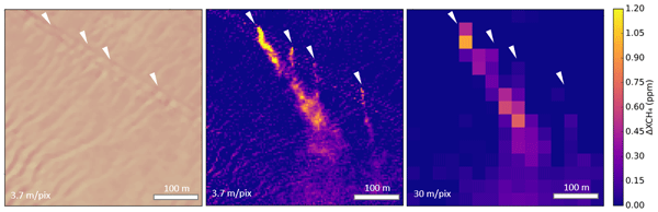
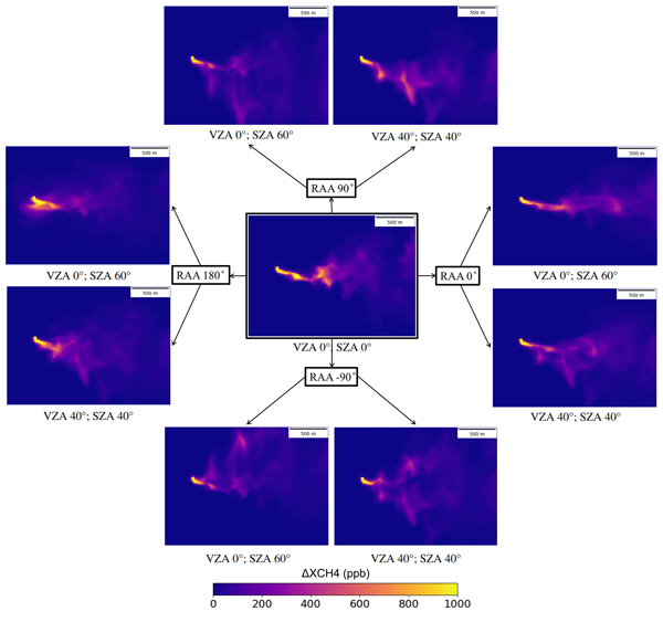
Methane plumes can be detected with several instruments from space at a high spatial resolution nowadays. We see a ground projection of these methane plumes from the satellites that, similarly to clouds or buildings, are distorted depending on the observation and illumination angle. Here we highlight this issue and propose a methodology to account for it using simulations that could enhance current and upcoming retrieval and quantification algorithms.
Javier Roger, Luis Guanter, and Javier Gorroño
Atmos. Meas. Tech., 18, 5545–5567, https://doi.org/10.5194/amt-18-5545-2025, https://doi.org/10.5194/amt-18-5545-2025, 2025
Short summary
Short summary
Detection of methane point source emissions with satellite-based imaging spectrometers is assessed in offshore areas. After integrating simulations into data from 2 different satellite missions, we extract the probability of detection. We compare our results with real plumes, which shows the consistency of the models. Detection and monitoring efforts can be optimized by filtering data based on these results, reducing unnecessary searches and increasing the action taken on these emissions.
Anna Vaughan, Gonzalo Mateo-García, Luis Gómez-Chova, Vít Růžička, Luis Guanter, and Itziar Irakulis-Loitxate
Atmos. Meas. Tech., 17, 2583–2593, https://doi.org/10.5194/amt-17-2583-2024, https://doi.org/10.5194/amt-17-2583-2024, 2024
Short summary
Short summary
Methane is a potent greenhouse gas that has been responsible for around 25 % of global warming since the industrial revolution. Consequently identifying and mitigating methane emissions comprise an important step in combating the climate crisis. We develop a new deep learning model to automatically detect methane plumes from satellite images and demonstrate that this can be applied to monitor large methane emissions resulting from the oil and gas industry.
Russell Doughty, Yujie Wang, Jennifer Johnson, Nicholas Parazoo, Troy Magney, Zoe Pierrat, Xiangming Xiao, Luis Guanter, Philipp Köhler, Christian Frankenberg, Peter Somkuti, Shuang Ma, Yuanwei Qin, Sean Crowell, and Berrien Moore III
EGUsphere, https://doi.org/10.22541/essoar.168167172.20799710/v1, https://doi.org/10.22541/essoar.168167172.20799710/v1, 2024
Preprint archived
Short summary
Short summary
Here we present a novel model of global photosynthesis, ChloFluo, which uses spaceborne chlorophyll fluorescence to estimate the amount of photosynthetically active radiation absorbed by chlorophyll. Potential uses of our model are to advance our understanding of the timing and magnitude of photosynthesis, its effect on atmospheric carbon dioxide fluxes, and vegetation response to climate events and change.
Javier Roger, Luis Guanter, Javier Gorroño, and Itziar Irakulis-Loitxate
Atmos. Meas. Tech., 17, 1333–1346, https://doi.org/10.5194/amt-17-1333-2024, https://doi.org/10.5194/amt-17-1333-2024, 2024
Short summary
Short summary
Methane emissions can be identified using remote sensing, but surface-related structures disturb detection. In this work, a variation of the matched filter method that exploits a large fraction of the near-infrared range (1000–2500 nm) is applied. In comparison to the raw matched filter, it reduces background noise and strongly attenuates the surface-related artifacts, which leads to a greater detection capability. We propose this variation as a standard methodology for methane detection.
Berend J. Schuit, Joannes D. Maasakkers, Pieter Bijl, Gourav Mahapatra, Anne-Wil van den Berg, Sudhanshu Pandey, Alba Lorente, Tobias Borsdorff, Sander Houweling, Daniel J. Varon, Jason McKeever, Dylan Jervis, Marianne Girard, Itziar Irakulis-Loitxate, Javier Gorroño, Luis Guanter, Daniel H. Cusworth, and Ilse Aben
Atmos. Chem. Phys., 23, 9071–9098, https://doi.org/10.5194/acp-23-9071-2023, https://doi.org/10.5194/acp-23-9071-2023, 2023
Short summary
Short summary
Using two machine learning models, which were trained on TROPOMI methane satellite data, we detect 2974 methane plumes, so-called super-emitters, in 2021. We detect methane emissions globally related to urban areas or landfills, coal mining, and oil and gas production. Using our monitoring system, we identify 94 regions with frequent emissions. For 12 locations, we target high-resolution satellite instruments to enlarge and identify the exact infrastructure responsible for the emissions.
Javier Gorroño, Daniel J. Varon, Itziar Irakulis-Loitxate, and Luis Guanter
Atmos. Meas. Tech., 16, 89–107, https://doi.org/10.5194/amt-16-89-2023, https://doi.org/10.5194/amt-16-89-2023, 2023
Short summary
Short summary
We present a methane flux rate retrieval methodology using the Sentinel-2 mission, validating the algorithm for different scenes and plumes. The detection limit is 1000–2000 kg h−1 for homogeneous scenes and temporally invariant surfaces and above 5000 kg h−1 for heterogeneous ones. Dominant quantification errors are wind-related or plume mask-related. For heterogeneous scenes, the surface structure underlying the methane plume can become a dominant source of uncertainty.
Daniel J. Jacob, Daniel J. Varon, Daniel H. Cusworth, Philip E. Dennison, Christian Frankenberg, Ritesh Gautam, Luis Guanter, John Kelley, Jason McKeever, Lesley E. Ott, Benjamin Poulter, Zhen Qu, Andrew K. Thorpe, John R. Worden, and Riley M. Duren
Atmos. Chem. Phys., 22, 9617–9646, https://doi.org/10.5194/acp-22-9617-2022, https://doi.org/10.5194/acp-22-9617-2022, 2022
Short summary
Short summary
We review the capability of satellite observations of atmospheric methane to quantify methane emissions on all scales. We cover retrieval methods, precision requirements, inverse methods for inferring emissions, source detection thresholds, and observations of system completeness. We show that current instruments already enable quantification of regional and national emissions including contributions from large point sources. Coverage and resolution will increase significantly in coming years.
Elena Sánchez-García, Javier Gorroño, Itziar Irakulis-Loitxate, Daniel J. Varon, and Luis Guanter
Atmos. Meas. Tech., 15, 1657–1674, https://doi.org/10.5194/amt-15-1657-2022, https://doi.org/10.5194/amt-15-1657-2022, 2022
Short summary
Short summary
This study seeks to present the as-yet-unknown potential use of WorldView-3 for the mapping of methane point source emissions. The proposed retrieval methodology is based on the idea that the spectral channels not affected by methane can be used to predict the methane-affected band through regression analysis. The results show the precise location of 26 independent point emissions over different methane hotspot regions worldwide, which prove the game-changing potential that this mission entails.
Luis Guanter, Cédric Bacour, Andreas Schneider, Ilse Aben, Tim A. van Kempen, Fabienne Maignan, Christian Retscher, Philipp Köhler, Christian Frankenberg, Joanna Joiner, and Yongguang Zhang
Earth Syst. Sci. Data, 13, 5423–5440, https://doi.org/10.5194/essd-13-5423-2021, https://doi.org/10.5194/essd-13-5423-2021, 2021
Short summary
Short summary
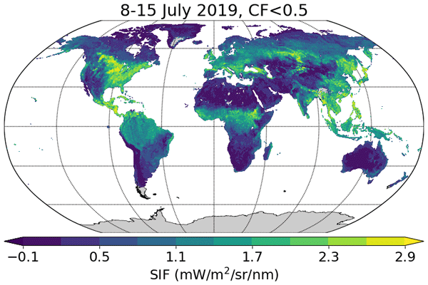
Sun-induced chlorophyll fluorescence (SIF) is an electromagnetic signal emitted by plants in the red and far-red parts of the spectrum. It has a functional link to photosynthesis and can be measured by satellite instruments, which makes it an important variable for the remote monitoring of the photosynthetic activity of vegetation ecosystems around the world. In this contribution we present a SIF dataset derived from the new Sentinel-5P TROPOMI missions.
Cited articles
Alvarez, R. A., Zavala-Araiza, D., Lyon, D. R., Allen, D. T., Barkley, Z. R., Brandt, A. R., Davis, K. J., Herndon, S. C., Jacob, D. J., Karion, A., Kort, E. A., Lamb, B. K., Lauvaux, T., Maasakkers, J. D., Marchese, A. J., Omara, M., Pacala, S. W., Peischl, J., Robinson, A. L., Shepson, P. B., Sweeney, C., Townsend-Small, A., Wofsy, S. C., and Hamburg, S. P.: Assessment of methane emissions from the U.S. oil and gas supply chain, Science, 361, 186–188, https://doi.org/10.1126/science.aar7204, 2018. a
Anifowose, B., Lawler, D. M., van der Horst, D., and Chapman, L.: A systematic quality assessment of Environmental Impact Statements in the oil and gas industry, Sci. Total Environ., 572, 570–585, https://doi.org/10.1016/j.scitotenv.2016.07.083, 2016. a
Bernstein, B. B.: Evaluating alternatives for decommissioning California's offshore oil and gas platforms, Integr. Environ. Assess. Manag., 11, 537–541, https://doi.org/10.1002/ieam.1657, 2015. a
Cantle, P. and Bernstein, B.: Air emissions associated with decommissioning California's offshore oil and gas platforms, Integr. Environ. Assess. Manag., 11, 564–571, https://doi.org/10.1002/ieam.1653, 2015. a
Casadio, S., Arino, O., and Minchella, A.: Use of ATSR and SAR measurements for the monitoring and characterisation of night-time gas flaring from off-shore platforms: the North Sea test case, Remote Sens. Environ., 123, 175–186, https://doi.org/10.1016/j.rse.2012.03.021, 2012. a, b
Charfeddine, L. and Barkat, K.: Short- and long-run asymmetric effect of oil prices and oil and gas revenues on the real GDP and economic diversification in oil-dependent economy, Energy Econ., 86, 104680, https://doi.org/10.1016/j.eneco.2020.104680, 2020. a
Chen, S., Wang, H., Xu, F., and Jin, Y.: Target classification using the deep convolutional networks for SAR images, IEEE T. Geosci. Remote, 54, 4806–4817, https://doi.org/10.1109/TGRS.2016.2551720, 2016. a
Chen, X., Wang, Z., Li, C., Gao, F., and Wei, Q.: Characteristics of global offshore oil and gas development, in: Proceedings of the International Field Exploration and Development Conference (IFEDC) 2023, Springer Series in Geomechanics and Geoengineering, Springer Nature Singapore, Wuhan, China, https://doi.org/10.1007/978-981-97-0475-0_87, 1026–1053, 2024. a
Ekins, P., Vanner, R., and Firebrace, J.: Zero emissions of oil in water from offshore oil and gas installations: economic and environmental implications, J. Clean. Prod., 15, 1302–1315, https://doi.org/10.1016/j.jclepro.2006.07.014, 2007. a
Elvidge, C. D., Zhizhin, M., Baugh, K., Hsu, F.-C., and Ghosh, T.: Methods for global survey of natural gas flaring from visible infrared imaging radiometer suite data, Energies, 9, 14, https://doi.org/10.3390/en9010014, 2016. a, b, c
Falqueto, L. E., Sá, J. A. S., Paes, R. L., and Passaro, A.: Oil rig recognition using convolutional neural network on Sentinel-1 SAR images, IEEE Geosci. Remote S., 16, 1329–1333, https://doi.org/10.1109/LGRS.2019.2894845, 2019. a, b
Faruolo, M., Genzano, N., Marchese, F., and Pergola, N.: Multi-temporal satellite investigation of gas flaring in Iraq and Iran: the DAFI porting on Collection 2 Landsat 8/9 and Sentinel 2A/B, Sensors, 23, 5734, https://doi.org/10.3390/s23125734, 2023. a
Hamed, K. H.: Trend detection in hydrologic data: the Mann–Kendall trend test under the scaling hypothesis, J. Hydrol., 349, 350–363, https://doi.org/10.1016/j.jhydrol.2007.11.009, 2008. a
Henrion, M., Bernstein, B., and Swamy, S.: A multi-attribute decision analysis for decommissioning offshore oil and gas platforms, Integr. Environ. Assess. Manag., 11, 594–609, https://doi.org/10.1002/ieam.1693, 2015. a
Hoeser, T., Feuerstein, S., and Kuenzer, C.: DeepOWT: a global offshore wind turbine data set derived with deep learning from Sentinel-1 data, Earth Syst. Sci. Data, 14, 4251–4270, https://doi.org/10.5194/essd-14-4251-2022, 2022. a
Hunt, J. D., Nascimento, A., Nascimento, N., Vieira, L. W., and Romero, O. J.: Possible pathways for oil and gas companies in a sustainable future: from the perspective of a hydrogen economy, Renew. Sustain. Energy Rev., 160, 112291, https://doi.org/10.1016/j.rser.2022.112291, 2022. a
IEA: World Energy Outlook 2024, https://www.iea.org/reports/world-energy-outlook-2024 (last access: 28 June 2026), 2024. a
IPCC: Summary for policymakers, in: Global warming of 1.5 °C: An IPCC special report on the impacts of global warming of 1.5 °C above pre-industrial levels and related global greenhouse gas emission pathways, in the context of strengthening the global response to the threat of climate change, sustainable development, and efforts to eradicate poverty, World Meteorological Organization, Geneva, Switzerland, https://doi.org/10.1017/9781009157940, 1–32, 2018. a
IPCC: Climate change 2022: Impacts, adaptation and vulnerability. Working Group II contribution to the Sixth Assessment Report of the Intergovernmental Panel on Climate Change, Cambridge University Press, Cambridge, UK and New York, NY, USA, https://doi.org/10.1017/9781009325844, 2022. a
Irakulis-Loitxate, I., Gorroño, J., Zavala-Araiza, D., and Guanter, L.: Satellites detect a methane ultra-emission event from an offshore platform in the Gulf of Mexico, Environ. Sci. Tech. Let., 9, 520–525, https://doi.org/10.1021/acs.estlett.2c00225, 2022. a
Jackson, R. B., Irvin, J. A., Ramachandran, N., Wang, C., Ouyang, Z., Tulloch, P. A., Liu, F. Y., and Ng, A. Y.: MEthane Tracking Emissions Reference (METER): A global database of methane-emitting infrastructure, Earth Syst. Sci. Data Discuss. [preprint], https://doi.org/10.5194/essd-2026-124, in review, 2026. a
Kaiser, M. J.: Offshore oil and gas records circa 2020, Sh. Offshore Struct., 17, 205–241, https://doi.org/10.1080/17445302.2020.1827633, 2022. a
Kendall, M. G.: Rank correlation methods, Econ. J., 59, 575–577, https://doi.org/10.2307/2226580, 1949. a
Lee, J.: The regional economic impact of oil and gas extraction in Texas, Energ. Policy, 87, 60–71, https://doi.org/10.1016/j.enpol.2015.08.032, 2015. a
Liu, Y., Sun, C., Yang, Y., Zhou, M., Zhan, W., and Cheng, W.: Automatic extraction of offshore platforms using time-series Landsat-8 Operational Land Imager data, Remote Sens. Environ., 175, 73–91, https://doi.org/10.1016/j.rse.2015.12.047, 2016. a
Liu, Y., Pu, Y., Hu, X., Dong, Y., Wu, W., Hu, C., Zhang, Y., and Wang, S.: Global declines of offshore gas flaring inadequate to meet the 2030 goal, Nat. Sustain., 6, 1095–1102, https://doi.org/10.1038/s41893-023-01125-5, 2023. a
Ma, R., Wu, W., Wang, Q., Liu, N., and Chang, Y.: Offshore hydrocarbon exploitation target extraction based on time-series night light remote sensing images and machine learning models: a comparison of six machine learning algorithms and their multi-feature importance, Remote Sens.-Basel, 15, 1843, https://doi.org/10.3390/rs15071843, 2023. a
Mann, H. B.: Nonparametric tests against trend, Econometrica, 13, 245–259, https://doi.org/10.2307/1907187, 1945. a
Martins, M. C. I., Carter, M. I., Rouse, S., and Russell, D. J.: Offshore energy structures in the North Sea: past, present and future, Mar. Policy, 152, 105629, https://doi.org/10.1016/j.marpol.2023.105629, 2023. a
Nguyen, T.-V., Tock, L., Breuhaus, P., Maréchal, F., and Elmegaard, B.: CO2-mitigation options for the offshore oil and gas sector, Appl. Energ., 161, 673–694, https://doi.org/10.1016/j.apenergy.2015.09.088, 2016. a
Omara, M., Gautam, R., O'Brien, M. A., Himmelberger, A., Franco, A., Meisenhelder, K., Hauser, G., Lyon, D. R., Chulakadabba, A., Miller, C. C., Franklin, J., Wofsy, S. C., and Hamburg, S. P.: Developing a spatially explicit global oil and gas infrastructure database for characterizing methane emission sources at high resolution, Earth Syst. Sci. Data, 15, 3761–3790, https://doi.org/10.5194/essd-15-3761-2023, 2023. a, b
Pei, J., Huang, Y., Huo, W., Zhang, Y., Yang, J., and Yeo, T.-S.: SAR automatic target recognition based on multiview deep learning framework, IEEE T. Geosci. Remote, 56, 2196–2210, https://doi.org/10.1109/TGRS.2017.2776357, 2018. a
Peng, C., Wang, J., and Li, D.: Oil platform investigation by multi-temporal SAR remote sensing image, in: SAR Image Analysis, Modeling, and Techniques XI, Vol. 8179, SPIE, Prague, Czech Republic, https://doi.org/10.1117/12.897937, 81790V, 2011. a
Ronconi, R. A., Allard, K. A., and Taylor, P. D.: Bird interactions with offshore oil and gas platforms: review of impacts and monitoring techniques, J. Environ. Manage., 147, 34–45, https://doi.org/10.1016/j.jenvman.2014.07.031, 2015. a
Si, L., Zhou, S., Irakulis-Loitxate, I., Roger, J., and Guanter, L.: The Offshore Oil and Gas Platforms (OOGPs) dataset based on satellite data spanning 2017 to 2023, Zenodo [data set], https://doi.org/10.5281/zenodo.18350974, 2026. a, b
Spanier, R. and Kuenzer, C.: Marine infrastructure detection with satellite data: a review, Remote Sens.-Basel, 16, 1675, https://doi.org/10.3390/rs16101675, 2024. a
Spanier, R., Hoeser, T., and Kuenzer, C.: Deep learning-based object detection of offshore platforms on Sentinel-1 imagery and the impact of synthetic training data, Int. J. Remote Sens.-Basel, 47, 2120–2144, https://doi.org/10.1080/01431161.2026.2612908, 2026. a, b
Tan, Y., Li, H. X., Cheng, J. C. P., Wang, J., Jiang, B., Song, Y., and Wang, X.: Cost and environmental impact estimation methodology and potential impact factors in offshore oil and gas platform decommissioning: a review, Environ. Impact Assess. Rev., 87, 106536, https://doi.org/10.1016/j.eiar.2020.106536, 2021. a
Wang, J., Liu, Y., Li, M., Yang, K., and Cheng, L.: Drilling platform detection based on ENVISAT ASAR remote sensing data: a case of southeastern Vietnam offshore area, Geogr. Res., 32, 2143–2152, https://doi.org/10.11821/dlyj201311015, 2013. a
Wang, Z., Li, S., Jin, Z., Li, Z., Liu, Q., and Zhang, K.: Oil and gas pathway to net-zero: review and outlook, Energy Strateg. Rev., 45, 101048, https://doi.org/10.1016/j.esr.2022.101048, 2023. a
Wong, B. A., Thomas, C., and Halpin, P.: Automating offshore infrastructure extractions using synthetic aperture radar & Google Earth Engine, Remote Sens. Environ., 233, 111412, https://doi.org/10.1016/j.rse.2019.111412, 2019. a
Zhang, N., Zhao, H., Jing, P., Gao, Y., Liu, S., Shen, J., Huang, S., Zeng, Q., Liu, Y., and Huang, M.: Deep learning-based intelligent monitoring of petroleum infrastructure using high-resolution remote sensing imagery, Processes, 14, 28, https://doi.org/10.3390/pr14010028, 2025. a
Zhang, T., Tian, B., Sengupta, D., Zhang, L., and Si, Y.: Global offshore wind turbine dataset, Sci. Data, 8, 191, https://doi.org/10.1038/s41597-021-00982-z, 2021. a
Zhang, Z., Yang, J., and Du, Y.: Deep convolutional generative adversarial network with autoencoder for semisupervised SAR image classification, IEEE Geosci. Remote S., 19, 1–5, https://doi.org/10.1109/LGRS.2020.3018186, 2022. a
Zhao, S., Sun, C., Wang, H., and Cheng, W.: Extraction and monitoring of offshore oil and gas platforms based on Landsat imagery, Trop. Geogr., 37, 112–119, https://doi.org/10.13284/j.cnki.rddl.002921, 2017. a
Zhu, H., Jia, G., Zhang, Q., Zhang, S., Lin, X., and Shuai, Y.: Detecting offshore drilling rigs with multitemporal NDWI: a case study in the Caspian Sea, Remote Sens.-Basel, 13, 1576, https://doi.org/10.3390/rs13081576, 2021. a, b
Short summary
We constructed a dataset of offshore oil and gas platforms to improve knowledge of human activities at sea and their environmental impacts. Using satellite images from the Sentinel-1 and Sentinel-2 missions, we identified over 5000 platforms in six major offshore basins between 2017 and 2023 and recorded their locations and status. This open dataset extends existing records and supports environmental monitoring, offshore infrastructure management, and planning of mitigation strategies.
We constructed a dataset of offshore oil and gas platforms to improve knowledge of human...
Altmetrics
Final-revised paper
Preprint