Articles | Volume 18, issue 8
https://doi.org/10.5194/essd-18-5871-2026
© Author(s) 2026. This work is distributed under
the Creative Commons Attribution 4.0 License.
the Creative Commons Attribution 4.0 License.
https://doi.org/10.5194/essd-18-5871-2026
© Author(s) 2026. This work is distributed under
the Creative Commons Attribution 4.0 License.
the Creative Commons Attribution 4.0 License.
Data description article
| Highlight paper
| 
14 Aug 2026
Data description article | Highlight paper |
| 14 Aug 2026
| 14 Aug 2026
A global high-resolution dataset of snowmelt runoff onset timing from Sentinel-1 SAR, 2015–2024

Department of Civil and Environmental Engineering, University of Washington, Seattle, WA 98195, USA
David Shean
Department of Civil and Environmental Engineering, University of Washington, Seattle, WA 98195, USA
Scott Henderson
Department of Earth and Space Sciences, University of Washington, Seattle, WA 98195, USA
eScience Institute, University of Washington, Seattle, WA 98195, USA
Related authors
Zachary Hoppinen, Ross T. Palomaki, George Brencher, Devon Dunmire, Eric Gagliano, Adrian Marziliano, Jack Tarricone, and Hans-Peter Marshall
The Cryosphere, 18, 5407–5430, https://doi.org/10.5194/tc-18-5407-2024, https://doi.org/10.5194/tc-18-5407-2024, 2024
Short summary
Short summary
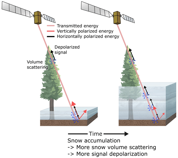
This study uses radar imagery from the Sentinel-1 satellite to derive snow depth from increases in the returning energy. These retrieved depths are then compared to nine lidar-derived snow depths across the western United State to assess the ability of this technique to be used to monitor global snow distributions. We also qualitatively compare the changes in underlying Sentinel-1 amplitudes against both the total lidar snow depths and nine automated snow monitoring stations.
Amaury Dehecq, Friedrich Knuth, Joaquín M. C. Belart, Livia Piermattei, Camillo Ressl, Adina Racoviteanu, Robert McNabb, David Shean, and Luc Godin
Int. Arch. Photogramm. Remote Sens. Spatial Inf. Sci., XLIX-B2-2026, 9–16, https://doi.org/10.5194/isprs-archives-XLIX-B2-2026-9-2026, https://doi.org/10.5194/isprs-archives-XLIX-B2-2026-9-2026, 2026
George Brencher, Scott T. Henderson, and David E. Shean
The Cryosphere, 20, 67–86, https://doi.org/10.5194/tc-20-67-2026, https://doi.org/10.5194/tc-20-67-2026, 2026
Short summary
Short summary
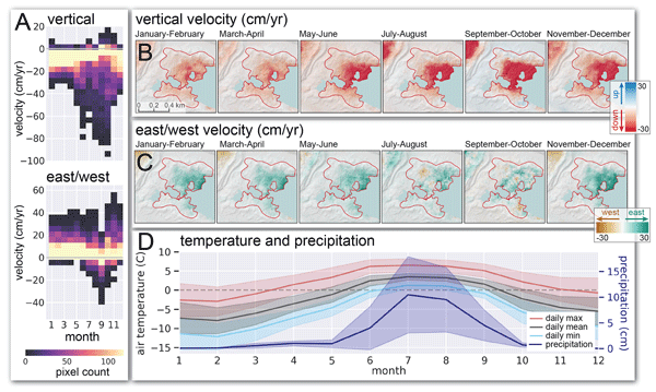
Glacial lakes are often dammed by moraines, which can fail, causing floods. Traditional methods of measuring moraine dam structure are not feasible for thousands of lakes. We instead developed a method to measure moraine dam movement with satellite radar data and applied this approach to the Imja Lake moraine dam in Nepal. We found that the moraine dam moved ~90 cm from 2017–2024, providing information about its internal structure. These data can help guide limited hazard remediation resources.
Zachary Fair, Carrie Vuyovich, Thomas Neumann, Justin Pflug, David Shean, Ellyn M. Enderlin, Karina Zikan, Hannah Besso, Jessica Lundquist, Cesar Deschamps-Berger, and Désirée Treichler
The Cryosphere, 19, 5671–5691, https://doi.org/10.5194/tc-19-5671-2025, https://doi.org/10.5194/tc-19-5671-2025, 2025
Short summary
Short summary
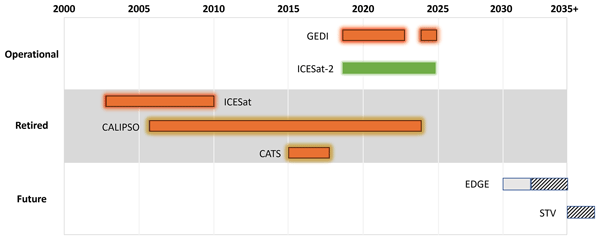
Lidar is commonly used to measure snow over global water reservoirs. However, ground-based and airborne lidar surveys are expensive, so satellite-based methods are needed. In this review, we outline the latest research using satellite-based lidar to monitor snow. Best practices for lidar-based snow monitoring are given, as is a discussion on challenges in this field of research.
Zachary Hoppinen, Ross T. Palomaki, George Brencher, Devon Dunmire, Eric Gagliano, Adrian Marziliano, Jack Tarricone, and Hans-Peter Marshall
The Cryosphere, 18, 5407–5430, https://doi.org/10.5194/tc-18-5407-2024, https://doi.org/10.5194/tc-18-5407-2024, 2024
Short summary
Short summary
This study uses radar imagery from the Sentinel-1 satellite to derive snow depth from increases in the returning energy. These retrieved depths are then compared to nine lidar-derived snow depths across the western United State to assess the ability of this technique to be used to monitor global snow distributions. We also qualitatively compare the changes in underlying Sentinel-1 amplitudes against both the total lidar snow depths and nine automated snow monitoring stations.
Livia Piermattei, Michael Zemp, Christian Sommer, Fanny Brun, Matthias H. Braun, Liss M. Andreassen, Joaquín M. C. Belart, Etienne Berthier, Atanu Bhattacharya, Laura Boehm Vock, Tobias Bolch, Amaury Dehecq, Inés Dussaillant, Daniel Falaschi, Caitlyn Florentine, Dana Floricioiu, Christian Ginzler, Gregoire Guillet, Romain Hugonnet, Matthias Huss, Andreas Kääb, Owen King, Christoph Klug, Friedrich Knuth, Lukas Krieger, Jeff La Frenierre, Robert McNabb, Christopher McNeil, Rainer Prinz, Louis Sass, Thorsten Seehaus, David Shean, Désirée Treichler, Anja Wendt, and Ruitang Yang
The Cryosphere, 18, 3195–3230, https://doi.org/10.5194/tc-18-3195-2024, https://doi.org/10.5194/tc-18-3195-2024, 2024
Short summary
Short summary
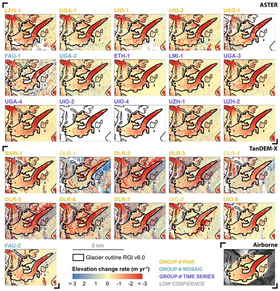
Satellites have made it possible to observe glacier elevation changes from all around the world. In the present study, we compared the results produced from two different types of satellite data between different research groups and against validation measurements from aeroplanes. We found a large spread between individual results but showed that the group ensemble can be used to reliably estimate glacier elevation changes and related errors from satellite data.
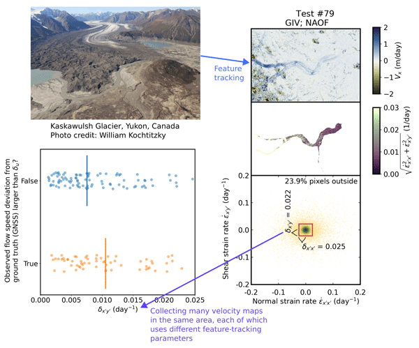
Whyjay Zheng, Shashank Bhushan, Maximillian Van Wyk De Vries, William Kochtitzky, David Shean, Luke Copland, Christine Dow, Renette Jones-Ivey, and Fernando Pérez
The Cryosphere, 17, 4063–4078, https://doi.org/10.5194/tc-17-4063-2023, https://doi.org/10.5194/tc-17-4063-2023, 2023
Short summary
Short summary
We design and propose a method that can evaluate the quality of glacier velocity maps. The method includes two numbers that we can calculate for each velocity map. Based on statistics and ice flow physics, velocity maps with numbers close to the recommended values are considered to have good quality. We test the method using the data from Kaskawulsh Glacier, Canada, and release an open-sourced software tool called GLAcier Feature Tracking testkit (GLAFT) to help users assess their velocity maps.
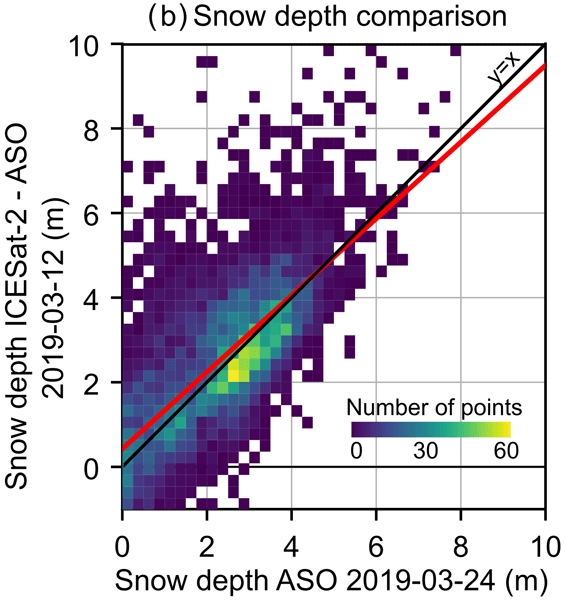
César Deschamps-Berger, Simon Gascoin, David Shean, Hannah Besso, Ambroise Guiot, and Juan Ignacio López-Moreno
The Cryosphere, 17, 2779–2792, https://doi.org/10.5194/tc-17-2779-2023, https://doi.org/10.5194/tc-17-2779-2023, 2023
Short summary
Short summary
The estimation of the snow depth in mountains is hard, despite the importance of the snowpack for human societies and ecosystems. We measured the snow depth in mountains by comparing the elevation of points measured with snow from the high-precision altimetric satellite ICESat-2 to the elevation without snow from various sources. Snow depths derived only from ICESat-2 were too sparse, but using external airborne/satellite products results in spatially richer and sufficiently precise snow depths.
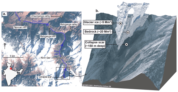
Maximillian Van Wyk de Vries, Shashank Bhushan, Mylène Jacquemart, César Deschamps-Berger, Etienne Berthier, Simon Gascoin, David E. Shean, Dan H. Shugar, and Andreas Kääb
Nat. Hazards Earth Syst. Sci., 22, 3309–3327, https://doi.org/10.5194/nhess-22-3309-2022, https://doi.org/10.5194/nhess-22-3309-2022, 2022
Short summary
Short summary
On 7 February 2021, a large rock–ice avalanche occurred in Chamoli, Indian Himalaya. The resulting debris flow swept down the nearby valley, leaving over 200 people dead or missing. We use a range of satellite datasets to investigate how the collapse area changed prior to collapse. We show that signs of instability were visible as early 5 years prior to collapse. However, it would likely not have been possible to predict the timing of the event from current satellite datasets.
Cited articles
Abernathey, R.: A Serverless Approach to Building Planetary-Scale EO Datacubes in Zarr, Earthmover, https://earthmover.io/blog/serverless-datacube-pipeline (last access: 12 August 2026), 2024.
Aguayo, R., León-Muñoz, J., Garreaud, R., and Montecinos, A.: Hydrological droughts in the southern Andes (40–45° S) from an ensemble experiment using CMIP5 and CMIP6 models, Sci. Rep.-UK, 11, 5530, https://doi.org/10.1038/s41598-021-84807-4, 2021.
Alabi, I. O., Marshall, H.-P., Mead, J., and Trujillo, E.: Advancing terrestrial snow depth monitoring with machine learning and L-band InSAR data: a case study using NASA's SnowEx 2017 data, Front. Remote Sens., 5, 1481848, https://doi.org/10.3389/frsen.2024.1481848, 2025.
Ali, I., Cao, S., Naeimi, V., Paulik, C., and Wagner, W.: Methods to Remove the Border Noise From Sentinel-1 Synthetic Aperture Radar Data: Implications and Importance For Time-Series Analysis, IEEE J. Sel. Top. Appl., 11, 777–786, https://doi.org/10.1109/JSTARS.2017.2787650, 2018.
Awasthi, S. and Varade, D.: Recent advances in the remote sensing of alpine snow: a review, GISci. Remote Sens., 58, 852–888, https://doi.org/10.1080/15481603.2021.1946938, 2021.
Ayala, Á., Schauwecker, S., and MacDonell, S.: Spatial distribution and controls of snowmelt runoff in a sublimation-dominated environment in the semiarid Andes of Chile, Hydrol. Earth Syst. Sci., 27, 3463–3484, https://doi.org/10.5194/hess-27-3463-2023, 2023.
Balik, J., Coop, J., and Parks, S. A.: Snowpack decline kindles more severe fire in the western United States, Environ. Res. Lett., https://doi.org/10.1088/1748-9326/ae4e4a, 2026.
Barnett, T. P., Adam, J. C., and Lettenmaier, D. P.: Potential impacts of a warming climate on water availability in snow-dominated regions, Nature, 438, 303–309, https://doi.org/10.1038/nature04141, 2005.
BC Ministry of Environment: Snow survey data – Province of British Columbia, https://www2.gov.bc.ca/gov/content/environment/air-land-water/water/water-science-data/water-data-tools/snow-survey-data (last access: 12 August 2026), 2024.
Bonnell, R., McGrath, D., Williams, K., Webb, R., Fassnacht, S. R., and Marshall, H.-P.: Spatiotemporal Variations in Liquid Water Content in a Seasonal Snowpack: Implications for Radar Remote Sensing, Remote Sens.-Basel, 13, 4223, https://doi.org/10.3390/rs13214223, 2021.
Bonnell, R., Elder, K., McGrath, D., Marshall, H. P., Starr, B., Adebisi, N., Palomaki, R. T., and Hoppinen, Z.: L-Band InSAR Snow Water Equivalent Retrieval Uncertainty Increases With Forest Cover Fraction, Geophys. Res. Lett., 51, e2024GL111708, https://doi.org/10.1029/2024GL111708, 2024.
Bonner, H. M., Raleigh, M. S., and Small, E. E.: Isolating forest process effects on modelled snowpack density and snow water equivalent, Hydrol. Process., 36, e14475, https://doi.org/10.1002/hyp.14475, 2022.
Boudreau, E. T.: Mapping snow cover at fine resolution in complex and forested terrain, MS thesis, University of Washington, https://hdl.handle.net/1773/53953 (last access: 12 August 2026), 2025.
Brangers, I., Marshall, H.-P., De Lannoy, G., Dunmire, D., Mätzler, C., and Lievens, H.: Tower-based C-band radar measurements of an alpine snowpack, The Cryosphere, 18, 3177–3193, https://doi.org/10.5194/tc-18-3177-2024, 2024.
Brooks, P. D., Solomon, D. K., Kampf, S., Warix, S., Bern, C., Barnard, D., Barnard, H. R., Carling, G. T., Carroll, R. W. H., Chorover, J., Harpold, A., Lohse, K., Meza, F., McIntosh, J., Neilson, B., Sears, M., and Wolf, M.: Groundwater dominates snowmelt runoff and controls streamflow efficiency in the western United States, Commun. Earth Environ., 6, 1–8, https://doi.org/10.1038/s43247-025-02303-3, 2025.
Brooks, S. T., Jabour, J., van den Hoff, J., and Bergstrom, D. M.: Our footprint on Antarctica competes with nature for rare ice-free land, Nat. Sustain., 2, 185–190, https://doi.org/10.1038/s41893-019-0237-y, 2019.
Buchhorn, M., Smets, B., Bertels, L., Roo, B. D., Lesiv, M., Tsendbazar, N.-E., Herold, M., and Fritz, S.: Copernicus Global Land Service: Land Cover 100 m: collection 3: epoch 2019: Globe, Zenodo [data set], https://doi.org/10.5281/zenodo.3939050, 2020.
California Department of Water Resources: California Cooperative Snow Surveys (CCSS), https://cdec.water.ca.gov/snow/ (last access: 12 August 2026), 2025.
Carletti, F., Marin, C., Ghielmini, C., Bavay, M., and Lehning, M.: Multitemporal analysis of Sentinel-1 backscatter during snowmelt using high-resolution field measurements and radiative transfer modelling, The Cryosphere, 19, 5579–5612, https://doi.org/10.5194/tc-19-5579-2025, 2025.
Christopher-Moody, K. E.: Effects of Forest Management on Snow Accumulation and Ablation in a Montane Watershed, MS thesis, Montana State University, Bozeman, College of Letters & Science, https://scholarworks.montana.edu/handle/1/19430 (last access: 12 August 2026), 2025.
Cortés, G. and Margulis, S.: Impacts of El Niño and La Niña on interannual snow accumulation in the Andes: Results from a high-resolution 31 year reanalysis, Geophys. Res. Lett., 44, 6859–6867, https://doi.org/10.1002/2017GL073826, 2017.
Cowherd, M., Mital, U., Rahimi, S., Girotto, M., Schwartz, A., and Feldman, D.: Climate change-resilient snowpack estimation in the Western United States, Commun. Earth Environ., 5, 1–10, https://doi.org/10.1038/s43247-024-01496-3, 2024.
Crumley, R. L., Palomaki, R. T., Nolin, A. W., Sproles, E. A., and Mar, E. J.: SnowCloudMetrics: Snow Information for Everyone, Remote Sens.-Basel, 12, 3341, https://doi.org/10.3390/rs12203341, 2020.
Darychuk, S. E., Shea, J. M., Menounos, B., Chesnokova, A., Jost, G., and Weber, F.: Snowmelt characterization from optical and synthetic-aperture radar observations in the La Joie Basin, British Columbia, The Cryosphere, 17, 1457–1473, https://doi.org/10.5194/tc-17-1457-2023, 2023.
Darychuk, S. E., Shea, J. M., and Derksen, C.: Comparison of snowmelt timing estimates from Sentinel-1 SAR and surface observations in British Columbia, Canada, Remote Sens. Environ., 328, 114863, https://doi.org/10.1016/j.rse.2025.114863, 2025.
Dask Development Team: Dask: Library for dynamic task scheduling, http://dask.pydata.org (last access: 12 August 2026), 2016.
Dawson, N., Broxton, P., Zeng, X., Leuthold, M., Barlage, M., and Holbrook, P.: An Evaluation of Snow Initializations in NCEP Global and Regional Forecasting Models, J. Hydrometeorol., 17, 1885–1901, https://doi.org/10.1175/JHM-D-15-0227.1, 2016.
Detre, A., McGrath, D., Gagliano, E., Bonnell, R., Webb, R., Marshall, H.-P., and Shean, D.: Sentinel-1 SAR Estimates of Snowmelt Onset Coincide With SNOTEL Soil Moisture Pulses Across the Western United States, Hydrol. Process., 39, e70341, https://doi.org/10.1002/hyp.70341, 2025.
Dingman, S. L.: Physical Hydrology, 3rd Edn., Waveland Press, 657 pp., ISBN 13:978-1-4786-1118-9, 2015.
Dudley, R. W., Hodgkins, G. A., McHale, M. R., Kolian, M. J., and Renard, B.: Trends in snowmelt-related streamflow timing in the conterminous United States, J. Hydrol., 547, 208–221, https://doi.org/10.1016/j.jhydrol.2017.01.051, 2017.
Fassnacht, S. R., Deitemeyer, D. C., and Venable, N. B. H.: Capitalizing on the daily time step of snow telemetry data to model the snowmelt components of the hydrograph for small watersheds, Hydrol. Process., 28, 4654–4668, https://doi.org/10.1002/hyp.10260, 2014.
Fleming, S. W., Zukiewicz, L., Strobel, M. L., Hofman, H., and Goodbody, A. G.: SNOTEL, the Soil Climate Analysis Network, and water supply forecasting at the Natural Resources Conservation Service: Past, present, and future, J. Am. Water Resour. As., https://doi.org/10.1111/1752-1688.13104, 2023.
Frisbee, M. D., Phillips, F. M., Campbell, A. R., Liu, F., and Sanchez, S. A.: Streamflow generation in a large, alpine watershed in the southern Rocky Mountains of Colorado: Is streamflow generation simply the aggregation of hillslope runoff responses?, Water Resour. Res., 47, https://doi.org/10.1029/2010WR009391, 2011.
Gagliano, E.: From Peak to Planet: Advancing Multi-Scale Detection of Snowmelt Timing with Satellite Radar, PhD thesis, University of Washington, United States, Washington, 187 pp., https://hdl.handle.net/1773/55173 (last access: 12 August 2026), 2025.
Gagliano, E.: Global MODIS snow phenology: snow appearance date, snow disappearance date, and maximum consecutive snow days, water years 2015–2025, Zenodo [data set], https://doi.org/10.5281/zenodo.21783366, 2026a.
Gagliano, E.: Global MODIS snow phenology, water years 2015–2025, Zenodo [code], https://doi.org/10.5281/zenodo.21783174, 2026b.
Gagliano, E.: Global snowmelt runoff onset from Sentinel-1 SAR (v1.0), Zenodo [code], https://doi.org/10.5281/zenodo.21910383, 2026c.
Gagliano, E., Shean, D., Henderson, S., and Vanderwilt, S.: Capturing the Onset of Mountain Snowmelt Runoff Using Satellite Synthetic Aperture Radar, Geophys. Res. Lett., 50, e2023GL105303, https://doi.org/10.1029/2023GL105303, 2023.
Gagliano, E., Shean, D., and Henderson, S.: A global high-resolution dataset of snowmelt runoff onset timing from Sentinel-1 SAR, 2015–2024 (1.1.0), Zenodo [data set], https://doi.org/10.5281/zenodo.16953614, 2026.
Gao, B. and Ma, W.: Capturing Snowmelt Runoff Onset Date under Different Land Cover Types Using Synthetic Aperture Radar: Case Study of Sierra Nevada Mountains, USA, Appl. Sci., 14, 6844, https://doi.org/10.3390/app14156844, 2024.
Gascoin, S., Lhermitte, S., Kinnard, C., Bortels, K., and Liston, G. E.: Wind effects on snow cover in Pascua-Lama, Dry Andes of Chile, Adv. Water Resour., 55, 25–39, https://doi.org/10.1016/j.advwatres.2012.11.013, 2013.
Hall, D. and Riggs, G.: MODIS/Terra Snow Cover 8-Day L3 Global 500 m SIN Grid, Version 61, NASA National Snow and Ice Data Center Distributed Active Archive Center [data set], https://doi.org/10.5067/MODIS/MOD10A2.061, 2021.
Hoppinen, Z., Palomaki, R. T., Brencher, G., Dunmire, D., Gagliano, E., Marziliano, A., Tarricone, J., and Marshall, H.-P.: Evaluating snow depth retrievals from Sentinel-1 volume scattering over NASA SnowEx sites, The Cryosphere, 18, 5407–5430, https://doi.org/10.5194/tc-18-5407-2024, 2024.
Ismail, M. F., Bogacki, W., Disse, M., Schäfer, M., and Kirschbauer, L.: Estimating degree-day factors of snow based on energy flux components, The Cryosphere, 17, 211–231, https://doi.org/10.5194/tc-17-211-2023, 2023.
John, A., Ong, J., Theobald, E. J., Olden, J. D., Tan, A., and HilleRisLambers, J.: Detecting Montane Flowering Phenology with CubeSat Imagery, Remote Sens.-Basel, 12, 2894, https://doi.org/10.3390/rs12182894, 2020.
Johnson, J. B. and Schaefer, G. L.: The influence of thermal, hydrologic, and snow deformation mechanisms on snow water equivalent pressure sensor accuracy, Hydrol. Process., 16, 3529–3542, https://doi.org/10.1002/hyp.1236, 2002.
Kaur, P., Webb, R., Tarricone, J., Rittger, K., McGrath, D., Gagliano, E., Palomaki, R., Bonnell, R., Forster, R., and Marshall, H.-P.: Feasibility Mapping of L-Band InSAR for SWE Retrievals Across the Western United States, Geophys. Res. Lett., 53, e2025GL120162, https://doi.org/10.1029/2025GL120162, 2026.
Kurum, M.: C-Band SAR Backscatter Evaluation of 2008 Gallipoli Forest Fire, IEEE Geosci. Remote S., 12, 1091–1095, https://doi.org/10.1109/LGRS.2014.2382716, 2015.
Lemmetyinen, J., Ruiz, J. J., Cohen, J., Haapamaa, J., Kontu, A., Pulliainen, J., and Praks, J.: Attenuation of Radar Signal by a Boreal Forest Canopy in Winter, IEEE Geosci. Remote S., 19, 1–5, https://doi.org/10.1109/LGRS.2022.3187295, 2022.
Lievens, H., Brangers, I., Marshall, H.-P., Jonas, T., Olefs, M., and De Lannoy, G.: Sentinel-1 snow depth retrieval at sub-kilometer resolution over the European Alps, The Cryosphere, 16, 159–177, https://doi.org/10.5194/tc-16-159-2022, 2022.
Liston, G. and Sturm, M.: Global Seasonal-Snow Classification, Version 1, NASA [data set], https://doi.org/10.5067/99FTCYYYLAQ0, 2021.
Lowry, C. S., Deems, J. S., Loheide II, S. P., and Lundquist, J. D.: Linking snowmelt-derived fluxes and groundwater flow in a high elevation meadow system, Sierra Nevada Mountains, California, Hydrol. Process., 24, 2821–2833, https://doi.org/10.1002/hyp.7714, 2010.
Lund, J., Forster, R. R., Rupper, S. B., Deeb, E. J., Marshall, H. P., Hashmi, M. Z., and Burgess, E.: Mapping Snowmelt Progression in the Upper Indus Basin With Synthetic Aperture Radar, Front. Earth Sci., 7, https://doi.org/10.3389/feart.2019.00318, 2020.
Lund, J., Forster, R. R., Deeb, E. J., Liston, G. E., Skiles, S. M., and Marshall, H.-P.: Interpreting Sentinel-1 SAR Backscatter Signals of Snowpack Surface Melt/Freeze, Warming, and Ripening, through Field Measurements and Physically-Based SnowModel, Remote Sens.-Basel, 14, 4002, https://doi.org/10.3390/rs14164002, 2022.
Lundquist, J. D., Cayan, D. R., and Dettinger, M. D.: Spring Onset in the Sierra Nevada: When Is Snowmelt Independent of Elevation?, J. Hydrometeorol., 5, 327–342, https://doi.org/10.1175/1525-7541(2004)005<0327:SOITSN>2.0.CO;2, 2004.
Lundquist, J. D., Dickerson-Lange, S. E., Lutz, J. A., and Cristea, N. C.: Lower forest density enhances snow retention in regions with warmer winters: A global framework developed from plot-scale observations and modeling, Water Resour. Res., 49, 6356–6370, https://doi.org/10.1002/wrcr.20504, 2013.
MacDonald, M., Fassnacht, S. R., and Tedesche, M. E.: High Elevation Post-Fire Landscapes on Snow Melt Trends in Seasonal and Transitional Snow Zones, AGU Fall Meeting Abstracts, ADS Bibcode: 2022AGUFMGC53B..08M, GC53B-08, 2022.
Manickam, S. and Barros, A.: Parsing Synthetic Aperture Radar Measurements of Snow in Complex Terrain: Scaling Behaviour and Sensitivity to Snow Wetness and Landcover, Remote Sens.-Basel, 12, 483, https://doi.org/10.3390/rs12030483, 2020.
Marin, C., Bertoldi, G., Premier, V., Callegari, M., Brida, C., Hürkamp, K., Tschiersch, J., Zebisch, M., and Notarnicola, C.: Use of Sentinel-1 radar observations to evaluate snowmelt dynamics in alpine regions, The Cryosphere, 14, 935–956, https://doi.org/10.5194/tc-14-935-2020, 2020.
Matias, M. T., Ramage, J. M., Gurarie, E., and Brodzik, M. J.: Snowmelt Onset and Caribou (Rangifer tarandus) Spring Migration, Remote Sens.-Basel, 16, 2391, https://doi.org/10.3390/rs16132391, 2024.
Mätzler, C.: Applications of the interaction of microwaves with the natural snow cover, Remote Sens. Rev., 2, 259–387, https://doi.org/10.1080/02757258709532086, 1987.
Meromy, L., Molotch, N. P., Link, T. E., Fassnacht, S. R., and Rice, R.: Subgrid variability of snow water equivalent at operational snow stations in the western USA, Hydrol. Process., 27, 2383–2400, https://doi.org/10.1002/hyp.9355, 2013.
Microsoft Open Source, McFarland, M., Emanuele, R., Morris, D., and Augspurger, T.: microsoft/PlanetaryComputer: October 2022, Zenodo [code], https://doi.org/10.5281/zenodo.7261897, 2022.
Microsoft Planetary Computer: Sentinel 1 Radiometrically Terrain Corrected (RTC), https://planetarycomputer.microsoft.com/dataset/sentinel-1-rtc (last access: 12 August 2026), 2022.
Mioduszewski, J. R., Rennermalm, A. K., Robinson, D. A., and Wang, L.: Controls on Spatial and Temporal Variability in Northern Hemisphere Terrestrial Snow Melt Timing, 1979–2012, J. Climate, 28, 2136–2153, https://doi.org/10.1175/JCLI-D-14-00558.1, 2015.
Mirza, B. N., Small, E. E., and Raleigh, M. S.: Evaluating the utility of Sentinel-1 in a Data Assimilation System for estimating snow depth in a mountainous basin, The Cryosphere, 19, 6691–6709, https://doi.org/10.5194/tc-19-6691-2025, 2025.
Nagler, T.: Methods and analysis of synthetic aperture radar data from ERS-1 and X-SAR for snow and glacier applications, PhD thesis, Leopold-Franzens-Universität Innsbruck, 1996.
Nagler, T., Rott, H., Ripper, E., Bippus, G., and Hetzenecker, M.: Advancements for Snowmelt Monitoring by Means of Sentinel-1 SAR, Remote Sens.-Basel, 8, 348, https://doi.org/10.3390/rs8040348, 2016.
Palomaki, R. T. and Sproles, E. A.: Assessment of L-band InSAR snow estimation techniques over a shallow, heterogeneous prairie snowpack, Remote Sens. Environ., 296, 113744, https://doi.org/10.1016/j.rse.2023.113744, 2023.
Pan, C. G., Kirchner, P. B., Kimball, J. S., and Du, J.: ABoVE: Passive Microwave-derived Annual Snowpack Main Melt Onset Date Maps, 1988–2023 (1.0), ORNL Distributed Active Archive Center [data set], https://doi.org/10.3334/ORNLDAAC/1841, 2021.
Petersky, R. and Harpold, A.: Now you see it, now you don't: a case study of ephemeral snowpacks and soil moisture response in the Great Basin, USA, Hydrol. Earth Syst. Sci., 22, 4891–4906, https://doi.org/10.5194/hess-22-4891-2018, 2018.
Pflug, J. M., Yang, K., Cristea, N., Boudreau, E. T., Vuyovich, C. M., and Kumar, S. V.: Using Commercial Satellite Imagery to Reconstruct 3 m and Daily Spring Snow Water Equivalent, Water Resour. Res., 60, e2024WR037983, https://doi.org/10.1029/2024WR037983, 2024.
Potin, P., Colin, O., Pinheiro, M., Rosich, B., O'Connell, A., Ormston, T., Gratadour, J.-B., and Torres, R.: Status And Evolution Of The Sentinel-1 Mission, in: IGARSS 2022 – 2022 IEEE International Geoscience and Remote Sensing Symposium, 4707–4710, https://doi.org/10.1109/IGARSS46834.2022.9884753, 2022.
Qin, Y., Hong, C., Zhao, H., Siebert, S., Abatzoglou, J. T., Huning, L. S., Sloat, L. L., Park, S., Li, S., Munroe, D. K., Zhu, T., Davis, S. J., and Mueller, N. D.: Snowmelt risk telecouplings for irrigated agriculture, Nat. Clim. Change, 12, 1007–1015, https://doi.org/10.1038/s41558-022-01509-z, 2022.
Raleigh, M. S., Gutmann, E. D., Van Stan II, J. T., Burns, S. P., Blanken, P. D., and Small, E. E.: Challenges and Capabilities in Estimating Snow Mass Intercepted in Conifer Canopies With Tree Sway Monitoring, Water Resour. Res., 58, e2021WR030972, https://doi.org/10.1029/2021WR030972, 2022.
Réveillet, M., MacDonell, S., Gascoin, S., Kinnard, C., Lhermitte, S., and Schaffer, N.: Impact of forcing on sublimation simulations for a high mountain catchment in the semiarid Andes, The Cryosphere, 14, 147–163, https://doi.org/10.5194/tc-14-147-2020, 2020.
Rickenbaugh, L., Sproles, E., Gagliano, E., Covino, T., Tuholske, C., and Carroll, R. W. H.: When and where does water originate? Leveraging stable water isotopes and Synthetic Aperture Radar to assess the hydrology of a snow-dominated watershed in Southwestern Montana, Remote Sens. Appl. Soc. Environ., 101887, https://doi.org/10.1016/j.rsase.2026.101887, 2026.
Rott, H. and Nagler, T.: Monitoring temporal dynamics of snowmelt with ERS-1 SAR, in: 1995 International Geoscience and Remote Sensing Symposium, IGARSS '95, Quantitative Remote Sensing for Science and Applications, 1747–1749, https://doi.org/10.1109/IGARSS.1995.524014, 1995.
Royer, A., Picard, G., Vargel, C., Langlois, A., Gouttevin, I., and Dumont, M.: Improved Simulation of Arctic Circumpolar Land Area Snow Properties and Soil Temperatures, Front. Earth Sci., 9, https://doi.org/10.3389/feart.2021.685140, 2021.
Saavedra, F. A., Kampf, S. K., Fassnacht, S. R., and Sibold, J. S.: A snow climatology of the Andes Mountains from MODIS snow cover data, Int. J. Climatol., 37, 1526–1539, https://doi.org/10.1002/joc.4795, 2017.
Skiles, S. M., Flanner, M., Cook, J. M., Dumont, M., and Painter, T. H.: Radiative forcing by light-absorbing particles in snow, Nat. Clim. Change, 8, 964–971, https://doi.org/10.1038/s41558-018-0296-5, 2018.
Steele-Dunne, S. C., Friesen, J., and van de Giesen, N.: Using Diurnal Variation in Backscatter to Detect Vegetation Water Stress, IEEE T. Geosci. Remote, 50, 2618–2629, https://doi.org/10.1109/TGRS.2012.2194156, 2012.
Stranden, H. and Saloranta, T.: NVE's snow reference datasets for climate change studies, 6 pp., last updated December 2021, https://www.nve.no/media/13163/nve_snow_reference_datasets_2021.pdf (last access: 12 August 2026), 2021.
Sturm, M. and Liston, G. E.: Revisiting the Global Seasonal Snow Classification: An Updated Dataset for Earth System Applications, J. Hydrometeorol., 22, 2917–2938, https://doi.org/10.1175/JHM-D-21-0070.1, 2021.
Sturm, M., Holmgren, J., and Liston, G. E.: A Seasonal Snow Cover Classification System for Local to Global Applications, J. Climate, 8, 1261–1283, https://doi.org/10.1175/1520-0442(1995)008<1261:ASSCCS>2.0.CO;2, 1995.
Tang, Z., Deng, G., Hu, G., Zhang, H., Pan, H., and Sang, G.: Satellite observed spatiotemporal variability of snow cover and snow phenology over high mountain Asia from 2002 to 2021, J. Hydrol., 613, 128438, https://doi.org/10.1016/j.jhydrol.2022.128438, 2022.
Tarricone, J., Webb, R. W., Marshall, H.-P., Nolin, A. W., and Meyer, F. J.: Estimating snow accumulation and ablation with L-band interferometric synthetic aperture radar (InSAR), The Cryosphere, 17, 1997–2019, https://doi.org/10.5194/tc-17-1997-2023, 2023.
Torralbo, P., Pimentel, R., Polo, M. J., and Notarnicola, C.: Characterizing Snow Dynamics in Semi-Arid Mountain Regions with Multitemporal Sentinel-1 Imagery: A Case Study in the Sierra Nevada, Spain, Remote Sens.-Basel, 15, 5365, https://doi.org/10.3390/rs15225365, 2023.
Tsai, Y.-L. S., Dietz, A., Oppelt, N., and Kuenzer, C.: Remote Sensing of Snow Cover Using Spaceborne SAR: A Review, Remote Sens.-Basel, 11, 1456, https://doi.org/10.3390/rs11121456, 2019.
USDA Natural Resources Conservation Service: SNOwpack TELemetry Network (SNOTEL), https://hdl.handle.net/10113/AF29410634 (last access: 12 August 2026), 1977.
Webb, R. W., Fassnacht, S. R., and Gooseff, M. N.: Defining the Diurnal Pattern of Snowmelt Using a Beta Distribution Function, J. Am. Water Resour. As., 53, 684–696, https://doi.org/10.1111/1752-1688.12522, 2017.
Wrzesien, M. L., Pavelsky, T. M., Durand, M. T., Dozier, J., and Lundquist, J. D.: Characterizing Biases in Mountain Snow Accumulation From Global Data Sets, Water Resour. Res., 55, 9873–9891, https://doi.org/10.1029/2019WR025350, 2019.
Yang, T., Li, Q., Zou, Q., Hamdi, R., Cui, F., and Li, L.: Impact of Snowpack on the Land Surface Phenology in the Tianshan Mountains, Central Asia, Remote Sens.-Basel, 14, 3462, https://doi.org/10.3390/rs14143462, 2022.
Zheng, L., Cheng, X., Chen, Z., Wang, S., Liang, Q., and Wang, K.: Global Snowmelt Onset Reflects Climate Variability: Insights from Spaceborne Radiometer Observations, J. Climate, 35, 2945–2959, https://doi.org/10.1175/JCLI-D-21-0265.1, 2022.
Editorial statement
This paper presents a global, high-resolution dataset of snowmelt runoff onset spanning a decade of Sentinel-1 observations. Its combination of global coverage, fine spatial resolution, comprehensive documentation, and broad applicability makes it a valuable resource for hydrology, cryosphere research, and water resource management.
This paper presents a global, high-resolution dataset of snowmelt runoff onset spanning a decade...
Short summary
Meltwater from seasonal snow sustains over a billion people globally, making the timing of snowmelt runoff onset a critical hydrological parameter. We used satellite radar images, which can detect liquid water in snowpack regardless of cloud cover, to create a global dataset of snowmelt runoff onset timing from 2015 to 2024 at 80 m resolution. The dataset shows close agreement with a network of ground-based snow sensors, and can support water resource management in snow-dominated watersheds.
Meltwater from seasonal snow sustains over a billion people globally, making the timing of...


Altmetrics
Final-revised paper
Preprint