Articles | Volume 18, issue 7
https://doi.org/10.5194/essd-18-4697-2026
© Author(s) 2026. This work is distributed under
the Creative Commons Attribution 4.0 License.
https://doi.org/10.5194/essd-18-4697-2026
© Author(s) 2026. This work is distributed under
the Creative Commons Attribution 4.0 License.
Unified Global Landslide Catalogue (UGLC): a single, standardised global-scale landslide dataset

Saverio Mancino
CORRESPONDING AUTHOR
Department of Earth and Geoenvironmental Sciences, University of Bari Aldo Moro, 70125 Bari, Italy
Planetek Italia, 70132 Bari, Italy
Anna Sblano
Planetek Italia, 70132 Bari, Italy
Francesco Paolo Lovergine
Institute for Electromagnetic Sensing of the Environment (IREA), National Research Council of Italy (CNR), 70126 Bari, Italy
Vincenzo Massimi
Planetek Italia, 70132 Bari, Italy
Tushar Sethi
Margosa Environmental Solutions Ltd., Brandon House, 1st Floor, 90 The Broadway, Chesham, HP5 1EG, UK
Domenico Capolongo
Department of Earth and Geoenvironmental Sciences, University of Bari Aldo Moro, 70125 Bari, Italy
Giuseppe Amatulli
CORRESPONDING AUTHOR
Margosa Environmental Solutions Ltd., Brandon House, 1st Floor, 90 The Broadway, Chesham, HP5 1EG, UK
Spatial Ecology, Brandon House, 1st Floor, 90 The Broadway, Chesham, HP5 1EG, UK
School of the Environment, Yale University, New Haven, CT 06511, USA
Related authors
No articles found.
Samuel Shou-En Tsao, Tim Jesper Surhoff, Giuseppe Amatulli, Maya Almaraz, Jonathan Gewirtzman, Beck Woollen, Eric W. Slessarev, James E. Saiers, Christopher T. Reinhard, Shuang Zhang, Noah J. Planavsky, and Peter A. Raymond
Earth Syst. Sci. Data Discuss., https://doi.org/10.5194/essd-2025-411, https://doi.org/10.5194/essd-2025-411, 2025
Revised manuscript under review for ESSD
Short summary
Short summary
We created the first detailed map of how much agricultural lime has been used across the United States from 1930 to 1987. Lime helps improve soil health and crop growth. Our study shows that how and where lime is used depends on climate, soil, and farming practices. By using machine learning, we found patterns that help explain these differences. This work helps us better understand the environmental role of lime and its impact on farming and climate.
Giuseppe Amatulli, Jaime Garcia Marquez, Tushar Sethi, Jens Kiesel, Afroditi Grigoropoulou, Maria M. Üblacker, Longzhu Q. Shen, and Sami Domisch
Earth Syst. Sci. Data, 14, 4525–4550, https://doi.org/10.5194/essd-14-4525-2022, https://doi.org/10.5194/essd-14-4525-2022, 2022
Short summary
Short summary
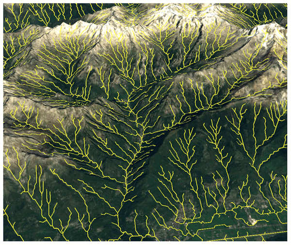
Streams and rivers drive several processes in hydrology, geomorphology, geography, and ecology. A hydrographic network that accurately delineates streams and rivers, along with their topographic and topological properties, is needed for environmental applications. Using the MERIT Hydro Digital Elevation Model at 90 m resolution, we derived a globally seamless, standardised hydrographic network: Hydrography90m. The validation demonstrates improved accuracy compared to other datasets.
Holger Virro, Giuseppe Amatulli, Alexander Kmoch, Longzhu Shen, and Evelyn Uuemaa
Earth Syst. Sci. Data, 13, 5483–5507, https://doi.org/10.5194/essd-13-5483-2021, https://doi.org/10.5194/essd-13-5483-2021, 2021
Short summary
Short summary
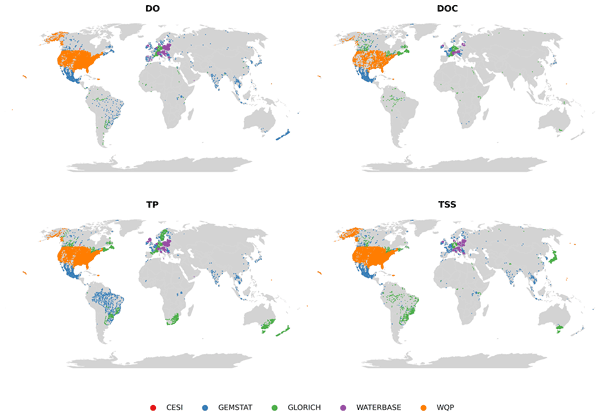
Water quality modeling is essential for understanding and mitigating water quality deterioration in river networks due to agricultural and industrial pollution. Improving the availability and usability of open data is vital to support global water quality modeling efforts. The GRQA extends the spatial and temporal coverage of previously available water quality data and provides a reproducible workflow for combining multi-source water quality datasets.
Cited articles
Amatulli, G., McInerney, D., Sethi, T., Strobl, P., and Domisch, S.: Geomorpho90m, empirical evaluation and accuracy assessment of global high-resolution geomorphometric layers, Sci. Data, 7, 162, https://doi.org/10.1038/s41597-020-0479-6, 2020. a
Amatulli, G., Garcia Marquez, J., Sethi, T., Kiesel, J., Grigoropoulou, A., Üblacker, M. M., Shen, L. Q., and Domisch, S.: Hydrography90m: a new high-resolution global hydrographic dataset, Earth Syst. Sci. Data, 14, 4525–4550, https://doi.org/10.5194/essd-14-4525-2022, 2022. a
BGS – British Geological Survey: Polygon inventory of 12,920 Asia Summer Monsoon (ASM) Triggered landslides in Nepal (NERC Grant NE/L002582/1), https://www.data.gov.uk/dataset/d614bc9b-2696-4bd6-be01-b461cee575d1/polygon-inventory-of-12920-asia-summer-monsoon-asm- triggered-landslides-in-nepal-nerc-grant-ne- (last access: December 2025), 2024. a, b
Bhuyan, K., Tanyaş, H., Nava, L., Puliero, S., Meena, S., Floris, M., van Westen, C., and Catani, F.: Generating multi-temporal landslide inventories through a general deep transfer learning strategy using HR EO data, Sci. Rep., 13, https://doi.org/10.1038/s41598-022-27352-y, 2023. a
Bragagnolo, L., Rezende, L., da Silva, R., and Grzybowski, J.: Japan landslide dataset for semantic segmentation, Zenodo [data set], https://doi.org/10.5281/zenodo.3775870, 2020. a, b
Brideau, M.-A., Lau, C.-A., Brayshaw, D., Lipovsky, P., Cronmiller, D., and Friele, P.: Preliminary Canadian Landslide Database, Zenodo [data set], https://doi.org/10.5281/zenodo.10799126, 2024. a, b
Cogan, J. and Gratchev, I.: A study on the effect of rainfall and slope characteristics on landslide initiation by means of flume tests, Landslides, 16, 2369–2379, https://doi.org/10.1007/s10346-019-01261-0, 2019. a
Depicker, A., Jacobs, L., Delvaux, D., Havenith, H.-B., Maki Mateso, J.-C., Govers, G., and Dewitte, O.: The added value of a regional landslide susceptibility assessment: The western branch of the East African Rift, Geomorphology, 353, 106886, https://doi.org/10.1016/j.geomorph.2019.106886, 2020. a, b
Depicker, A., Govers, G., Jacobs, L., Campforts, B., Uwihirwe, J., and Dewitte, O.: Interactions between deforestation, landscape rejuvenation, and shallow landslides in the North Tanganyika–Kivu rift region, Africa, Earth Surf. Dynam., 9, 445–462, https://doi.org/10.5194/esurf-9-445-2021, 2021. a, b
Development Team: pandas-dev/pandas: Pandas, Zenodo [code], https://doi.org/10.5281/zenodo.3509134, 2020. a, b
Di Napoli, M., Carotenuto, F., Cevasco, A., Confuorto, P., Di Martire, D., Firpo, M., Pepe, G., Raso, E., and Calcaterra, D.: Machine learning ensemble modelling as a tool to improve landslide susceptibility mapping reliability, Landslides, 17, 1897–1914, https://doi.org/10.1007/s10346-020-01392-9, 2020. a
Esposito, G. and Matano, F.: A geodatabase of historical landslide events occurring in the highly urbanized volcanic area of Campi Flegrei, Italy, Earth Syst. Sci. Data, 15, 1133–1149, https://doi.org/10.5194/essd-15-1133-2023, 2023. a, b
Ferrario, M.: Landslides triggered by the 2015 Mw .0 Sabah (Malaysia) earthquake: inventory and ESI-07 intensity assignment, Nat. Hazards Earth Syst. Sci., 22, 3527–3542, https://doi.org/10.5194/nhess-22-3527-2022, 2022. a, b
Ferrario, M., Perez, J., Dizon, M., Livio, F., Rimando, J., and Michetti, A.: Environmental effects following a seismic sequence: the 2019 Cotabato-Davao del Sur (Philippines) earthquakes, Nat. Hazards, 120, 6125–6147, https://doi.org/10.1007/s11069-024-06467-7, 2023. a, b
Froude, M. and Petley, D.: Global fatal landslide occurrence from 2004 to 2016, Nat. Hazards Earth Syst. Sci., 18, 2161–2181, https://doi.org/10.5194/nhess-18-2161-2018, 2018. a, b
Gariano, S. and Guzzetti, F.: Landslides in a changing climate, Earth-Sci. Rev., 162, 227–252, https://doi.org/10.1016/j.earscirev.2016.08.011, 2016. a
Gomez, D., Garcia, E., and Aristizábal, E.: Spatial and temporal landslide distributions using global and open landslide databases, Nat. Hazards, 117, 22–55, https://doi.org/10.1007/s11069-023-05848-8, 2020. a, b
Hearn, G. and Hart, A.: Chapter Five - Geomorphological Contributions to Landslide Risk Assessment: Theory and Practice, in: vol. 15, Elsevier, 107–148, https://doi.org/10.1016/B978-0-444-53446-0.00005-7, 2011. a
Herrera-Coy, M., Calderón, L., Herrera-Pérez, I., Bravo-López, P., Conoscenti, C., Delgado, J., Sánchez-Gómez, M., and Fernández, T.: Landslide Susceptibility Analysis on the Vicinity of Bogotá-Villavicencio Road (Eastern Cordillera of the Colombian Andes), Remote Sens., 15, 3870, https://doi.org/10.3390/rs15153870, 2023. a, b
Hovius, N. and Stark, C.: Landslide-driven erosion and topographic evolution of active mountain belts, in: vol. 49, Springer, 573–590, https://doi.org/10.1007/978-1-4020-4037-5_30, 2006. a
Huffman, G., Stocker, E., Bolvin, D., Nelkin, E., and Tan, J.: GPM IMERG Final Precipitation L3 Half Hourly 0.1°×0.1° V06, NASA Goddard Earth Sciences Data and Information Services Center (GES DISC) [data set], https://doi.org/10.5067/GPM/IMERG/3B-HH/06, 2019. a
Hungr, O., Leroueil, S., and Picarelli, L.: The Varnes classification of landslide types, an update, Landslides, 11, 167–194, https://doi.org/10.1007/s10346-013-0436-y, 2014. a, b, c, d
IPCC: Climate Change 2022: Impacts, Adaptation, and Vulnerability, Cambridge University Press, Cambridge, UK and New York, NY, USA, https://doi.org/10.1017/9781009325844, 2022. a
Jaboyedoff, M., Michoud, C., Derron, M.-H., Voumard, J., Leibundgut, G., Sudmeier-Rieux, K., Nadim, F., and Leroi, E.: Human-Induced Landslides: Toward the Analysis of Anthropogenic Changes of the Slope Environment, CRC ress, 217–232, ISBN 9781315375007, 2018. a
Jiang, L. and Wang, X.: Dataset Constrution through Ontology-Based Data Requirements Analysis, Appl. Sci., 14, 2237, https://doi.org/10.3390/app14062237, 2024. a
Juang, C., Stanley, T., and Kirschbaum, D.: Using citizen science to expand the global map of landslides: Introducing the Cooperative Open Online Landslide Repository (COOLR), PLoS ONE, 14, e0218657, https://doi.org/10.1371/journal.pone.0218657, 2019. a
Kirschbaum, D., Stanley, T., and Yatheendradas, S.: Modeling landslide susceptibility over large regions with fuzzy overlay, Landslides, 13, 485–496, https://doi.org/10.1007/s10346-015-0577-2, 2016. a
Koneru, S., Badavathula, H., Vadttitya, P., and Kosaraju, S.: Landslide identification using convolutional neural network, CRC Press, 416–423, ISBN 9781003471059, https://doi.org/10.1201/9781003471059-54, 2024. a
Liu, S., Li, Y.-E., Wang, B., Cai, A.-D., Feng, C., Lan, H., and Zhao, R.-C.: Challenges and countermeasures for developing countries in addressing loss and damage caused by climate change, Adv. Clim. Change Res., 15, 353–363, https://doi.org/10.1016/j.accre.2024.02.003, 2024. a, b
Loche, M., Alvioli, M., Marchesini, I., Bakka, H., and Lombardo, L.: Landslide susceptibility maps of Italy: Lesson learnt from dealing with multiple landslide types and the uneven spatial distribution of the national inventory, Earth-Sci. Rev., 232, 104125, https://doi.org/10.1016/j.earscirev.2022.104125, 2022. a
Luetzenburg, G., Svennevig, K., Bjørk, A., Keiding, M., and Kroon, A.: A national landslide inventory for Denmark, Earth Syst. Sci. Data, 14, 3157–3165, https://doi.org/10.5194/essd-14-3157-2022, 2022. a, b
Malet, J.-P., Hibert, C., Radiguet, M., Gautier, S., Larose, E., Amitrano, D., Jongmans, D., Bièvre, G., and RESIF: French Landslide Observatory – OMIV (Temporary data) (MT-campagne) (RESIF – SISMOB), EPOS-FRANCE Seismology, https://doi.org/10.15778/RESIF.1N2015, 2015. a, b
Mancino, S., Sblano, A., Lovergine, F., Sethi, T., Capolongo, D., and Amatulli, G.: Unified Global Landslide Catalogue (UGLC), Zenodo [data set], https://doi.org/10.5281/zenodo.16755044, 2025a. a, b, c
Mancino, S., Sblano, A., Lovergine, F., Sethi, T., Capolongo, D., and Amatulli, G.: Unified Global Landslide Catalogue (UGLC) – Point Catalogue, Zenodo [data set], https://doi.org/10.5281/zenodo.20925165, 2025b. a, b, c
Mancino, S., Sblano, A., Lovergine, F., Sethi, T., Capolongo, D., and Amatulli, G.: Unified Global Landslide Catalogue (UGLC) – Polygonal Catalogue, Zenodo [code], https://doi.org/10.5281/zenodo.20925213, 2025c. a, b, c
Martinez, S., Allstadt, K., Slaughter, S., Schmitt, R., Collins, E., Schaefer, L., and Ellison, S.: Landslides triggered by the August 14, 2021, magnitude 7.2 Nippes, Haiti, earthquake, Tech. rep., US Geological Survey, https://doi.org/10.3133/ofr20211112, 2021. a, b
Massey, C., Townsend, D., Rosser, B., Morgenstern, R., Jones, K., Lukovic, B., and Davidson, J.: Version 2.0 of the landslide inventory for the Mw 7.8 14 November 2016, NSF, https://doi.org/10.17603/ds2-1ftv-hm22, 2021. a, b
Mirus, B., Jones, E., Baum, R., Godt, J., Slaughter, S., Crawford, M., Lancaster, J., Stanley, T., Kirschbaum, D., Burns, W., Schmitt, R., Lindsey, K., and McCoy, K.: Landslides across the USA: occurrence, susceptibility, and data limitations, Landslides, 17, 2271–2285, https://doi.org/10.1007/s10346-020-01424-4, 2020. a, b
Mitsugi, H.: Foreword by Hiroto Mitsugi for the Journal of the International Consortium on Landslides, Landslides, 15, 2323–2324, https://doi.org/10.1007/s10346-018-1076-z, 2018. a
Morales, B., Garcia-Pedrero, A., Lizama, E., Lillo-Saavedra, M., Gonzalo-Martín, C., Chen, N., and Somos-Valenzuela, M.: Patagonian Andes Landslides Inventory: The Deep Learning’s Way to Their Automatic Detection, Remote Sens., 14, 4622, https://doi.org/10.3390/rs14184622, 2022. a, b, c
Pagani, M., Weatherill, G., Garcia-Pelaez, J., Crowley, H., Silva, V., Henshaw, P., Butler, L., Simionato, M., Vigano, D., Danciu, L., and Monelli, D.: Global Earthquake Model (GEM) Seismic Hazard Map (PGA, 10 % probability of exceedance in 50 years), https://www.globalquakemodel.org (last access: December 2025), 2020. a
Pennington, C., Freeborough, K., Dashwood, C., Dijkstra, T., and Lawrie, K.: The National Landslide Database of Great Britain: Acquisition, communication and the role of social media, Geomorphology, 249, 44–51, https://doi.org/10.1016/j.geomorph.2015.03.013, 2015. a, b, c
Peruccacci, S., Gariano, S., Melillo, M., Solimano, M., Guzzetti, F., and Brunetti, M.: The ITAlian rainfall-induced LandslIdes CAtalogue, an extensive and accurate spatio-temporal catalogue of rainfall-induced landslides in Italy, Earth Syst. Sci. Data, 15, 2863–2877, https://doi.org/10.5194/essd-15-2863-2023, 2023. a, b
Petley, D.: Global patterns of loss of life from landslides, Geology, 40, 927–930, https://doi.org/10.1130/G33217.1, 2012. a
Poggio, L., de Sousa, L., Batjes, N., Heuvelink, G., Kempen, B., Ribeiro, E., Rossiter, D., and Gardi, C.: SoilGrids 2.0, Zenodo [data set], https://doi.org/10.5281/zenodo.5099749, 2021. a
Pradhan, B., Lee, S., and Buchroithner, M.: A GIS-based back-propagation neural network model and its cross-application and validation for landslide susceptibility analyses, Comput. Environ. Urban Syst., 34, 216–235, https://doi.org/10.1016/j.compenvurbsys.2009.12.004, 2010. a
Reichenbach, P., Rossi, M., Malamud, B., Mihir, M., and Guzzetti, F.: A review of statistically-based landslide susceptibility models, Earth-Sci. Rev., 180, 60–91, https://doi.org/10.1016/j.earscirev.2018.03.001, 2018. a, b
Schmitt, R., Tanyas, H., Jessee, M., Zhu, J., Biegel, K., Allstadt, K., Jibson, R., Thompson, E., van Westen, C., Sato, H., Wald, D., Godt, J., Gorum, T., Xu, C., Rathje, E., and Knudsen, K.: An open repository of earthquake-triggered ground-failure inventories, USGS, https://doi.org/10.5066/F7H70DB4, 2017. a, b, c, d
Shang, H., Su, L., Chen, W., Tsangaratos, P., Ilia, I., Liu, S., Cui, S., and Duan, Z.: Spatial Prediction of Landslide Susceptibility Using Logistic Regression (LR), Functional Trees (FTs), and Random Subspace Functional Trees (RSFTs) for Pengyang County, China, Remote Sens., 15, https://doi.org/10.3390/rs15204952, 2023. a
Sim, K., Lee, M., Remenyte-Prescott, R., and Wong, S.: An Overview of Causes of Landslides and Their Impact on Transport Networks, in: Advances in Modelling to Improve Network Resilience: Proceedings of the 60th ESReDA Seminar, Publications Office of the European Union, Luxembourg, 114–124, https://doi.org/10.2760/503700, 2022. a
Stanley, T. and Kirschbaum, D.: A heuristic approach to global landslide susceptibility mapping, Nat. Hazards, 87, 145–164, https://doi.org/10.1007/s11069-017-2757-y, 2017. a
Steger, S., Moreno, M., Crespi, A., Zellner, P., Gariano, S., Brunetti, M., Melillo, M., Peruccacci, S., Marra, F., Kohrs, R., Goetz, J., Mair, V., and Pittore, M.: Deciphering seasonal effects of triggering and preparatory precipitation for improved shallow landslide prediction using generalized additive mixed models, Nat. Hazards Earth Syst. Sci., 23, 1483–1506, https://doi.org/10.5194/nhess-23-1483-2023, 2023. a
Tehrani, F., Calvello, M., Liu, Z., Zhang, L., and Lacasse, S.: Machine learning and landslide studies: recent advances and applications, Nat. Hazards, 114, 1197–1245, https://doi.org/10.1007/s11069-022-05423-7, 2022. a, b, c
UNDRR: International Cooperation in Disaster Risk Reduction: Target F, https://reliefweb.int/report/world/international-cooperation-disaster-risk-reduction-target-f (last access: December 2025), 2021. a
Wang, H., Zhang, L., Yin, K., Luo, H., and Li, J.: Landslide identification using machine learning, Geosci. Front., 12, https://doi.org/10.1016/j.gsf.2020.02.012, 2020. a
Wen, M., Qiu, Q., Zheng, S., Ma, K., Zheng, S., Xie, Z., and Tao, L.: Construction and application of a multilevel geohazard domain ontology: A case study of landslide geohazards, Appl. Comput. Geosci., 20, 100134, https://doi.org/10.1016/j.acags.2023.100134, 2023. a
Short summary
Landslides can cause loss of life and damage to communities. This study presents a global catalogue of more than one million events collected from many open sources between 1700 and 2023. The data were organised into a consistent structure to make them easier to explore and compare. The catalogue can support large-scale analyses and help improve understanding of where and when landslides occur.
Landslides can cause loss of life and damage to communities. This study presents a global...
Altmetrics
Final-revised paper
Preprint