Articles | Volume 18, issue 9
https://doi.org/10.5194/essd-18-6973-2026
© Author(s) 2026. This work is distributed under
the Creative Commons Attribution 4.0 License.
the Creative Commons Attribution 4.0 License.
https://doi.org/10.5194/essd-18-6973-2026
© Author(s) 2026. This work is distributed under
the Creative Commons Attribution 4.0 License.
the Creative Commons Attribution 4.0 License.
Data description article
| 
23 Sep 2026
Data description article |
| 23 Sep 2026
| 23 Sep 2026
Extending daily river discharge records across China using satellite-derived river widths
Yong Wang
School of Geographical Sciences, Southwest University, Chongqing 400715, China
Yulin Gong
School of Geographical Sciences, Southwest University, Chongqing 400715, China
Yinghong Jing
School of Geographical Sciences, Southwest University, Chongqing 400715, China
Xiaojun She
School of Geographical Sciences, Southwest University, Chongqing 400715, China

School of Geographical Sciences, Southwest University, Chongqing 400715, China
Related authors
Fukun Tao, Yong Wang, Yinghong Jing, Xiaojun She, Shanlong Lu, and Yao Li
Hydrol. Earth Syst. Sci., 30, 2741–2758, https://doi.org/10.5194/hess-30-2741-2026, https://doi.org/10.5194/hess-30-2741-2026, 2026
Short summary
Short summary
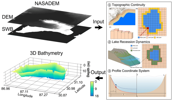
This study presents a cost-effective method to reconstruct lake bathymetry using only digital elevation model (DEM) data, without relying on field measurements or optical imagery. By simulating lake-level decline and using shoreline topography, it accurately infers underwater terrain. Validation across 12 lakes on the Tibetan Plateau and Lake Mead demonstrates good accuracy and generalizability, enabling scalable lake storage estimation for hydrological and ecological applications.
Fukun Tao, Yong Wang, Yinghong Jing, Xiaojun She, Shanlong Lu, and Yao Li
Hydrol. Earth Syst. Sci., 30, 2741–2758, https://doi.org/10.5194/hess-30-2741-2026, https://doi.org/10.5194/hess-30-2741-2026, 2026
Short summary
Short summary
This study presents a cost-effective method to reconstruct lake bathymetry using only digital elevation model (DEM) data, without relying on field measurements or optical imagery. By simulating lake-level decline and using shoreline topography, it accurately infers underwater terrain. Validation across 12 lakes on the Tibetan Plateau and Lake Mead demonstrates good accuracy and generalizability, enabling scalable lake storage estimation for hydrological and ecological applications.
Cited articles
Allen, G. H. and Pavelsky, T. M.: Global extent of rivers and streams, Science, 361, 585–588, https://doi.org/10.1126/science.aat0636, 2018.
Alsdorf, D. E., Rodríguez, E., and Lettenmaier, D. P.: Measuring surface water from space, Rev. Geophys., 45, RG2002, https://doi.org/10.1029/2006RG000197, 2007.
Altenau, E. H., Pavelsky, T. M., Durand, M. T., Yang, X., Frasson, R. P. M., and Bendezu, L.: The Surface Water and Ocean Topography (SWOT) Mission River Database (SWORD): A global river network for satellite data products, Water Resour. Res., 57, e2021WR030054, https://doi.org/10.1029/2021WR030054, 2021.
Altenau, E. H., Pavelsky, T. M., Durand, M. T., Yang, X., Frasson, R. P. d. M., and Bendezu, L.: SWOT River Database (SWORD) (Version v17), Zenodo [data set], https://doi.org/10.5281/zenodo.14727521, 2025.
Andrews, L. and Grantham, T. E.: Strategic stream gauging network design for sustainable water management, Nat. Sustain., 7, 714–723, https://doi.org/10.1038/s41893-024-01357-z, 2024.
Ashmore, P. and Sauks, E.: Prediction of discharge from water surface width in a braided river with implications for at-a-station hydraulic geometry, Water Resour. Res., 42, W03407, https://doi.org/10.1029/2005WR003993, 2006.
Beven, K.: Towards integrated environmental models of everywhere: uncertainty, data and modelling as a learning process, Hydrol. Earth Syst. Sci., 11, 460–467, https://doi.org/10.5194/hess-11-460-2007, 2007.
Bonnema, M. G., Sikder, S., Hossain, F., Durand, M., Gleason, C. J., and Bjerklie, D. M.: Benchmarking wide swath altimetry-based river discharge estimation algorithms for the Ganges river system, Water Resour. Res., 52, 2439–2461, https://doi.org/10.1002/2015WR017296, 2016.
Che, L., Li, S., and Liu, X.: Improved surface water mapping using satellite remote sensing imagery based on optimization of the Otsu threshold and effective selection of remote-sensing water index, J. Hydrol., 654, 132771, https://doi.org/10.1016/j.jhydrol.2025.132771, 2025.
Chen, Z. and Zhao, S.: Automatic monitoring of surface water dynamics using Sentinel-1 and Sentinel-2 data with Google Earth Engine, Int. J. Appl. Earth Obs., 113, 103010, https://doi.org/10.1016/j.jag.2022.103010, 2022.
Collins, E. L., David, C. H., Riggs, R., Allen, G. H., Pavelsky, T. M., Lin, P., Pan, M., Yamazaki, D., Meentemeyer, R. K., and Sanchez, G. M.: Global patterns in river water storage dependent on residence time, Nat. Geosci., 17, 433–439, https://doi.org/10.1038/s41561-024-01421-5, 2024.
Do, H. X., Gudmundsson, L., Leonard, M., and Westra, S.: The Global Streamflow Indices and Metadata Archive (GSIM) – Part 1: The production of a daily streamflow archive and metadata, Earth Syst. Sci. Data, 10, 765–785, https://doi.org/10.5194/essd-10-765-2018, 2018.
Durand, M., Gleason, C. J., Garambois, P. A., Bjerklie, D., Smith, L. C., Roux, H., Rodriguez, E., Bates, P. D., Pavelsky, T. M., Monnier, J., Chen, X., Di Baldassarre, G., Fiset, J.-M., Flipo, N., Frasson, R. P. d. M., Fulton, J., Goutal, N., Hossain, F., Humphries, E., Minear, J. T., Mukolwe, M. M., Neal, J. C., Ricci, S., Sanders, B. F., Schumann, G., Schubert, J. E., and Vilmin, L.: An intercomparison of remote sensing river discharge estimation algorithms from measurements of river height, width, and slope, Water Resour. Res., 52, 4527–4549, https://doi.org/10.1002/2015WR018434, 2016.
Durand, M., Gleason, C. J., Pavelsky, T. M., Frasson, R. P. M., Turmon, M., David, C. H., Altenau, E. H., Tebaldi, N., Larnier, K., Monnier, J., Malaterre, P. O., Oubanas, H., Allen, G. H., Astifan, B., Brinkerhoff, C., Bates, P. D., Bjerklie, D., Coss, S., Dudley, R., Fenoglio, L., Garambois, P.-A., Getirana, A., Lin, P., Margulis, S. A., Matte, P., Minear, J. T., Muhebwa, A., Pan, M., Peters, D., Riggs, R., Sikder, M. S., Simmons, T., Stuurman, C., Taneja, J., Tarpanelli, A., Schulze, K., Tourian, M. J., and Wang, J.: A framework for estimating global river discharge from the Surface Water and Ocean Topography satellite mission, Water Resour. Res., 59, e2021WR031614, https://doi.org/10.1029/2021WR031614, 2023.
Eggleston, J., Mason, C., Bjerklie, D., Durand, M., Dudley, R., and Harlan, M.: Siting considerations for satellite observation of river discharge, Water Resour. Res., 60, e2023WR034583, https://doi.org/10.1029/2023WR034583, 2024.
Elmi, O., Tourian, M. J., Saemian, P., and Sneeuw, N.: Remote Sensing-Based Extension of GRDC River Discharge Time Series, V4, DaRUS [data set], https://doi.org/10.18419/DARUS-3558, 2023.
Elmi, O., Tourian, M. J., Saemian, P., and Sneeuw, N.: Remote sensing-based extension of GRDC Discharge time series – a monthly product with uncertainty estimates, Sci. Data, 11, 240, https://doi.org/10.1038/s41597-024-03078-6, 2024.
Famiglietti, J. S., Cazenave, A., Eicker, A., Reager, J. T., Rodell, M., and Velicogna, I.: Satellites provide the big picture, Science, 349, 684–685, https://doi.org/10.1126/science.aac9238, 2015.
Färber, C., Plessow, H., Mischel, S. A., Kratzert, F., Addor, N., Shalev, G., and Looser, U.: GRDC-Caravan: extending Caravan with data from the Global Runoff Data Centre, Earth Syst. Sci. Data, 17, 4613–4625, https://doi.org/10.5194/essd-17-4613-2025, 2025.
Fekete, B. M., Robarts, R. D., Kumagai, M., Nachtnebel, H.-P., Odada, E., and Zhulidov, A. V.: Time for in situ renaissance, Science, 349, 685–686, https://doi.org/10.1126/science.aac7358, 2015.
Feng, D., Gleason, C. J., Yang, X., and Pavelsky, T. M.: Comparing discharge estimates made via the BAM algorithm in high-order Arctic rivers derived solely from optical CubeSat, Landsat, and Sentinel-2 data, Water Resour. Res., 55, 7753–7771, https://doi.org/10.1029/2019WR025599, 2019.
Feng, D., Gleason, C. J., Yang, X., Allen, G. H., and Pavelsky, T. M.: How have global river widths changed over time?, Water Resour. Res., 58, e2021WR031712, https://doi.org/10.1029/2021WR031712, 2022.
Ghiggi, G., Humphrey, V., Seneviratne, S. I., and Gudmundsson, L.: GRUN: an observation-based global gridded runoff dataset from 1902 to 2014, Earth Syst. Sci. Data, 11, 1655–1674, https://doi.org/10.5194/essd-11-1655-2019, 2019.
Gleason, C. J. and Smith, L. C.: Toward global mapping of river discharge using satellite images and at-many-stations hydraulic geometry, P. Natl. Acad. Sci. USA, 111, 4788–4791, https://doi.org/10.1073/pnas.1317606111, 2014.
Gleason, C. J. and Wang, J.: Theoretical basis for at-many-stations hydraulic geometry, Geophys. Res. Lett., 42, 7107–7114, https://doi.org/10.1002/2015GL064935, 2015.
Hannah, D. M., Demuth, S., van Lanen, H. A. J., Looser, U., Prudhomme, C., Rees, G., Stahl, K., and Tallaksen, L. M.: Large-scale river flow archives: Importance, current status and future needs, Hydrol. Process., 25, 1191–1200, https://doi.org/10.1002/hyp.7794, 2011.
Hao, Z., Xiang, N., Cai, X., Zhong, M., Jin, J., Du, Y., and Ling, F.: Remote sensing of river discharge from medium-resolution satellite imagery based on deep learning, Water Resour. Res., 60, e2023WR036880, https://doi.org/10.1029/2023WR036880, 2024.
Henck, A. C., Montgomery, D. R., Huntington, K. W., and Liang, C.: Monsoon control of effective discharge, Yunnan and Tibet, Geology, 38, 975–978, https://doi.org/10.1130/G31444.1, 2010.
Hesterberg, T.: Bootstrap, WIREs Comput. Stat., 3, 497–526, https://doi.org/10.1002/wics.182, 2011.
Hou, J., van Dijk, A. I. J. M., and Beck, H. E.: Global satellite-based river gauging and the influence of river morphology on its application, Remote Sens. Environ., 239, 111629, https://doi.org/10.1016/j.rse.2019.111629, 2020.
Kim, Y. H., Im, J., Ha, H. K., Choi, J.-K., and Ha, S.: Machine learning approaches to coastal water quality monitoring using GOCI satellite data, GIScience Remote Sens., 51, 158–174, https://doi.org/10.1080/15481603.2014.900983, 2014.
Knoben, W. J. M., Freer, J. E., and Woods, R. A.: Technical note: Inherent benchmark or not? Comparing Nash–Sutcliffe and Kling–Gupta efficiency scores, Hydrol. Earth Syst. Sci., 23, 4323–4331, https://doi.org/10.5194/hess-23-4323-2019, 2019.
Krabbenhoft, C. A., Allen, G. H., Lin, P., Godsey, S. E., Allen, D. C., Burrows, R. M., DelVecchia, A. G., Fritz, K. M., Shanafield, M., Burgin, A. J., Zimmer, M. A., Datry, T., Dodds, W. K., Jones, C. N., Mims, M. C., Franklin, C., Hammond, J. C., Zipper, S., Ward, A. S., Costigan, K. H., Beck, H. E., and Olden, J. D.: Assessing placement bias of the global river gauge network, Nat. Sustain., 5, 586–592, https://doi.org/10.1038/s41893-022-00873-0, 2022.
Langhorst, T., Andreadis, K. M., and Allen, G. H.: Global cloud biases in optical satellite remote sensing of rivers, Geophys. Res. Lett., 51, e2024GL110085, https://doi.org/10.1029/2024GL110085, 2024.
Leopold, L. B. and Maddock, T.: The hydraulic geometry of stream channels and some physiographic implications, U.S. Government Printing Office, Washington, DC, https://pubs.usgs.gov/pp/0252/report.pdf (last access: 12 March 2026), 1953.
Lettenmaier, D. P., Alsdorf, D., Dozier, J., Huffman, G. J., Pan, M., and Wood, E. F.: Inroads of remote sensing into hydrologic science during the WRR era, Water Resour. Res., 51, 7309–7342, https://doi.org/10.1002/2015WR017616, 2015.
Lin, P., Pan, M., Beck, H. E., Yang, Y., Yamazaki, D., Frasson, R., David, C. H., Durand, M., Pavelsky, T. M., Allen, G. H., Gleason, C. J., and Wood, E. F.: Global reconstruction of naturalized river flows at 2.94 Million reaches, Water Resour. Res., 55, 6499–6516, https://doi.org/10.1029/2019WR025287, 2019.
Lin, P., Feng, D., Gleason, C. J., Pan, M., Brinkerhoff, C. B., Yang, X., Beck, H. E., and Frasson, R. P. d. M.: Remote sensing of river discharge (RSQ) estimates derived from multi-temporal Landsat width observations and BAM/geoBAM discharge inversion algorithms (Version v1), Zenodo [data set], https://doi.org/10.5281/zenodo.6655532, 2022.
Lin, P., Feng, D., Gleason, C. J., Pan, M., Brinkerhoff, C. B., Yang, X., Beck, H. E., and Frasson, R. P. d. M.: Inversion of river discharge from remotely sensed river widths: A critical assessment at three-thousand global river gauges, Remote Sens. Environ., 287, 113489, https://doi.org/10.1016/j.rse.2023.113489, 2023.
Mann, H. B.: Nonparametric tests against trend, Econometrica, 13, 245–259, https://doi.org/10.2307/1907187, 1945.
Mansanarez, V., Renard, B., Le Coz, J., Lang, M., and Darienzo, M.: Shift happens! Adjusting stage-discharge rating curves to morphological changes at known times, Water Resour. Res., 55, 2876–2899, https://doi.org/10.1029/2018WR023389, 2019.
McFeeters, S. K.: The use of the Normalized Difference Water Index (NDWI) in the delineation of open water features, Int. J. Remote Sens., 17, 1425–1432, https://doi.org/10.1080/01431169608948714, 1996.
Oh, J. and Bartos, M.: Scalable, adaptive and risk-informed design of hydrological sensor networks, Nat. Water, 3, 1144–1154, https://doi.org/10.1038/s44221-025-00496-7, 2025.
Oki, T. and Kanae, S.: Global hydrological cycles and world water resources, Science, 313, 1068–1072, https://doi.org/10.1126/science.1128845, 2006.
Otsu, N.: A threshold selection method from gray-level histograms, IEEE T. Syst. Man Cyb., 9, 62–66, https://doi.org/10.1109/TSMC.1979.4310076, 1979.
Palmer, M. and Ruhi, A.: Measuring Earth's rivers, Science, 361, 546–547, https://doi.org/10.1126/science.aau3842, 2018.
Paris, A., Dias de Paiva, R., Santos da Silva, J., Medeiros Moreira, D., Calmant, S., Garambois, P.-A., Collischonn, W., Bonnet, M.-P., and Seyler, F.: Stage-discharge rating curves based on satellite altimetry and modeled discharge in the Amazon basin, Water Resour. Res., 52, 3787–3814, https://doi.org/10.1002/2014WR016618, 2016.
Park, C. C.: World-wide variations in hydraulic geometry exponents of stream channels: An analysis and some observations, J. Hydrol., 33, 133–146, https://doi.org/10.1016/0022-1694(77)90103-2, 1977.
Patidar, G., Indu, J., and Karmakar, S.: Performance assessment of Surface Water and Ocean Topography (SWOT) mission for WSE measurement across India, Geophys. Res. Lett., 52, e2025GL115804, https://doi.org/10.1029/2025GL115804, 2025.
Pavelsky, T. M.: Using width-based rating curves from spatially discontinuous satellite imagery to monitor river discharge, Hydrol. Process., 28, 3035–3040, https://doi.org/10.1002/hyp.10157, 2014.
Pavelsky, T. M. and Smith, L. C.: RivWidth: A software tool for the calculation of river widths from remotely sensed imagery, IEEE Geosci. Remote S., 5, 70–73, https://doi.org/10.1109/LGRS.2007.908305, 2008.
Resplandy, L., Keeling, R. F., Rödenbeck, C., Stephens, B. B., Khatiwala, S., Rodgers, K. B., Long, M. C., Bopp, L., and Tans, P. P.: Revision of global carbon fluxes based on a reassessment of oceanic and riverine carbon transport, Nat. Geosci., 11, 504–509, https://doi.org/10.1038/s41561-018-0151-3, 2018.
Riggs, R. M., Allen, G. H., Wang, J., Pavelsky, T. M., Gleason, C. J., David, C. H., and Durand, M.: Extending Global River Gauge Records Using Satellite Observations, Zenodo [data set], https://doi.org/10.5281/zenodo.7150168, 2022.
Riggs, R. M., Allen, G. H., Wang, J., Pavelsky, T. M., Gleason, C. J., David, C. H., and Durand, M.: Extending global river gauge records using satellite observations, Environ. Res. Lett., 18, 064027, https://doi.org/10.1088/1748-9326/acd407, 2023.
Rodrigues, D. B. B., Gupta, H. V., Mendiondo, E. M., and Oliveira, P. T. S.: Assessing uncertainties in surface water security: An empirical multimodel approach, Water Resour. Res., 51, 9013–9028, https://doi.org/10.1002/2014WR016691, 2015.
Roy, D. P., Wulder, M. A., Loveland, T. R., Woodcock, C. E., Allen, R. G., Anderson, M. C., Helder, D., Irons, J. R., Johnson, D. M., Kennedy, R., Scambos, T. A., Schaaf, C. B., Schott, J. R., Sheng, Y., Vermote, E. F., Belward, A. S., Bindschadler, R., Cohen, W. B., Gao, F., Hipple, J. D., Hostert, P., Huntington, J., Justice, C. O., Kilic, A., Kovalskyy, V., Lee, Z. P., Lymburner, L., Masek, J. G., McCorkel, J., Shuai, Y., Trezza, R., Vogelmann, J., Wynne, R. H., and Zhu, Z.: Landsat-8: Science and product vision for terrestrial global change research, Remote Sens. Environ., 145, 154–172, https://doi.org/10.1016/j.rse.2014.02.001, 2014.
Ruhi, A., Messager, M. L., and Olden, J. D.: Tracking the pulse of the Earth's fresh waters, Nat. Sustain., 1, 198–203, https://doi.org/10.1038/s41893-018-0047-7, 2018.
Saemian, P., Elmi, O., Stroud, M., Riggs, R., Kitambo, B. M., Papa, F., Allen, G. H., and Tourian, M. J.: Satellite Altimetry-based Extension of global-scale in situ river discharge Measurements (SAEM), V2, DaRUS [data set], https://doi.org/10.18419/DARUS-4475, 2024.
Saemian, P., Elmi, O., Stroud, M., Riggs, R., Kitambo, B. M., Papa, F., Allen, G. H., and Tourian, M. J.: Satellite Altimetry-based Extension of global-scale in situ river discharge Measurements (SAEM), Earth Syst. Sci. Data, 17, 2063–2085, https://doi.org/10.5194/essd-17-2063-2025, 2025.
Scherer, D., Schwatke, C., Dettmering, D., and Seitz, F.: Monitoring river discharge from space: An optimization approach with uncertainty quantification for small ungauged rivers, Remote Sens. Environ., 315, 114434, https://doi.org/10.1016/j.rse.2024.114434, 2024.
Schmidt, A. H., Montgomery, D. R., Huntington, K. W., and Liang, C.: The question of communist land degradation: New evidence from local erosion and basin-wide sediment yield in Southwest China and Southeast Tibet, Ann. Assoc. Am. Geogr., 101, 477–496, https://doi.org/10.1080/00045608.2011.560059, 2011.
Sen, P. K.: Estimates of the regression coefficient based on Kendall's tau, J. Am. Stat. Assoc., 63, 1379–1389, https://doi.org/10.1080/01621459.1968.10480934, 1968.
Sichangi, A. W., Wang, L., Yang, K., Chen, D., Wang, Z., Li, X., Zhou, J., Liu, W., and Kuria, D.: Estimating continental river basin discharges using multiple remote sensing data sets, Remote Sens. Environ., 179, 36–53, https://doi.org/10.1016/j.rse.2016.03.019, 2016.
Singh, V. P., Yang, C. T., and Deng, Z. Q.: Downstream hydraulic geometry relations: 1. Theoretical development, Water Resour. Res., 39, 1337, https://doi.org/10.1029/2003WR002484, 2003.
Smith, L. C.: Satellite remote sensing of river inundation area, stage, and discharge: A review, Hydrol. Process., 11, 1427–1439, https://doi.org/10.1002/(SICI)1099-1085(199708)11:10<1427::AID-HYP473>3.0.CO;2-S, 1997.
Sun, M., Tangdamrongsub, N., Sun, Y., Dong, J., Sutanudjaja, E., and Smilovic, M.: Assessing and optimizing high-resolution global river streamflow estimates with triple collocation analysis, J. Hydrol., 646, 135122, https://doi.org/10.1016/j.jhydrol.2026.135122, 2026.
Syvitski, J. P. M., Vörösmarty, C. J., Kettner, A. J., and Green, P.: Impact of humans on the flux of terrestrial sediment to the global coastal ocean, Science, 308, 376–380, https://doi.org/10.1126/science.1109454, 2005.
Tang, G., Clark, M. P., Knoben, W. J. M., Liu, H., Gharari, S., Arnal, L., Beck, H. E., Wood, A. W., Newman, A. J., and Papalexiou, S. M.: The impact of meteorological forcing uncertainty on hydrological modeling: A global analysis of cryosphere basins, Water Resour. Res., 59, e2022WR033767, https://doi.org/10.1029/2022WR033767, 2023.
Tourian, M. J., Elmi, O., Shafaghi, Y., Behnia, S., Saemian, P., Schlesinger, R., and Sneeuw, N.: HydroSat: geometric quantities of the global water cycle from geodetic satellites, Earth Syst. Sci. Data, 14, 2463–2486, https://doi.org/10.5194/essd-14-2463-2022, 2022.
Vogelmann, J. E., Helder, D., Morfitt, R., Choate, M. J., Merchant, J. W., and Bulley, H.: Effects of Landsat 5 Thematic Mapper and Landsat 7 Enhanced Thematic Mapper Plus radiometric and geometric calibrations and corrections on landscape characterization, Remote Sens. Environ., 78, 55–70, https://doi.org/10.1016/S0034-4257(01)00249-8, 2001.
Wang, B. and Smith, L. C.: Remote sensing of discharge ratios at river channel bifurcations, Geophys. Res. Lett., 52, e2024GL114045, https://doi.org/10.1029/2024GL114045, 2025.
Wang, K., Liu, X., Cui, P., Zhang, Y., Xie, J., Liu, C., and Gosling, S. N.: China's nationwide streamflow decline driven by landscape changes and human interventions, Sci. Adv., 11, eadu8032, https://doi.org/10.1126/sciadv.adu8032, 2025a.
Wang, L., Li, X., Lutz, A., Nepal, S., Chen, D., Yao, T., Su, F., Cuo, L., Yao, Z., Zhang, Y., Hu, Z., Huang, J., Hou, M., Liu, R., Long, J., Chai, C., Liu, Z., Bashir, A., Khanal, S., Sun, H., Nie, Y., Zhang, Y., and Wang, T.: Acceleration of diverging runoff trends on the Third Pole, Commun. Earth Environ., 6, 907, https://doi.org/10.1038/s43247-025-02854-5, 2025b.
Wang, Y. and Li, Y.: China Daily River Discharge Records (CDR2) dataset, Zenodo [data set], https://doi.org/10.5281/zenodo.22231453, 2026.
Wulder, M. A., White, J. C., Loveland, T. R., Woodcock, C. E., Belward, A. S., Cohen, W. B., Fosnight, E. A., Shaw, J., Masek, J. G., and Roy, D. P.: The global Landsat archive: Status, consolidation, and direction, Remote Sens. Environ., 185, 271–283, https://doi.org/10.1016/j.rse.2015.11.032, 2016.
Xu, H.: Modification of normalised difference water index (NDWI) to enhance open water features in remotely sensed imagery, Int. J. Remote Sens., 27, 3025–3033, https://doi.org/10.1080/01431160600589179, 2006.
Yang, L., Zhao, G., Tian, P., Mu, X., Tian, X., Feng, J., and Bai, Y.: Runoff changes in the major river basins of China and their responses to potential driving forces, J. Hydrol., 607, 127536, https://doi.org/10.1016/j.jhydrol.2022.127536, 2022.
Yang, X., Pavelsky, T. M., Allen, G. H., and Donchyts, G.: RivWidthCloud: An automated Google Earth Engine algorithm for river width extraction from remotely sensed imagery, IEEE Geosci. Remote S., 17, 217–221, https://doi.org/10.1109/LGRS.2019.2920225, 2019.
Yao, T., Bolch, T., Chen, D., Gao, J., Immerzeel, W., Piao, S., Su, F., Thompson, L., Wada, Y., Wang, L., Wang, T., Wu, G., Xu, B., Yang, W., Zhang, G., and Zhao, P.: The imbalance of the Asian water tower, Nat. Rev. Earth Environ., 3, 618–632, https://doi.org/10.1038/s43017-022-00299-4, 2022.
Yuan, Z., Lin, P., Guo, X., Zhang, K., and Beck, H. E.: Revisiting at-a-station hydraulic geometry using discharge observations and satellite-derived river widths, J. Remote Sens., 4, 0271, https://doi.org/10.34133/remotesensing.0271, 2024.
Zhang, W., Wang, W.-G., Zheng, J.-H., Wang, H.-G., Wang, G., and Zhang, J.-S.: Reconstruction of stage–discharge relationships and analysis of hydraulic geometry variations: The case study of the Pearl River Delta, China, Global Planet. Change, 125, 60–70, https://doi.org/10.1016/j.gloplacha.2014.12.004, 2015.
Zheng, H., Yang, Z.-L., Lin, P., Wei, J., Wu, W.-Y., Li, L., Zhao, L., and Wang, S.: On the sensitivity of the precipitation partitioning into evapotranspiration and runoff in land surface parameterizations, Water Resour. Res., 55, 95–111, https://doi.org/10.1029/2017WR022236, 2019.
Short summary
Rivers are vital sources of freshwater, but long-term records of how much water they carry are unavailable for many regions. This study combined satellite imagery with observations from more than 1000 river gauges to create the most comprehensive daily river discharge dataset for China (1990–2024). The dataset reveals widespread declines in river discharge across much of the country and provides an important resource for water management, environmental research, and future satellite missions.
Rivers are vital sources of freshwater, but long-term records of how much water they carry are...


Altmetrics
Final-revised paper
Preprint